Track 12: CT Passenger Stations, MI-MY
See TCS Home Page links for notes, abbreviations, and sources.
Use Track 11 map link to locate stations, rail and trolley lines, and POIs.
Use Track 11 map link to locate stations, rail and trolley lines, and POIs.
MIDDLE HADDAM [> COBALT & MIDDLE HADDAM]
MIDDLE TURNPIKE [> TAINTORS CROSSING]
MIDDLE TURNPIKE [> TAINTORS CROSSING]
MIDDLEFIELD [NHM&W, 1870]
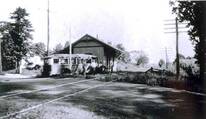
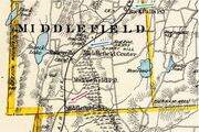
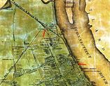
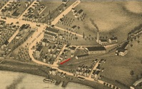
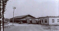
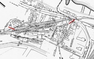
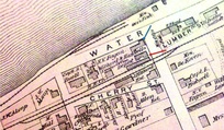
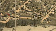
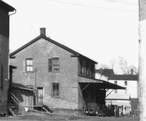
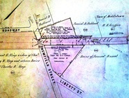
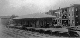
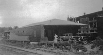
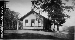
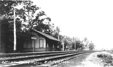
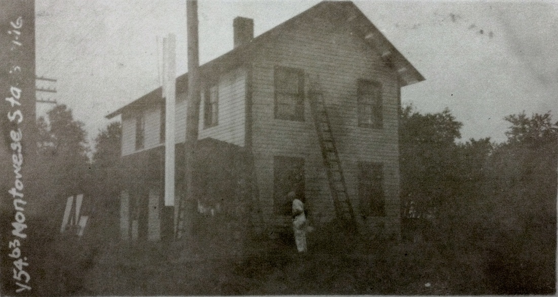
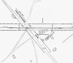
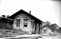
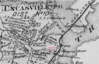
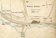
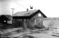
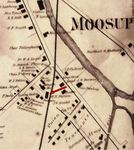
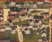
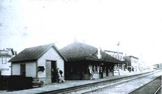
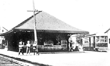
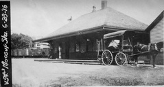
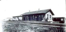
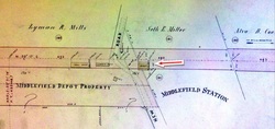
This stop was established in 1870 when the NHM&W opened. The Register reported in August that this depot, measuring 55x22 feet "with a large platform on both sides" was up and would soon be finished. The real estate map at lower left is from 1886 and our red arrow points to the depot. The siting of this station was somewhat controversial. The railroad commissioners ruled for this location in the Falls District, near the house of Ira N. Johnson. Dissatisfaction persisted until a depot was also established at MIDDLEFIELD CENTER, as many had wanted to begin with. If the enlarged freight area in the third shot, an 8/17/1916 val photo, is any indication, there was plenty of need for service here, both initially and in later years. [REFS: RRC7.224 (7/8/1870); CR/08/06/1870/02; CRC18.1871.279][rev070213]
This stop was established in 1870 when the NHM&W opened. The Register reported in August that this depot, measuring 55x22 feet "with a large platform on both sides" was up and would soon be finished. The real estate map at lower left is from 1886 and our red arrow points to the depot. The siting of this station was somewhat controversial. The railroad commissioners ruled for this location in the Falls District, near the house of Ira N. Johnson. Dissatisfaction persisted until a depot was also established at MIDDLEFIELD CENTER, as many had wanted to begin with. If the enlarged freight area in the third shot, an 8/17/1916 val photo, is any indication, there was plenty of need for service here, both initially and in later years. [REFS: RRC7.224 (7/8/1870); CR/08/06/1870/02; CRC18.1871.279][rev070213]
MIDDLEFIELD CENTER [NHM&W, 1873]
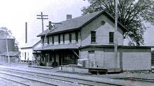
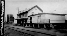
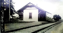
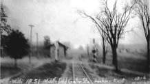
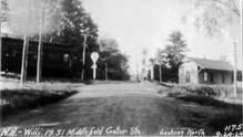
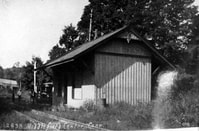
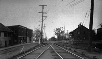
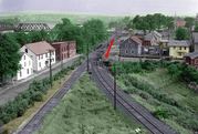
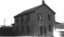
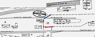
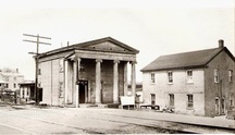
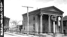
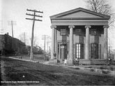
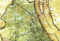
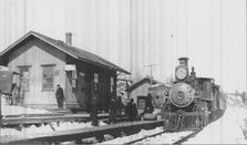
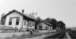
This stop was not established until 1873. Dissatisfaction with the MIDDLEFIELD station, which was to the south and "in the swamp," caused the townspeople to hold off endorsing $30,000 worth of the second mortgage bonds that the NHM&W needed to finance the 1873 extension to Willimantic. The acquiescence of the railroad in building the center depot resulted in the needed endorsement. This sum was in addition to the $40,000 worth of stock the town had subscribed to. The $70,000 reportedly represented 7.5% of the town's total grand list of taxable properties. The newspaper said that work on the MIDDLEFIELD CENTER depot was "rapidly progressing" in September of 1873, with the expectation of a fine-looking building that would be a convenience for travelers and an improvement "to the appearance of that locality." The val photo at [1] is dated 9/17/1916. The PUC photos at [2] and [3] are dated 9/24/1924 and 10/22/1925(?) respectively, looking north and east at the depot. The image at [4] is Lewis H. Benton's #2838 taken in a westerly direction in September, 1930. The exact provenance of the shot at [5] is lost to us but seems to reflect bus service after passenger trains were discontinued in 1936 or 1937 according to Karr. The 1893 map at [6] shows MIDDLEFIELD at the red arrow, MIDDLEFIELD CENTER at the blue arrow and ROCKFALL, the next station on the line, at the green arrow. It should be noted, for all the controversy caused, that the distance between the first two stations was a mere mile and ROCKFALL was only a mile and a half from the MIDDLEFIELD CENTER depot. According to the SSRR, the only remaining structure at this site was a cattle pen which was razed on 4/3/1938. The depot presumably had been razed prior to that and after the photo at [6]. [REFS: MDC/07/16/1873/02; MDC/07/31/1873/02; MDC/09/09/1873/02; MDC/09/10/1873/02; 1938 Status of Structures To Be Retired and Removed; K90][rev050417, 041120]
This stop was not established until 1873. Dissatisfaction with the MIDDLEFIELD station, which was to the south and "in the swamp," caused the townspeople to hold off endorsing $30,000 worth of the second mortgage bonds that the NHM&W needed to finance the 1873 extension to Willimantic. The acquiescence of the railroad in building the center depot resulted in the needed endorsement. This sum was in addition to the $40,000 worth of stock the town had subscribed to. The $70,000 reportedly represented 7.5% of the town's total grand list of taxable properties. The newspaper said that work on the MIDDLEFIELD CENTER depot was "rapidly progressing" in September of 1873, with the expectation of a fine-looking building that would be a convenience for travelers and an improvement "to the appearance of that locality." The val photo at [1] is dated 9/17/1916. The PUC photos at [2] and [3] are dated 9/24/1924 and 10/22/1925(?) respectively, looking north and east at the depot. The image at [4] is Lewis H. Benton's #2838 taken in a westerly direction in September, 1930. The exact provenance of the shot at [5] is lost to us but seems to reflect bus service after passenger trains were discontinued in 1936 or 1937 according to Karr. The 1893 map at [6] shows MIDDLEFIELD at the red arrow, MIDDLEFIELD CENTER at the blue arrow and ROCKFALL, the next station on the line, at the green arrow. It should be noted, for all the controversy caused, that the distance between the first two stations was a mere mile and ROCKFALL was only a mile and a half from the MIDDLEFIELD CENTER depot. According to the SSRR, the only remaining structure at this site was a cattle pen which was razed on 4/3/1938. The depot presumably had been razed prior to that and after the photo at [6]. [REFS: MDC/07/16/1873/02; MDC/07/31/1873/02; MDC/09/09/1873/02; MDC/09/10/1873/02; 1938 Status of Structures To Be Retired and Removed; K90][rev050417, 041120]
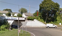
MIDDLETOWN/H1 [MRR, 1850]
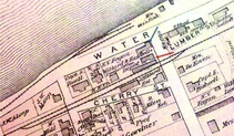
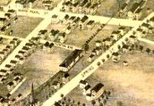
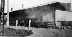
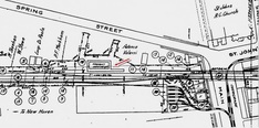
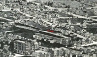
Also known as the Middletown & Berlin, the Middletown RR opened in March, 1850 from a junction with the H&NH at BERLIN to a terminus here on North Main St. The newspaper said that "this road is now in running order. The steam horse took his start from the depot with a passenger train on Friday [3/8], for the first time. The cars are, for beauty and comfort, of the first class." The MRR was built per an agreement of 7/12/1849 that it would become "part and parcel" of the H&NH and did so on 4/24/1850, according the Chronological History of the New Haven Railroad [CHNH]. The upper red arrow on the 1859MC map at [1] points to MIDDLETOWN/H1. The map also shows the Air Line in the planning stages and the H&NH's 1860 terminus at the lower arrow, a 'tidewater' point that was authorized in 1849 and even shows up on an 1851 map but was not built until a decade later. The cash-conservative H&NH was leery of any branches and apparently happy enough with its depot which was located, inconveniently for most, on the northern edge of the downtown area. The 1860 annual report unabashedly admits that this extension only came... "in pursuance of an implied understanding with the citizens of that place, that the Middletown Branch should be built to the River..." The Constitution said on 6/6/1860 that "the railroad to the river is complete. The rails are laid, and the locomotive has been run over 'the line.'" Indicator number '10' on the 1877 Bailey bird's-eye map [click here] shows this as the 'N.Y.N.H.&H. Railroad Station at [2]. The use of this depot for passengers was likely discontinued in 1879 when trains were run to Washington St. The structure was thereafter partially rented but remained as a freight station; the 8/16/1916 val photo at [3] shows the later freight depot of similar design. Our red arrows on the val map at [4] show the connection that was built in 1884 by the NYNH&H to allow branch trains to access MIDDLETOWN/J2. The photo at [5] shows the Portland trolley lead on the left, the CV main in the middle, the Berlin branch connection to Union Station at the right, and the line to Washington St. passing under Bridge St. in the ravine to the far right. In 1925 a $200G project built Hartford Ave. with an overpass for the railroad, the purpose being to close the dangerous Bridge St. grade crossing that had existed since the CV opened in 1871. A temporary wooden trestle was "pushed aside" when the steel bridge was lowered into place "secretly some morning between midnight and 4 o'clock," so as not to attract crowds of onlookers. Since the city did not want any rail across the new thoroughfare, the tunnel track had to go. With boat traffic declining, service on the Dock branch terminated on 6/19/1925 in connection with the newly built Hartford Ave., which opened on 11/22/1925. The tunnel is buried to this day. The arrow in the photo at [6] points to the north portal in the late 1940s and the image at [7] shows where the south portal once saw daylight. [REFS: MC/03/13/1850/03; HDC/05/30/1851/02; CRC1.1854.12; MC/07/16/1856/07; HDC/11/16/1859/02; MC/11/19/1859/02; HNHAR24.1859.6; MC/06/06/1860/02; NHJC/12/08/1877/02; HNHAR25.1860.6; CC/06/09/1860/02 ; MP/04/21/1925/01; MP/08/25/1925/01; MP/11/19/1925/01; K75][rev 021715]
Also known as the Middletown & Berlin, the Middletown RR opened in March, 1850 from a junction with the H&NH at BERLIN to a terminus here on North Main St. The newspaper said that "this road is now in running order. The steam horse took his start from the depot with a passenger train on Friday [3/8], for the first time. The cars are, for beauty and comfort, of the first class." The MRR was built per an agreement of 7/12/1849 that it would become "part and parcel" of the H&NH and did so on 4/24/1850, according the Chronological History of the New Haven Railroad [CHNH]. The upper red arrow on the 1859MC map at [1] points to MIDDLETOWN/H1. The map also shows the Air Line in the planning stages and the H&NH's 1860 terminus at the lower arrow, a 'tidewater' point that was authorized in 1849 and even shows up on an 1851 map but was not built until a decade later. The cash-conservative H&NH was leery of any branches and apparently happy enough with its depot which was located, inconveniently for most, on the northern edge of the downtown area. The 1860 annual report unabashedly admits that this extension only came... "in pursuance of an implied understanding with the citizens of that place, that the Middletown Branch should be built to the River..." The Constitution said on 6/6/1860 that "the railroad to the river is complete. The rails are laid, and the locomotive has been run over 'the line.'" Indicator number '10' on the 1877 Bailey bird's-eye map [click here] shows this as the 'N.Y.N.H.&H. Railroad Station at [2]. The use of this depot for passengers was likely discontinued in 1879 when trains were run to Washington St. The structure was thereafter partially rented but remained as a freight station; the 8/16/1916 val photo at [3] shows the later freight depot of similar design. Our red arrows on the val map at [4] show the connection that was built in 1884 by the NYNH&H to allow branch trains to access MIDDLETOWN/J2. The photo at [5] shows the Portland trolley lead on the left, the CV main in the middle, the Berlin branch connection to Union Station at the right, and the line to Washington St. passing under Bridge St. in the ravine to the far right. In 1925 a $200G project built Hartford Ave. with an overpass for the railroad, the purpose being to close the dangerous Bridge St. grade crossing that had existed since the CV opened in 1871. A temporary wooden trestle was "pushed aside" when the steel bridge was lowered into place "secretly some morning between midnight and 4 o'clock," so as not to attract crowds of onlookers. Since the city did not want any rail across the new thoroughfare, the tunnel track had to go. With boat traffic declining, service on the Dock branch terminated on 6/19/1925 in connection with the newly built Hartford Ave., which opened on 11/22/1925. The tunnel is buried to this day. The arrow in the photo at [6] points to the north portal in the late 1940s and the image at [7] shows where the south portal once saw daylight. [REFS: MC/03/13/1850/03; HDC/05/30/1851/02; CRC1.1854.12; MC/07/16/1856/07; HDC/11/16/1859/02; MC/11/19/1859/02; HNHAR24.1859.6; MC/06/06/1860/02; NHJC/12/08/1877/02; HNHAR25.1860.6; CC/06/09/1860/02 ; MP/04/21/1925/01; MP/08/25/1925/01; MP/11/19/1925/01; K75][rev 021715]
 Russell Library
MIDDLETOWN/H2 [NYNH&H, 1879]
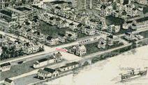
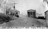
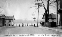
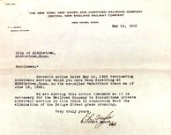
The second passenger depot on the Berlin Branch stood on Washington St. at the end of the Middletown Extension RR referenced in our previous entry. Obviously re-purposed, the building may previously have been Willard & Haskel's store. Its railroad service probably dates from 1879 to 1884. The former date is when the Courant speaks of a further extension to a new freight house at the steamboat wharf and the latter is when the hitherto-unconnected Berlin Branch was given access to MIDDLETOWN/J2 and all passenger service was handled there. An 1882 article foreshadows this when it says "that the buildings now used together with the hotel and restaurant at the foot of Washington street, will be made into dwelling houses." The 1874 Beers atlas map at [1] has trackage ending at the steamboat dock; the blue arrow points to this structure but does not yet label it as a depot and the red arrow points to the CV station in our next entry. The 1877 Bailey map at [2] shows this structure with no track to it. The shot at [3] is a 12/11/1924 val photo. The 1884 Sanborn map at [4] shows this structure as the 'Passenger Depot' at the blue arrow, above the 1879 freight station; the former CV station at the blue arrow is labeled as a dwelling. The val photo at [5] is dated 3/13/1932. The undated photo at [6] shows both former depots. The letter at [7] shows service to Washington St. discontinued on 6/19/1925, for reasons explained in our previous entry. [REFS: NHJC/12/08/1877/02; HDC/07/16/1879/04; HDC/09/16/1879/04; HDC/09/29/ 1879/02; HDC/11/19/1879/04; NHER/12/23/1880/00; CRC27.1880.13; HDC/10/31/1881/02; HDC/11/01/1882 /02; HDC/10/31/1884/04][rev032115]
The second passenger depot on the Berlin Branch stood on Washington St. at the end of the Middletown Extension RR referenced in our previous entry. Obviously re-purposed, the building may previously have been Willard & Haskel's store. Its railroad service probably dates from 1879 to 1884. The former date is when the Courant speaks of a further extension to a new freight house at the steamboat wharf and the latter is when the hitherto-unconnected Berlin Branch was given access to MIDDLETOWN/J2 and all passenger service was handled there. An 1882 article foreshadows this when it says "that the buildings now used together with the hotel and restaurant at the foot of Washington street, will be made into dwelling houses." The 1874 Beers atlas map at [1] has trackage ending at the steamboat dock; the blue arrow points to this structure but does not yet label it as a depot and the red arrow points to the CV station in our next entry. The 1877 Bailey map at [2] shows this structure with no track to it. The shot at [3] is a 12/11/1924 val photo. The 1884 Sanborn map at [4] shows this structure as the 'Passenger Depot' at the blue arrow, above the 1879 freight station; the former CV station at the blue arrow is labeled as a dwelling. The val photo at [5] is dated 3/13/1932. The undated photo at [6] shows both former depots. The letter at [7] shows service to Washington St. discontinued on 6/19/1925, for reasons explained in our previous entry. [REFS: NHJC/12/08/1877/02; HDC/07/16/1879/04; HDC/09/16/1879/04; HDC/09/29/ 1879/02; HDC/11/19/1879/04; NHER/12/23/1880/00; CRC27.1880.13; HDC/10/31/1881/02; HDC/11/01/1882 /02; HDC/10/31/1884/04][rev032115]
MIDDLETOWN/V [CV, 1871]
We have listed this CV station here for its location on Washington St. adjacent to our previous entry. Its railroad career spanned 1871 to 1884. The first we hear of it is in August, 1871 when a newspaper article said that "the depot for the present in this city will be at the foot of Washington street in the old Brooks' house, next west of Willard & Haskel's store. Mr. Buckley Bacon has been appointed depot master..." In September, 1872 another article probably referred to this building when it said a "dwelling house" had been obtained for use as a temporary depot and that citizens had signed a petition for a permanent one at the foot of William St. This structure was in service until 6/17/1884, according to Max Miller's research in the Middletown Constitution and it is seen as a dwelling already on the 1884 Sanborn map at [3] in our previous entry. An 1885 Courant article tells us that "the long platform at the old depot of the Valley railroad has been removed this week," thus transferring all passenger service to MIDDLETOWN/J2 as the new union depot for the city's three railroads. In years from 1872 to 1884, therefore it is likely that CV trains were making stops at the junction as well as here. The 1874 Beers map at [1] shows this station and its 'long platform' at the red arrow. The image at [2] is the 1915 Bailey map [click here] and shows this depot next to MIDDLETOWN/H2. The 4/30/1924 PUC shots at [3] and [4] look north and west respectively. The val photo at [5] was taken on 5/23/1924 when the building, still railroad property, was apparently under lease as the 'New Custom House' after the old one was razed in 1916. It is seen so labeled in [6], with a string of freight cars to the left and the Connecticut River bridge glimpsed to the right. [REFS: MDC/09/02/1863/02; MDC/06/19/1867/02; MC/06/05/1872/02; MC/09/04/1872/02; HDC/01/07/1885/04; C169][rev020615]
We have listed this CV station here for its location on Washington St. adjacent to our previous entry. Its railroad career spanned 1871 to 1884. The first we hear of it is in August, 1871 when a newspaper article said that "the depot for the present in this city will be at the foot of Washington street in the old Brooks' house, next west of Willard & Haskel's store. Mr. Buckley Bacon has been appointed depot master..." In September, 1872 another article probably referred to this building when it said a "dwelling house" had been obtained for use as a temporary depot and that citizens had signed a petition for a permanent one at the foot of William St. This structure was in service until 6/17/1884, according to Max Miller's research in the Middletown Constitution and it is seen as a dwelling already on the 1884 Sanborn map at [3] in our previous entry. An 1885 Courant article tells us that "the long platform at the old depot of the Valley railroad has been removed this week," thus transferring all passenger service to MIDDLETOWN/J2 as the new union depot for the city's three railroads. In years from 1872 to 1884, therefore it is likely that CV trains were making stops at the junction as well as here. The 1874 Beers map at [1] shows this station and its 'long platform' at the red arrow. The image at [2] is the 1915 Bailey map [click here] and shows this depot next to MIDDLETOWN/H2. The 4/30/1924 PUC shots at [3] and [4] look north and west respectively. The val photo at [5] was taken on 5/23/1924 when the building, still railroad property, was apparently under lease as the 'New Custom House' after the old one was razed in 1916. It is seen so labeled in [6], with a string of freight cars to the left and the Connecticut River bridge glimpsed to the right. [REFS: MDC/09/02/1863/02; MDC/06/19/1867/02; MC/06/05/1872/02; MC/09/04/1872/02; HDC/01/07/1885/04; C169][rev020615]
MIDDLETOWN/A1 [NHM&W, 1870]
The newspaper said in early August, 1870 that "the Air Line Road was opened for regular trains on Monday of this week [the 1st]... A temporary depot has been erected at Berlin street, which will be used until the road is finished to Spring St." A Register article sheds more light when it says that "the Middletown depot 52x26 feet, is being built for a temporary depot and will be used as a car house, after the regular depot is built." Tickets were sold here for the first time on 8/5/1870. The red arrow in the lower left corner of the 1859MC map at left points to the location of the depot, which would be used until December. The 1886 real estate map at right shows parcels owned by the railroad on what was then labeled Newfield St. First proposed in the 1840s as the New York and Boston RR, the New Haven, Middletown & Willimantic would not open between the first two points until 1870. It was popularly known from the beginning as the Air Line for the directness of its route. We have no photo of this depot. [REFS: MC/08/03/1870/02; CR/05/13/1870/02][rev021315]
The newspaper said in early August, 1870 that "the Air Line Road was opened for regular trains on Monday of this week [the 1st]... A temporary depot has been erected at Berlin street, which will be used until the road is finished to Spring St." A Register article sheds more light when it says that "the Middletown depot 52x26 feet, is being built for a temporary depot and will be used as a car house, after the regular depot is built." Tickets were sold here for the first time on 8/5/1870. The red arrow in the lower left corner of the 1859MC map at left points to the location of the depot, which would be used until December. The 1886 real estate map at right shows parcels owned by the railroad on what was then labeled Newfield St. First proposed in the 1840s as the New York and Boston RR, the New Haven, Middletown & Willimantic would not open between the first two points until 1870. It was popularly known from the beginning as the Air Line for the directness of its route. We have no photo of this depot. [REFS: MC/08/03/1870/02; CR/05/13/1870/02][rev021315]
MIDDLETOWN/A2 [NHM&W, 1870]
According to a December, 1870 article in the Register, "the new depot at Pearl street, over one hundred feet in length is nearly completed." This structure is presumably the one that the Courant referred to in 1875 when it said that "the old depot of the Air Line road, in Middletown, was burned yesterday. The building was used for freighting, and the freight burned with the building. This station was apparently rebuilt, as seen in the photos, but the replacement for the "old depot" was likely just for freight with passengers using MIDDLETOWN/J1 at the junction with the CV by this time. The 1877 Bailey map image at [1] correctly reflects the reorganization of the NHM&W as the B&NYAL in 1875 and shows the station at the north end of Clinton Ave. with Spring St. running east-west above it. The 8/17/1916 val photo at [2] labels the building as the old freight house and the 1915 val map at upper right shows the layout of the grounds. The image at [4] is the 1915 Bailey map. The lower photos probably date to the 1920s. [REFS: MC/08/03/1870/02; CR/12/17/1870/02; MC/07/26/1871/02; CC/08/21/1875/04][rev020615]
According to a December, 1870 article in the Register, "the new depot at Pearl street, over one hundred feet in length is nearly completed." This structure is presumably the one that the Courant referred to in 1875 when it said that "the old depot of the Air Line road, in Middletown, was burned yesterday. The building was used for freighting, and the freight burned with the building. This station was apparently rebuilt, as seen in the photos, but the replacement for the "old depot" was likely just for freight with passengers using MIDDLETOWN/J1 at the junction with the CV by this time. The 1877 Bailey map image at [1] correctly reflects the reorganization of the NHM&W as the B&NYAL in 1875 and shows the station at the north end of Clinton Ave. with Spring St. running east-west above it. The 8/17/1916 val photo at [2] labels the building as the old freight house and the 1915 val map at upper right shows the layout of the grounds. The image at [4] is the 1915 Bailey map. The lower photos probably date to the 1920s. [REFS: MC/08/03/1870/02; CR/12/17/1870/02; MC/07/26/1871/02; CC/08/21/1875/04][rev020615]
MIDDLETOWN/J1 [CV/NHM&W, 1871]
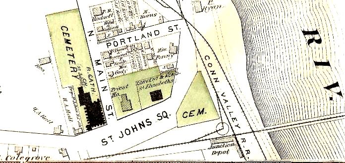
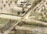
A union railroad station was constructed sometime after 1871 and before the 1874 Beers map at [1] where we first see it. As early as 1870, even as the NHM&W and the CV were both still under construction, the Courant reported that "the Middletown people are seriously discussing the question of a union depot for the three railroads running into that city." The Hackstaff property that "fronts on Main street, just south of the Catholic church, and extends from the street to the river bank" was said to be the best location. The Courant said late in 1871 that "the Air Line road is preparing to make a junction with the Valley railroad on the Hackstaff property... and it is expected that the connection will be made this week." This connection may well have meant the curious arrangement of two stub-ended tracks meeting a turntable in the northwest quadrant of the junction, a space cramped by the adjacent cemetery. Interestingly and never seen before, there are multiple copies of the Mr. Bailey's 1877 bird's-eye map of Middletown, the one at [2] misrepresenting the turntable as being only for the CV instead of connecting both roads. At any rate, the Constitution reported on 6/5/1872 that "on and after this week the 8,18 [sic] train on the Air Line road will run from the Connecticut River bridge [instead of Spring St.] to accommodate passengers on the first up train on the Valley road, which in the future will stop at the bridge." Regular trains began running to Willimantic on 8/12/1873 and shortly thereabout it is reported that "the platform of the Air Line and Valley railroads, at the junction, has been considerably lengthened. The old Hackstaff house will soon be used as a passenger depot. The view from the east window of the house will be an attraction to all travelers." The 1877 Bailey map at [2] says locator number 9 is the Union Railroad Station and we see the long covered platform and the smallish structure right at the junction. By 1874 we read that the Air Line "connects with all trains on the Valley road at Middletown junction..." and this would remain become an important transfer point between the railroads and street railways in Middletown for the next half century. The newspapers reflected public opinion about the inadequacy of the facilities here as early as 1881 when they said this was a "decidedly inconvenient" depot that, in use for less than a decade, "has outlived its day and generation." [REFS: CC/03/19/1870/01; CC/10/21/1871/02; MC/06/05/1872/02; HDC/04/28/1873/04; MDC/08/13/1873 /02; PP/11/00/1873/00; CRC21.1874.191; HDC/07/08/1874/04; NHER/04/25/ 1881/04; HEP/05/11/1881/00][rev031915]
A union railroad station was constructed sometime after 1871 and before the 1874 Beers map at [1] where we first see it. As early as 1870, even as the NHM&W and the CV were both still under construction, the Courant reported that "the Middletown people are seriously discussing the question of a union depot for the three railroads running into that city." The Hackstaff property that "fronts on Main street, just south of the Catholic church, and extends from the street to the river bank" was said to be the best location. The Courant said late in 1871 that "the Air Line road is preparing to make a junction with the Valley railroad on the Hackstaff property... and it is expected that the connection will be made this week." This connection may well have meant the curious arrangement of two stub-ended tracks meeting a turntable in the northwest quadrant of the junction, a space cramped by the adjacent cemetery. Interestingly and never seen before, there are multiple copies of the Mr. Bailey's 1877 bird's-eye map of Middletown, the one at [2] misrepresenting the turntable as being only for the CV instead of connecting both roads. At any rate, the Constitution reported on 6/5/1872 that "on and after this week the 8,18 [sic] train on the Air Line road will run from the Connecticut River bridge [instead of Spring St.] to accommodate passengers on the first up train on the Valley road, which in the future will stop at the bridge." Regular trains began running to Willimantic on 8/12/1873 and shortly thereabout it is reported that "the platform of the Air Line and Valley railroads, at the junction, has been considerably lengthened. The old Hackstaff house will soon be used as a passenger depot. The view from the east window of the house will be an attraction to all travelers." The 1877 Bailey map at [2] says locator number 9 is the Union Railroad Station and we see the long covered platform and the smallish structure right at the junction. By 1874 we read that the Air Line "connects with all trains on the Valley road at Middletown junction..." and this would remain become an important transfer point between the railroads and street railways in Middletown for the next half century. The newspapers reflected public opinion about the inadequacy of the facilities here as early as 1881 when they said this was a "decidedly inconvenient" depot that, in use for less than a decade, "has outlived its day and generation." [REFS: CC/03/19/1870/01; CC/10/21/1871/02; MC/06/05/1872/02; HDC/04/28/1873/04; MDC/08/13/1873 /02; PP/11/00/1873/00; CRC21.1874.191; HDC/07/08/1874/04; NHER/04/25/ 1881/04; HEP/05/11/1881/00][rev031915]
 Al Lawrence Collection
MIDDLETOWN/J2 [B&NYAL, 1881]
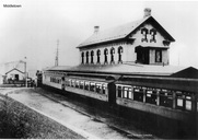
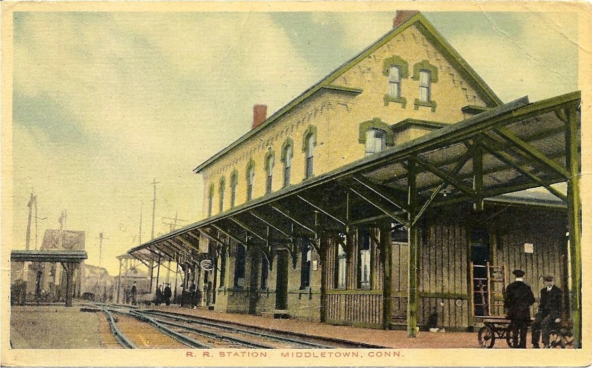
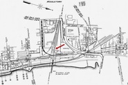
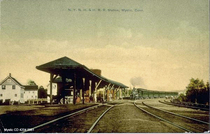
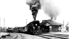
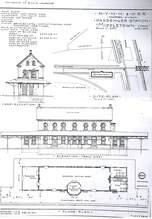
The B&NYAL took the initiative here after the CV rejected plans in 1875 for a union station and the railroad commissioners met in Middletown on 4/22/1881 to locate a site "near the junction of the Air Line and Valley roads on the flats between the present decidedly inconvenient depot and the river... just west of the present stopping place." The Hartford Weekly Times said in August, 1881 that "the building will be seventy-two by twenty-four feet, standing lengthwise, northwest to southeast... two stories high, built of brick and furnished with all the modern improvements... A large sitting room for passengers will be on the first floor, also baggage room and ticket office. The directors room will be in the second story facing east and the other rooms will be used for offices... The building will be a handsome one. The windows and doors are to have Portland brown stone and black brick trimmings..." Max Miller tells us from the Deep River New Era newspaper that the station was first occupied on 12/9/1881 and the painters finished up on 1/19/1882. The ever-expanding NYNH&H leased the B&NYAL on 8/31/1882, got majority stock control of the CV by 10/1/1882 and in November, 1884 built the link to allow branch trains to access what finally had become a union station for all of Middletown's railroads. Karr says passenger service ended on the CV by 1931 and on the Air Line by 1937 but our references say there was NETCo bus service on the Air Line by 11/18/1928 and only Berlin branch service otherwise. By 1938 a Courant article says tickets could still be purchased at Middletown which "for some time has had no passenger service from the 'New Haven' road" and trains had to be accessed at BERLIN via shuttle bus service from here. The Middletown Press reports that the station closed 11/9/1939, with only Railway Express Agency quarters remaining in that building for the time being. In spite of protest from the town, the NYNH&H went ahead with demolition plans that commenced on 6/10 and ended on 6/21/1940, thus eradicating the 60-year-old landmark which the newspaper recalled had once hosted the Ghost Train on the fastest route to Boston. That NY&NE train is seen ca. 1895 at [1]. The view at [2] is a card postmarked 3/16/1917. The 1915 val map at [3] shows the depot at our red arrow, a transportation hub of rail and trolley lines. The postcard at [4] shows a local streetcar at the station. The view at [5] is Lewis H. Benton's #2131 taken in June, 1928 and looking south. SS F-279, controlling the junction, is in the foreground and a gas-electric bound for Berlin is also seen. The shot at [6] looks north and shows the southwest quadrant track that likely came in 1881 with this structure. The 12/13/1913 architectural drawing at [7] is dated April, 1890, which is not in agreement with other sources. This copy was found in the papers of the late Ed Sweeney of Norwood, MA and supplied to us by long-time TCS contributor Richard Fleischer of Newton Centre, MA. [REFS: MC/11/10/1875/02; NHER/04/25/1881/04; RRC12.114 (5/10/1881); NHER/06/25/1881/01; NHER/07/12/1881/01; NHER/07/21/1881/01; HWT/08/18/1881/03; NHER/08/23/1881/04; NHER/11/12/1881/01; NE/12/09/1881/00; CRC29.1882. 15,29; NE/01/19/1882/00; HDC/06/30/1882/02; HDC/09/07/1882/04; HDC/11/01/1882/02; HDC/05/29/1883/04; HDC/12/06/1883/04; PP/10/31/1884/04; PP/11/01/1884/02; HDC/11/07/1884/04; HC/05/21/1891/06; HC/12/12/1928/15; HC/05/24/1938/03; MP/11/09/1939/01; MP/11/11/1939/Mag; HC/11/07/1965/ 10A; K90, 98][rev050315, 103021]
The B&NYAL took the initiative here after the CV rejected plans in 1875 for a union station and the railroad commissioners met in Middletown on 4/22/1881 to locate a site "near the junction of the Air Line and Valley roads on the flats between the present decidedly inconvenient depot and the river... just west of the present stopping place." The Hartford Weekly Times said in August, 1881 that "the building will be seventy-two by twenty-four feet, standing lengthwise, northwest to southeast... two stories high, built of brick and furnished with all the modern improvements... A large sitting room for passengers will be on the first floor, also baggage room and ticket office. The directors room will be in the second story facing east and the other rooms will be used for offices... The building will be a handsome one. The windows and doors are to have Portland brown stone and black brick trimmings..." Max Miller tells us from the Deep River New Era newspaper that the station was first occupied on 12/9/1881 and the painters finished up on 1/19/1882. The ever-expanding NYNH&H leased the B&NYAL on 8/31/1882, got majority stock control of the CV by 10/1/1882 and in November, 1884 built the link to allow branch trains to access what finally had become a union station for all of Middletown's railroads. Karr says passenger service ended on the CV by 1931 and on the Air Line by 1937 but our references say there was NETCo bus service on the Air Line by 11/18/1928 and only Berlin branch service otherwise. By 1938 a Courant article says tickets could still be purchased at Middletown which "for some time has had no passenger service from the 'New Haven' road" and trains had to be accessed at BERLIN via shuttle bus service from here. The Middletown Press reports that the station closed 11/9/1939, with only Railway Express Agency quarters remaining in that building for the time being. In spite of protest from the town, the NYNH&H went ahead with demolition plans that commenced on 6/10 and ended on 6/21/1940, thus eradicating the 60-year-old landmark which the newspaper recalled had once hosted the Ghost Train on the fastest route to Boston. That NY&NE train is seen ca. 1895 at [1]. The view at [2] is a card postmarked 3/16/1917. The 1915 val map at [3] shows the depot at our red arrow, a transportation hub of rail and trolley lines. The postcard at [4] shows a local streetcar at the station. The view at [5] is Lewis H. Benton's #2131 taken in June, 1928 and looking south. SS F-279, controlling the junction, is in the foreground and a gas-electric bound for Berlin is also seen. The shot at [6] looks north and shows the southwest quadrant track that likely came in 1881 with this structure. The 12/13/1913 architectural drawing at [7] is dated April, 1890, which is not in agreement with other sources. This copy was found in the papers of the late Ed Sweeney of Norwood, MA and supplied to us by long-time TCS contributor Richard Fleischer of Newton Centre, MA. [REFS: MC/11/10/1875/02; NHER/04/25/1881/04; RRC12.114 (5/10/1881); NHER/06/25/1881/01; NHER/07/12/1881/01; NHER/07/21/1881/01; HWT/08/18/1881/03; NHER/08/23/1881/04; NHER/11/12/1881/01; NE/12/09/1881/00; CRC29.1882. 15,29; NE/01/19/1882/00; HDC/06/30/1882/02; HDC/09/07/1882/04; HDC/11/01/1882/02; HDC/05/29/1883/04; HDC/12/06/1883/04; PP/10/31/1884/04; PP/11/01/1884/02; HDC/11/07/1884/04; HC/05/21/1891/06; HC/12/12/1928/15; HC/05/24/1938/03; MP/11/09/1939/01; MP/11/11/1939/Mag; HC/11/07/1965/ 10A; K90, 98][rev050315, 103021]
MIDDLETOWN JUNCTION [> BERLIN]
MIDWAY [> POQUONNOCK]
MILFORD1 [NY&NH, 1848, WB]
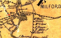
The 1882 Bailey bird's-eye map [click here] shows the 1848 depot standing north of the tracks, opposite the new 1881 passenger station. The cross-gabled style matches NORWALK1, STRATFORD1, and other early NY&NH depots, right down to the diamond window in the gable. According to a Palladium article on the progress of the new station, "... the old building is to be used as a freight house..." and so it is seen on the map. Milford would eventually get two purpose-built freight houses for the eastbound and westbound sides, with the 1890s four-tracking. MILFORD1 undoubtedly came down to make way for the westbound passenger station, MILFORD3. The wider area and the depot's location at the red arrow are shown on the 1852NH map at [2]. [REFS: NHDP/09/28/1881/00][rev050217]
The 1882 Bailey bird's-eye map [click here] shows the 1848 depot standing north of the tracks, opposite the new 1881 passenger station. The cross-gabled style matches NORWALK1, STRATFORD1, and other early NY&NH depots, right down to the diamond window in the gable. According to a Palladium article on the progress of the new station, "... the old building is to be used as a freight house..." and so it is seen on the map. Milford would eventually get two purpose-built freight houses for the eastbound and westbound sides, with the 1890s four-tracking. MILFORD1 undoubtedly came down to make way for the westbound passenger station, MILFORD3. The wider area and the depot's location at the red arrow are shown on the 1852NH map at [2]. [REFS: NHDP/09/28/1881/00][rev050217]
MILFORD2 [NYNH&H, 1881, EB]
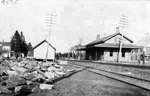
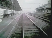
This station was built in 1881 on the eastbound (south) side of what was by then the double-tracked line to New York. The Palladium reported that the foundation walls were up in July, 1881 but that work had stopped "on account of the scarcity of brick" that was supposed to come from the "North Haven yards." Another article in September said that "... At Milford the new brick station house is nearly completed... the new building is 25 by 90 feet, is of brick and is fitted with all modern improvements. It will cost from $6,000 to $7,000." Work was finished for a late November opening with the Courant reporting that "the new depot of the New York, New Haven and Hartford road at Milford, a neat brick structure, was opened for public use Monday [11/21]." [REFS: NHJC/04/15/1881/02; NHDP/07/02/1881/04; HDC/11/22/1881/04; NHAR10.1882.6; R64][rev080915, 110320]
This station was built in 1881 on the eastbound (south) side of what was by then the double-tracked line to New York. The Palladium reported that the foundation walls were up in July, 1881 but that work had stopped "on account of the scarcity of brick" that was supposed to come from the "North Haven yards." Another article in September said that "... At Milford the new brick station house is nearly completed... the new building is 25 by 90 feet, is of brick and is fitted with all modern improvements. It will cost from $6,000 to $7,000." Work was finished for a late November opening with the Courant reporting that "the new depot of the New York, New Haven and Hartford road at Milford, a neat brick structure, was opened for public use Monday [11/21]." [REFS: NHJC/04/15/1881/02; NHDP/07/02/1881/04; HDC/11/22/1881/04; NHAR10.1882.6; R64][rev080915, 110320]
MILFORD3 [NYNH&H, 1894, WB]
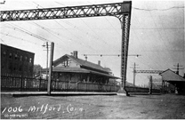
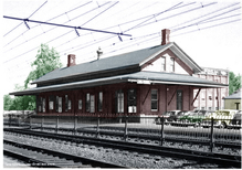
The saltbox-style MILFORD3 was built in 1894 with the four-tracking and grade-crossing elimination project on the New York Division. The image at [1] shows the high-level platform in place and coversheds gone, probably in the 1970s. The shot at [2] looks toward New Haven after the 1914 electrification, with MILFORD3 on the left and MILFORD2 on the right. The image at [3] also looks east and shows SS-72. Dale Martin, former operator at the Berk and Stam towers, says it is possible the foundation is still in the ground, just west of High St. The photo appears to be ca. 1900. According to our research, the Milford tower opened as SS-18 when the block system was first introduced in 1888. [REFS: NHER/05/01/1888/04; CRC42.1894.17; R65][rev080915]
The saltbox-style MILFORD3 was built in 1894 with the four-tracking and grade-crossing elimination project on the New York Division. The image at [1] shows the high-level platform in place and coversheds gone, probably in the 1970s. The shot at [2] looks toward New Haven after the 1914 electrification, with MILFORD3 on the left and MILFORD2 on the right. The image at [3] also looks east and shows SS-72. Dale Martin, former operator at the Berk and Stam towers, says it is possible the foundation is still in the ground, just west of High St. The photo appears to be ca. 1900. According to our research, the Milford tower opened as SS-18 when the block system was first introduced in 1888. [REFS: NHER/05/01/1888/04; CRC42.1894.17; R65][rev080915]
MILLDALE1 [NH&N, 1848; opened as HITCHCOCKS]
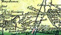
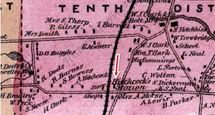
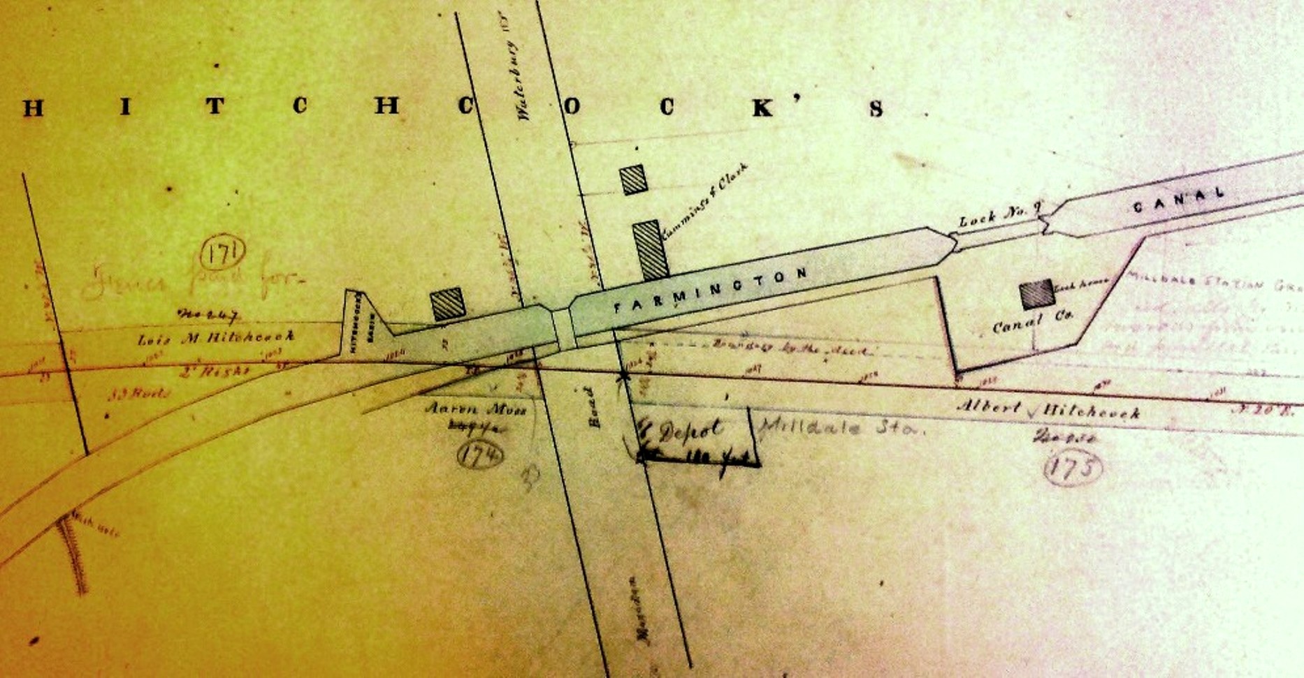
This stop was an original one on the Canal line from 1848 when it was known as HITCHCOCKS for the prominent local family which owned the land at Lock 9 on the Farmington Canal. This is where the waterway intersected with the Meriden-Waterbury Tpke, today's Rte 322. HITCHCOCKS station stood east of the track at the road, as shown by the red arrows on the 1855HC map at [1] and the 1869 Baker & Tilden map at [2]. Image [3] is from the NH&N Index Map Book that dates back to 1848 and was subsequently revised as the official NYNH&H property record for this line. Some interesting details are seen, including the route of the canal along today's Canal Street and the name Albert Hitchcock, the energetic entrepreneur who operated boats to New Haven and built 'Waterbury (aka Hitchcock's) Basin' to receive freight for the Brass City. Also seen is the newer name MILLDALE pencilled by the old station and the footprint of the 66x100-ft structure itself. We have no photo yet of the first station which may have been a purpose-built depot similar to early Canal line stations like CHESHIRE and AVON. The post office here was established on 5/27/1872. The Milldale name for it reportedly came about because there was another Hitchcocks post office in the state. The name Milldale is first seen in the newspapers in 1873. The start of postal service, here as elsewhere, was a banner day for communities like this, tantamount to federal recognition of a locale's existence. Undoubtedly, the concentration of mills along the nearby Quinnipiac, Eight Mile and Ten Mile Rivers figured into the naming. Surprisingly, perhaps, the railroad stuck with the old name until 1890 when a terse mention in the Southington Weekly Phoenix said: "Milldale. The legend 'Milldale' now adorns the railroad station and 'Hitchcock's' is no more. The railroad people put up the sign last week." Albert Hitchcock lived until 1899 and one wonders what he thought about the name change as he lived out the last years of his life on M-W Tpke, just west of Canal St. According to the Southington News, MILLDALE1 burned in 1891. [REFS: HDC/06/13/1873/03; HDC/04/12/1879/04; SWP/04/04/1890/02; SNE/02/09/1928/01; NYNHH 1890TT][rev071417]
This stop was an original one on the Canal line from 1848 when it was known as HITCHCOCKS for the prominent local family which owned the land at Lock 9 on the Farmington Canal. This is where the waterway intersected with the Meriden-Waterbury Tpke, today's Rte 322. HITCHCOCKS station stood east of the track at the road, as shown by the red arrows on the 1855HC map at [1] and the 1869 Baker & Tilden map at [2]. Image [3] is from the NH&N Index Map Book that dates back to 1848 and was subsequently revised as the official NYNH&H property record for this line. Some interesting details are seen, including the route of the canal along today's Canal Street and the name Albert Hitchcock, the energetic entrepreneur who operated boats to New Haven and built 'Waterbury (aka Hitchcock's) Basin' to receive freight for the Brass City. Also seen is the newer name MILLDALE pencilled by the old station and the footprint of the 66x100-ft structure itself. We have no photo yet of the first station which may have been a purpose-built depot similar to early Canal line stations like CHESHIRE and AVON. The post office here was established on 5/27/1872. The Milldale name for it reportedly came about because there was another Hitchcocks post office in the state. The name Milldale is first seen in the newspapers in 1873. The start of postal service, here as elsewhere, was a banner day for communities like this, tantamount to federal recognition of a locale's existence. Undoubtedly, the concentration of mills along the nearby Quinnipiac, Eight Mile and Ten Mile Rivers figured into the naming. Surprisingly, perhaps, the railroad stuck with the old name until 1890 when a terse mention in the Southington Weekly Phoenix said: "Milldale. The legend 'Milldale' now adorns the railroad station and 'Hitchcock's' is no more. The railroad people put up the sign last week." Albert Hitchcock lived until 1899 and one wonders what he thought about the name change as he lived out the last years of his life on M-W Tpke, just west of Canal St. According to the Southington News, MILLDALE1 burned in 1891. [REFS: HDC/06/13/1873/03; HDC/04/12/1879/04; SWP/04/04/1890/02; SNE/02/09/1928/01; NYNHH 1890TT][rev071417]
 UConn Libraries
MILLDALE2 [NYNH&H, 1892]
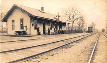
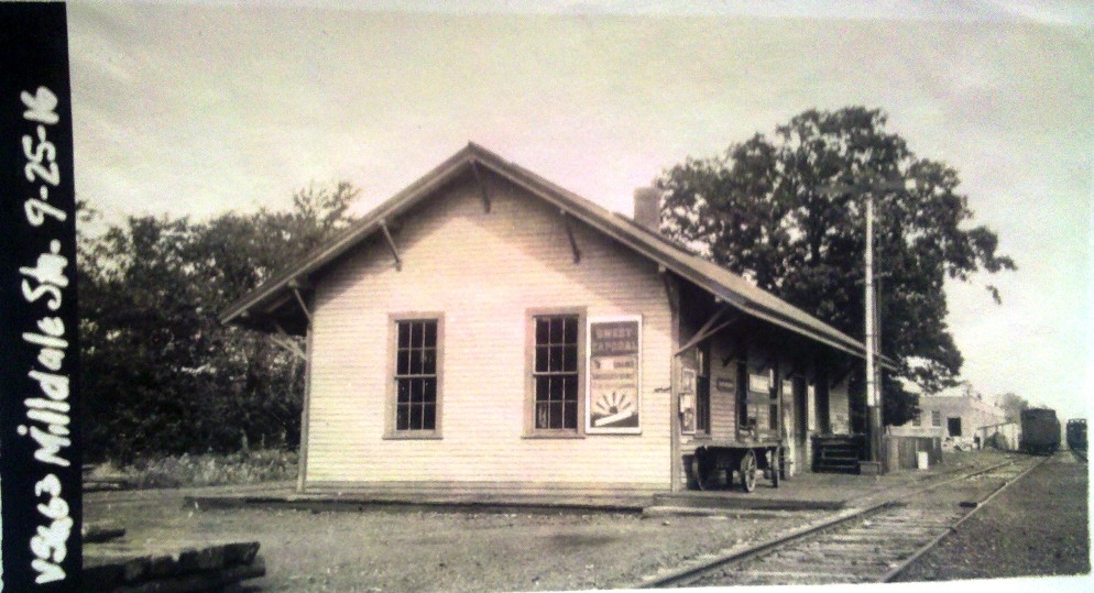
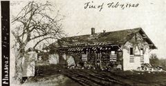
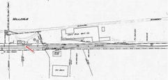
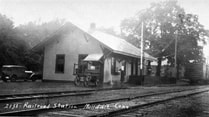
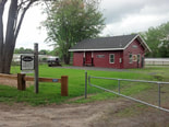
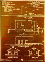
According to the 1911 NYNH&H real estate card, this depot was constructed in 1894 but new research has proved that wrong. A May, 1892 article in the Southington Weekly Phoenix reads "The new depot is a great improvement over the old one and our pretty village gets the benefit of it in the increased respect of travellers who laughed at the old structure. First impressions count for a good deal, and a neat depot is a first-class advertisement for any town or village." Our thinking is that the depot was newly opened just about that time or perhaps even late in 1891. The 1909-postmarked card at [1] is perhaps the earliest view we have and it is full of historical detail: wooden order board, ladder steps up to freight platform, old baggage wagon and pushcart, bicycle, uniformed station agent with cap, loiterers with Chico Marx-hatted fellow on the left. Just fabuous, wish we could see inside! The ICC val photo at [2] is dated 9/25/1916; already the signal mast that still stands today has replaced the roof-top order board. Both these views show three windows, a double-doored entryway at the foot of the freight-platform steps, the platform and the freight door. No agent's bay is seen in this rather uniquely configured building, only seen elsewhere we think in Carolina R.I. The new station was located about a a few hundred feet north of the old one, but now west side of the track on the site of the old Famington Canal lock #9. The new facility undoubtedly pleased the Clark Bros. Bolt Co., which was adjacent to the new depot but had its own siding seen on the 1915 val map seen at [4]. The plant was reportedly consuming 100 tons of iron monthly in its production of metal products shipped all over the continent. MILLDALE2 was heavily damaged by a fire that long-time (1913-1960) agent David Lienhardt saw at 7:30 a.m. on 2/4/1928 from his house which was just south of the depot. The stove in the passenger waiting room had exploded. The PUC image at [3] was taken on 2/6/1928 right after the fire, perhaps for insurance purposes. Lienhardt conducted business for the next four months from space at Clark Bros. According to him, they "were able to save all of the building except the passenger station." Since passenger service on the Canal line had ceased on 12/31/1925 and the waiting room was no longer needed, the railroad did not miss the opportunity to reduce the size of the building and pay less taxes in the process. In a timely coincidence, peripatetic depot photographer Lewis H. Benton visited in 1928, probably on 6/22, just after the repairs were completed. His photo #2133 is seen at [5] and shows the entrance relocated to the south end of the depot. Our red arrow on the 1914 tracing at [7] faintly shows the south wall erased at left [upper arrow] as well as the hacked roof [lower arrow] as the old plan was tweaked after the fire. Note also the ornate end bracket work that was not restored in the rebuild. Penn Central Bulletin Order 1-S30 dated 12/26/1969 announced the closing of MILLDALE2, a part-time agency station since Lienhardt's death in 1960. This portion of the Canal line was opened in 2011 as a link in the Farmington Canal Heritage Greenway [click here]. The station was sold in 1977 and was in private hands, even apparently being used as a residence for a time. In 2010 it was purchased by the town of Southington and opened as a museum in 2013, as seen at [6]. [REFS: SWP/05/20/1891/02; NHER/10/20/1897/11; NHER/11/21/1899/10; NHER/06/30/1900/08; CWN/07/05/1900/02; HC/02/05/1928/5A; SNE/02/09/1928/01; WR/03/15/1953/M3; R66: incorrect in saying north end was removed][rev101617, 062322]
According to the 1911 NYNH&H real estate card, this depot was constructed in 1894 but new research has proved that wrong. A May, 1892 article in the Southington Weekly Phoenix reads "The new depot is a great improvement over the old one and our pretty village gets the benefit of it in the increased respect of travellers who laughed at the old structure. First impressions count for a good deal, and a neat depot is a first-class advertisement for any town or village." Our thinking is that the depot was newly opened just about that time or perhaps even late in 1891. The 1909-postmarked card at [1] is perhaps the earliest view we have and it is full of historical detail: wooden order board, ladder steps up to freight platform, old baggage wagon and pushcart, bicycle, uniformed station agent with cap, loiterers with Chico Marx-hatted fellow on the left. Just fabuous, wish we could see inside! The ICC val photo at [2] is dated 9/25/1916; already the signal mast that still stands today has replaced the roof-top order board. Both these views show three windows, a double-doored entryway at the foot of the freight-platform steps, the platform and the freight door. No agent's bay is seen in this rather uniquely configured building, only seen elsewhere we think in Carolina R.I. The new station was located about a a few hundred feet north of the old one, but now west side of the track on the site of the old Famington Canal lock #9. The new facility undoubtedly pleased the Clark Bros. Bolt Co., which was adjacent to the new depot but had its own siding seen on the 1915 val map seen at [4]. The plant was reportedly consuming 100 tons of iron monthly in its production of metal products shipped all over the continent. MILLDALE2 was heavily damaged by a fire that long-time (1913-1960) agent David Lienhardt saw at 7:30 a.m. on 2/4/1928 from his house which was just south of the depot. The stove in the passenger waiting room had exploded. The PUC image at [3] was taken on 2/6/1928 right after the fire, perhaps for insurance purposes. Lienhardt conducted business for the next four months from space at Clark Bros. According to him, they "were able to save all of the building except the passenger station." Since passenger service on the Canal line had ceased on 12/31/1925 and the waiting room was no longer needed, the railroad did not miss the opportunity to reduce the size of the building and pay less taxes in the process. In a timely coincidence, peripatetic depot photographer Lewis H. Benton visited in 1928, probably on 6/22, just after the repairs were completed. His photo #2133 is seen at [5] and shows the entrance relocated to the south end of the depot. Our red arrow on the 1914 tracing at [7] faintly shows the south wall erased at left [upper arrow] as well as the hacked roof [lower arrow] as the old plan was tweaked after the fire. Note also the ornate end bracket work that was not restored in the rebuild. Penn Central Bulletin Order 1-S30 dated 12/26/1969 announced the closing of MILLDALE2, a part-time agency station since Lienhardt's death in 1960. This portion of the Canal line was opened in 2011 as a link in the Farmington Canal Heritage Greenway [click here]. The station was sold in 1977 and was in private hands, even apparently being used as a residence for a time. In 2010 it was purchased by the town of Southington and opened as a museum in 2013, as seen at [6]. [REFS: SWP/05/20/1891/02; NHER/10/20/1897/11; NHER/11/21/1899/10; NHER/06/30/1900/08; CWN/07/05/1900/02; HC/02/05/1928/5A; SNE/02/09/1928/01; WR/03/15/1953/M3; R66: incorrect in saying north end was removed][rev101617, 062322]
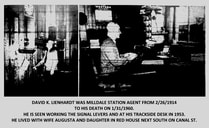
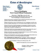
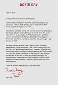
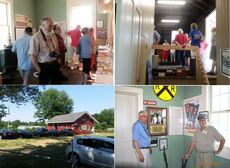
MILLDALE2 played a cameo role as HOLGATE in the 1958 filming of the movie It Happened to Jane. We have suggested that the Southington Historical Society show the movie as part of a reunion of the many local folks who stop at the museum and tell us their memories of Doris Day and Jack Lemmon being in town. The 60-year-to-the-day anniversary of the filming was celebrated in 2018 by town proclamation of 'Doris Day' on June 30. Ms. Day sent an autographed photo and letter of thanks to "My Friends in the Town of Southington," acknowledging the honor and expressing her gratitude for the Milldale Depot Museum project. Sadly, at age 97, Doris Day passed away on May 14, 2019. We were blessed to have been able to have her as part of the celebration which included a presentation at the Southington Public Library and a tour of the depot. It must have been the highlight of Stationmaster David K. Lienhardt's half-century railroad career when he and wife Augusta had Jack and Doris over for lunch at their beautiful garden and koi pond. Their house, recently demolished, stood next door to the station. A 'Doris Day' search party from the depot was sent out and successfully discovered in the reeds behind the house the bench on which Jack and Doris sat. It was later brought to the MDM where it awaits a plaque and relocation to a place of honor on the depot property. The sheet cake was donated by Stop & Shop; bakery decorator extraordinaire Natasha took the movie still we gave her of the Old 97 and recreated it beautifully, with '97' on the head end and smoke wafting from the stack. Anyone who has seen the movie knows why the lobster is there. If you are a NH railfan and you haven't seen the movie, you are missing out on a great treat, neat train scenes and trip back to a time when there was civility and sanity in the world. There is much more to tell about Doris, the movie and the depot when you come to visit the MDM! The building is open on summer weekends from 9-4. Call 203-913-9630 to make sure a docent is there to give you the tour. [rev082619]
MILLERS [NH&N, c1848]
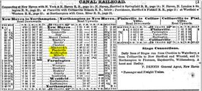
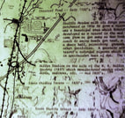
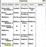
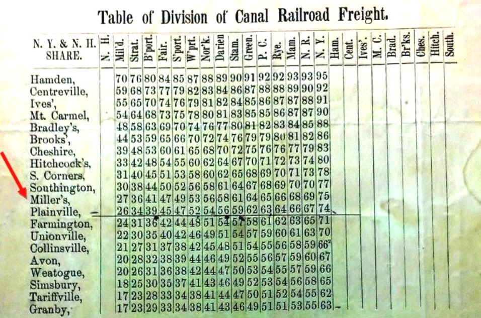
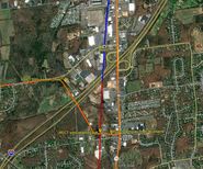
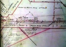
This obscure and short-lived Canal line station does not appear on anything we have from 1849 to 1854 but it is seen on the 1855 Colton map of Connecticut at [1] and the 1858TT at [2]. The map at [3] is from the Southington Historical Society and shows the location of this station, perhaps on Spring St. just above where today's I-84 crosses Queen St. The map info says that the H. A. Miller Clock Co. was founded in 1837 and lasted until the mid 1800s, making wooden clocks and later metal products. W.R. Wilbur says that Henry A. Miller partnered in 1848 with Lewis Merriman and "... built a factory at what was afterwards known as Miller's Station on the New Haven and North Hampton Railroad, where they engaged in manufacturing carriage bolts, brass shovels, tongs and other articles, making a specialty of the bolt business..." The venture ended in the mid-1850s when the machinery was sold, ''... divesting Miller's Station of everything but its name and solitude." What exactly was here in terms of railroad accommodations and precisely how long the stop lasted is unclear. We do know that during the NY&NH lease of the Canal line from 1848 to 1869 several smaller stations like ALLENS in Avon and BROOKS in Cheshire were maintained for freight service and as passenger flag stops, sometimes not seen on public timetables. The PLANTSVILLE controversy of the 1870s makes no reference to a fourth station in Southington, more evidence that it was gone by then. The stop is still seen on the 1858 Geers directory at [4] but it is gone by our 1870TT (not shown). The 1855 revenue-division sheet at [5] shows that the NY&NH got a 27% cut of the take, the Canal line getting 73%, on freight shipped from MILLERS station on the Canal line to MILFORD on the NY&NH. The snippet from our Track 11 GE map at [6] shows the end of track in the ground today as blue, abandoned as red and trolley lines as orange. Coincidentally, the 1994 Canal line abandonment north from Cheshire stopped here, just below I-84, and Pan Am Southern still serves customers along the line today up to the junction at Plainville. Many thanks to archaeological and preservation historian Bruce Clouette for much of this new information. We are always happy to have contributors add to our research! [REFS: B278; GED (1858), p233; W.R. Wilbur, History of the Bolt and Nut Industry of America (1905), p45-46][rev101617]
This obscure and short-lived Canal line station does not appear on anything we have from 1849 to 1854 but it is seen on the 1855 Colton map of Connecticut at [1] and the 1858TT at [2]. The map at [3] is from the Southington Historical Society and shows the location of this station, perhaps on Spring St. just above where today's I-84 crosses Queen St. The map info says that the H. A. Miller Clock Co. was founded in 1837 and lasted until the mid 1800s, making wooden clocks and later metal products. W.R. Wilbur says that Henry A. Miller partnered in 1848 with Lewis Merriman and "... built a factory at what was afterwards known as Miller's Station on the New Haven and North Hampton Railroad, where they engaged in manufacturing carriage bolts, brass shovels, tongs and other articles, making a specialty of the bolt business..." The venture ended in the mid-1850s when the machinery was sold, ''... divesting Miller's Station of everything but its name and solitude." What exactly was here in terms of railroad accommodations and precisely how long the stop lasted is unclear. We do know that during the NY&NH lease of the Canal line from 1848 to 1869 several smaller stations like ALLENS in Avon and BROOKS in Cheshire were maintained for freight service and as passenger flag stops, sometimes not seen on public timetables. The PLANTSVILLE controversy of the 1870s makes no reference to a fourth station in Southington, more evidence that it was gone by then. The stop is still seen on the 1858 Geers directory at [4] but it is gone by our 1870TT (not shown). The 1855 revenue-division sheet at [5] shows that the NY&NH got a 27% cut of the take, the Canal line getting 73%, on freight shipped from MILLERS station on the Canal line to MILFORD on the NY&NH. The snippet from our Track 11 GE map at [6] shows the end of track in the ground today as blue, abandoned as red and trolley lines as orange. Coincidentally, the 1994 Canal line abandonment north from Cheshire stopped here, just below I-84, and Pan Am Southern still serves customers along the line today up to the junction at Plainville. Many thanks to archaeological and preservation historian Bruce Clouette for much of this new information. We are always happy to have contributors add to our research! [REFS: B278; GED (1858), p233; W.R. Wilbur, History of the Bolt and Nut Industry of America (1905), p45-46][rev101617]
MILL PLAIN [NY&NE, 1881]
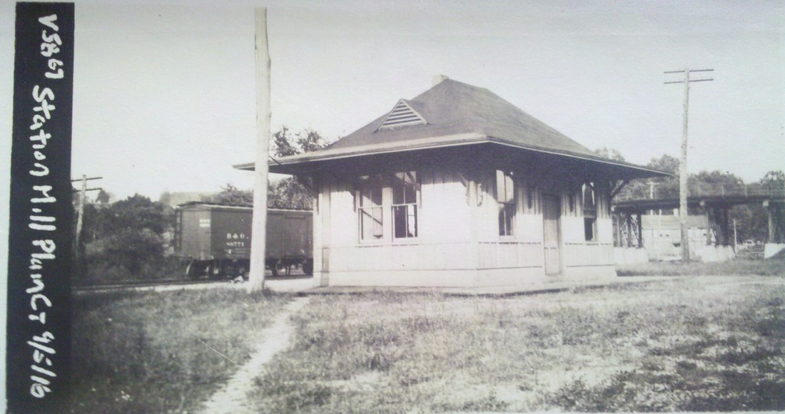
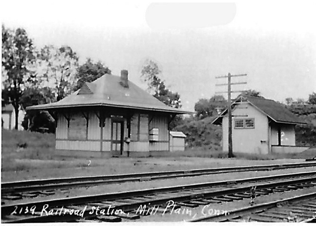
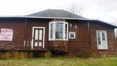
This station in the western part of DANBURY was up in 1881 for the opening of the NY&NE extension to the Hudson River and was described by one reporter as "a pretty depot building." If it is another of Leman Oatman's stations, it looks virtually identical to NEWTOWN/N and similar in size and design to TOWANTIC. IN 1918 it became part of the CNE with a divisional shake-up that moved that railroad's headquarters to Danbury. MILL PLAIN stood in railroad use until passenger service on this line ended ca. 1928. In 1930 it was purchased by Jeremiah J. Coffey, the Danbury dog warden, and moved to the corner of Rte. 6 and Ridgebury Rd. to be his residence. Later moved slightly east, it became the Best Round Golf Car Repair shop until a few years ago. The new property owner then donated the vintage structure to the Danbury Railway Museum. Prior to moving it on 10/26/2018, the wings added by later owners were shorn off and the hipped roof was removed for tranport; ironically and thankfully the addition of the wings protected the walls of the original building which were left intact inside! DRM intends to reassemble the depot and use it as a yard-destination attraction. Many thanks go to well-known rail photographer Dan Gallo for his tireless efforts which finally came to fruition two years after the planning began. Thanks also to Stan Madyda and DRM for their vision and determination to see this project through and save this attractive, historic little depot from the wrecker's ball. The val photo at [1] is dated 9/5/1916. Lewis H. Benton's shot #2139 at [2] dates to late June, 1928 and shows the freight house behind the passenger station. That freight building may also date to 1881 when the Bristol Weekly Press said work on the new station there had slowed and carpenters were coming here. Our photos at [3] and [4] were taken on 4/2/2016. The move shots were taken live on-site at Mill Plain [5] and DRM [6] on 10/26/2018. The image at [7] is the from the 1886-1889 NY&NE real estate atlas and shows the layout of the station grounds at that time. [REFS: DN/07/27/1881/01; BWP/11/17/1881/02; DEN/05/23/1930/08; K84; R66: John Roy's ca. 1885 date and HP&F origins for this station are in error.][rev112818, 112420]
MILL RIVER JUNCTION [NH&NL, 1849]
Known otherwise as TIN BRIDGE, BELLE DOCK JUNCTION, and SHORE LINE JUNCTION, this city of NEW HAVEN passenger stop seems to have started in 1849 when the NY&NH laid track to this point and created a junction with the H&NH main line to Belle Dock. The 1849 annual report actually defines the extent of the NY&NH as "commencing at the junction of the Hartford and New-Haven Rail Road, near Mill River..." The first H&NH bridge over the river was wooden and covered with tin as was often done to prevent locomotive-spark fires. and, in spite of the replacement with one in arches "constructed of massive blocks" of Portland sandstone in 1864, the 'Tin Bridge' name persisted for the station and the area. An 1867 newspaper article lends credence to the existence of an actual station structure here when it reports that passenger was severely injured while detraining "at the junction just above the Shore Line depot here, and instead, stepped off the Stone bridge -- formerly known as the tin bridge..." and fell into the river bed below. The NH&NL had, of course, opened in 1852 and crossed the river here on its own 'tin bridge' that was removed in 1881 when the Consolidated reconfigured the Shore Line Division come in on its Hartford line bridge. The snippet from the Bailey 1879 bird's-eye map of New Haven shows the two adjacent bridges. An 1873 article said that a new station was going to be built here between East St. and the 'tin' bridge with the opening of NEW HAVEN4, but we do not think that ever happened. When the new downtown depot on Meadow St. opened in 1875, the newspaper said that "short trains" were being run from FAIR HAVEN EAST, FAIR HAVEN, "the Tin bridge," and "the old depot" [NEW HAVEN3] to the new station. While we can't be certain yet, we are thinking that the TIN BRIDGE station was in the tall building that stands at the corner of Walnut St. and Mill River St., an intersection that still exists today. This stop appears only in the 1875 newspaper articles cited below and on no timetable we have yet seen, being apparently considered a local affair. The designation of SHORE LINE JUNCTION seems to appear for the first time in the 1888 annual report as the beginning mileage point for the division. The other two alternate names seem as unofficial in use as TIN BRIDGE for this important junction point that was eclipsed when the CEDAR HILL station debuted just across the river in 1889. The photos show the bridge today that surely does not date back to 1852, but does mark the spot where the old Shore Line diverged eastward through Fair Haven and where the Manufacturers' RR also accessed the NYNH&H tracks for years. Today, trains for the Belle Dock branch use a newer connection just to the south and out of sight in the photo at right. [REFS: NYNHAR 1849; NHDP/01/27/1849/02; HDC/08/08/1864/02; HDC/11/24/1864/02; NA/09/25/1867/04; NHJC/05/20/1875/02; NHER/05/21/1875/04; HET/08/19/1881/??; NHER/08/19/1881/04; NHAR17.1888.10]
Known otherwise as TIN BRIDGE, BELLE DOCK JUNCTION, and SHORE LINE JUNCTION, this city of NEW HAVEN passenger stop seems to have started in 1849 when the NY&NH laid track to this point and created a junction with the H&NH main line to Belle Dock. The 1849 annual report actually defines the extent of the NY&NH as "commencing at the junction of the Hartford and New-Haven Rail Road, near Mill River..." The first H&NH bridge over the river was wooden and covered with tin as was often done to prevent locomotive-spark fires. and, in spite of the replacement with one in arches "constructed of massive blocks" of Portland sandstone in 1864, the 'Tin Bridge' name persisted for the station and the area. An 1867 newspaper article lends credence to the existence of an actual station structure here when it reports that passenger was severely injured while detraining "at the junction just above the Shore Line depot here, and instead, stepped off the Stone bridge -- formerly known as the tin bridge..." and fell into the river bed below. The NH&NL had, of course, opened in 1852 and crossed the river here on its own 'tin bridge' that was removed in 1881 when the Consolidated reconfigured the Shore Line Division come in on its Hartford line bridge. The snippet from the Bailey 1879 bird's-eye map of New Haven shows the two adjacent bridges. An 1873 article said that a new station was going to be built here between East St. and the 'tin' bridge with the opening of NEW HAVEN4, but we do not think that ever happened. When the new downtown depot on Meadow St. opened in 1875, the newspaper said that "short trains" were being run from FAIR HAVEN EAST, FAIR HAVEN, "the Tin bridge," and "the old depot" [NEW HAVEN3] to the new station. While we can't be certain yet, we are thinking that the TIN BRIDGE station was in the tall building that stands at the corner of Walnut St. and Mill River St., an intersection that still exists today. This stop appears only in the 1875 newspaper articles cited below and on no timetable we have yet seen, being apparently considered a local affair. The designation of SHORE LINE JUNCTION seems to appear for the first time in the 1888 annual report as the beginning mileage point for the division. The other two alternate names seem as unofficial in use as TIN BRIDGE for this important junction point that was eclipsed when the CEDAR HILL station debuted just across the river in 1889. The photos show the bridge today that surely does not date back to 1852, but does mark the spot where the old Shore Line diverged eastward through Fair Haven and where the Manufacturers' RR also accessed the NYNH&H tracks for years. Today, trains for the Belle Dock branch use a newer connection just to the south and out of sight in the photo at right. [REFS: NYNHAR 1849; NHDP/01/27/1849/02; HDC/08/08/1864/02; HDC/11/24/1864/02; NA/09/25/1867/04; NHJC/05/20/1875/02; NHER/05/21/1875/04; HET/08/19/1881/??; NHER/08/19/1881/04; NHAR17.1888.10]
MILLSTONE [NYNH&H, 1895]
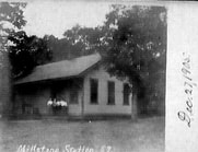
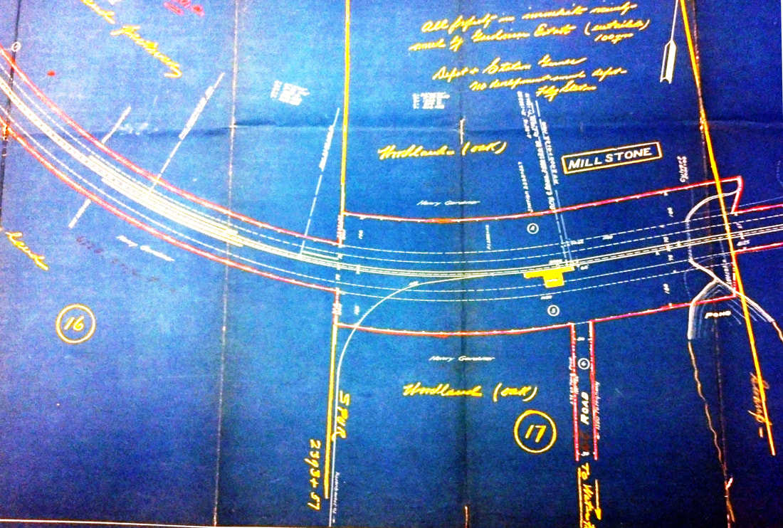
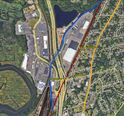
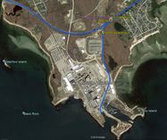
The first we hear of plans for this station in the town of Waterford is in 1894 in a Niantic newspaper called the Connecticut Eastern News. An article on 10/9/1894 said that surveying had begun through an area known as Gardiner's Woods and that "this station will accommodate passengers from Millstone and Pleasure Beach and will undoubtedly be a great convenience..." A Journal Courier article puts the opening date as 1/1/1895, saying "the station at Millstone is a new but small structure that was opened by the railroad company on the first of January." The opening date and the appointment of Samuel Rogers, Jr. as the first agent are corroborated in the News. The mention of Pleasure Beach in the first article has brought out some interesting aspects of the establishment this station as a late addition to the Shore Line. In 1904, a petition to the state railroad commissioners asked for a separate station there like other beach communities had requested. The railroad said that area service was adequate, pointing out that a Pleasure Beach station would only be 2250 feet east of MILLSTONE and that the WATERFORD station was only about 1.5 miles further east. The response to the commissioners on 5/26/1905 from Asst. Attorney Benjamin Spock (father of the famous Dr. Spock) is instructive in saying that "... the present station was established at the end of a long litigation with Mr. [Henry] Gardner..." and Spock said that the NYNH&H would formally petition to abandon MILLSTONE if the Pleasure Beach community, located on the east bank of Jordan Cove as seen in [6], could get Gardner to agree. The matter was dropped on 6/30/1905. Would Gardner have allowed the move? Interestingly, eight months after MILLSTONE opened, the newspaper was praising the Millstone Point granite-quarry owner for his innovation that changed "the manner of hauling stone from the quarry to the Consolidated railroad track. A new and good-sized locomotive has been added to the plant and switches laid..." The article goes on to say that lines of track will probably be soon reaching all parts of the quarry and that he [Gardner] is following the example of operations at Portland and Cromwell in replacing oxen with the Iron Horse. The CEN of 9/18/1894 says "... the first cars were run over the road early last week." The spur, of course, branched off right at the MILLSTONE station where a block tower, SS-109, would be established to, among other regular duties, control access to the quarry track. One might well speculate that a depot at MILLSTONE only came about through Gardner and that the "extended litigation" resulted in its being where he wanted it: positioned to serve his business. The image at [1], the earliest we have of this station, was taken on 12/27/1905. The real estate map at [2] shows the depot situated south of the tracks and the 'flag station' note in yellow would indicate diminished service in the early 1920s. Gardner's name is seen on a number of land parcels; the spur curving south at middle goes to the quarries. The 9/8/1916 val photo at [3] looks east. The image at [4] is Lewis H. Benton #2391 taken in late June 1929; the well-composed photo looks west and captures the sweeping curve of the track. Fellow photographer Irving Drake is on the platform by what looks like the flag-stop signal used in the later days. The quarry spur would be behind him; no SS-109 is seen there where you might expect it (and we have yet to see it in a photo anywhere). The last appearance of MILLSTONE in the timetables we have is 1923 and the listing is gone by 1928 so the boarded windows in the 1929 Benton shot likely indicate permanent closing. The depot seems to be in place at the right arrow on the 1934 aerial at [5], the left arrow indicating the spur. The SSRR list of 1938 does not show any structures to be retired here so the building must have been sold and removed before that time. The quarry spur, clearly shown on the 1938 topographic map at [6], outlived the closing of the quarry operation in 1963 and the 1970 opening of the Millstone nuclear power plant which is there now. Track still in the ground today is semi-active, according to author and TCS successor John Roy; Jersey barriers are removed as needed to bring trains off the NEC. The spur to Millstone Point is seen on the GE map at [7]; the old quarry itself is filled with water today. [REFS: CEN/10/09/1894/03; CEN 10/23/1894/03; CEN/11/20/1894/03; CEN/01/08/1895/03; NHJC/01/18/1895/02; CEN/08/13/1895/03; rev7/1/1896TT: yes; CSLIB RG 041:001 3.53.6 (1904-1905); NBU/03/15/1919/01: temporary depot shutdown; rev12/2/1923TT: yes; 11/18/1928TT: no; HC/12/19/1970/12][rev120818,
121818]
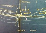
MOHEGAN [NLW&P, 1849]
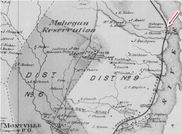
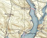
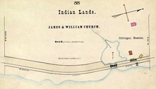
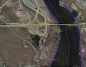
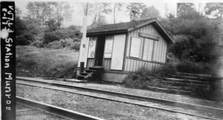
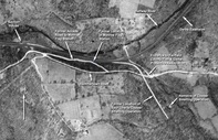
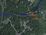
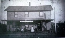
This station in the town of MONTVILLE was established by the NLW&P when it opened in 1849. Image [1] is thought to be the covered platform that served the flag station here, in later days at least, and the mound corresponds to the terrain today, as seen through the foliage in photo [5]. An arrow points to the station site on the 1868 map [2] and the 1893 topo map [3] shows the MOHEGAN stop as well as MASSAPEAG, two miles south. The 1883 NLN map [4] shows Shiantic Brook running just south of the stop and the scene of a derailment in 1877, plus the platform and some scattered buildings. The icon on the Track 11 snippet [6] marks the location today, in the shadow of the Mohegan Sun casino. The 1917 val map [7] shows the words 'Flag Signal' above the symbol that our red arrow points to. [REFS: CR/07/11/1859/02; NA/09/01/1869/03; HDC/08/27/1877/03][rev012014]
This station in the town of MONTVILLE was established by the NLW&P when it opened in 1849. Image [1] is thought to be the covered platform that served the flag station here, in later days at least, and the mound corresponds to the terrain today, as seen through the foliage in photo [5]. An arrow points to the station site on the 1868 map [2] and the 1893 topo map [3] shows the MOHEGAN stop as well as MASSAPEAG, two miles south. The 1883 NLN map [4] shows Shiantic Brook running just south of the stop and the scene of a derailment in 1877, plus the platform and some scattered buildings. The icon on the Track 11 snippet [6] marks the location today, in the shadow of the Mohegan Sun casino. The 1917 val map [7] shows the words 'Flag Signal' above the symbol that our red arrow points to. [REFS: CR/07/11/1859/02; NA/09/01/1869/03; HDC/08/27/1877/03][rev012014]
MONROE1 [NH&D, 1890]
On 11/10/1889, fully a year after the line was opened to Botsford, the Newtown Bee said that "Monroe people have long wished for a station on the Derby extension, one nearer than STEVENSON... and... "a station will be built. It will be a small but pretty and suitable building, costing $200 to $300." There apparently were no plans for another stop in this town until it came about as a trade-off for a settlement of highway issues satisfactory to the NH&D. A few days later, a Register article ran on 11/20, saying that this was the day the location was to be decided upon at a meeting between Pres. Stevenson, Supt. Hopson, and the Monroe selectmen. Hammertown Rd. may have been chosen based on an ongoing revival of its old manufacturing days with Ansonia businessman Edward L. Smith's purchase of the old Minott Booth homestead. Likely due to Smith's influence and perhaps built by him and given to the railroad, the diminutive depot was put up sometime before 8/1/1890 when the Bee reported that there were complaints to the selectmen that "... our station on the Derby line has not been open regularly..." and, next week that "... it was "now open to the public." Freight shipments of apples, cattle, and lumber originating here are reported in the newspaper as are several mentions of incoming carloads of coal on the siding. Human cargo, boarders and workers, were said to be conveyed daily from here by a local hackman in June, 1894. Early mentions of a spur to the Smith's land notwithstanding, the railroad commissioners approved two parallel tracks "a short distance apart" in 1894 to reach across the road to Smith's latest venture, the Fairfield Copper Co. A smelting operation replete with 92-ft smokestack and a switchback to cut car charges, it was reportedly shipping out a carload of product a day for a short time. The entrepreneurial hero of the hour, for whom the Monroe stop was almost named Smithville, however, soon faltered and bankruptcy proceedings ensued by 1896. A second station, MONROE2, was built and removed to become STEVENSON2 in 1905. Upon its removal, the Bee said that "the old Monroe station now in use, it is said, is to be renovated and improved," and on 1/18/1907, that it had "been given a new coat of paint and presents a much neater appearance." MONROE1 is seen in the 8/17/1916 val photo at [1]. Kevin Daly's arrows on the 1934 aerial map at [2] clarify the precise location of the station, the spur and the factory site after a permitted recon mission with Bill Bracco a few years back. The snippet at [3] from our Track 11 Google Earth map shows the area today; the Fairfield County Protective Association, a gun club, owns the land adjacent to the station site. The ultimate fate of MONROE1 is unknown; it was likely disposed of before the 1938 SSRR list on which it does not appear. [REFS: NBE/11/01/1889/04; NBE/11/15/1889/02; NHER/11/20/1889/02; NBE/08/01/1890/03; NBE/08/08/1890/03; HRRAR 1890, p5; NHER/01/22/1894/04; BH/03/28/1894/02; RRC19.216 (6/21/1894); CRC42.1894.34; NBE/01/25/1895/03: accident at crossing; NBE/02/15/1895/06; NBE/11/08/1895/07; NBE/10/06/1905/07; NBE/01/18/1907/10; NBE/12/06/1907/10; Edward N. Coffey, A Glimpse of Old Monroe, p58+][rev010418]
On 11/10/1889, fully a year after the line was opened to Botsford, the Newtown Bee said that "Monroe people have long wished for a station on the Derby extension, one nearer than STEVENSON... and... "a station will be built. It will be a small but pretty and suitable building, costing $200 to $300." There apparently were no plans for another stop in this town until it came about as a trade-off for a settlement of highway issues satisfactory to the NH&D. A few days later, a Register article ran on 11/20, saying that this was the day the location was to be decided upon at a meeting between Pres. Stevenson, Supt. Hopson, and the Monroe selectmen. Hammertown Rd. may have been chosen based on an ongoing revival of its old manufacturing days with Ansonia businessman Edward L. Smith's purchase of the old Minott Booth homestead. Likely due to Smith's influence and perhaps built by him and given to the railroad, the diminutive depot was put up sometime before 8/1/1890 when the Bee reported that there were complaints to the selectmen that "... our station on the Derby line has not been open regularly..." and, next week that "... it was "now open to the public." Freight shipments of apples, cattle, and lumber originating here are reported in the newspaper as are several mentions of incoming carloads of coal on the siding. Human cargo, boarders and workers, were said to be conveyed daily from here by a local hackman in June, 1894. Early mentions of a spur to the Smith's land notwithstanding, the railroad commissioners approved two parallel tracks "a short distance apart" in 1894 to reach across the road to Smith's latest venture, the Fairfield Copper Co. A smelting operation replete with 92-ft smokestack and a switchback to cut car charges, it was reportedly shipping out a carload of product a day for a short time. The entrepreneurial hero of the hour, for whom the Monroe stop was almost named Smithville, however, soon faltered and bankruptcy proceedings ensued by 1896. A second station, MONROE2, was built and removed to become STEVENSON2 in 1905. Upon its removal, the Bee said that "the old Monroe station now in use, it is said, is to be renovated and improved," and on 1/18/1907, that it had "been given a new coat of paint and presents a much neater appearance." MONROE1 is seen in the 8/17/1916 val photo at [1]. Kevin Daly's arrows on the 1934 aerial map at [2] clarify the precise location of the station, the spur and the factory site after a permitted recon mission with Bill Bracco a few years back. The snippet at [3] from our Track 11 Google Earth map shows the area today; the Fairfield County Protective Association, a gun club, owns the land adjacent to the station site. The ultimate fate of MONROE1 is unknown; it was likely disposed of before the 1938 SSRR list on which it does not appear. [REFS: NBE/11/01/1889/04; NBE/11/15/1889/02; NHER/11/20/1889/02; NBE/08/01/1890/03; NBE/08/08/1890/03; HRRAR 1890, p5; NHER/01/22/1894/04; BH/03/28/1894/02; RRC19.216 (6/21/1894); CRC42.1894.34; NBE/01/25/1895/03: accident at crossing; NBE/02/15/1895/06; NBE/11/08/1895/07; NBE/10/06/1905/07; NBE/01/18/1907/10; NBE/12/06/1907/10; Edward N. Coffey, A Glimpse of Old Monroe, p58+][rev010418]
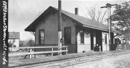
MONROE2 [NYNH&H, 1895]
It had been claimed from time to time that the MONROE station was moved to Stevenson in 1905 to take the place of the one that burned there in that year. As revealed by the Bee, it was not MONROE1 that was moved but MONROE2, the offspring of the 1890s industrial boom. The rumor in July, 1894 was that "the depot [MONROE1] is to be used as a tool house and a larger one built." By February, 1895 an agent was hired, apparently first doing duty at the tiny MONROE1, and "... a new and commodious station with freight house is to be erected immediately, with telegraph and telephone connections..." and by May... "The foundation for the new depot is being laid, this week, and Monroe may soon be proud of a grand new station building... 50 feet long by 25 feet wide... rapidly approaching completion," later in the month. No notice has been found about the actual opening but, by this time the Botsford Brothers' plow works was operating among the copper factory's "several other buildings, a tenement and a store, likely Milwood's, aka Millwood Hall where social events were held. Monroe Station had indeed had become a 'place' and was referred to as such just like Botsford or Stepney in the newspapers. The locale was flourishing, or was it? Perhaps affected by the copper collapse across the street, suddenly the 10/18/1895 Bee reported that "the Monroe station has been closed, the agent M.T. Ryan, having been transferred to Lanesville. Trains will stop on signal as here-to-fore, but tickets will have to be procured on the cars." Next we learn on 8/11/1905 that "the station building at Monroe that has been closed the past few years, is to be moved here [Stevenson] and placed on the same site of the one burned, but it will be much larger." In September, ... "the large depot at Monroe station has been taken down and was moved here, last week Thursday night, to take the place of the depot burned a few months ago." And finally in October: "The large station and freight house built several years ago at Monroe but never opened, [italics ours] has been moved to Stevenson to take the place of the depot which was burned. The old Monroe station now in use, it is said, is to be renovated and improved." Thus on 9/21/1905 MONROE2 became STEVENSON2, as seen in the val photo of 10/27/1916, and MONROE1 resumed its old post. Where exactly MONROE2 originally stood is uncertain. Perhaps at the FCPA crossing? Is the foundation still in the ground? Why did the station never open and remain unused for a decade? Where was Millwood's store and dance hall? Many questions remain. We are speechless! [REFS: NBE/07/27/1894/02; NBE/01/11/1895/02; NBE/02/01/1895/04; NBE/05/31/1895/02; NBE/06/23/1899/10; NBE/08/11/1905/07; NBE/09/29/1905/10][rev010418]
It had been claimed from time to time that the MONROE station was moved to Stevenson in 1905 to take the place of the one that burned there in that year. As revealed by the Bee, it was not MONROE1 that was moved but MONROE2, the offspring of the 1890s industrial boom. The rumor in July, 1894 was that "the depot [MONROE1] is to be used as a tool house and a larger one built." By February, 1895 an agent was hired, apparently first doing duty at the tiny MONROE1, and "... a new and commodious station with freight house is to be erected immediately, with telegraph and telephone connections..." and by May... "The foundation for the new depot is being laid, this week, and Monroe may soon be proud of a grand new station building... 50 feet long by 25 feet wide... rapidly approaching completion," later in the month. No notice has been found about the actual opening but, by this time the Botsford Brothers' plow works was operating among the copper factory's "several other buildings, a tenement and a store, likely Milwood's, aka Millwood Hall where social events were held. Monroe Station had indeed had become a 'place' and was referred to as such just like Botsford or Stepney in the newspapers. The locale was flourishing, or was it? Perhaps affected by the copper collapse across the street, suddenly the 10/18/1895 Bee reported that "the Monroe station has been closed, the agent M.T. Ryan, having been transferred to Lanesville. Trains will stop on signal as here-to-fore, but tickets will have to be procured on the cars." Next we learn on 8/11/1905 that "the station building at Monroe that has been closed the past few years, is to be moved here [Stevenson] and placed on the same site of the one burned, but it will be much larger." In September, ... "the large depot at Monroe station has been taken down and was moved here, last week Thursday night, to take the place of the depot burned a few months ago." And finally in October: "The large station and freight house built several years ago at Monroe but never opened, [italics ours] has been moved to Stevenson to take the place of the depot which was burned. The old Monroe station now in use, it is said, is to be renovated and improved." Thus on 9/21/1905 MONROE2 became STEVENSON2, as seen in the val photo of 10/27/1916, and MONROE1 resumed its old post. Where exactly MONROE2 originally stood is uncertain. Perhaps at the FCPA crossing? Is the foundation still in the ground? Why did the station never open and remain unused for a decade? Where was Millwood's store and dance hall? Many questions remain. We are speechless! [REFS: NBE/07/27/1894/02; NBE/01/11/1895/02; NBE/02/01/1895/04; NBE/05/31/1895/02; NBE/06/23/1899/10; NBE/08/11/1905/07; NBE/09/29/1905/10][rev010418]
MONTOWESE [NHM&W, 1870; depot 1871]
The New Haven, Middletown & Willimantic began running trains on 8/1/1870. This station in the town of North Haven was opened late in 1870 and a local committee raised money to grade the road to the new depot, likely Montowese Ave., and, by some accounts, to build the station as well. By March of the next year, we read that the "... people in the vicinity of the new station in the southern part of the town [North Haven] on the Air Line, viz. 'Montowese,' are about to erect a dwelling house and depot combined...." Thus, the two-story residential appearance of the structure is explained. The upstairs apartments were usually for the agent and his family. According to the Courant, the stop was named for "an old Indian chief who formerly dwelt thereabouts...." This choice of names had the benefit also of distinguishing it from the nearby NORTH HAVEN stop on the Hartford line. A post office was established here in June, 1871 with Wallace A. Robinson appointed postmaster. This event was a milestone for any village, amounting to federal recognition of the locale. The railroad put places on the map by creating population centers where there were none before, thus the wording that "... we see no reason why a large village will not soon be added to that section of our town." And the trains also brought the mail so the station was often the post office as well, with the agent wearing both hats. What was it like to stop here? A disgruntled visitor in January, 1872 says that "stepping into the 'waiting room' to get warm... we found a rusty stove without a pipe... no chairs... not even a man in the building to point you to the road to the village... a cold, cheerless depot...," for which he chided the locals for "lack of public spirit and private pride," which he hoped was not typical of North Haven hospitality. It is hard to believe this could be the case a year and a half after the railroad opened. If by chance this was the post office and the agent did live upstairs, it is unlikely that no one was around to meet the train. Of course, we do not know what 'staffing' was like in those early days. Could he have gotten off at tiny QUINNIPIACK? And why was he not blaming the company for operational deficiencies? Personal impressions aside, his assertions that this station opened in the fall of 1871 is off by several months and his claim that there was no depot at EAST HAVEN is also false. But, we digress! The historical photo at [1] perhaps dates to the 1890s when that dress style was in vogue. The valuation photo at [2] was taken on 8/21/1916. The station location in the northeast quadrant at the Montowese Ave. crossing is seen on the 6/30/1915 val map at [3]. The blue arrow on the 1921 Cedar Hill map at [4] shows the depot along the original NHM&W line. That location appears to correspond to the I-91 overpass built in the 1960s when the track was relocated slightly west due to the highway construction. This was still a flag stop in 1925 but is gone by 1928. Perhaps at some time therein, the station was moved a short distance east and rotated to face Montowese Ave. at the corner of Clark Ave. Our shot at [5] was taken in 2012 and Google maps still still show it standing. Front porches have obviously been added. The snippet from our Track 11 Google Earth map shows the old and new locations for the structure. The current alignment of the Air Line is in blue, the old right of way is red. The friendly folk at the North Haven Historical Society [click here] were very helpful in providing photos. [REFS: HDC/12/12/1870/04; CR/12/17/1870/04; MC/12/21/1870/02; SR/03/17/1871/08; BDA/06/17/1871/04; SR/07/21/1871/08; NHJC/01/26/1872/02: says incorrectly that depot opened last Fall, i.e. 1871; also that EAST HAVEN does not have a station; NHER/07/03/1872/02; HC/12/25/1921/22; 12/2/1925 Form 220 LWTT: yes; 11/18/1928 Form 200 TT: no][rev053117, 050922]
The New Haven, Middletown & Willimantic began running trains on 8/1/1870. This station in the town of North Haven was opened late in 1870 and a local committee raised money to grade the road to the new depot, likely Montowese Ave., and, by some accounts, to build the station as well. By March of the next year, we read that the "... people in the vicinity of the new station in the southern part of the town [North Haven] on the Air Line, viz. 'Montowese,' are about to erect a dwelling house and depot combined...." Thus, the two-story residential appearance of the structure is explained. The upstairs apartments were usually for the agent and his family. According to the Courant, the stop was named for "an old Indian chief who formerly dwelt thereabouts...." This choice of names had the benefit also of distinguishing it from the nearby NORTH HAVEN stop on the Hartford line. A post office was established here in June, 1871 with Wallace A. Robinson appointed postmaster. This event was a milestone for any village, amounting to federal recognition of the locale. The railroad put places on the map by creating population centers where there were none before, thus the wording that "... we see no reason why a large village will not soon be added to that section of our town." And the trains also brought the mail so the station was often the post office as well, with the agent wearing both hats. What was it like to stop here? A disgruntled visitor in January, 1872 says that "stepping into the 'waiting room' to get warm... we found a rusty stove without a pipe... no chairs... not even a man in the building to point you to the road to the village... a cold, cheerless depot...," for which he chided the locals for "lack of public spirit and private pride," which he hoped was not typical of North Haven hospitality. It is hard to believe this could be the case a year and a half after the railroad opened. If by chance this was the post office and the agent did live upstairs, it is unlikely that no one was around to meet the train. Of course, we do not know what 'staffing' was like in those early days. Could he have gotten off at tiny QUINNIPIACK? And why was he not blaming the company for operational deficiencies? Personal impressions aside, his assertions that this station opened in the fall of 1871 is off by several months and his claim that there was no depot at EAST HAVEN is also false. But, we digress! The historical photo at [1] perhaps dates to the 1890s when that dress style was in vogue. The valuation photo at [2] was taken on 8/21/1916. The station location in the northeast quadrant at the Montowese Ave. crossing is seen on the 6/30/1915 val map at [3]. The blue arrow on the 1921 Cedar Hill map at [4] shows the depot along the original NHM&W line. That location appears to correspond to the I-91 overpass built in the 1960s when the track was relocated slightly west due to the highway construction. This was still a flag stop in 1925 but is gone by 1928. Perhaps at some time therein, the station was moved a short distance east and rotated to face Montowese Ave. at the corner of Clark Ave. Our shot at [5] was taken in 2012 and Google maps still still show it standing. Front porches have obviously been added. The snippet from our Track 11 Google Earth map shows the old and new locations for the structure. The current alignment of the Air Line is in blue, the old right of way is red. The friendly folk at the North Haven Historical Society [click here] were very helpful in providing photos. [REFS: HDC/12/12/1870/04; CR/12/17/1870/04; MC/12/21/1870/02; SR/03/17/1871/08; BDA/06/17/1871/04; SR/07/21/1871/08; NHJC/01/26/1872/02: says incorrectly that depot opened last Fall, i.e. 1871; also that EAST HAVEN does not have a station; NHER/07/03/1872/02; HC/12/25/1921/22; 12/2/1925 Form 220 LWTT: yes; 11/18/1928 Form 200 TT: no][rev053117, 050922]
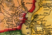
MONTVILLE1 [NLW&P, 1849]
This stop was established in 1849 when the NLW&P opened and the first depot was presumably built at that time. It was destroyed after catching fire from from the adjacent freight house which burned on 10/6/1862. Described as being two-story, the station's upper level also served as a public meeting hall. The railroad loss of the buildings and contents totaled $5,000; $2,000 worth of goods were lost by the Thomas Mill Co. No photo yet. [REFS: BA.17.1864.00 (10/6/1862); HDC/10/08/1862/04; CC/10/11/1862/03; SR/10/08/1862/04][rev100318]
This stop was established in 1849 when the NLW&P opened and the first depot was presumably built at that time. It was destroyed after catching fire from from the adjacent freight house which burned on 10/6/1862. Described as being two-story, the station's upper level also served as a public meeting hall. The railroad loss of the buildings and contents totaled $5,000; $2,000 worth of goods were lost by the Thomas Mill Co. No photo yet. [REFS: BA.17.1864.00 (10/6/1862); HDC/10/08/1862/04; CC/10/11/1862/03; SR/10/08/1862/04][rev100318]
MONTVILLE2 [NLN, 1863]
The foundation for a new combination depot was reportedly not laid for almost a year. In a Fifty-Years-Ago series in 1913, the paper is said to have reported on 9/21/1863 that "... preparations are being made to build a new depot and establish a telegraph at Montville station to replace the depot destroyed by fire some time since. The paper of 10/27/1863 said that "... the new depot at Montville station is nearly finished and will be ready for the reception of passengers in a few days. It is a decided improvement on either of the buildings previously used for that purpose, and is a credit to the road." Shot [1] is undated but has the old vertical board-and-batten exterior. The 1868 Beers map [2] shows the location where the depot stood along the river. Business must have been sufficient enough thereafter to once again build a separate freight depot and new car house in 1866, as reported in the Willimantic Journal; they are seen in the 1883 NLN real estate map [3]. Image [4] dates to the 1890s, since the 1874-built locomotive #175 only carried that number between 1890 and 1900. According to Bob Britten, former agent, this structure was clapboarded by the 1930s and it sported s a changed door-and-window arrangement and a new signal mast as well [5]. It looks Lewis H. Benton took his photo #2824 with Irving Drake seated on station steps in 1931, likely on 0906. Image [6] is probably from the 1950s and before this 100-year-old station was torn down in the late 1970s. Jim Murphy has an April, 1977 photo showing both buildings still standing in the Ambassador [3.11 (1994)]. The freight agency here and in NORWICH/W had been closed in 1972 in in favor of a new Serve-Centre computerized system. [REFS: HDC/10/08/1862/02; HDC/09/21/1863/02; HDC/10/13/1863/02; WJO/03/29/1866/54; HDC/11/05/1878/03; NMB/09/27/1913/14; NMB/11/01/1913/4][rev100318]
The foundation for a new combination depot was reportedly not laid for almost a year. In a Fifty-Years-Ago series in 1913, the paper is said to have reported on 9/21/1863 that "... preparations are being made to build a new depot and establish a telegraph at Montville station to replace the depot destroyed by fire some time since. The paper of 10/27/1863 said that "... the new depot at Montville station is nearly finished and will be ready for the reception of passengers in a few days. It is a decided improvement on either of the buildings previously used for that purpose, and is a credit to the road." Shot [1] is undated but has the old vertical board-and-batten exterior. The 1868 Beers map [2] shows the location where the depot stood along the river. Business must have been sufficient enough thereafter to once again build a separate freight depot and new car house in 1866, as reported in the Willimantic Journal; they are seen in the 1883 NLN real estate map [3]. Image [4] dates to the 1890s, since the 1874-built locomotive #175 only carried that number between 1890 and 1900. According to Bob Britten, former agent, this structure was clapboarded by the 1930s and it sported s a changed door-and-window arrangement and a new signal mast as well [5]. It looks Lewis H. Benton took his photo #2824 with Irving Drake seated on station steps in 1931, likely on 0906. Image [6] is probably from the 1950s and before this 100-year-old station was torn down in the late 1970s. Jim Murphy has an April, 1977 photo showing both buildings still standing in the Ambassador [3.11 (1994)]. The freight agency here and in NORWICH/W had been closed in 1972 in in favor of a new Serve-Centre computerized system. [REFS: HDC/10/08/1862/02; HDC/09/21/1863/02; HDC/10/13/1863/02; WJO/03/29/1866/54; HDC/11/05/1878/03; NMB/09/27/1913/14; NMB/11/01/1913/4][rev100318]
MOODUS [> EAST HADDAM]
MOOSUP1 [HP&F, 1854]
The HP&F established this stop in 1854 when they opened from Providence, RI to Willimantic through this manufacturing village in the town of PLAINFIELD. Our red arrows on the 1856WC map at left and the 1869 map at middle show the location. The first depot was built between October, 1855 and October, 1856, according to information in the annual reports. It apparently lasted until a 7/21/1892 spontaneous-combustion fire that caused $100,000 worth of damage over three acres in the heart of the community. MOOSUP1 is pictured at right on the Burleigh bird's-eye map of 1889 [click here], the building with the locator number '11' on the roof. Trains due at the time were reportedly held at each side of the burning passenger and freight stations for upwards of an hour until it was deemed safe for them to pass. [REFS: HPFAR6.1855.8; HPFAR7.1856.9; NHER/07/21/1892/01; SR/07/22/1892/07; CRC39.1893.39; CRC41.1893.39][rev070513, 121618]
The HP&F established this stop in 1854 when they opened from Providence, RI to Willimantic through this manufacturing village in the town of PLAINFIELD. Our red arrows on the 1856WC map at left and the 1869 map at middle show the location. The first depot was built between October, 1855 and October, 1856, according to information in the annual reports. It apparently lasted until a 7/21/1892 spontaneous-combustion fire that caused $100,000 worth of damage over three acres in the heart of the community. MOOSUP1 is pictured at right on the Burleigh bird's-eye map of 1889 [click here], the building with the locator number '11' on the roof. Trains due at the time were reportedly held at each side of the burning passenger and freight stations for upwards of an hour until it was deemed safe for them to pass. [REFS: HPFAR6.1855.8; HPFAR7.1856.9; NHER/07/21/1892/01; SR/07/22/1892/07; CRC39.1893.39; CRC41.1893.39][rev070513, 121618]
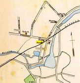
MOOSUP2 [NYNH&H, 1893]
This station opened toward the end of 1893, a full 15 months after the fire of July, 1892. Curiously, new station design plans dated 11/14/1892 can be found at CSL in RG 041 which contains the papers of the railroad commissioners. The reason for the delay in execution is unclear as is whether the NY&NE even told the commissioners that plans had been drawn up. Coincidentally, a few weeks after the date on the plans, public dissatisfaction surfaced in print when the Courant ran an article on 11/29/1892 as follows: "NO STATION AT MOOSUP. A Suggestion to the New England Road... Almost four months have gone by and no new railroad station has been built at Moosup. There is nothing but a baggage car for ladies and pack peddlers, smokers and tobacco chewers. A few days ago a gentleman and his invalid wife were obliged to stand out in the piercing cold wind waiting for the train, as she was not able to climb in and out of the car." Irregardless of any knowledge of the plans, the commissioners ordered the NY&NE to build a replacement station in late June, their first such action under new power given to them by the legislature as of 6/1/1893. At long last in October, 1893, the Courant said that "the new depot at Moosup will soon be ready for the public. The interior is finished in hard wood." The railroad commissioners, recounting the history of this affair, said in their December, 1893 annual report that this depot "is now in use." After all that trouble and public incovenience, MOOSUP2 itself would last only about three years, with an arson fire breaking out in the building at about 4:00 in the morning on 3/15/1897. The situation threatened to be another conflagration like 1892 but quick action stopped the spread of the flames. The fire was reportedly contained in the east end of the depot but it nevertheless soon enveloped the whole structure and damaged freight cars on the siding as well. Presumably with a baggage car pressed into service again, it took six months until October, 1897 for the Courant to be able to report that "all the ruins about the old depot have been removed and the foundation walls have been fenced in," thus setting the stage for yet another new structure. [REFS: HC/11/29/1892/06; RRC28.323 (6/26/1893); CRC41.1893.23,39; Public Acts, 1893, CLXV; HC/10/13/1893/08; NYNEAR18.1894.8; HC/10/02/1897/10; NHER/03/15/1897/07; BA51.1898.82 (3/14/1897)][rev032313]
This station opened toward the end of 1893, a full 15 months after the fire of July, 1892. Curiously, new station design plans dated 11/14/1892 can be found at CSL in RG 041 which contains the papers of the railroad commissioners. The reason for the delay in execution is unclear as is whether the NY&NE even told the commissioners that plans had been drawn up. Coincidentally, a few weeks after the date on the plans, public dissatisfaction surfaced in print when the Courant ran an article on 11/29/1892 as follows: "NO STATION AT MOOSUP. A Suggestion to the New England Road... Almost four months have gone by and no new railroad station has been built at Moosup. There is nothing but a baggage car for ladies and pack peddlers, smokers and tobacco chewers. A few days ago a gentleman and his invalid wife were obliged to stand out in the piercing cold wind waiting for the train, as she was not able to climb in and out of the car." Irregardless of any knowledge of the plans, the commissioners ordered the NY&NE to build a replacement station in late June, their first such action under new power given to them by the legislature as of 6/1/1893. At long last in October, 1893, the Courant said that "the new depot at Moosup will soon be ready for the public. The interior is finished in hard wood." The railroad commissioners, recounting the history of this affair, said in their December, 1893 annual report that this depot "is now in use." After all that trouble and public incovenience, MOOSUP2 itself would last only about three years, with an arson fire breaking out in the building at about 4:00 in the morning on 3/15/1897. The situation threatened to be another conflagration like 1892 but quick action stopped the spread of the flames. The fire was reportedly contained in the east end of the depot but it nevertheless soon enveloped the whole structure and damaged freight cars on the siding as well. Presumably with a baggage car pressed into service again, it took six months until October, 1897 for the Courant to be able to report that "all the ruins about the old depot have been removed and the foundation walls have been fenced in," thus setting the stage for yet another new structure. [REFS: HC/11/29/1892/06; RRC28.323 (6/26/1893); CRC41.1893.23,39; Public Acts, 1893, CLXV; HC/10/13/1893/08; NYNEAR18.1894.8; HC/10/02/1897/10; NHER/03/15/1897/07; BA51.1898.82 (3/14/1897)][rev032313]
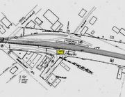
MOOSUP3 [NYNH&H, 1898]
This station was built in 1898 by what had become the New England RR after the NYNH&H got control of the NY&NE in 1895 and reorganized it as a subsidiary. The railroad commissioners said in December, 1897 that a new depot was being built here but we have found no actual opening date in the newspapers. The 1915 val map at lower left shows the location of MOOSUP3, west of the tracks and below Prospect St. like its two predecessors, indicating no move farther north toward Main St. as had been rumored. This station is on the 1938 SSRR list as being retired and subject to sale and removal in that year. [REFS: HC/03/15/1897/09; NHER/03/15/1897/07; CRC45.1897.23][rev010318]
This station was built in 1898 by what had become the New England RR after the NYNH&H got control of the NY&NE in 1895 and reorganized it as a subsidiary. The railroad commissioners said in December, 1897 that a new depot was being built here but we have found no actual opening date in the newspapers. The 1915 val map at lower left shows the location of MOOSUP3, west of the tracks and below Prospect St. like its two predecessors, indicating no move farther north toward Main St. as had been rumored. This station is on the 1938 SSRR list as being retired and subject to sale and removal in that year. [REFS: HC/03/15/1897/09; NHER/03/15/1897/07; CRC45.1897.23][rev010318]
MORRIS1 [SRR, 1873]
The item on the left is a card postmarked 5/2/1910 and it shows the residence where the first depot was reportedly located. In the photo on the right, we can see this building as well as the station that came in 1886. An August, 1873 newspaper report that the Shepaug RR was building a station at Smoke Hollow in West Morris is either incorrect or this residence was followed by a depot for which we have no other verification. That possibility needs to be researched further. [REFS: HDC/08/08/1873/04, HDC/8/15/1873/04][rev032313]
The item on the left is a card postmarked 5/2/1910 and it shows the residence where the first depot was reportedly located. In the photo on the right, we can see this building as well as the station that came in 1886. An August, 1873 newspaper report that the Shepaug RR was building a station at Smoke Hollow in West Morris is either incorrect or this residence was followed by a depot for which we have no other verification. That possibility needs to be researched further. [REFS: HDC/08/08/1873/04, HDC/8/15/1873/04][rev032313]
MORRIS2 [SV, 1886]
This is the only structure we have seen for a purpose-built station here in Morris and it probably is the one that the railroad commissioners mention as being built in 1886. This is certainly the one that lasted into the 1900s since the locomotive in the photo at upper right was renumbered as the 502 in 1905, according to Fisher. The photo at lower left reportedly dates to 7/11/1913. The interior shot at lower right is fascinating, but undated. [REFS: HDC/08/08/1873/04, HDC/8/15/1873/04; CRC34.1886. 12; Steam Locomotives, p.51][rev032313]
This is the only structure we have seen for a purpose-built station here in Morris and it probably is the one that the railroad commissioners mention as being built in 1886. This is certainly the one that lasted into the 1900s since the locomotive in the photo at upper right was renumbered as the 502 in 1905, according to Fisher. The photo at lower left reportedly dates to 7/11/1913. The interior shot at lower right is fascinating, but undated. [REFS: HDC/08/08/1873/04, HDC/8/15/1873/04; CRC34.1886. 12; Steam Locomotives, p.51][rev032313]
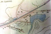
MOUNT CARMEL1 [NH&N, 1848, as AXLE WORKS]
Also referred to as AXLE WORKS or AXLE SHOP, this was the first early stop in northern Hamden and appears on a 3/25/1849 timetable at a point nine miles above New Haven. The photo at upper left shows the track in front of the factory with probably a remnant of the old canal alongside of it. Corroborating Hartley's History of Hamden [p328], the station is seen as just a platform at the red arrow on the 1856NH map at [2]. By 1880, the track would be moved farther west to lessen the number of grade crossings and to stop frightening the horses along Cheshire Tpke. The shot at right shows no track and an enlarged factory complex, the shapes of the buildings agreeing with the footprint on the 1870 map at [4]. The canal looks to have evolved into highway. The location of the platform appears to have been at the present intersection of West Woods Rd. and Rte 10. MOUNT CARMEL1 was abandoned in 1875 along with MOUNT CARMEL2 in favor of an actual station building, MOUNT CARMEL3, built at the Ives location in 1875. [rev121013]
Also referred to as AXLE WORKS or AXLE SHOP, this was the first early stop in northern Hamden and appears on a 3/25/1849 timetable at a point nine miles above New Haven. The photo at upper left shows the track in front of the factory with probably a remnant of the old canal alongside of it. Corroborating Hartley's History of Hamden [p328], the station is seen as just a platform at the red arrow on the 1856NH map at [2]. By 1880, the track would be moved farther west to lessen the number of grade crossings and to stop frightening the horses along Cheshire Tpke. The shot at right shows no track and an enlarged factory complex, the shapes of the buildings agreeing with the footprint on the 1870 map at [4]. The canal looks to have evolved into highway. The location of the platform appears to have been at the present intersection of West Woods Rd. and Rte 10. MOUNT CARMEL1 was abandoned in 1875 along with MOUNT CARMEL2 in favor of an actual station building, MOUNT CARMEL3, built at the Ives location in 1875. [rev121013]
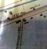
MOUNT CARMEL2 [NH&N, 1848, opened as IVES]
This was a simple platform, mostly used as a stop for workers at the Ives factory. Some of the buildings still stand at the bend in today's Rte. 22, seen on the map as the road to North Haven. This stop is not on the 1849TT. The 1870 map was created to show this stop and MOUNT CARMEL1, both up for abandonment at the time an actual station, MOUNT CARMEL3, was built at this location. Because of the proximity to the factory, this stop appears on most timetables as IVES. [REFS: R1.300][rev032313]
This was a simple platform, mostly used as a stop for workers at the Ives factory. Some of the buildings still stand at the bend in today's Rte. 22, seen on the map as the road to North Haven. This stop is not on the 1849TT. The 1870 map was created to show this stop and MOUNT CARMEL1, both up for abandonment at the time an actual station, MOUNT CARMEL3, was built at this location. Because of the proximity to the factory, this stop appears on most timetables as IVES. [REFS: R1.300][rev032313]
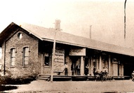
MOUNT CARMEL3 [NH&N, 1875]
This station was built in 1875 to replace the platform we have listed as MOUNT CARMEL2 and was also referred to as IVES. The structure seen here is a typical NH&N Italianate brick station of the period, complete with end 'portholes' under the eaves. In these years, the NH&N line still followed the old Farmington Canal bed that ran along Cheshire Turnpike, now Rte. 10. When the safety issues of the old alignment persuaded the town to vote funds to assist the railroad in relocating the line westward in 1880, this station was abandoned and used as a store thereafter. [REFS: NHDP/11/07/1874/04; RRC9.9 (6/2/1874); CRC23.1876.16; R67]
This station was built in 1875 to replace the platform we have listed as MOUNT CARMEL2 and was also referred to as IVES. The structure seen here is a typical NH&N Italianate brick station of the period, complete with end 'portholes' under the eaves. In these years, the NH&N line still followed the old Farmington Canal bed that ran along Cheshire Turnpike, now Rte. 10. When the safety issues of the old alignment persuaded the town to vote funds to assist the railroad in relocating the line westward in 1880, this station was abandoned and used as a store thereafter. [REFS: NHDP/11/07/1874/04; RRC9.9 (6/2/1874); CRC23.1876.16; R67]
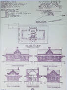
MOUNT CARMEL4 [NH&N, 1882]
The newspaper reported in 1881 that the relocation of the tracks, anywhere from 500 feet to one mile west of the original alignment along the turnpike [Whitney Ave., Rte. 10], was finished along a six-mile stretch northward from "the Plains to Ives' station." It actually went farther north to rejoin the original alignment just below West Woods Rd. The work cost the railroad $100,000, with the town chipping in $14,000. A new station, MOUNT CARMEL4, was built along the relocated line. We have not found an exact date but assume it was completed early in 1882. This brick depot is cross-gabled in Victorian rather than slightly earlier Canal line Italianate style; for a carbon copy, see FARMINGTON2. The strcuture stands on the rail trail just north of where it crosses at Sherman Ave. Heavily modified, it is presently in commercial use. The handsome brick freight station, also well preserved and looking as it originally did, survives as a restaurant in 2021. Address is 0 Depot Ave! Lewis H. Benton's #2832, taken in September, 1930, is a good north-looking shot of the depot and the freight house behind it; fellow photographer who transported the duo on their treks is walking the rail opposite the signal mast. The 1912 real estate map at [2] shows the layout at that time. Note the streetcar tracks and trolley station on Whitney Ave., and the path of the Farmington Canal where the original railroad ran. We have to recheck if the photo at [3] carries any date but it shows the nattily dressed staff posing in front of the station, perhaps in the 1930s. Thanks to our friends at the Hamden Historical Society for use of retired railroader Amos Hewitt's photo at [4]. It shows NH #3013 arriving here on the 10/19/1947 fall foliage excursion that ran to Holyoke. Seen in the distance is the old Railroad Ave. bridge over the tracks, now long gone. See image [2], upper left corner. The streetside shot at [5] has similar passenger cars and may be the same fan trip. The 1938 SSRR list says this station was being retained for railroad use; we do not know when it passed out of railroad hands. The Track 11 Google Earth map snippet at [6] shows the area today, the original Canal line (which follwed the canal shown in blue) and the relocated right of way which is the rail trail today. [REFS: NHER/10/20/1881/04][rev010318, 051422]
The newspaper reported in 1881 that the relocation of the tracks, anywhere from 500 feet to one mile west of the original alignment along the turnpike [Whitney Ave., Rte. 10], was finished along a six-mile stretch northward from "the Plains to Ives' station." It actually went farther north to rejoin the original alignment just below West Woods Rd. The work cost the railroad $100,000, with the town chipping in $14,000. A new station, MOUNT CARMEL4, was built along the relocated line. We have not found an exact date but assume it was completed early in 1882. This brick depot is cross-gabled in Victorian rather than slightly earlier Canal line Italianate style; for a carbon copy, see FARMINGTON2. The strcuture stands on the rail trail just north of where it crosses at Sherman Ave. Heavily modified, it is presently in commercial use. The handsome brick freight station, also well preserved and looking as it originally did, survives as a restaurant in 2021. Address is 0 Depot Ave! Lewis H. Benton's #2832, taken in September, 1930, is a good north-looking shot of the depot and the freight house behind it; fellow photographer who transported the duo on their treks is walking the rail opposite the signal mast. The 1912 real estate map at [2] shows the layout at that time. Note the streetcar tracks and trolley station on Whitney Ave., and the path of the Farmington Canal where the original railroad ran. We have to recheck if the photo at [3] carries any date but it shows the nattily dressed staff posing in front of the station, perhaps in the 1930s. Thanks to our friends at the Hamden Historical Society for use of retired railroader Amos Hewitt's photo at [4]. It shows NH #3013 arriving here on the 10/19/1947 fall foliage excursion that ran to Holyoke. Seen in the distance is the old Railroad Ave. bridge over the tracks, now long gone. See image [2], upper left corner. The streetside shot at [5] has similar passenger cars and may be the same fan trip. The 1938 SSRR list says this station was being retained for railroad use; we do not know when it passed out of railroad hands. The Track 11 Google Earth map snippet at [6] shows the area today, the original Canal line (which follwed the canal shown in blue) and the relocated right of way which is the rail trail today. [REFS: NHER/10/20/1881/04][rev010318, 051422]
MULLIGANS CROSSING [> HANOVER SPRINGS]
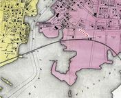
MYSTIC1 [NL&S, 1858]
This stop was established in 1858 when the New London and Stonington was built to connect with the NYP&B at Stonington Junction. The first station burned on 7/4/1866. The 1868 map shows the location, although by this time MYSTIC2 would be in place. We have no photo as of yet of MYSTIC1.
This stop was established in 1858 when the New London and Stonington was built to connect with the NYP&B at Stonington Junction. The first station burned on 7/4/1866. The 1868 map shows the location, although by this time MYSTIC2 would be in place. We have no photo as of yet of MYSTIC1.
MYSTIC2 [NYP&B, 1866]
Also known as MYSTIC BRIDGE. Based on the NYP&B annual report [p121] for the year ending 8/31/1867, a new station was built here "to replace the one burnt." That fire occurred on Wednesday, July 4, 1866, in what was probably not the first and certainly not the last Independence Day to see a railroad station accidentally consumed by flames. The cause of the fire was "the day we celebrate," according to the Courant and the value of the lost building was put at $3,000. The snippet is from the Bailey bird's-eye map of 1879: click here. [REFS: HDC/07/07/1866/04; SR/07/14/1866/01]
Also known as MYSTIC BRIDGE. Based on the NYP&B annual report [p121] for the year ending 8/31/1867, a new station was built here "to replace the one burnt." That fire occurred on Wednesday, July 4, 1866, in what was probably not the first and certainly not the last Independence Day to see a railroad station accidentally consumed by flames. The cause of the fire was "the day we celebrate," according to the Courant and the value of the lost building was put at $3,000. The snippet is from the Bailey bird's-eye map of 1879: click here. [REFS: HDC/07/07/1866/04; SR/07/14/1866/01]
MYSTIC3 [NYNH&H, 1905]
The Courant reported on 12/28/1905 that "the new depot is finished and occupied. The old depot will be used in the freight busines." Apparently, the "building boom" reported by the newspaper and the respectable amount of industry that it included was thought by the railroad to call for expanded facilties. The val photo at upper right is dated 5/31/1917 and the shot at lower left shows the covershed down after the hurricane of 1938. MYSTIC3, happily, survived and still serves Amtrak passengers today, as shown in the recent shots at lower middle and right. [REFS: CRC53.1905.28; HC/12/28/1905/14; HC/12/30/1905/15; HC/08/18/1976/40E; HC/05/22/1978/17D; HC/04/19/1979/52D]
The Courant reported on 12/28/1905 that "the new depot is finished and occupied. The old depot will be used in the freight busines." Apparently, the "building boom" reported by the newspaper and the respectable amount of industry that it included was thought by the railroad to call for expanded facilties. The val photo at upper right is dated 5/31/1917 and the shot at lower left shows the covershed down after the hurricane of 1938. MYSTIC3, happily, survived and still serves Amtrak passengers today, as shown in the recent shots at lower middle and right. [REFS: CRC53.1905.28; HC/12/28/1905/14; HC/12/30/1905/15; HC/08/18/1976/40E; HC/05/22/1978/17D; HC/04/19/1979/52D]
MYSTIC4 [ATK, c1986]
John Roy tells us [p69] that this small shelter on the eastbound side of the tracks was built ca. 1986.
John Roy tells us [p69] that this small shelter on the eastbound side of the tracks was built ca. 1986.

