Track 12: CT Passenger Stations, N-NE
See TCS Home Page links for notes, abbreviations, and sources.
Use Track 11 map link to locate stations, rail and trolley lines, and POIs.
Use Track 11 map link to locate stations, rail and trolley lines, and POIs.
NAUGATUCK DEPOT [> WINSTED/C2]

|
|

|
NAUGATUCK1 [NRR, 1849]
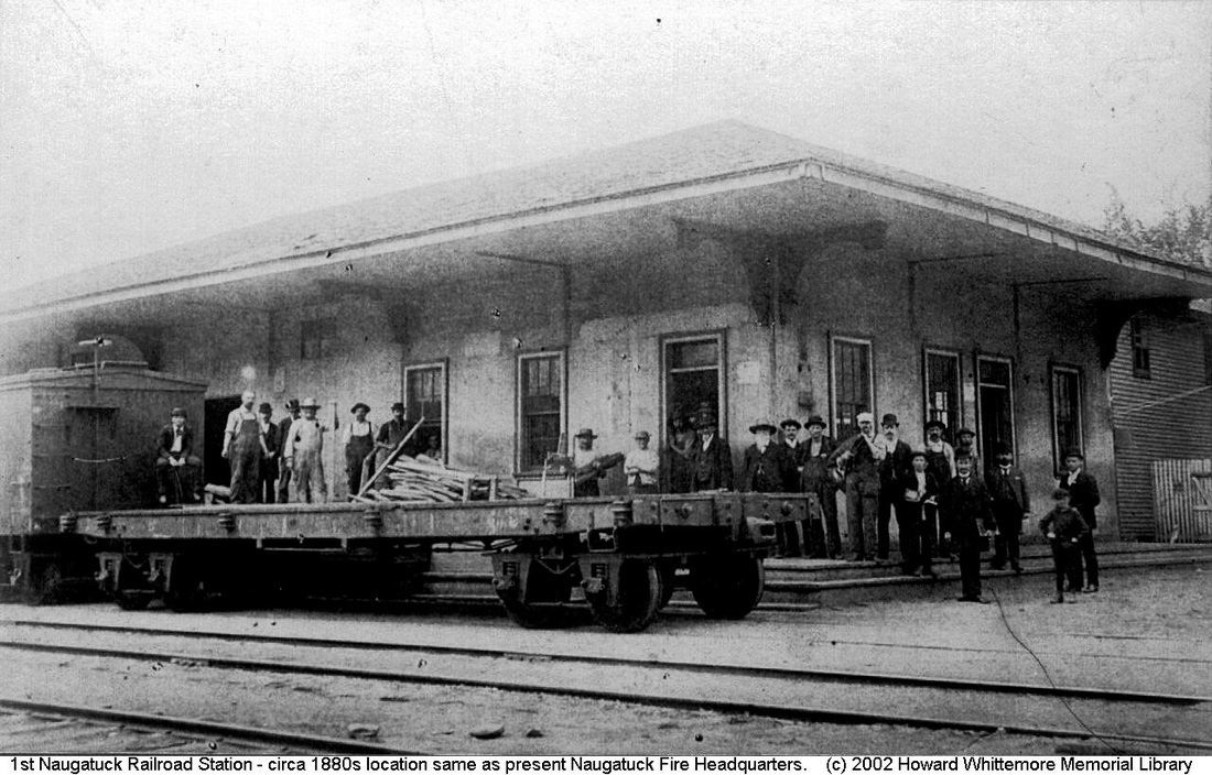
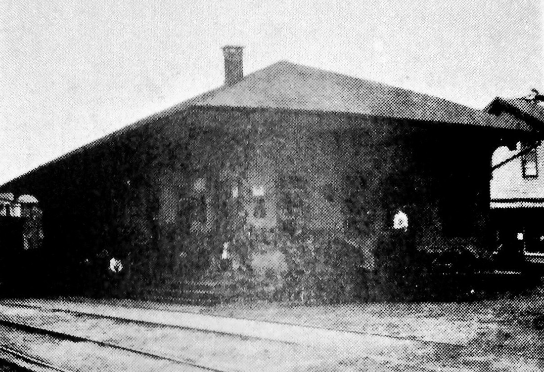
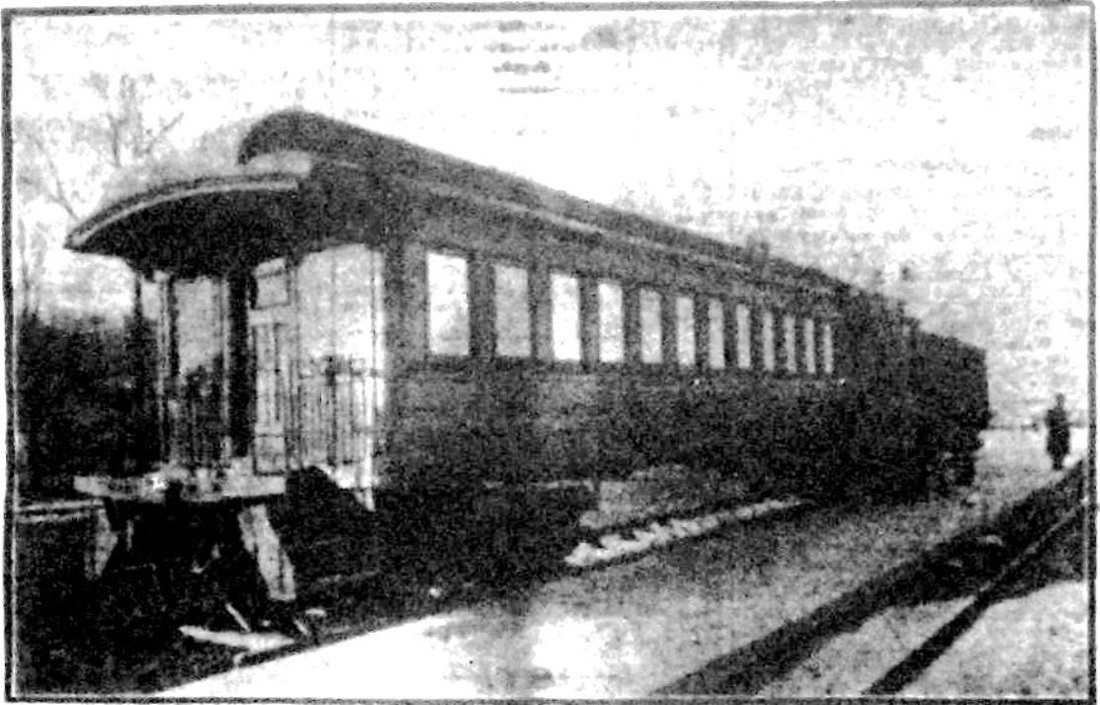
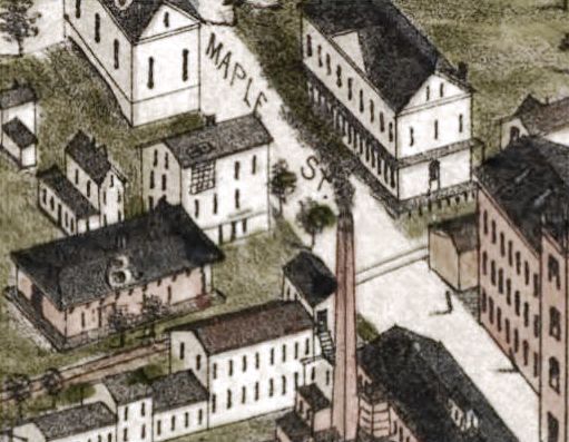
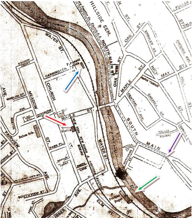
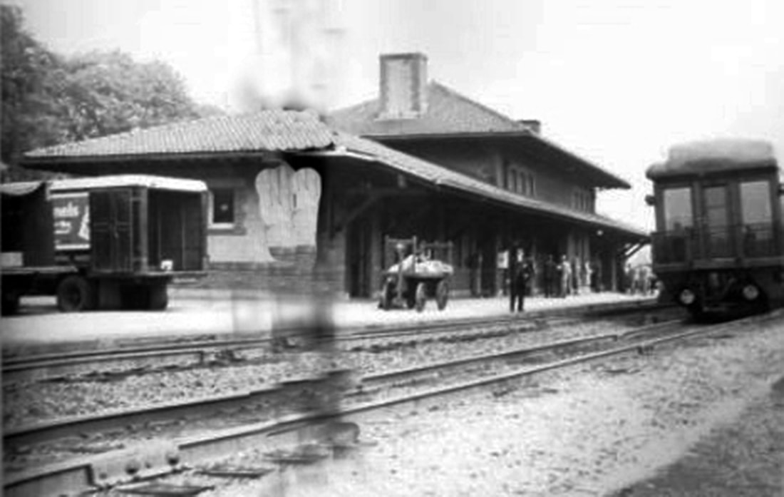
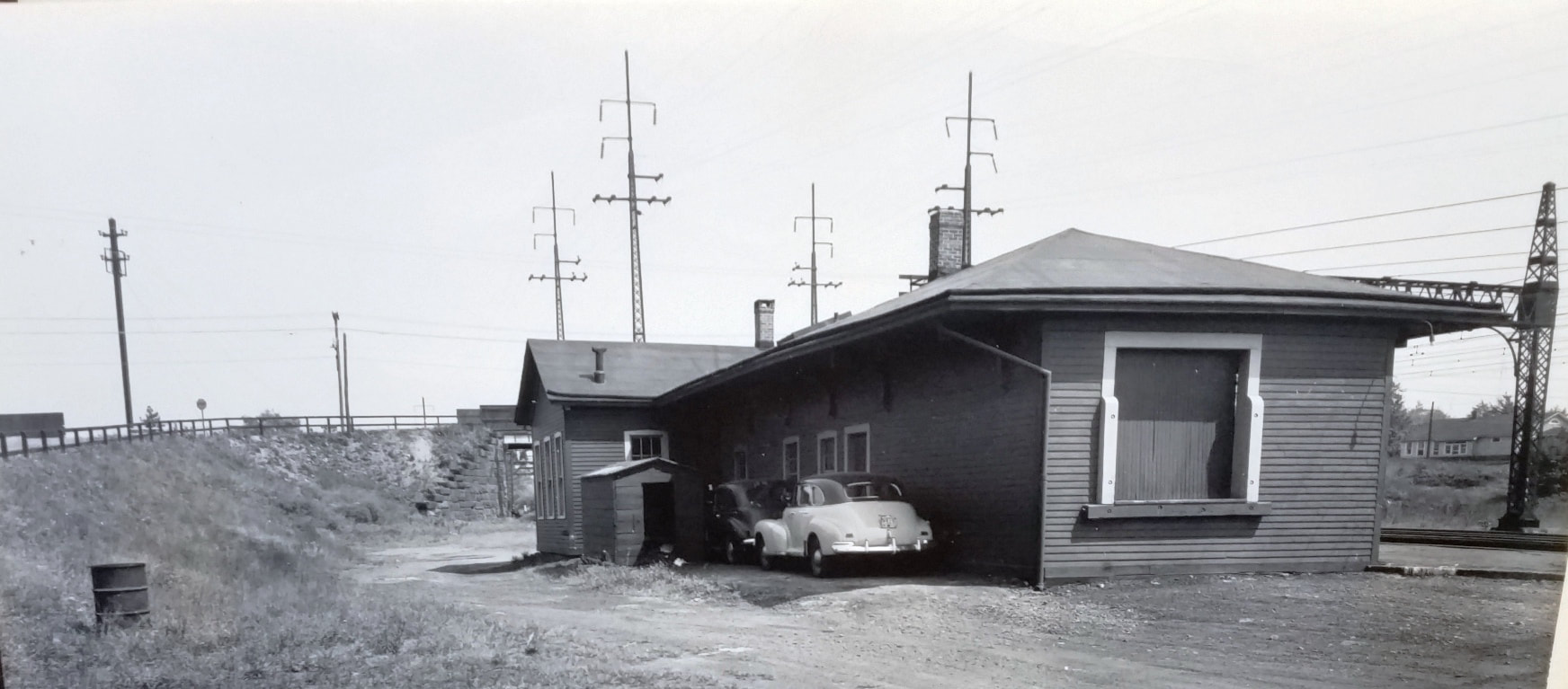
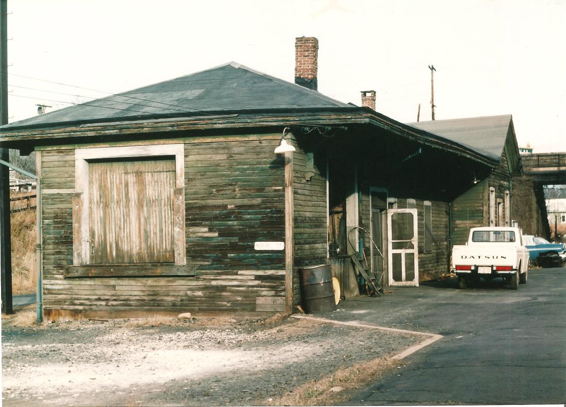
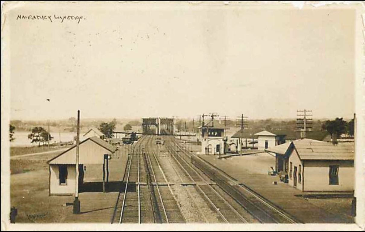
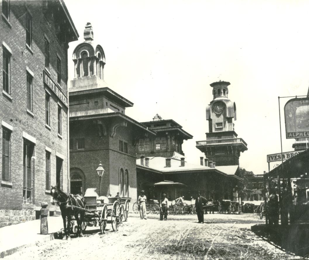
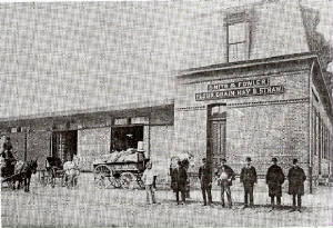
The photos [1] and [2] are the only ones we have ever seen of this station. The shot at [3] is from the Bailey bird's-eye map of 1877 and shows the station standing west of the track and just south of Maple St. with the locator number 3 on the roof. It is a simple NRR combination depot, similar to ANSONIA1 and DERBY1. NAUGATUCK1 was moved briefly to a new Water St. location as its successor station was being completed, at which time it was torn down late in 1908. The transition to a new station here was perhaps unlike any other such event in state railroad history. The shot at [4] is from the Hughes & Bailey map of 1906. NAUGATUCK1 is still in place, but no track crosses Maple St. there any more. The NRR right of way has been double-tracked and relocated to where the train is seen running along the river, the new trackage opening 1/19/1908. Four days later, the newspaper ran the photo at [5] showing a passenger coach and baggage car in service on Water St., the site where the borough's new permanent station was going up. The accompanying article remarked about the comfortable seats in the coach as compared to the "hard bone aching settees" in the old depot. The new comfort was short-lived because a few weeks later, NAUGATUCK1 was jacked up on flat cars, and with the usual difficulties encountered in such delicate operations, moved from Maple St. to the new location, at which time the cars were removed. Al Weaver's colorization of the image at [6] helps to show the locomotive pushing the depot north. The map at [7] is from the 1908 Price & Lee city directory. The red arrow points to the old Maple St. location and the blue arrow shows the new Water St. site where the adjacent steel work for NAUGATUCK2 was already going up and, when finished, NAUGATUCK1, then almost 50 years old, was to be torn down "as quickly as possible." The green arrow points to the freight depot at the junction of the new and old main lines and the purple arrow shows the trolley line running down the east side of the river. [REFS: CRC37.1889.19; CRC38.1890.20; NHAR19.1890.4; R2.709; HC/01/20/1908/12; WA/02/07/1908/01; NDN/02/08/1908/03; NDN/09/08/1908/01][rev081717, 060323]
|
Whittemore Library
|
|
|
|
|
NAUGATUCK2 [NYNH&H, 1908]
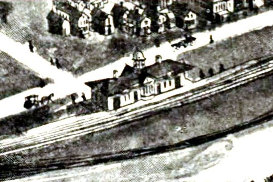
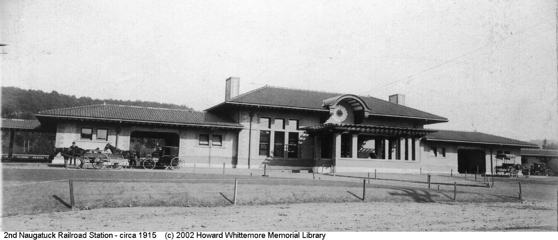
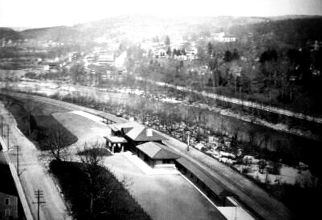
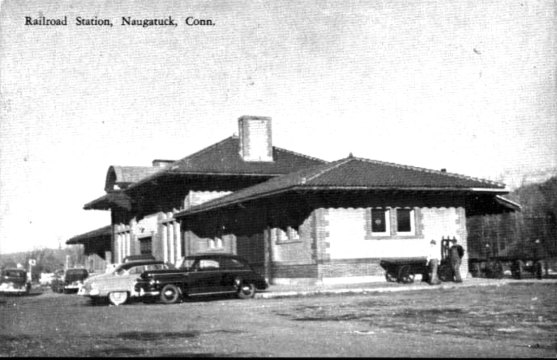
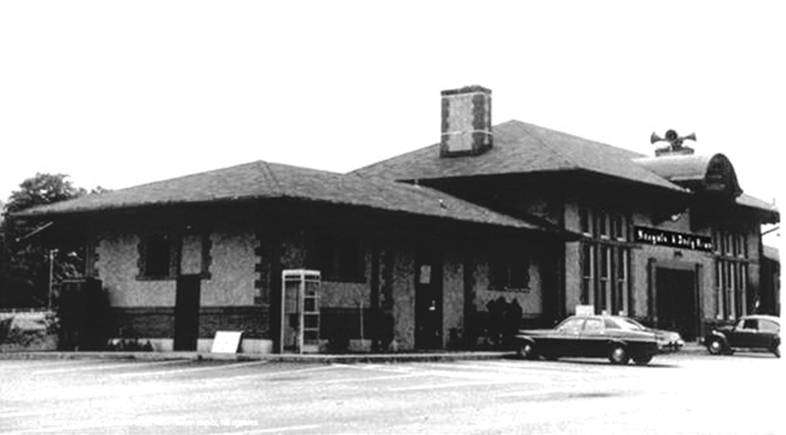
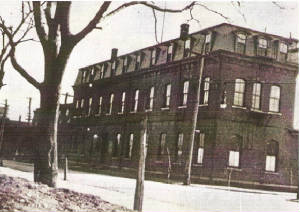
The 1906 Hughes & Bailey map image at [1] shows a cupola, several gabled dormers, a trackside portico, and other details that the photographs reveal were not part of the final design of this structure. One has to wonder exactly what the map artist encountered when he arrived, but it is likely that he was advised of the coming new station and either was shown a plan that was revised later or he simply drew something loosely based on what he was told the building would look like. Interestingly, his sketch, however inaccurate, actually made it to a postcard we have in our collection. The structure as built, "one of the handsomest railroad stations in this section of the country," was designed by Lincoln Memorial architect Henry Bacon [click here], the preferred choice of the ever-munificent J.H. Whittemore. Whether the industrialist actually paid for the station has not been determined; the railroad's annual report does not specify specific amounts under the $597,224.18 it spent on Buildings, Fixtures and Grounds. The station opened on 9/6/1908, not in 1910 as has often been bandied about. A great proponent of the City Beautiful movement, Whittemore was also instrumental in the creating the gardens that surrounded the new station and the grand new approach. First called Carrington St. for the property through which it cut, today's Cedar St. was built at this time from the green on Church St. to showcase both the borough and the stately new Spanish Colonial Revival station. The railroad commissioners said that this new structure was "a credit to the company and an ornament to the place." The ca. 1915 view at [2] looks eastward from the driveway; the adjoined building on the north end housed the baggage room and the one on the south end the express office. The aerial shot at [3] looks northeast. A train departs for Union City and Waterbury in the scene at [4]. The view at [5] shows the ornate exterior stucco walls and the porte cochere gone; it and the coversheds came down in 1953. The name over the entrance at [6] says Naugatuck Daily News, the new owner who purchased the building from the NYNH&H for $91,750 in 1964 bankruptcy proceedings, with the railroad reserving the right to use the north wing as a waiting room and agent's office. A sign of the times is the air raid horn over the iconic clock cupola. Penn Central closed the facility completely in 1973, the last station agent being Wendell Bacon, no relation to the famed architect. The newspaper moved to larger quarters ca. 1990. In fall 2001, the Henry Bacon building became the home of the Naugatuck Historical Society [click here], which vacated it in 2015. After a sumptuous remodeling that included a recreation of the porte cochere, the structure opened on August 14, 2017 as The Station restaurant. Long may it prosper and take abundant care of one of the state's most iconic railroad structures. [REFS: CRC56.1908.49; NDN/09/03/1908/01; NDN/09/08/1908/01; NHAR37.1908.8,19; NDN/01/31/1953/04; HC/12/01/1964/30; NDN/01/04/24/1973/00; HC/12/30/1987/B2; R69][rev082917, 032823, 060323]
The 1906 Hughes & Bailey map image at [1] shows a cupola, several gabled dormers, a trackside portico, and other details that the photographs reveal were not part of the final design of this structure. One has to wonder exactly what the map artist encountered when he arrived, but it is likely that he was advised of the coming new station and either was shown a plan that was revised later or he simply drew something loosely based on what he was told the building would look like. Interestingly, his sketch, however inaccurate, actually made it to a postcard we have in our collection. The structure as built, "one of the handsomest railroad stations in this section of the country," was designed by Lincoln Memorial architect Henry Bacon [click here], the preferred choice of the ever-munificent J.H. Whittemore. Whether the industrialist actually paid for the station has not been determined; the railroad's annual report does not specify specific amounts under the $597,224.18 it spent on Buildings, Fixtures and Grounds. The station opened on 9/6/1908, not in 1910 as has often been bandied about. A great proponent of the City Beautiful movement, Whittemore was also instrumental in the creating the gardens that surrounded the new station and the grand new approach. First called Carrington St. for the property through which it cut, today's Cedar St. was built at this time from the green on Church St. to showcase both the borough and the stately new Spanish Colonial Revival station. The railroad commissioners said that this new structure was "a credit to the company and an ornament to the place." The ca. 1915 view at [2] looks eastward from the driveway; the adjoined building on the north end housed the baggage room and the one on the south end the express office. The aerial shot at [3] looks northeast. A train departs for Union City and Waterbury in the scene at [4]. The view at [5] shows the ornate exterior stucco walls and the porte cochere gone; it and the coversheds came down in 1953. The name over the entrance at [6] says Naugatuck Daily News, the new owner who purchased the building from the NYNH&H for $91,750 in 1964 bankruptcy proceedings, with the railroad reserving the right to use the north wing as a waiting room and agent's office. A sign of the times is the air raid horn over the iconic clock cupola. Penn Central closed the facility completely in 1973, the last station agent being Wendell Bacon, no relation to the famed architect. The newspaper moved to larger quarters ca. 1990. In fall 2001, the Henry Bacon building became the home of the Naugatuck Historical Society [click here], which vacated it in 2015. After a sumptuous remodeling that included a recreation of the porte cochere, the structure opened on August 14, 2017 as The Station restaurant. Long may it prosper and take abundant care of one of the state's most iconic railroad structures. [REFS: CRC56.1908.49; NDN/09/03/1908/01; NDN/09/08/1908/01; NHAR37.1908.8,19; NDN/01/31/1953/04; HC/12/01/1964/30; NDN/01/04/24/1973/00; HC/12/30/1987/B2; R69][rev082917, 032823, 060323]
Wikipedia
NAUGATUCK3 [MN, c2000?]
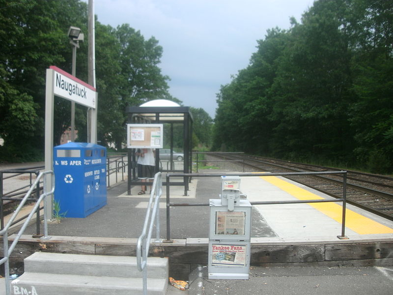
This simple enclosure stands north of NAUGATUCK2 and serves Metro North passengers today. [rev082916]
This simple enclosure stands north of NAUGATUCK2 and serves Metro North passengers today. [rev082916]
Copyright NHRHTA
|
|
|
Dave Peters Collection
|
|
|
NAUGATUCK JUNCTION1 [NY&NH, 1848]
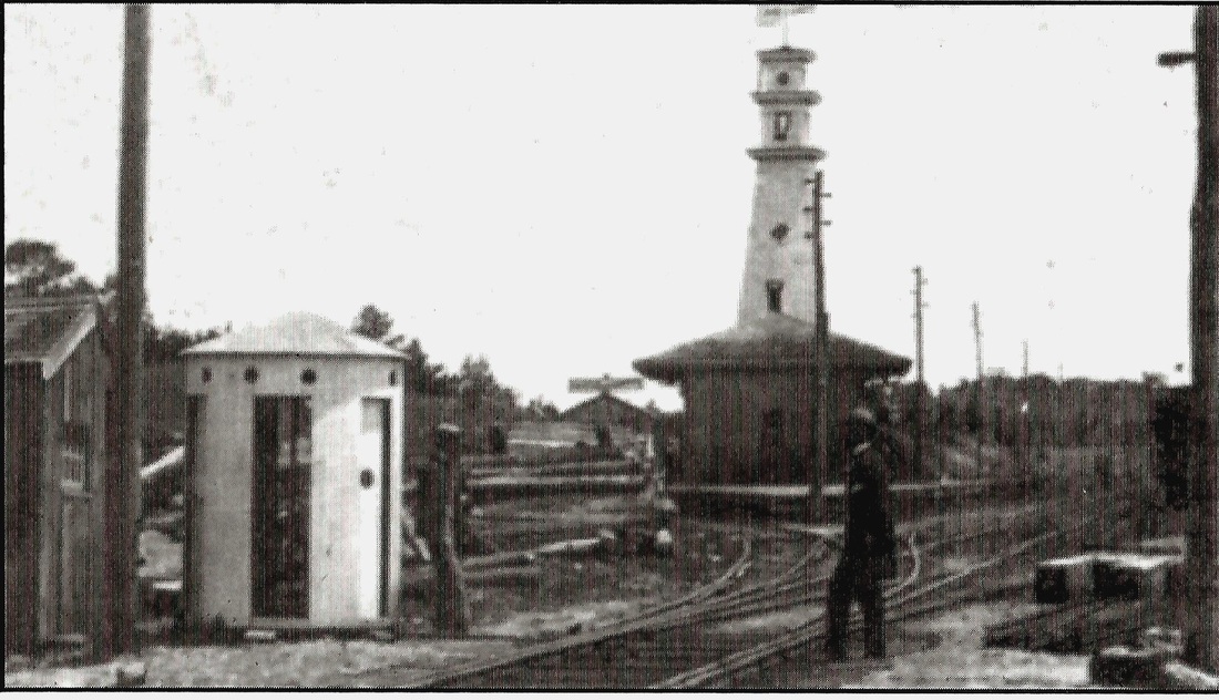
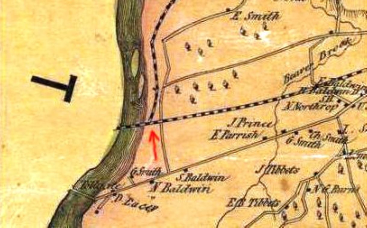
Station at the western edge of MILFORD on the Housatonic River, also called STRATFORD JUNCTION, or simply JUNCTION. The NY&NH opened at the very end of 1848 and its earliest timetables show no stop here. None was needed until 5/14/1849 when the first NRR train ran. The NRR's western traffic went to Bridgeport using the second track specially built by the NY&NH to dissuade the NRR from making New Haven its terminus. With the arrival of the NRR, the junction assumed an important role both as the transfer point for traffic on NY&NH trains to and from New Haven and gradually as a local Milford stop as well. This new station was advertised as of 7/23/1849 in Bridgeport's Republican Farmer newspaper. Initially there was probably a single platform spanning the two railroad tracks where they intersected, as shown on the 1852NH map at [2]. The depot on the north side of the main line to New York may have been built by the NY&NH as part of its agreement with the NRR. The photo at [1] is ca. 1870 with the station in its original location at the meeting point of the NRR and what then was the NY&NH's "down" track to New York. The 60-ft-high signal tower seen standing behind the station was jointly built by the NY&NH and the NRR. It debuted in December, 1852 and was manned 24/7 by operators who controlled signals a quarter mile away. The 1868 Beers map at [3] shows the depot at the downward red arrow and the signal tower at the upward arrow. This map also shows the addition of a track allowing NRR trains to go directly to New Haven. It was installed in 1868 in an attempt to fend off anticipated competition from the NH&D, then under construction. This track was removed early in 1872 after the NH&D opened and was awarded all the Valley passenger traffic to New Haven due to its shorter routing via Derby Jct. This east track was not reinstalled until after the NYNH&H leased the NRR in 1887. The frog for the final connection with the NYNH&H was installed late in that year, thus restoring the wye whose east leg had been removed some 15 years earlier. This also made direct freight service between Waterbury and New Haven possible once more, again to compete with the NH&D. The newspaper said just before all this that "the present depot structure will probably be removed to a point farther east to accommodate travel" as part of the reconfiguration. The ICC valuation photo at [5] is dated 10/25/1916 and shows an enlarged NAUGATUCK JUNCTION1 with freight wing added. The eastward-looking photo at [6] shows the rear of the station on 8/25/1953. To the left the access road to the station and tower comes down from the overpass for Naugatuck Ave. The 11/21/1969 shot at [6] looks eastward at the front of the building. [REFS: RF/09/18/1849/??; HDC/12/13/1852/02-missing; CC/12/18/1852/01; HDC/01/06/1868/02; CR/02/22/1868/03; HDC/03/27/ 1884/03; NHER/08/09/1887/01; NHER/10/21/1887/01; NHER/12/23/1887/04; HC/01/ 05/1888/08; R2:223 says ticket office established here in 1890(?)][rev013019, 060323]
Station at the western edge of MILFORD on the Housatonic River, also called STRATFORD JUNCTION, or simply JUNCTION. The NY&NH opened at the very end of 1848 and its earliest timetables show no stop here. None was needed until 5/14/1849 when the first NRR train ran. The NRR's western traffic went to Bridgeport using the second track specially built by the NY&NH to dissuade the NRR from making New Haven its terminus. With the arrival of the NRR, the junction assumed an important role both as the transfer point for traffic on NY&NH trains to and from New Haven and gradually as a local Milford stop as well. This new station was advertised as of 7/23/1849 in Bridgeport's Republican Farmer newspaper. Initially there was probably a single platform spanning the two railroad tracks where they intersected, as shown on the 1852NH map at [2]. The depot on the north side of the main line to New York may have been built by the NY&NH as part of its agreement with the NRR. The photo at [1] is ca. 1870 with the station in its original location at the meeting point of the NRR and what then was the NY&NH's "down" track to New York. The 60-ft-high signal tower seen standing behind the station was jointly built by the NY&NH and the NRR. It debuted in December, 1852 and was manned 24/7 by operators who controlled signals a quarter mile away. The 1868 Beers map at [3] shows the depot at the downward red arrow and the signal tower at the upward arrow. This map also shows the addition of a track allowing NRR trains to go directly to New Haven. It was installed in 1868 in an attempt to fend off anticipated competition from the NH&D, then under construction. This track was removed early in 1872 after the NH&D opened and was awarded all the Valley passenger traffic to New Haven due to its shorter routing via Derby Jct. This east track was not reinstalled until after the NYNH&H leased the NRR in 1887. The frog for the final connection with the NYNH&H was installed late in that year, thus restoring the wye whose east leg had been removed some 15 years earlier. This also made direct freight service between Waterbury and New Haven possible once more, again to compete with the NH&D. The newspaper said just before all this that "the present depot structure will probably be removed to a point farther east to accommodate travel" as part of the reconfiguration. The ICC valuation photo at [5] is dated 10/25/1916 and shows an enlarged NAUGATUCK JUNCTION1 with freight wing added. The eastward-looking photo at [6] shows the rear of the station on 8/25/1953. To the left the access road to the station and tower comes down from the overpass for Naugatuck Ave. The 11/21/1969 shot at [6] looks eastward at the front of the building. [REFS: RF/09/18/1849/??; HDC/12/13/1852/02-missing; CC/12/18/1852/01; HDC/01/06/1868/02; CR/02/22/1868/03; HDC/03/27/ 1884/03; NHER/08/09/1887/01; NHER/10/21/1887/01; NHER/12/23/1887/04; HC/01/ 05/1888/08; R2:223 says ticket office established here in 1890(?)][rev013019, 060323]
Dave Peters Collection
|
|
|
NAUGATUCK JUNCTION2 [NYNH&H, c1895]
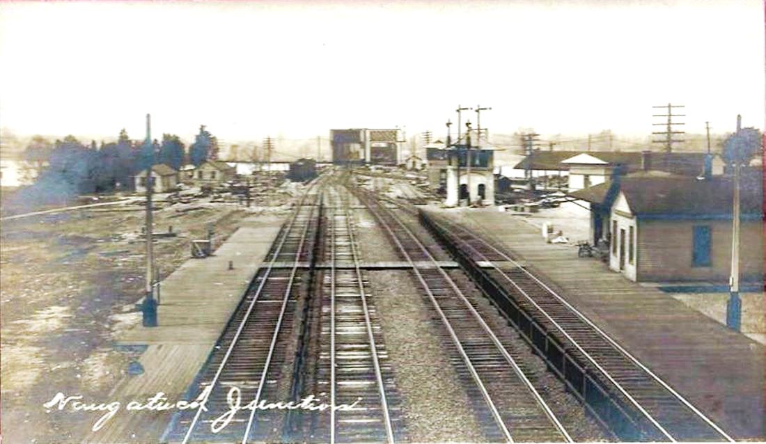
The 1887 upgrades, the eastward re-positioning of NAUGATUCK JUNCTION1, and the re-installation of the east leg of the wye probably led to the creation of a platform on the west leg. This was covered with a canopy in 1900, according to the railroad commissioners and a small station building, seen beyond the canopy in the photo at [1], was added. This accommodation of Valley passengers was needed especially for the heavy summer traffic as thousands came to nearby beaches. That was made easier in 1898 when Milford Street Rwy trolley cars started running down Naugatuck Ave. to Walnut Beach and downtown Milford. The photo at [2] was most likely taken shortly after June 17, 1907, when the commissioners said the new two-track bridge was completed, (making a total of four tracks on the two spans), and shows the concrete, pagoda-style SS-71 in place with the older wooden tower still standing behind it. NAUGATUCK JUNCTION1 is seen to the right foreground and NAUGATUCK JUNCTION2 is visible in the distance beyond it. Also visible is platform planking for NAUGATUCK JUNCTION3, the eastbound shelter, which is shown in place in the card at [3]. [REFS: CRC48.1900.22; NHER/06/09/1898/08; NL30.2009.6][rev102118]
The 1887 upgrades, the eastward re-positioning of NAUGATUCK JUNCTION1, and the re-installation of the east leg of the wye probably led to the creation of a platform on the west leg. This was covered with a canopy in 1900, according to the railroad commissioners and a small station building, seen beyond the canopy in the photo at [1], was added. This accommodation of Valley passengers was needed especially for the heavy summer traffic as thousands came to nearby beaches. That was made easier in 1898 when Milford Street Rwy trolley cars started running down Naugatuck Ave. to Walnut Beach and downtown Milford. The photo at [2] was most likely taken shortly after June 17, 1907, when the commissioners said the new two-track bridge was completed, (making a total of four tracks on the two spans), and shows the concrete, pagoda-style SS-71 in place with the older wooden tower still standing behind it. NAUGATUCK JUNCTION1 is seen to the right foreground and NAUGATUCK JUNCTION2 is visible in the distance beyond it. Also visible is platform planking for NAUGATUCK JUNCTION3, the eastbound shelter, which is shown in place in the card at [3]. [REFS: CRC48.1900.22; NHER/06/09/1898/08; NL30.2009.6][rev102118]
|

|
Richard A. Fleischer Collection
|
NAUGATUCK JUNCTION3 [NYNH&H, 1907]
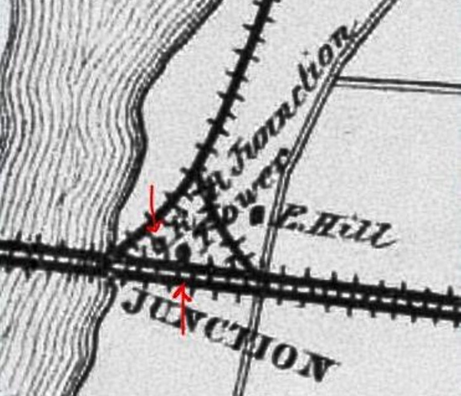
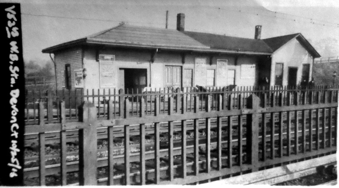
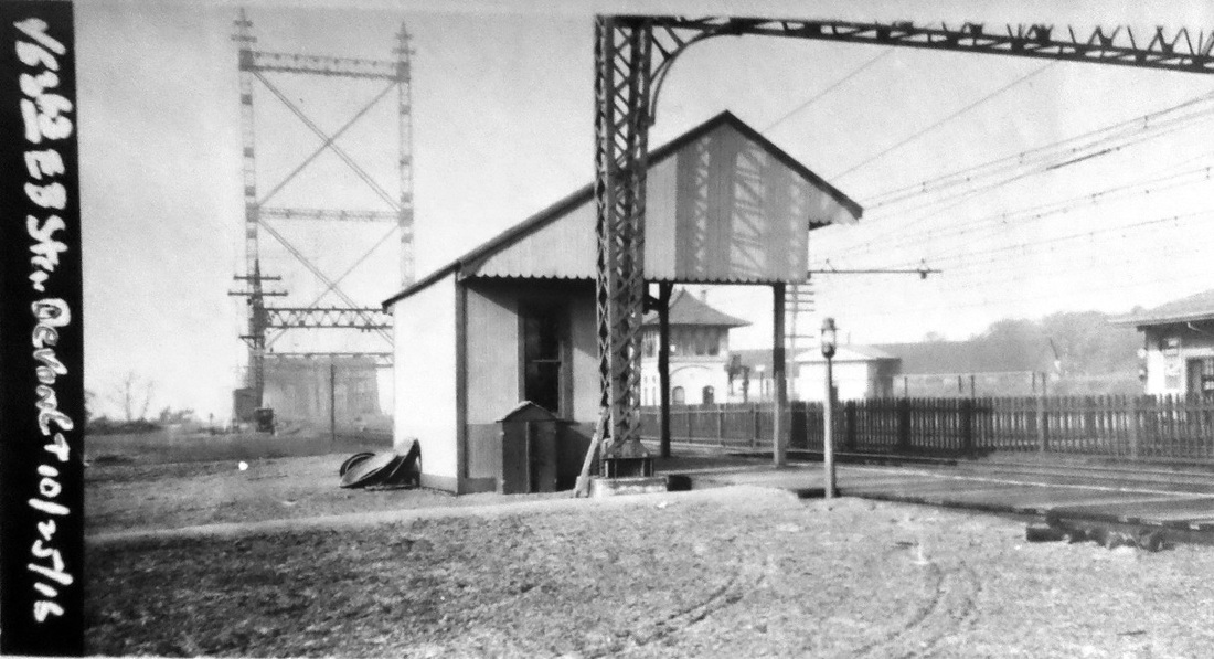
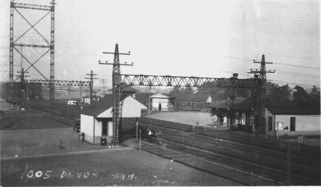
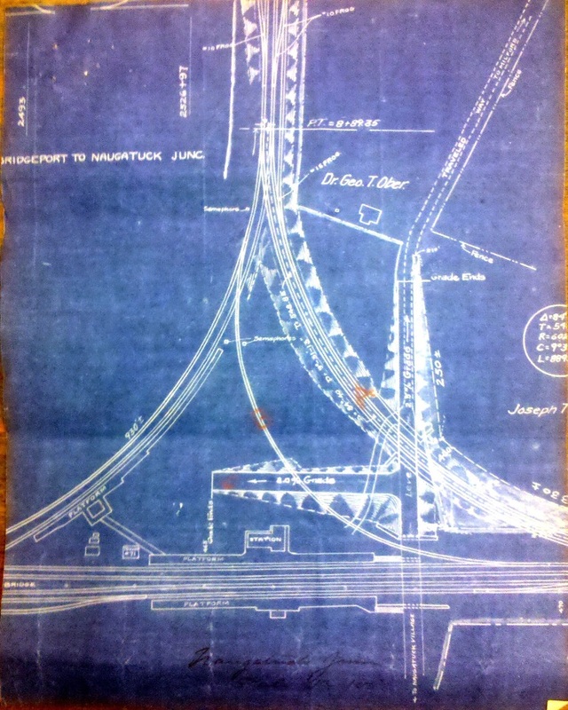
The ICC valuation photo at [1] is dated 10/25/1916. Prior to the building of this small station on the eastbound side, passengers apparently risked walking across the busy main line from NAUGATUCK JUNCTION1. This third depot was built probably in 1907 with the other improvements. As late as 1911, there were still complaints about the dangers here, especially in the summer, and likely resulted in the blueprint plan at [4] to address the safety concerns. The old east leg of the wye, marked 'B', was to be removed in favor of the new double-tracked 'A' leg and access road 'C' shunting the public out to the Naugatuck Ave. overpass, installed in 1893 with the completion of four-tracking from New Haven to the Housatonic River. The NAUGATUCK3 shelter finally shows up on the 6/30/1915 val map at [2]. The valuable panorama at [3] is an August, 1917 shot by Lewis H. Benton, his number 1005, and shows the junction fully developed. The 1914 electrification is in place, there is already some rust on the catenary bridge footing, and the name DEVON is in use. According to A History of the Devon Union Church [p.1], the new name was chosen by real estate developer Walter B. Perkins who purchased a large tract of land here in 1900. As local businesses, churches, and schools began to use it, residents asked the railroad to change the name of the station. According to the Federal Writers' Project History of Milford [p120], this was done on 11/1/1913 and references to the community here as Naugatuck Junction or Naugatuck Village, a name in use for over a half century, began to fade. The latter is still seen highlighted in yellow in the lower right corner of the blueprint map. All the Naugatuck references in this area on the east shore of the Housatonic River are completely unexplained without acknowledging the name of the railroad company that served the Valley. This is a fine example of how railroads everywhere influenced even what the communities they served were called. Sixteen daily main line trains each way were still stopping here in 1923, but by 1937 these were reduced to two daily and by 1947 there were none. [REFS: BEF/09/26/1913/03; HC/05/02/1914/02; 1923, 1937, 1947TTs][rev110118, 060323]
The ICC valuation photo at [1] is dated 10/25/1916. Prior to the building of this small station on the eastbound side, passengers apparently risked walking across the busy main line from NAUGATUCK JUNCTION1. This third depot was built probably in 1907 with the other improvements. As late as 1911, there were still complaints about the dangers here, especially in the summer, and likely resulted in the blueprint plan at [4] to address the safety concerns. The old east leg of the wye, marked 'B', was to be removed in favor of the new double-tracked 'A' leg and access road 'C' shunting the public out to the Naugatuck Ave. overpass, installed in 1893 with the completion of four-tracking from New Haven to the Housatonic River. The NAUGATUCK3 shelter finally shows up on the 6/30/1915 val map at [2]. The valuable panorama at [3] is an August, 1917 shot by Lewis H. Benton, his number 1005, and shows the junction fully developed. The 1914 electrification is in place, there is already some rust on the catenary bridge footing, and the name DEVON is in use. According to A History of the Devon Union Church [p.1], the new name was chosen by real estate developer Walter B. Perkins who purchased a large tract of land here in 1900. As local businesses, churches, and schools began to use it, residents asked the railroad to change the name of the station. According to the Federal Writers' Project History of Milford [p120], this was done on 11/1/1913 and references to the community here as Naugatuck Junction or Naugatuck Village, a name in use for over a half century, began to fade. The latter is still seen highlighted in yellow in the lower right corner of the blueprint map. All the Naugatuck references in this area on the east shore of the Housatonic River are completely unexplained without acknowledging the name of the railroad company that served the Valley. This is a fine example of how railroads everywhere influenced even what the communities they served were called. Sixteen daily main line trains each way were still stopping here in 1923, but by 1937 these were reduced to two daily and by 1947 there were none. [REFS: BEF/09/26/1913/03; HC/05/02/1914/02; 1923, 1937, 1947TTs][rev110118, 060323]
National Archives
|
|

|
|
|
|
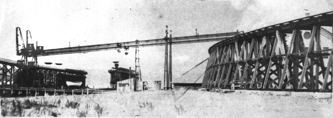
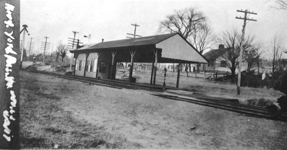
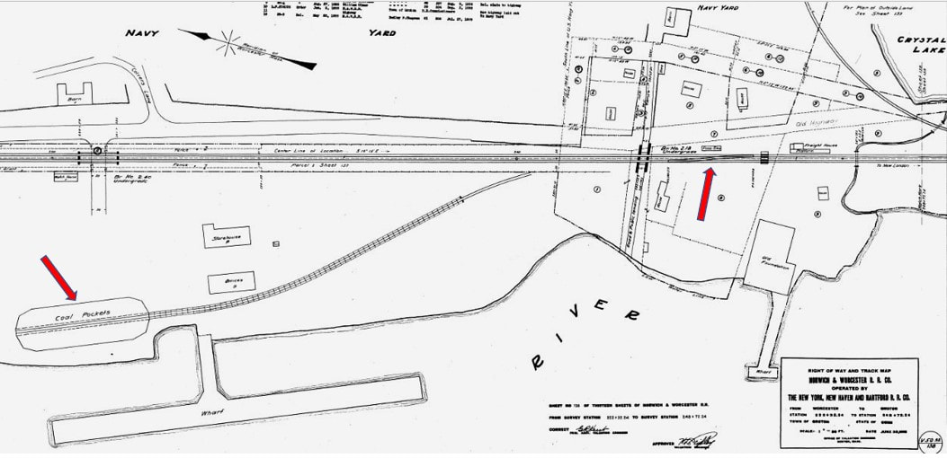
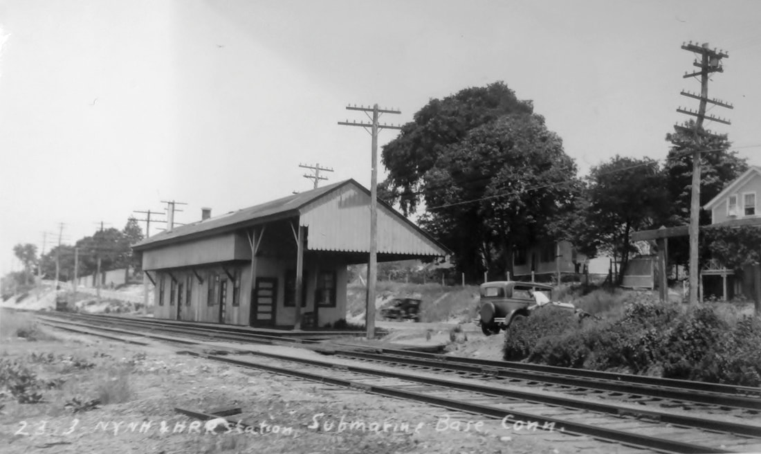
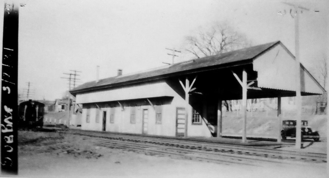
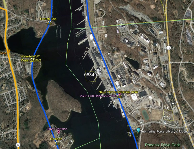
NAVY YARD [NYNH&H, 1899]
This GROTON stop came with the 6/2/1899 opening of the Groton Extension that was built through the grounds of the naval facility on the east side of the Thames River. The earliest newspaper mention we have found concerns severe washout damage here in January, 1900. The naval yard and storage depot date back to 4/11/1868. The N&W had wanted to build from ALLYNS POINT through this area for decades to connect with the steamboats at Groton Bank and avoid the "heavy rent" it was paying to the NLN for trackage rights on the west side of the river. Initial Congressional reaction was negative about allowing this to happen, as reported in an 1884 article, which said it was surprising since denial of permission to the N&W would have required "deep cuttings" to build around a facility that the government had seemingly "given up all notion... of protecting" at the time. The presence of the navy yard also complicated the 1889 railroad bridge across the Thames because many advocated building of the bridge north of the base for less chance of interfering with naval operations. While there was some expectation that the line would be completed with the opening of the bridge, the east side extension would not become a reality until a decade later, just after the NYNH&H got complete control of the NY&NE/N&W in 1898. Interesting historical coincidences seemed to have played a role here. The yard was actually closed from 1898 to 1900 and was about to be turned into a coaling facility for navy ships when Congress allowed the construction of the rail line with the stipulation that a spur be built to the coal pockets by the river. The changeover to oil as ship fuel in 1912 threatened yard closure again until, with undersea warfare a growing threat, the transformed facility was opened as the New London Submarine Flotilla base and training school on 6/21/1916. Presumably, the name of station was changed to SUBMARINE BASE at this time and it appears as such on the 1919 ICC list. The ICC valuation photo at [1] is dated 1917. The 6/30/1915 ICC valuation map at [2] shows the coal-pocket spur at our left arrow and the passenger station at the right arrow. The 1899 railroad commissioners' map at [3] is the first to show the Groton Extension. A 1918 newspaper article mentions that 1,200 construction workers were coming here daily to add buildings to the naval facility at the close of World War I. Lewis H. Benton's photo #2393 at [4] was taken in 1929; fellow photographer Irving Drake is seen leaning into the front seat of his auto which carried the pair on their jaunts. The 1931 PUC shot at [5] reveals a greatly enlarged station structure, perhaps dating back to the base expansion of 1918; a yard engine serving the base is glimpsed at left. The snippet from our Track 11 Google Earth map at [6] locates the station site today. The shot at [7] shows the elevated coal-pocket track and conveyor that once fed navy ships. We do not know the fate of the station building but it looks to be gone by 1938 as it is not seen on that year's NYNH&H list of structures to be retained or removed. [REFS: HDC/04/23/1875/01; HDC/01/27/1882/02; CRC31.1884.21; CRC47.1899.3; NHER/01/03/1884/01; NHER/02/19/1884/04; NHER/03/08/1884/01; NHER/11/20/1884/04; NHER/01/19/1885/04; NHER/07/23/1885/04; NHER/10/25/1895/06; HC/11/18/1898/13; NHER/01/13/1900/01; PTH871.1912.65; PTH925.1917.66; HC/04/04/1918/04; 1919ICC; 1937TT; 1938SSRR; CPN211; K106; Q151][rev100113, 122422, 060323]
This GROTON stop came with the 6/2/1899 opening of the Groton Extension that was built through the grounds of the naval facility on the east side of the Thames River. The earliest newspaper mention we have found concerns severe washout damage here in January, 1900. The naval yard and storage depot date back to 4/11/1868. The N&W had wanted to build from ALLYNS POINT through this area for decades to connect with the steamboats at Groton Bank and avoid the "heavy rent" it was paying to the NLN for trackage rights on the west side of the river. Initial Congressional reaction was negative about allowing this to happen, as reported in an 1884 article, which said it was surprising since denial of permission to the N&W would have required "deep cuttings" to build around a facility that the government had seemingly "given up all notion... of protecting" at the time. The presence of the navy yard also complicated the 1889 railroad bridge across the Thames because many advocated building of the bridge north of the base for less chance of interfering with naval operations. While there was some expectation that the line would be completed with the opening of the bridge, the east side extension would not become a reality until a decade later, just after the NYNH&H got complete control of the NY&NE/N&W in 1898. Interesting historical coincidences seemed to have played a role here. The yard was actually closed from 1898 to 1900 and was about to be turned into a coaling facility for navy ships when Congress allowed the construction of the rail line with the stipulation that a spur be built to the coal pockets by the river. The changeover to oil as ship fuel in 1912 threatened yard closure again until, with undersea warfare a growing threat, the transformed facility was opened as the New London Submarine Flotilla base and training school on 6/21/1916. Presumably, the name of station was changed to SUBMARINE BASE at this time and it appears as such on the 1919 ICC list. The ICC valuation photo at [1] is dated 1917. The 6/30/1915 ICC valuation map at [2] shows the coal-pocket spur at our left arrow and the passenger station at the right arrow. The 1899 railroad commissioners' map at [3] is the first to show the Groton Extension. A 1918 newspaper article mentions that 1,200 construction workers were coming here daily to add buildings to the naval facility at the close of World War I. Lewis H. Benton's photo #2393 at [4] was taken in 1929; fellow photographer Irving Drake is seen leaning into the front seat of his auto which carried the pair on their jaunts. The 1931 PUC shot at [5] reveals a greatly enlarged station structure, perhaps dating back to the base expansion of 1918; a yard engine serving the base is glimpsed at left. The snippet from our Track 11 Google Earth map at [6] locates the station site today. The shot at [7] shows the elevated coal-pocket track and conveyor that once fed navy ships. We do not know the fate of the station building but it looks to be gone by 1938 as it is not seen on that year's NYNH&H list of structures to be retained or removed. [REFS: HDC/04/23/1875/01; HDC/01/27/1882/02; CRC31.1884.21; CRC47.1899.3; NHER/01/03/1884/01; NHER/02/19/1884/04; NHER/03/08/1884/01; NHER/11/20/1884/04; NHER/01/19/1885/04; NHER/07/23/1885/04; NHER/10/25/1895/06; HC/11/18/1898/13; NHER/01/13/1900/01; PTH871.1912.65; PTH925.1917.66; HC/04/04/1918/04; 1919ICC; 1937TT; 1938SSRR; CPN211; K106; Q151][rev100113, 122422, 060323]
NEW BOSTON [> QUINEBAUG]
|
|
|
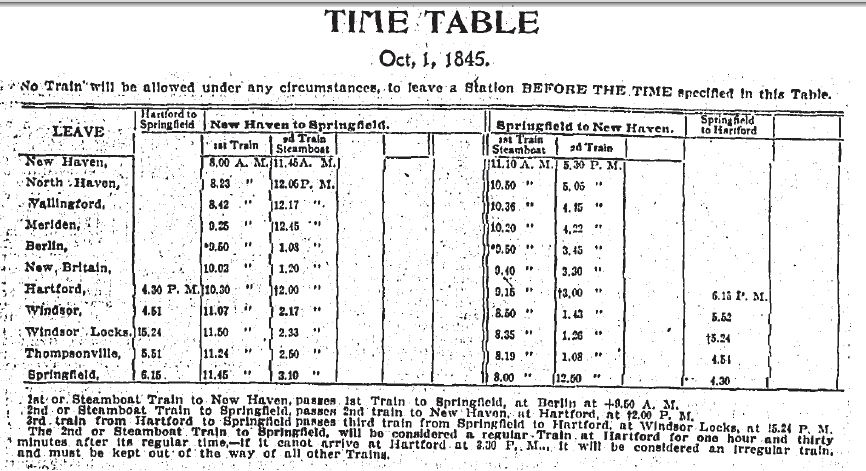
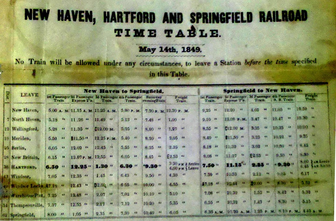
NEW BRITAIN/H1 [H&NH, 1839]
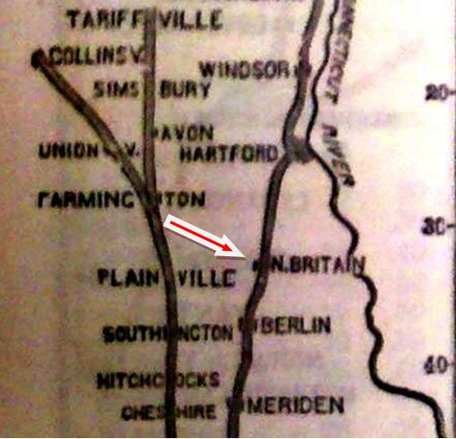
New research has uncovered the fact that the Hardware City's first depot was over its eastern border in today's NEWINGTON, then part of Wethersfield. We have used the '/H' to distinguish it and its successor as being on the H&NH. The timetable at [1] shows that a Hartford line station existed at least from 1845 and likely from the 1839 opening of the road. The 1849TT at [2] says this stop was three miles above BERLIN and it is, in fact, seen on the 1850 GHD map [3]. A number of newspaper articles imply or actually corroborate the existence of this station. What served as a depot here, whether a store or a private home or an early railroad-built structure, is not yet known. [REFS: BC/10/09/1843/03; HDC/12/11/1849/02; HNHAR 13.1848.14; B620,621][rev010615, 060323]
New research has uncovered the fact that the Hardware City's first depot was over its eastern border in today's NEWINGTON, then part of Wethersfield. We have used the '/H' to distinguish it and its successor as being on the H&NH. The timetable at [1] shows that a Hartford line station existed at least from 1845 and likely from the 1839 opening of the road. The 1849TT at [2] says this stop was three miles above BERLIN and it is, in fact, seen on the 1850 GHD map [3]. A number of newspaper articles imply or actually corroborate the existence of this station. What served as a depot here, whether a store or a private home or an early railroad-built structure, is not yet known. [REFS: BC/10/09/1843/03; HDC/12/11/1849/02; HNHAR 13.1848.14; B620,621][rev010615, 060323]
|
|
|
NEW BRITAIN/H2 [H&NH, 1848]
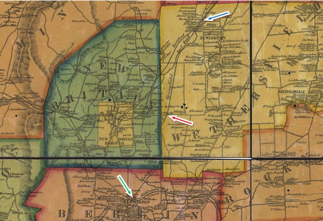
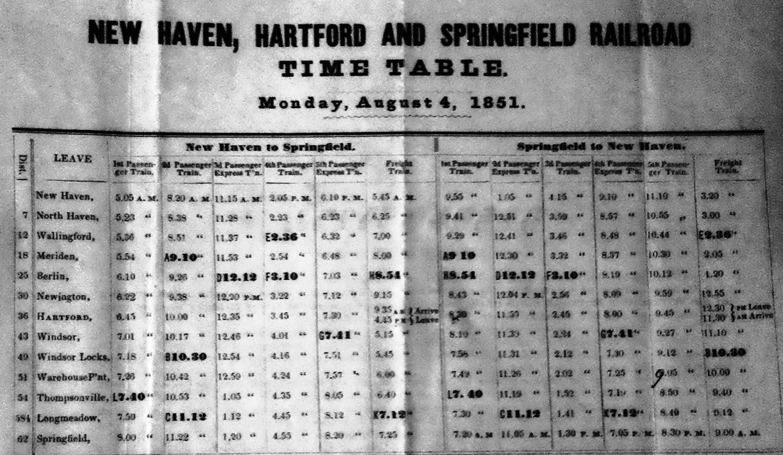
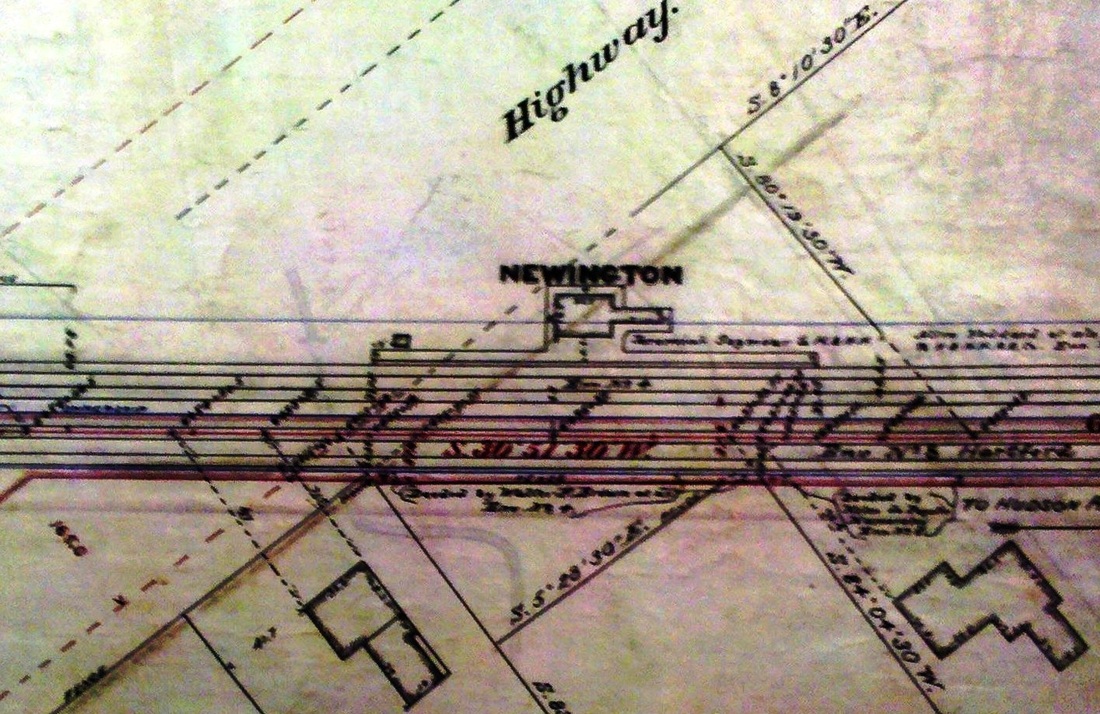
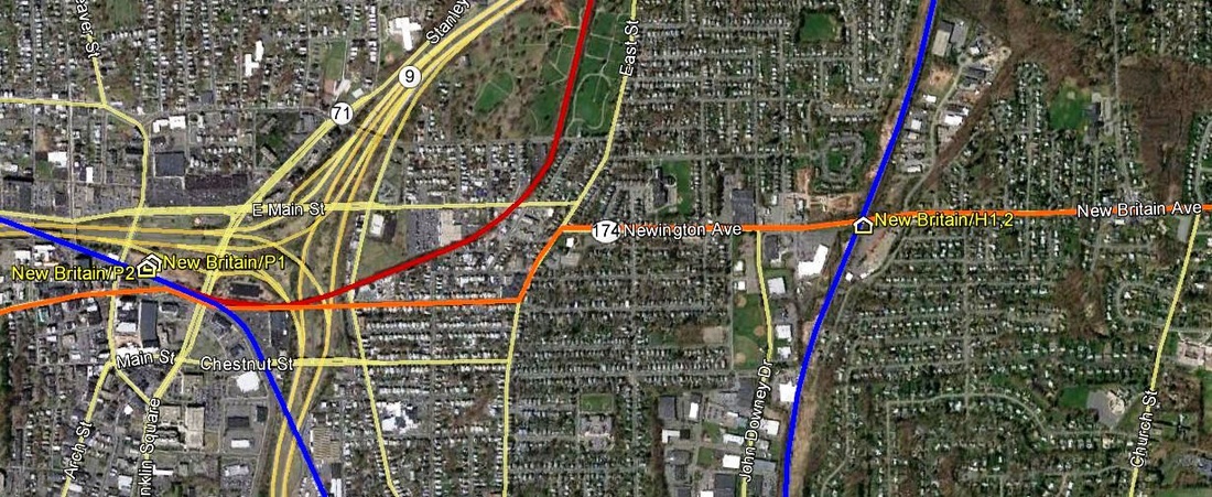
R&LHS notes at the Baker Library indicate that J.J. Smith of Springfield made an offer on 9/6/1847 to build a depot here at this Newington location for $875. Compared to an $1,805 price offer by him for a much larger BERLIN2, this one had to be comparatively small. While we do not know if Smith got the contract, the 1848 annual report says that a NEW BRITAIN depot was built but the cost is lumped together with other expenses. The 1855HC map at [1] shows no station at our red arrow where it most likely stood at the time; the green and blue arrows point to BERLIN and NEWINGTON. An article in late 1850 is quite revealing about the H&NH stops at the time: "An accident happened on the Railroad between Newington and New Britain stations on Thursday evening. As the express train for New York passed a cross road, it came upon a wagon containing a man and woman. The man was killed instently [sic] and the woman died in a few minutes. Their bodies were carried to the Berlin station. They were James Downes and his sister, (Irish.) The horse attached to the wagon was killed. No blame as far as we learn is attributed to the engineer." The 8/4/1851TT at [2] shows the NEWINGTON stop, probably just a year old, to be five miles north of BERLIN and apparently it has taken the place of the NEW BRITAIN station that is no longer listed. The likely explanation for the rearrangement is that, with the opening of the HP&F from Hartford to Bristol in 1850, New Britain had direct rail service of its own. The H&NH, in turn, seems to have decided to move its erstwhile NEW BRITAIN/H1 station to the junction where subsequent evidence tells us it was used by the two companies for the next 30 years as NEWINGTON1 [see entry below on this page]. Assuming that, we have reproduced the footprint image of that depot at [3] which looks to be about 16x20 feet in size. The image at [4] is a snippet from our Track 11 Google Earth map and shows where we think this station stood, appropriately enough, on New Britain Ave. [REFS: HNHAR13.1848.14; HDC/11/15/1850/02; MC/11/20/1850/02; B620,621][rev010615, 060323]
R&LHS notes at the Baker Library indicate that J.J. Smith of Springfield made an offer on 9/6/1847 to build a depot here at this Newington location for $875. Compared to an $1,805 price offer by him for a much larger BERLIN2, this one had to be comparatively small. While we do not know if Smith got the contract, the 1848 annual report says that a NEW BRITAIN depot was built but the cost is lumped together with other expenses. The 1855HC map at [1] shows no station at our red arrow where it most likely stood at the time; the green and blue arrows point to BERLIN and NEWINGTON. An article in late 1850 is quite revealing about the H&NH stops at the time: "An accident happened on the Railroad between Newington and New Britain stations on Thursday evening. As the express train for New York passed a cross road, it came upon a wagon containing a man and woman. The man was killed instently [sic] and the woman died in a few minutes. Their bodies were carried to the Berlin station. They were James Downes and his sister, (Irish.) The horse attached to the wagon was killed. No blame as far as we learn is attributed to the engineer." The 8/4/1851TT at [2] shows the NEWINGTON stop, probably just a year old, to be five miles north of BERLIN and apparently it has taken the place of the NEW BRITAIN station that is no longer listed. The likely explanation for the rearrangement is that, with the opening of the HP&F from Hartford to Bristol in 1850, New Britain had direct rail service of its own. The H&NH, in turn, seems to have decided to move its erstwhile NEW BRITAIN/H1 station to the junction where subsequent evidence tells us it was used by the two companies for the next 30 years as NEWINGTON1 [see entry below on this page]. Assuming that, we have reproduced the footprint image of that depot at [3] which looks to be about 16x20 feet in size. The image at [4] is a snippet from our Track 11 Google Earth map and shows where we think this station stood, appropriately enough, on New Britain Ave. [REFS: HNHAR13.1848.14; HDC/11/15/1850/02; MC/11/20/1850/02; B620,621][rev010615, 060323]
New Britain Public Library
|

|
|
NEW BRITAIN/P1 [HP&F, 1850]
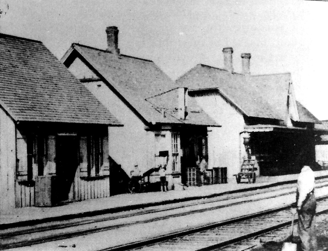
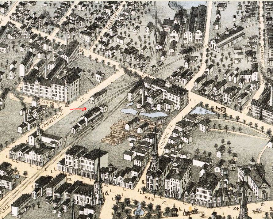
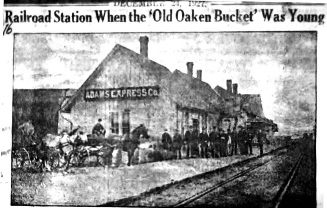
In the photo at [1], the 1850 passenger station is the cross-gabled structure at far right. Style-wise, it is very similar to BRISTOL1 to which point the HP&F opened in 1850. Undoubtedly later additions, the middle structure is the baggage building and the one in the foreground is the Adams Express facility. The 1855HC map at [2] shows the earliest arrangement of the railroad facilities in what would become known as the Hardware City. Our red arrow points to the engine house on the north side of the tracks. Inexplicably, the passenger station at the foot of Center St. is not shown. The snippet at [3] from the bird's-eye map of 1875 gives a good overview of the considerable changes from 20 years earlier, thanks in no small part to good rail service. The tracks are are seen splitting just east of the station where the upper line, now the NY&NE, goes to Hartford and the New Britain and Middletown RR, completed in January, 1865, heads for Berlin on the lower line. This prosperity of this heavily industrialized town and the increased rail activity that it required further added to the complex network of tracks engulfing the passenger station that now served both companies. Safety complaints to the railroad commissioners led to hearings in 1870 that resulted in changes in the track arrangements and "considerable improvements" in 1876 and perhaps, we had thought, to the enlarged appearance of the passenger station on the 1875 map. The photo at [4], however, appeared in a New Britain Observer requiem to the old station just after the opening of NEW BRITAIN/P2. Reproduced in 1927, it reportedly shows an 1882 view and seems to show the same three old buildings unchanged. The tartly written caption calls the station the "old rat trap" which no young man "had pluck enough to fire," but acknowledges that "whatever may be said, the much abused structure, built cheaply at first, has done actual service since 1850... it has earned a vacation... a long one... and let the matter now pass into 'innocuous desuetude.'" Thus, the build date of the 'sainted' old structure is verified and put to rest. The extensive and well-organized collection of materials and superior service we received in the local history room at the New Britain Public Library [click here], some of which materials we have reproduced here, make this library especially worth a research visit. [REFS: MC/01/25/1865/01; HDC/07/03/1869/04; HDC/09/18/1869/02; HDC/01/08/1870/02; CRC17.1870.18+; CRC24.1877.20; NBO/12/24/1927/??][rev010615, 060323]
In the photo at [1], the 1850 passenger station is the cross-gabled structure at far right. Style-wise, it is very similar to BRISTOL1 to which point the HP&F opened in 1850. Undoubtedly later additions, the middle structure is the baggage building and the one in the foreground is the Adams Express facility. The 1855HC map at [2] shows the earliest arrangement of the railroad facilities in what would become known as the Hardware City. Our red arrow points to the engine house on the north side of the tracks. Inexplicably, the passenger station at the foot of Center St. is not shown. The snippet at [3] from the bird's-eye map of 1875 gives a good overview of the considerable changes from 20 years earlier, thanks in no small part to good rail service. The tracks are are seen splitting just east of the station where the upper line, now the NY&NE, goes to Hartford and the New Britain and Middletown RR, completed in January, 1865, heads for Berlin on the lower line. This prosperity of this heavily industrialized town and the increased rail activity that it required further added to the complex network of tracks engulfing the passenger station that now served both companies. Safety complaints to the railroad commissioners led to hearings in 1870 that resulted in changes in the track arrangements and "considerable improvements" in 1876 and perhaps, we had thought, to the enlarged appearance of the passenger station on the 1875 map. The photo at [4], however, appeared in a New Britain Observer requiem to the old station just after the opening of NEW BRITAIN/P2. Reproduced in 1927, it reportedly shows an 1882 view and seems to show the same three old buildings unchanged. The tartly written caption calls the station the "old rat trap" which no young man "had pluck enough to fire," but acknowledges that "whatever may be said, the much abused structure, built cheaply at first, has done actual service since 1850... it has earned a vacation... a long one... and let the matter now pass into 'innocuous desuetude.'" Thus, the build date of the 'sainted' old structure is verified and put to rest. The extensive and well-organized collection of materials and superior service we received in the local history room at the New Britain Public Library [click here], some of which materials we have reproduced here, make this library especially worth a research visit. [REFS: MC/01/25/1865/01; HDC/07/03/1869/04; HDC/09/18/1869/02; HDC/01/08/1870/02; CRC17.1870.18+; CRC24.1877.20; NBO/12/24/1927/??][rev010615, 060323]
|

|

|

|
New Britain Public .Library
|
Copyright NHRHTA
|
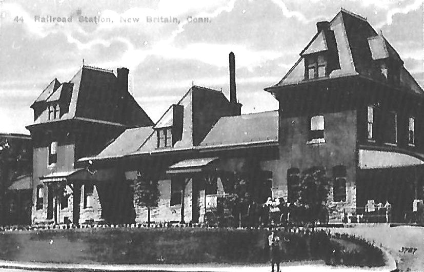
NEW BRITAIN/P2 [NYNH&H, 1887]
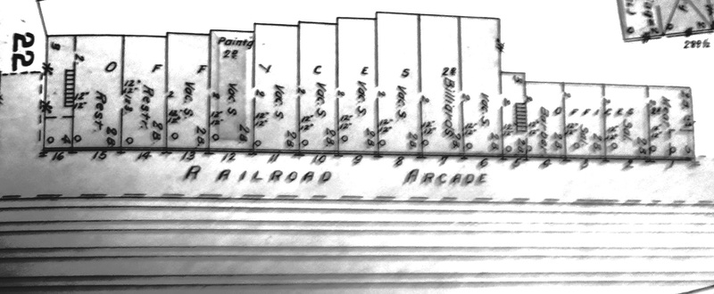
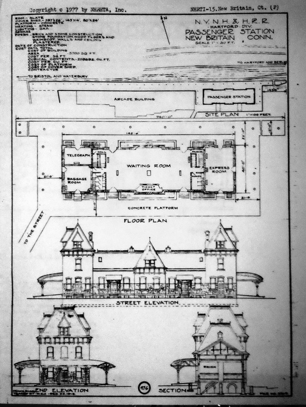
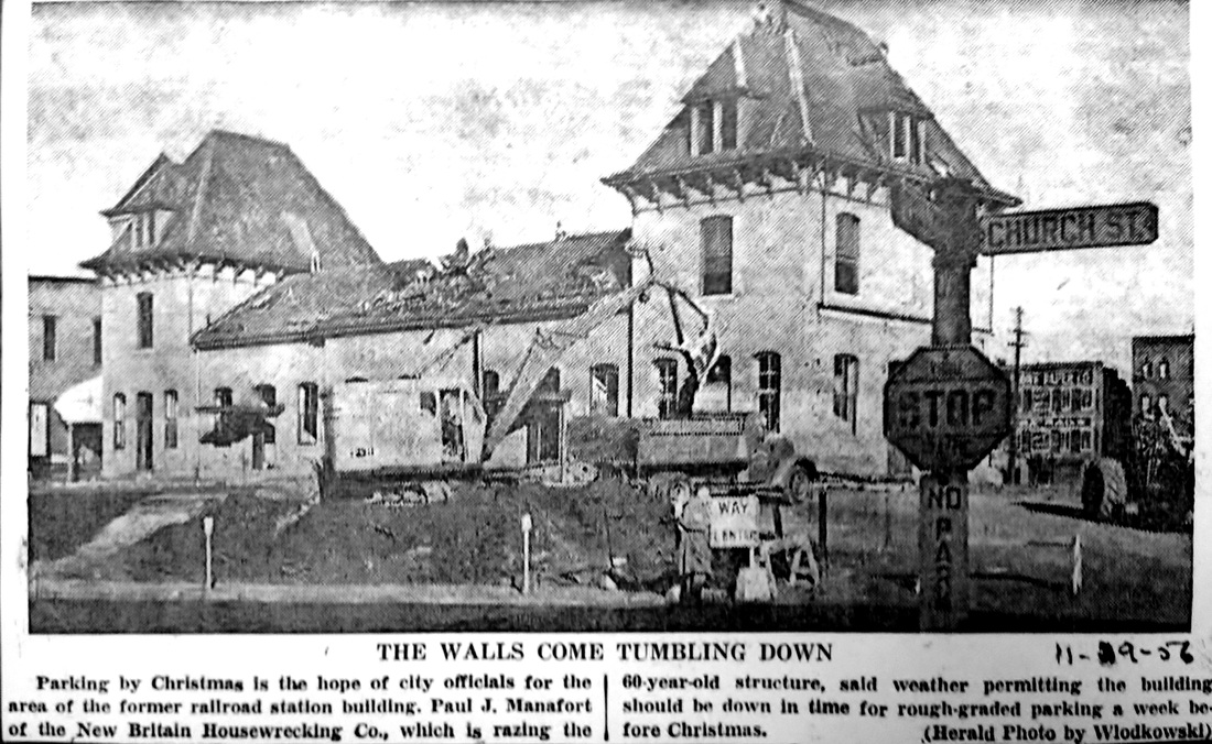
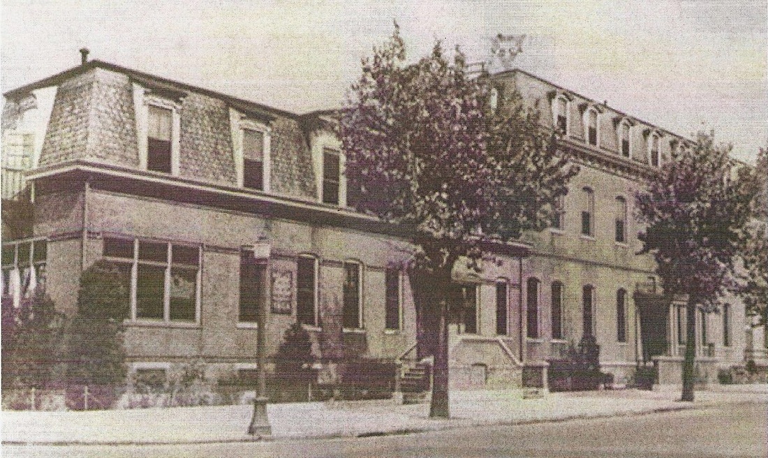
Continued complaints about the depot facilities here and the inability of the NY&NE and NYNH&H to agree on new arrangements occasioned a state legislative act in 1884 ordering a union station. Similar intervention was necessary to bring about NORWICH/W3 and WILLIMANTIC2. The situation was perhaps complicated by the plans of the interloping Hartford and Harlem RR which called for a connection with the NY&NE here in New Britain to form a new through line to Boston. Nevertheless, a deadline of 1/15/1887 was set for a new station and met within a few months of that. The railroad commissioners said that "an elegant and commodious passenger station" was being built late in 1886 and they reported that the "long-deferred" station had opened, according to the New Britain Observer on 7/1/1887, "with its covered platforms extending each way... a model of convenience and elegance." The 142x73-ft edifice constructed of pressed brick with granite trim was impressive and anchored a unique, trackside retail arcade, with apartments upstairs, that extended westward toward Main St. The ground-level layout of the arcade, with restaurants, a barber shop, and several vacant stalls in 1897, is seen at [5] and the floor plan of the station is shown at [6]. NEW BRITAIN/P2 stood until November, 1956 when it was purchased by the city, which was unfortunately only interested in land for a parking lot. The 11/29/1956 newspaper photo seen at [7], probably from the New Britain Herald, carried the caption "The Walls Come Tumbling Down" and said that parking was likely to be available in time for Christmas. The arcade, an unusual station adjunct at the time, had gone oddly unmentioned until we recently found an 1893 Register article which says that "some years ago the Consolidated road erected a business building at New Britain" on spare land near the new station, "a structure that would accommodate several stores," the brainchild of Vice Pres. Reed who thought it to be "a fine and enterprising thing for the railroad company to do." The building was erected and "the stores were readily let." Apparently other railroad officials thought that this was an aberration and that the company was "not in that kind of business," thereby denying that a similar structure was being planned for New Haven "on Water St. near Union." To our knowledge, no other similar retail complex was ever built elsewhere on the NYNH&H and the exact completion date of this one, thus clarified now as between 1887 and perhaps 1890, is still undetermined. The 3/23/1962 buildings inventory said "The Arcade Building sold. The quarters leased in the building for passenger station have been given up." [REFS: CRC31.1884.52; NHAR15.1885.11: now building; CRC34.1886.11; CRC35.1887. 18; RRC34.449; NHER/03/16/1887/01; NHAR16.1887.7; NHER/07/31/1893/04; NBH/11/29/1956 /00; NL18.3.7][rev010518, 060323]
Continued complaints about the depot facilities here and the inability of the NY&NE and NYNH&H to agree on new arrangements occasioned a state legislative act in 1884 ordering a union station. Similar intervention was necessary to bring about NORWICH/W3 and WILLIMANTIC2. The situation was perhaps complicated by the plans of the interloping Hartford and Harlem RR which called for a connection with the NY&NE here in New Britain to form a new through line to Boston. Nevertheless, a deadline of 1/15/1887 was set for a new station and met within a few months of that. The railroad commissioners said that "an elegant and commodious passenger station" was being built late in 1886 and they reported that the "long-deferred" station had opened, according to the New Britain Observer on 7/1/1887, "with its covered platforms extending each way... a model of convenience and elegance." The 142x73-ft edifice constructed of pressed brick with granite trim was impressive and anchored a unique, trackside retail arcade, with apartments upstairs, that extended westward toward Main St. The ground-level layout of the arcade, with restaurants, a barber shop, and several vacant stalls in 1897, is seen at [5] and the floor plan of the station is shown at [6]. NEW BRITAIN/P2 stood until November, 1956 when it was purchased by the city, which was unfortunately only interested in land for a parking lot. The 11/29/1956 newspaper photo seen at [7], probably from the New Britain Herald, carried the caption "The Walls Come Tumbling Down" and said that parking was likely to be available in time for Christmas. The arcade, an unusual station adjunct at the time, had gone oddly unmentioned until we recently found an 1893 Register article which says that "some years ago the Consolidated road erected a business building at New Britain" on spare land near the new station, "a structure that would accommodate several stores," the brainchild of Vice Pres. Reed who thought it to be "a fine and enterprising thing for the railroad company to do." The building was erected and "the stores were readily let." Apparently other railroad officials thought that this was an aberration and that the company was "not in that kind of business," thereby denying that a similar structure was being planned for New Haven "on Water St. near Union." To our knowledge, no other similar retail complex was ever built elsewhere on the NYNH&H and the exact completion date of this one, thus clarified now as between 1887 and perhaps 1890, is still undetermined. The 3/23/1962 buildings inventory said "The Arcade Building sold. The quarters leased in the building for passenger station have been given up." [REFS: CRC31.1884.52; NHAR15.1885.11: now building; CRC34.1886.11; CRC35.1887. 18; RRC34.449; NHER/03/16/1887/01; NHAR16.1887.7; NHER/07/31/1893/04; NBH/11/29/1956 /00; NL18.3.7][rev010518, 060323]

Copyright NHRHTA
NEW BRITAIN/P3
A ticket office set up in the Arcade served as the station from 1956 until passenger service was discontinued in 1960. We have only this photo looking west from the parking lot where the earlier station once stood. The last train ran from Waterbury to Hartford on 1/22/1960, according to the Courant, ending 110 years of service from when the HP&F began running in 1850 to Bristol and then on to Waterbury in 1855. Special CR&L buses were to begin running via Newington to take commuters to Hartford with the train service gone. The office, open thereafter to only sell tickets, was to close on 9/16/1960. It was reported to have taken in $5,865 from January to June, only $729 of which went to the NYNH&H, the rest to other railroads via connections. The cost of operating the office was put at $8,500 annually. [REFS: HC/01/23/1960/6A; NBH/01/22/1960/00; HC/08/25/1960/26D][rev062213, 032422, 060323]
A ticket office set up in the Arcade served as the station from 1956 until passenger service was discontinued in 1960. We have only this photo looking west from the parking lot where the earlier station once stood. The last train ran from Waterbury to Hartford on 1/22/1960, according to the Courant, ending 110 years of service from when the HP&F began running in 1850 to Bristol and then on to Waterbury in 1855. Special CR&L buses were to begin running via Newington to take commuters to Hartford with the train service gone. The office, open thereafter to only sell tickets, was to close on 9/16/1960. It was reported to have taken in $5,865 from January to June, only $729 of which went to the NYNH&H, the rest to other railroads via connections. The cost of operating the office was put at $8,500 annually. [REFS: HC/01/23/1960/6A; NBH/01/22/1960/00; HC/08/25/1960/26D][rev062213, 032422, 060323]
NEW BRITAIN JUNCTION [> BERLIN]

|

|

|

NEW CANAAN [NC, 1868]
This classic Gothic, gabled wooden station was said by the Courant to be going up at Park and Elm Sts. in January, 1868 and was "nearly ready" on the opening of the NCRR on July 4. It is still in service in 2023 at the end of a line that has had steam, trolley, and electric service over its 130+ years of existence. There is no south canopy in the ca. 1900 view at [1] and there is catenary for electric operation in the ca. 1920 shot at [2]. The contemporary street-side view at [3] shows the structure well cared for today. The map at [4] is from 1893. [REFS: HDC/01/20/1868/02; HDC/04/04/1868/04; R70][rev050513, 060323]
This classic Gothic, gabled wooden station was said by the Courant to be going up at Park and Elm Sts. in January, 1868 and was "nearly ready" on the opening of the NCRR on July 4. It is still in service in 2023 at the end of a line that has had steam, trolley, and electric service over its 130+ years of existence. There is no south canopy in the ca. 1900 view at [1] and there is catenary for electric operation in the ca. 1920 shot at [2]. The contemporary street-side view at [3] shows the structure well cared for today. The map at [4] is from 1893. [REFS: HDC/01/20/1868/02; HDC/04/04/1868/04; R70][rev050513, 060323]

|
|

|

|
|
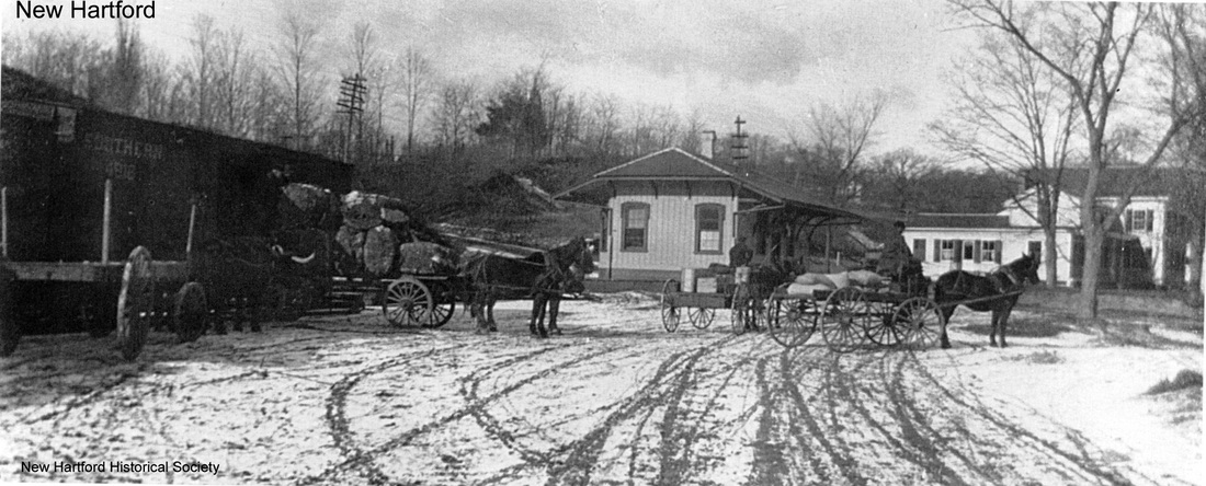
NEW HARTFORD1 [CW, 1871]
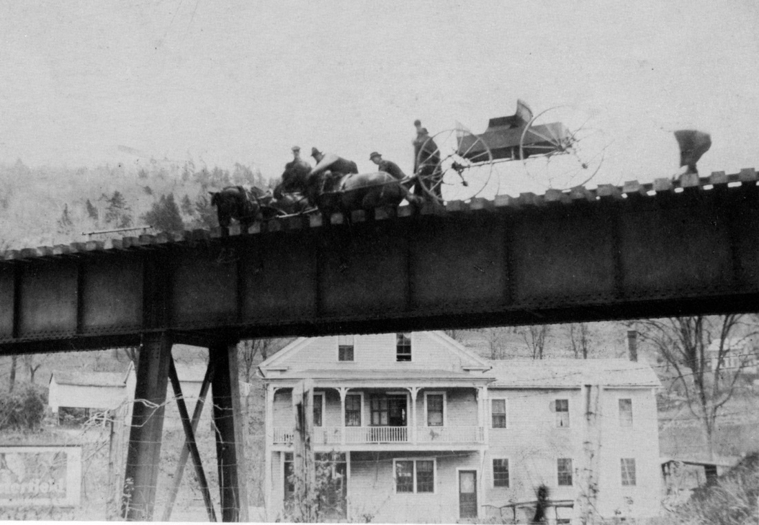
The Courant said this station was ready when regular service commenced on 12/21/1871. The photo at [1] shows the depot as it originally appeared without an agent's bay. The undated view at [2] looks west and shows the station to be a pretty busy place. The 1880 NY&NE appraisal of CW property said this depot was in fair condition and worth $1300 at that time, comparable to BLOOMFIELD and CANTON, which were both valued at $1500. The photo at [3] shows the depot with the agent's bay and an addition on the east end that centers the chimney. Lord gives 1896 and Nimke says 1898 for the expansion and both may reflect a newspaper report of general PR&NE improvements late in 1897. That article also happens to mention that the PR&NE stations have been painted in a cream color with red trim, an elusive detail that is of interest both to historians and modelers. The shot at [4] shows a Hartford-bound train on the trestle just east of this station. The scenario in [5] was reportedly the result of a bet over a glass of beer that a horse-drawn carriage could get across the trestle. This was no exception in the many horse-and-train incidents that usually ended sadly. Help arrived in this case before the train came but one of the animals had to be sacrificed. This depot stood until at least until the 8/20/1935 PUC photo at [6]. The 1938 SSRR seems to say that all the CNE buildings were sold on 11/7/1937. A Farmington Valley Herald article of 12/30/1937 says the purchaser of the passenger and freight buildings was George Dietze who intended to use the lumber for other building projects. The article goes on to say that in 1930 and 1932 the passenger station was rented by the Pulver Novelty Co. which made kids' toys, tool sets and jigsaw puzzles that were in vogue at the time. [REFS: HDC/12/14/1871/02; CW/NYNE1880; HC/10/22/1897/04; RLHS Bulletin 119.6-32; C147; D27,28; N3.34.][rev062715, 021520, 013123, 060323, 012024]
The Courant said this station was ready when regular service commenced on 12/21/1871. The photo at [1] shows the depot as it originally appeared without an agent's bay. The undated view at [2] looks west and shows the station to be a pretty busy place. The 1880 NY&NE appraisal of CW property said this depot was in fair condition and worth $1300 at that time, comparable to BLOOMFIELD and CANTON, which were both valued at $1500. The photo at [3] shows the depot with the agent's bay and an addition on the east end that centers the chimney. Lord gives 1896 and Nimke says 1898 for the expansion and both may reflect a newspaper report of general PR&NE improvements late in 1897. That article also happens to mention that the PR&NE stations have been painted in a cream color with red trim, an elusive detail that is of interest both to historians and modelers. The shot at [4] shows a Hartford-bound train on the trestle just east of this station. The scenario in [5] was reportedly the result of a bet over a glass of beer that a horse-drawn carriage could get across the trestle. This was no exception in the many horse-and-train incidents that usually ended sadly. Help arrived in this case before the train came but one of the animals had to be sacrificed. This depot stood until at least until the 8/20/1935 PUC photo at [6]. The 1938 SSRR seems to say that all the CNE buildings were sold on 11/7/1937. A Farmington Valley Herald article of 12/30/1937 says the purchaser of the passenger and freight buildings was George Dietze who intended to use the lumber for other building projects. The article goes on to say that in 1930 and 1932 the passenger station was rented by the Pulver Novelty Co. which made kids' toys, tool sets and jigsaw puzzles that were in vogue at the time. [REFS: HDC/12/14/1871/02; CW/NYNE1880; HC/10/22/1897/04; RLHS Bulletin 119.6-32; C147; D27,28; N3.34.][rev062715, 021520, 013123, 060323, 012024]

|

|
|

|

|

|

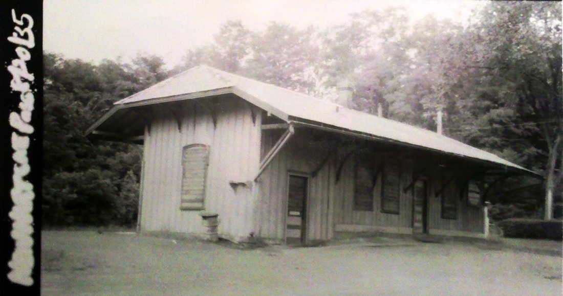
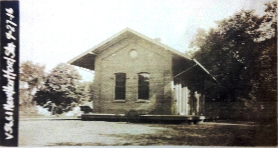
NEW HARTFORD2 [NH&N, 1877]
This was the NH&N depot on the 3,500-ft Canal line extension that was built across the Farmington River in 1876. Service to the "ample station grounds" purchased from the Greenwoods Co. began on 11/1/1876 after the railroad commissioners certified the line as safe on 10/27/1876. The 1878 Bailey map at [7] looks south and provides a sweeping view of all the depots and the impressive trestle to the east of NEW HARTFORD1, the CW passenger station [map i.d. 3], with its freight house over to the left. The large building at lower left [map i.d. 7] is NEW HARTFORD2, the NH&N passenger depot; the adjacent freight depot to its right is used today for the local community's ambulance service. The shot at [1] looks south at the NH&N passenger station and shows a turntable at the far left; it replaced the one that locals claim was behind St. Johns Episcopal Church in Pine Meadow until the early 1900s. The photo at [2] looks north with a coach at the station. The ICC valuation photo at [3] is dated 9/27/1916. The image at [4] shows a southbound passenger train crossing the river to PINE MEADOW using what is probably the 1878 iron bridge; the wooden coach is lettered for the NH&N, so this is probably before the 1887 lease to the NYNH&H. The photo at [5] catches a later-day train going north on the newer three-span bridge built in the early 1900s. As reported in the New Hartford Times, the PUC allowed passenger service to end on 4/24/1921, with the CNE station used for Canal line riders thereafter. The snippet at [6] is from an undated map that shows this station as LANDERS, a change that most likely took place with the 1927 NYNH&H/CNE merger, which left the 'victor' with two stations named NEW HARTFORD. The 1928 Official List shows the NH&N station now named for the Landers, Frary & Clark company. The New Britain small-appliance maker had converted the Greenwoods Co. plant in 1921 to turn out vacuum cleaners after the previous concern, a cotton duck-cloth processor, had moved south in 1902 for cheaper labor. With its grand list devastated and population cut in half by 1920, the town voted to lure LF&C with the promise of no tax increase for ten years. An article in the Courant said that the "little town fairly went wild" at the thought of the prosperity regained and that "... the movies will be able to run every night in this consequent millenium (sic), and the long consequent millennium, and the long sparkle with gleaming coin."(!) The rail line to the Greenwoods Co. would remain just a spur in spite of "the twenty miles which are already graded and provided with culverts in part..." reported by the newspaper in 1876 for an extension all the way to Massachusetts. In fact, hope for this new line went back at least to 1872 when the Winsted Herald humorously reported that a car had run off the end of the track in Pine Meadow and that "the people in Riverton and other places north, who have been looking with longing eyes for the coming of the cars, may feel encouraged, as it was a move in that direction." Though never built, this projected Lee & New Haven line appears on RRMs from 1876 until the last one published by the railroad commissioners in 1912! The 7/19/1940 SSRR list says this station was sold on 5/22/1940. [REFS: WH/04/19/1872/02; HDC/03/02/1875/02; NHNAR40.1876.5; CWN/01/28/1876/02; CRC23.1876.17; CRC24.1877.17; HC/08/04/1902/13; HC/09/10/1920/02; NHT/04/21/1921/01; HC/08/06/1922/03; OL5/1/1928; D121][rev082319, 060323, 012124]
This was the NH&N depot on the 3,500-ft Canal line extension that was built across the Farmington River in 1876. Service to the "ample station grounds" purchased from the Greenwoods Co. began on 11/1/1876 after the railroad commissioners certified the line as safe on 10/27/1876. The 1878 Bailey map at [7] looks south and provides a sweeping view of all the depots and the impressive trestle to the east of NEW HARTFORD1, the CW passenger station [map i.d. 3], with its freight house over to the left. The large building at lower left [map i.d. 7] is NEW HARTFORD2, the NH&N passenger depot; the adjacent freight depot to its right is used today for the local community's ambulance service. The shot at [1] looks south at the NH&N passenger station and shows a turntable at the far left; it replaced the one that locals claim was behind St. Johns Episcopal Church in Pine Meadow until the early 1900s. The photo at [2] looks north with a coach at the station. The ICC valuation photo at [3] is dated 9/27/1916. The image at [4] shows a southbound passenger train crossing the river to PINE MEADOW using what is probably the 1878 iron bridge; the wooden coach is lettered for the NH&N, so this is probably before the 1887 lease to the NYNH&H. The photo at [5] catches a later-day train going north on the newer three-span bridge built in the early 1900s. As reported in the New Hartford Times, the PUC allowed passenger service to end on 4/24/1921, with the CNE station used for Canal line riders thereafter. The snippet at [6] is from an undated map that shows this station as LANDERS, a change that most likely took place with the 1927 NYNH&H/CNE merger, which left the 'victor' with two stations named NEW HARTFORD. The 1928 Official List shows the NH&N station now named for the Landers, Frary & Clark company. The New Britain small-appliance maker had converted the Greenwoods Co. plant in 1921 to turn out vacuum cleaners after the previous concern, a cotton duck-cloth processor, had moved south in 1902 for cheaper labor. With its grand list devastated and population cut in half by 1920, the town voted to lure LF&C with the promise of no tax increase for ten years. An article in the Courant said that the "little town fairly went wild" at the thought of the prosperity regained and that "... the movies will be able to run every night in this consequent millenium (sic), and the long consequent millennium, and the long sparkle with gleaming coin."(!) The rail line to the Greenwoods Co. would remain just a spur in spite of "the twenty miles which are already graded and provided with culverts in part..." reported by the newspaper in 1876 for an extension all the way to Massachusetts. In fact, hope for this new line went back at least to 1872 when the Winsted Herald humorously reported that a car had run off the end of the track in Pine Meadow and that "the people in Riverton and other places north, who have been looking with longing eyes for the coming of the cars, may feel encouraged, as it was a move in that direction." Though never built, this projected Lee & New Haven line appears on RRMs from 1876 until the last one published by the railroad commissioners in 1912! The 7/19/1940 SSRR list says this station was sold on 5/22/1940. [REFS: WH/04/19/1872/02; HDC/03/02/1875/02; NHNAR40.1876.5; CWN/01/28/1876/02; CRC23.1876.17; CRC24.1877.17; HC/08/04/1902/13; HC/09/10/1920/02; NHT/04/21/1921/01; HC/08/06/1922/03; OL5/1/1928; D121][rev082319, 060323, 012124]

|
|
NEW HAVEN1 [H&NH, 1838]
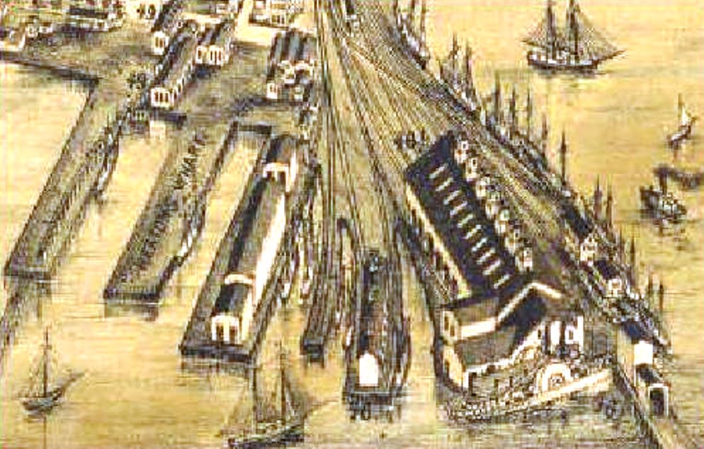
The first station in the Elm City was at Belle Dock, the terminus of the H&NH, which opened in 1838. The shot on the left is from the 1852NH map showing the location. The snippet on the right is from the 1879 Bailey bird's-eye map of New Haven [click here]. The large building in the lower right, with the paddle wheeler docked below, served as the passenger station. Freight and passengers made the connection here with the boats for New York City, but New Haven-bound passengers alighted here as well until 1848 when NEW HAVEN3 was built.
The first station in the Elm City was at Belle Dock, the terminus of the H&NH, which opened in 1838. The shot on the left is from the 1852NH map showing the location. The snippet on the right is from the 1879 Bailey bird's-eye map of New Haven [click here]. The large building in the lower right, with the paddle wheeler docked below, served as the passenger station. Freight and passengers made the connection here with the boats for New York City, but New Haven-bound passengers alighted here as well until 1848 when NEW HAVEN3 was built.
NEW HAVEN2 [NH&N, 1848]
There are no extant photos of the Canal road's first terminal property in New Haven off Temple St., but this was drawn from the Index Book of maps of the NH&N right of way. The map appeared in Connecticut Railroads. These index map books are in the collections of the New Haven Museum. The Connecticut Herald said on 1/1/1848 that "the first Locomotive for the Canal Railroad was landed at Belle Wharf yesterday. It was manufactured at Patterson, N.J. and will be taken to the new Car House, at the head of Temple street, today...," presumably by rail via the H&NH interchange at MILL RIVER JCT. This station terminus was supplanted by NEW HAVEN3, the Austin depot, in 1848 and taken out of service completely at least by July, 1849. [REFS: CH/01/01/1848/02; C62; NHDP/07/05/1849/01][rev092213, 060123]
There are no extant photos of the Canal road's first terminal property in New Haven off Temple St., but this was drawn from the Index Book of maps of the NH&N right of way. The map appeared in Connecticut Railroads. These index map books are in the collections of the New Haven Museum. The Connecticut Herald said on 1/1/1848 that "the first Locomotive for the Canal Railroad was landed at Belle Wharf yesterday. It was manufactured at Patterson, N.J. and will be taken to the new Car House, at the head of Temple street, today...," presumably by rail via the H&NH interchange at MILL RIVER JCT. This station terminus was supplanted by NEW HAVEN3, the Austin depot, in 1848 and taken out of service completely at least by July, 1849. [REFS: CH/01/01/1848/02; C62; NHDP/07/05/1849/01][rev092213, 060123]
|
|
|
 Joseph Taylor Collection
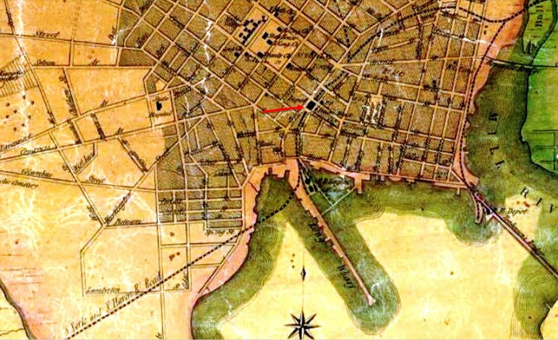
NEW HAVEN3 [NY&NH, 1849]
The Elm City's first Union Station, designed by Henry Austin, was located in the block bounded by Chapel, Union and Cherry, later Wooster, Sts., with the railroad running underneath in the bed of the old Farmington Canal. The Palladium reported it as nearly being completed in February, 1849. The 1852HC map at [1] shows the location. This station was a bombastic additional to the local architectural scene but not noted in the newspapers as much as one might have thought. Austin's Italianate design with Indian and Moorish influences strikes us even to this day as futuristic, Imagine what New Havenites must have thought in 1848! We think the image at [2] is from the 1848 or 1849 city directory which reportedly detailed the the opulent, parlor furnishings inside. This landmark would be replaced officially in May, 1875 when NEW HAVEN4 opened on Meadow St., but trains continued to stop here as per the contract the railroad had for use of the property. The view at [3] predates the transformation of this depot into the trendy city market which the stereo card at [4] shows had a glass pyramid roof replacing the original center tower. The reconfigured structure lasted until 7/4/1894 when the accidental ignition of a vendor's fireworks caused a massive fire that destroyed the building. The taller north tower survived, minus the clock and cupola, until 2/21/1906 when "the last brick was thrown into a dump cart and carried away with the debris" with the widening of the railroad cut in the center of the city. See Track 6, MP 6.7.1 for more details. [REFS: NHDP/02/13/1849/02; NHER/02/21/1906/??][rev121716, 030219, 012823, 060123]
The Elm City's first Union Station, designed by Henry Austin, was located in the block bounded by Chapel, Union and Cherry, later Wooster, Sts., with the railroad running underneath in the bed of the old Farmington Canal. The Palladium reported it as nearly being completed in February, 1849. The 1852HC map at [1] shows the location. This station was a bombastic additional to the local architectural scene but not noted in the newspapers as much as one might have thought. Austin's Italianate design with Indian and Moorish influences strikes us even to this day as futuristic, Imagine what New Havenites must have thought in 1848! We think the image at [2] is from the 1848 or 1849 city directory which reportedly detailed the the opulent, parlor furnishings inside. This landmark would be replaced officially in May, 1875 when NEW HAVEN4 opened on Meadow St., but trains continued to stop here as per the contract the railroad had for use of the property. The view at [3] predates the transformation of this depot into the trendy city market which the stereo card at [4] shows had a glass pyramid roof replacing the original center tower. The reconfigured structure lasted until 7/4/1894 when the accidental ignition of a vendor's fireworks caused a massive fire that destroyed the building. The taller north tower survived, minus the clock and cupola, until 2/21/1906 when "the last brick was thrown into a dump cart and carried away with the debris" with the widening of the railroad cut in the center of the city. See Track 6, MP 6.7.1 for more details. [REFS: NHDP/02/13/1849/02; NHER/02/21/1906/??][rev121716, 030219, 012823, 060123]
|

Joe Taylor Collection
|

|
|
|
|
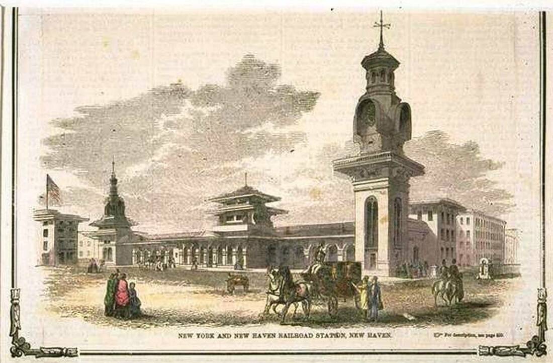
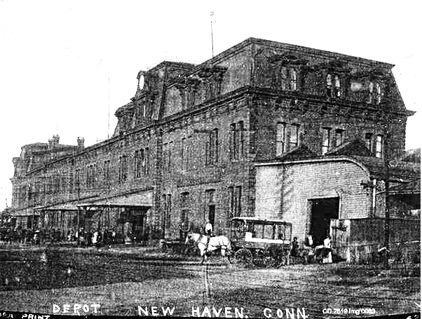
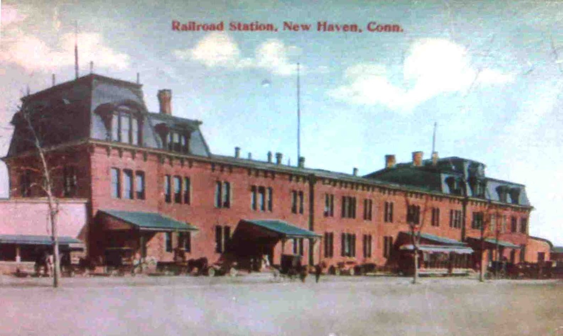
NEW HAVEN4 [NYNH&H, 1875]
The three-story Meadow St. Union Station was designed in-house by C.J. Danforth, a draftsman in the engineering department, and possession was taken on May 24, 1875. Its 255x75-ft size and its generous appointments were said to be on a par with the 1871 Grand Central Depot in New York City. An 1883 Register article credits William P. Dickerman, prolific contractor for the NYNH&H, as building this structure. The new depot had a center ticket office, a “commodious” baggage room on the east end, an express room on the west end, separate men’s and women’s waiting rooms and a restaurant in between. The cooking facilities and furnaces were in the basement and “dumb waiters” were used to connect with the dining room and “do the art culinary on an extensive scale.” By 1877, the busy restaurant would be going through 150 lbs of roast beef, 60 to 75 chickens, 100 gallons of coffee, 50 gallons of tea, 60 to 80 gallons of oysters when in season, plus sandwiches and desserts each day. Outside, a 1000-ft covered platform protected passengers boarding trains in the open air in the rear where, as a correspondent from The New York Times said, “the blue water comes up to the very track of the road.” Additional stub-end tracks and covered platforms met the new depot on both ends. The exterior was faced with 750,000 pressed bricks from Hartford and North Haven, and was trimmed in Portland brownstone. A Mansard roof, in vogue at the time, adorned the top with short end towers and a taller clock tower in the center facing Union Ave., a two-block-long street created to angle southwest from the foot of State St. to the new station. The Meadow St. station is pictured at [1] probably around the opening, with the harbor right behind it. Five of the Elm City's six railroads would use it from the start, the NH&D to follow later. The ca. 1890 view at [2] shows dump cars on the overhead coaling track ready to feed locomotive tenders when positioned below. The scene is otherwise serene and almost deserted, predating the reconfiguration of the west end of the depot for the accommodation of the Derby line trains which started coming here late in 1892. The card at [3] shows that, as well as the 1894 GOB across Union Ave. Originally, NEW HAVEN4 was symmetrical, with two end towers and one in the center with the clock. In November, 1887, the west end was elongated with an addition for meeting space. On 3/19/1892 a fire destroyed most of the third floor and took out the center tower. The postcard at [4] shows a trackside view to the southwest with the changes to the building. The image at [5] appears to show the clock moved to the western tower after the fire. The postcard at [6] shows a street-side view of the structure in the early 1900s with an open trolley car in front. This station was "closed for good" to the public on 6/10/1917 with the opening of a temporary station, NEW HAVEN9, to serve passengers while NEW HAVEN10 was rising just to the west. NEW HAVEN4 would serve as office space for the railroad until it was destroyed by a second fire on 5/8/1918. See Track 6, MP 6.8.5, for more. [REFS: NHER/11/21/1883/01; NHER/04/30/1887/01; NHAR17.1888.7][rev010514, 060123]
The three-story Meadow St. Union Station was designed in-house by C.J. Danforth, a draftsman in the engineering department, and possession was taken on May 24, 1875. Its 255x75-ft size and its generous appointments were said to be on a par with the 1871 Grand Central Depot in New York City. An 1883 Register article credits William P. Dickerman, prolific contractor for the NYNH&H, as building this structure. The new depot had a center ticket office, a “commodious” baggage room on the east end, an express room on the west end, separate men’s and women’s waiting rooms and a restaurant in between. The cooking facilities and furnaces were in the basement and “dumb waiters” were used to connect with the dining room and “do the art culinary on an extensive scale.” By 1877, the busy restaurant would be going through 150 lbs of roast beef, 60 to 75 chickens, 100 gallons of coffee, 50 gallons of tea, 60 to 80 gallons of oysters when in season, plus sandwiches and desserts each day. Outside, a 1000-ft covered platform protected passengers boarding trains in the open air in the rear where, as a correspondent from The New York Times said, “the blue water comes up to the very track of the road.” Additional stub-end tracks and covered platforms met the new depot on both ends. The exterior was faced with 750,000 pressed bricks from Hartford and North Haven, and was trimmed in Portland brownstone. A Mansard roof, in vogue at the time, adorned the top with short end towers and a taller clock tower in the center facing Union Ave., a two-block-long street created to angle southwest from the foot of State St. to the new station. The Meadow St. station is pictured at [1] probably around the opening, with the harbor right behind it. Five of the Elm City's six railroads would use it from the start, the NH&D to follow later. The ca. 1890 view at [2] shows dump cars on the overhead coaling track ready to feed locomotive tenders when positioned below. The scene is otherwise serene and almost deserted, predating the reconfiguration of the west end of the depot for the accommodation of the Derby line trains which started coming here late in 1892. The card at [3] shows that, as well as the 1894 GOB across Union Ave. Originally, NEW HAVEN4 was symmetrical, with two end towers and one in the center with the clock. In November, 1887, the west end was elongated with an addition for meeting space. On 3/19/1892 a fire destroyed most of the third floor and took out the center tower. The postcard at [4] shows a trackside view to the southwest with the changes to the building. The image at [5] appears to show the clock moved to the western tower after the fire. The postcard at [6] shows a street-side view of the structure in the early 1900s with an open trolley car in front. This station was "closed for good" to the public on 6/10/1917 with the opening of a temporary station, NEW HAVEN9, to serve passengers while NEW HAVEN10 was rising just to the west. NEW HAVEN4 would serve as office space for the railroad until it was destroyed by a second fire on 5/8/1918. See Track 6, MP 6.8.5, for more. [REFS: NHER/11/21/1883/01; NHER/04/30/1887/01; NHAR17.1888.7][rev010514, 060123]
NEW HAVEN5 [NH&D, 1875]
As best as we can determine the little building above the 'ST' at 211 West Water St. served as the the NH&D's station when it departed NEW HAVEN3, the Austin depot on Chapel St., in consequence of the opening of NEW HAVEN4. See Track 2, MP 2.3 for more.
As best as we can determine the little building above the 'ST' at 211 West Water St. served as the the NH&D's station when it departed NEW HAVEN3, the Austin depot on Chapel St., in consequence of the opening of NEW HAVEN4. See Track 2, MP 2.3 for more.
NEW HAVEN6 [NH&D, 1877]
This was the NH&D's 1877 depot location in rented space on Custom House Square just below West Water St. until NEW HAVEN7 opened.
This was the NH&D's 1877 depot location in rented space on Custom House Square just below West Water St. until NEW HAVEN7 opened.
|
|
NEW HAVEN7 [NH&D, 1878]
The 1879 bird's-eye map snippet at left shows the NH&D's first self-built station where it stood at the southwest corner of Meadow and West Water Sts. As shown in the ca. 1900 photo at right, the structure was later shunted over to Commerce St. and was in use as a feed and grain store. This photo and all the others we have show this building with a Mansard roof on a second story that originally housed railroad offices. Why the artist did not portray the roof accurately at left is something we have never been able to explain. This depot was "locked up" on 11/26/1888 with the opening of the our next entry. [REFS: NHJC/01/17/1878/02; NHER/11/26/1888/01][rev061120, 060123]
The 1879 bird's-eye map snippet at left shows the NH&D's first self-built station where it stood at the southwest corner of Meadow and West Water Sts. As shown in the ca. 1900 photo at right, the structure was later shunted over to Commerce St. and was in use as a feed and grain store. This photo and all the others we have show this building with a Mansard roof on a second story that originally housed railroad offices. Why the artist did not portray the roof accurately at left is something we have never been able to explain. This depot was "locked up" on 11/26/1888 with the opening of the our next entry. [REFS: NHJC/01/17/1878/02; NHER/11/26/1888/01][rev061120, 060123]
Archives & Spec. Colls, UConn Libraries
|
|
NEW HAVEN8 [HRR/NH&D, 1888]
The two-story 1878 station, now as the freight office on the southern end, and the newly built three-story 1888 passenger station have been joined together on Commerce St. as NEW HAVEN8, the new terminal facility of the HRR and NH&D. The building opened on 11/26/1888. This view on the right is ca. 1920, long after the NYNH&H takeover and the use of this composite building as the South Orange St. RR YMCA starting in 1896. [rev060123]
Joe Taylor Collection
|

|
Joe Taylor Collection
|
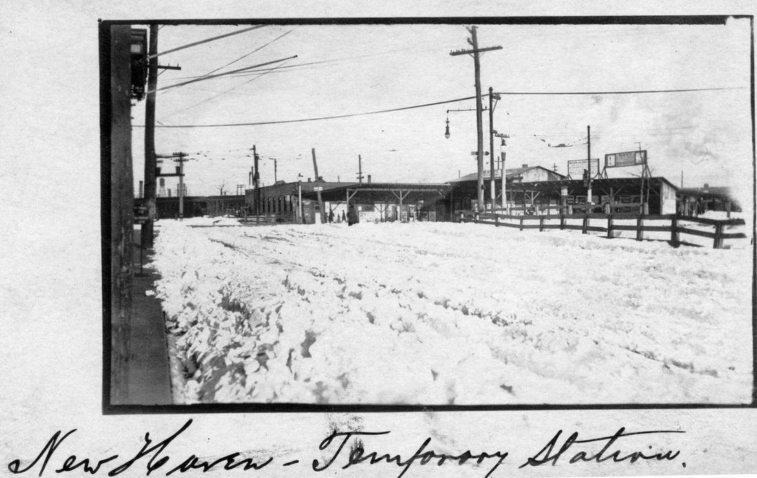
NEW HAVEN9 [NYNH&H, 1917]
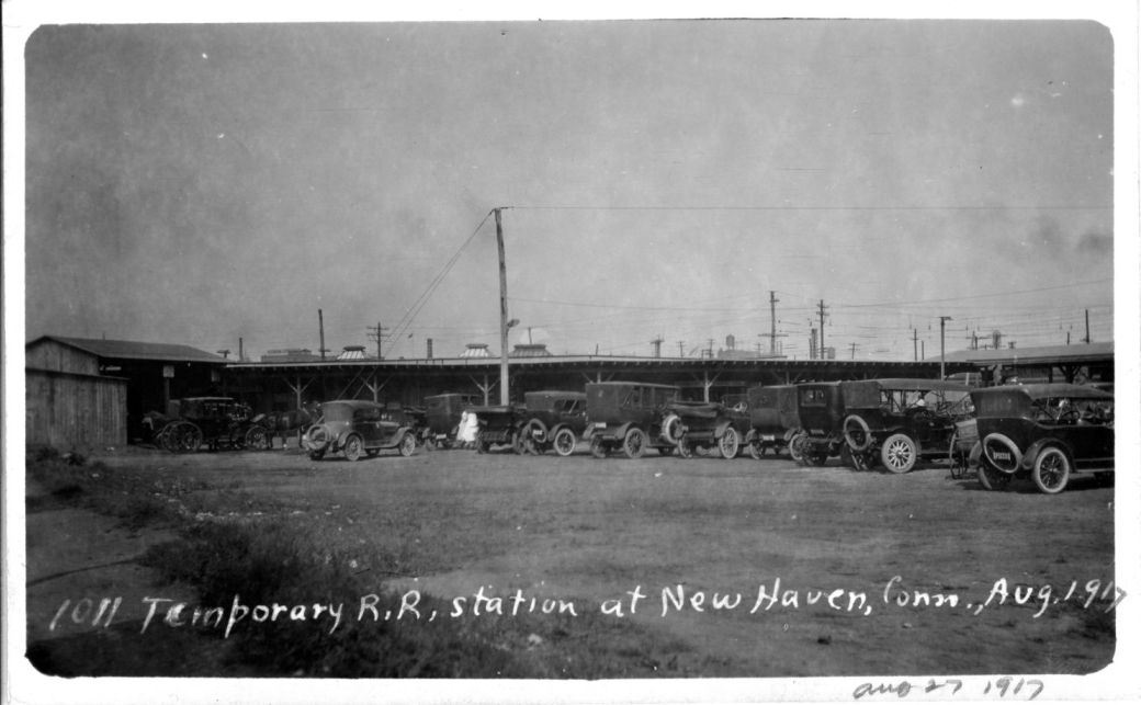
This was the temporary station in front of NEW HAVEN4 that was put into service when the 1875 depot closed on 6/10/1917. The Courant reported that "the restaurant ranges have been installed, the ticket office made ready for the staff and today [6/8] a big gang of men attacked the present station, ripped up benches and took them over to the new building." Crossover tracks routing some trains around the front of the old depot were also said to be in the process of completion. The photo on the left is dated 8/27/1917, shortly after the interim depot opened. The shot is from Lewis H. Benton's own collection, with his signature captioning on the front and his ownership stamp on the back (not shown here). In the photo on the right, the temporary station is seen in front of the 1875 station that caught fire on 5/8/1918 and burned to the ground. This shot was probably taken from the GOB across Union Ave. NEW HAVEN10, the 1920 station, is under construction and out of view to the right. [REFS: HC/06/09/1917/22][rev09022016, 060123]
This was the temporary station in front of NEW HAVEN4 that was put into service when the 1875 depot closed on 6/10/1917. The Courant reported that "the restaurant ranges have been installed, the ticket office made ready for the staff and today [6/8] a big gang of men attacked the present station, ripped up benches and took them over to the new building." Crossover tracks routing some trains around the front of the old depot were also said to be in the process of completion. The photo on the left is dated 8/27/1917, shortly after the interim depot opened. The shot is from Lewis H. Benton's own collection, with his signature captioning on the front and his ownership stamp on the back (not shown here). In the photo on the right, the temporary station is seen in front of the 1875 station that caught fire on 5/8/1918 and burned to the ground. This shot was probably taken from the GOB across Union Ave. NEW HAVEN10, the 1920 station, is under construction and out of view to the right. [REFS: HC/06/09/1917/22][rev09022016, 060123]

|

|

|
NEW HAVEN10 [NYNH&H, 1920]
This station opened on 4/5/1920, was brought back from the prospect of demolition in 1985, and still serves as today's rail transit hub in the Elm City. The card at left shows what this station was originally planned to look like until the railroad's financial problems scaled back the construction budget. The postmark is from Yale Station on 6/25/1913. It is interesting that the aborted design made it to post card status, even as the actual station would not be built for seven more years.
This station opened on 4/5/1920, was brought back from the prospect of demolition in 1985, and still serves as today's rail transit hub in the Elm City. The card at left shows what this station was originally planned to look like until the railroad's financial problems scaled back the construction budget. The postmark is from Yale Station on 6/25/1913. It is interesting that the aborted design made it to post card status, even as the actual station would not be built for seven more years.
New Haven Register
|
Wikipedia
|
Shore Line East
|
NEW HAVEN11 [SLE, 2002]
This steel and glass structure opened on 6/7/2002 at State and Chapel Sts. to serve patrons of Shore Line East. Ironically, this location was diagonally across from the Austin depot, NEW HAVEN3, where many people bemoaned the lack of service for years after NEW HAVEN4 opened on Meadow St. The shot at [1] is from 2015. On 6/6/2018 Hartford line service to Springfield commenced to serve this station as well. The view at [2] is from 2018. The image at [3] shows a more current view. ATK trains also run on this line but do not stop here. [REFS: R95][reev060123]
This steel and glass structure opened on 6/7/2002 at State and Chapel Sts. to serve patrons of Shore Line East. Ironically, this location was diagonally across from the Austin depot, NEW HAVEN3, where many people bemoaned the lack of service for years after NEW HAVEN4 opened on Meadow St. The shot at [1] is from 2015. On 6/6/2018 Hartford line service to Springfield commenced to serve this station as well. The view at [2] is from 2018. The image at [3] shows a more current view. ATK trains also run on this line but do not stop here. [REFS: R95][reev060123]
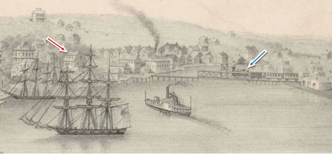
Connecticut Historical Society
|
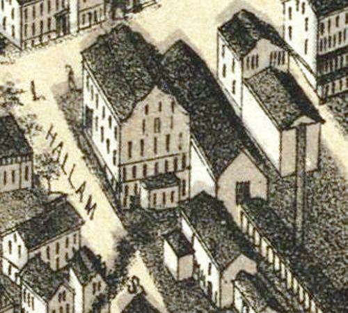
|
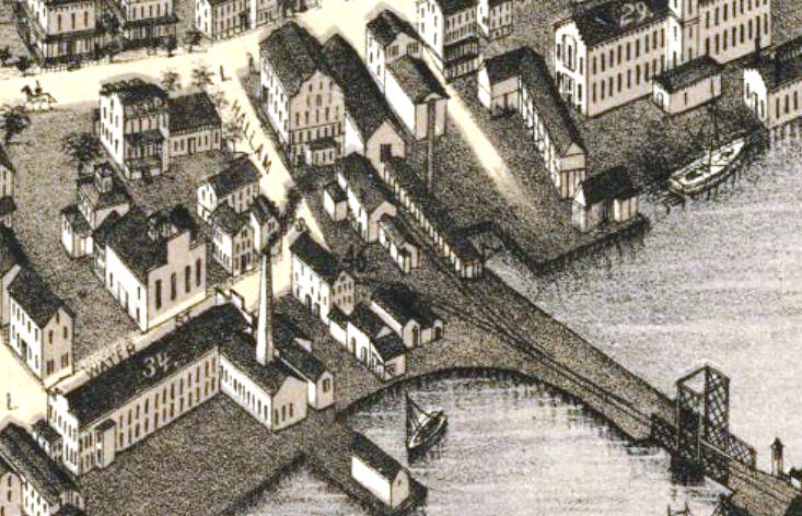
|
NEW LONDON/W1 [NLW&P, 1849]
The first railroad to serve this important coastal town was the New London, Willimantic and Palmer and we have affixed the '/W' to distinguish its depots from the union stations to the south. The inaugural cars ran on 11/13/1849, covering the 28 miles to Willimantic in one hour and ten minutes. The image at upper left is from the ca. 1854 Joseph Ropes landscape entitled View of New London from Fort Griswold. It shows an NLW&P train on the Winthrop Cove bridge at right heading for the gambrel-roofed building that served as NEW LONDON/W1. An 11/6/1852 Norwich Evening Courier ad for sale or lease of this building describes it as "... the large Ware House now occupied as the Depot of the New London, Willimantic and Palmer Railroad Company... fifty-two feet front on Main street and sixty-six feet on Hallam street, four and a half stories highs, with cellar and sub-cellar...." An 1859 article speaks of a "New London lower depot" and likely means that that NLW&P did not entirely abandon this 'upper' depot when it made the connection with the NH&NL down at The Parade, running its first train on 11/20/1852. The second two shots are from the 1876 Bailey bird's-eye map and show the same building at Main and Hallam Sts. [REFS: NLD/06/26/1847/02; HDC/11/16/1849/02; NLD/05/11/1850/01; NEC/11/06/1852/03; HDC/09/12/1859/02; R72][rev011315, 110322, 060123]
The first railroad to serve this important coastal town was the New London, Willimantic and Palmer and we have affixed the '/W' to distinguish its depots from the union stations to the south. The inaugural cars ran on 11/13/1849, covering the 28 miles to Willimantic in one hour and ten minutes. The image at upper left is from the ca. 1854 Joseph Ropes landscape entitled View of New London from Fort Griswold. It shows an NLW&P train on the Winthrop Cove bridge at right heading for the gambrel-roofed building that served as NEW LONDON/W1. An 11/6/1852 Norwich Evening Courier ad for sale or lease of this building describes it as "... the large Ware House now occupied as the Depot of the New London, Willimantic and Palmer Railroad Company... fifty-two feet front on Main street and sixty-six feet on Hallam street, four and a half stories highs, with cellar and sub-cellar...." An 1859 article speaks of a "New London lower depot" and likely means that that NLW&P did not entirely abandon this 'upper' depot when it made the connection with the NH&NL down at The Parade, running its first train on 11/20/1852. The second two shots are from the 1876 Bailey bird's-eye map and show the same building at Main and Hallam Sts. [REFS: NLD/06/26/1847/02; HDC/11/16/1849/02; NLD/05/11/1850/01; NEC/11/06/1852/03; HDC/09/12/1859/02; R72][rev011315, 110322, 060123]

NEW LONDON/W2 [NLN, 1861]
This was the NLN's depot and wharf at The Parade where passengers boarded the steamboats for New York. The newspaper tells us in 1861 that a one-story 60x300-ft depot was to be erected with two tracks running into it for passengers and freight. The 1868 Beers map shows the elongated structure, though after it burned on 5/8/1864 and was rebuilt. Fire loss was reportedly $100,000 to $150,000. [REFS: NLDC/05/17/1861/02; HDC/05/09/1864/02; SR/05/09/1864/04; BET/05/10/1864/02; BH/05/11/1864/05; CR/05/14/1864/01][rev060123]
This was the NLN's depot and wharf at The Parade where passengers boarded the steamboats for New York. The newspaper tells us in 1861 that a one-story 60x300-ft depot was to be erected with two tracks running into it for passengers and freight. The 1868 Beers map shows the elongated structure, though after it burned on 5/8/1864 and was rebuilt. Fire loss was reportedly $100,000 to $150,000. [REFS: NLDC/05/17/1861/02; HDC/05/09/1864/02; SR/05/09/1864/04; BET/05/10/1864/02; BH/05/11/1864/05; CR/05/14/1864/01][rev060123]

NEW LONDON/W3 [NLN, 1864]
This snippet from the 1876 Bailey bird's-eye map shows the rebuilt structure [red arrow] in some detail. [rev060123]
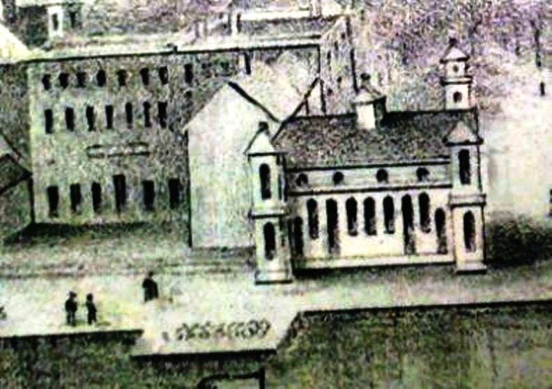
Connecticut Historical Society
|
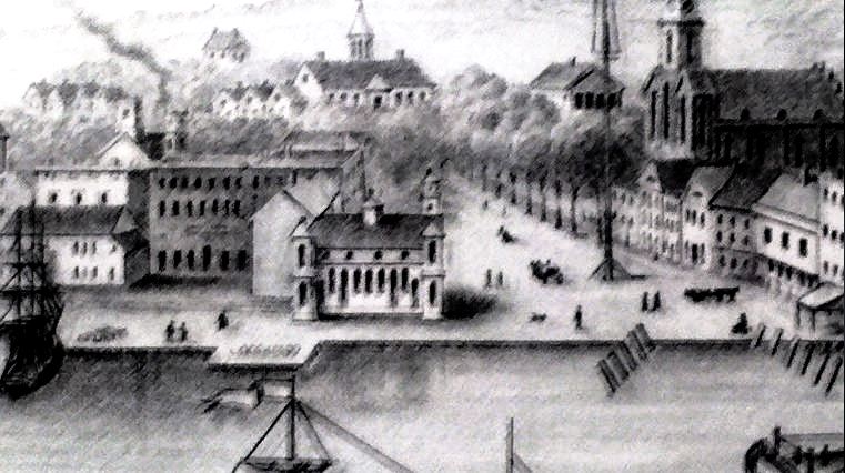
Connecticut Historical Society
|
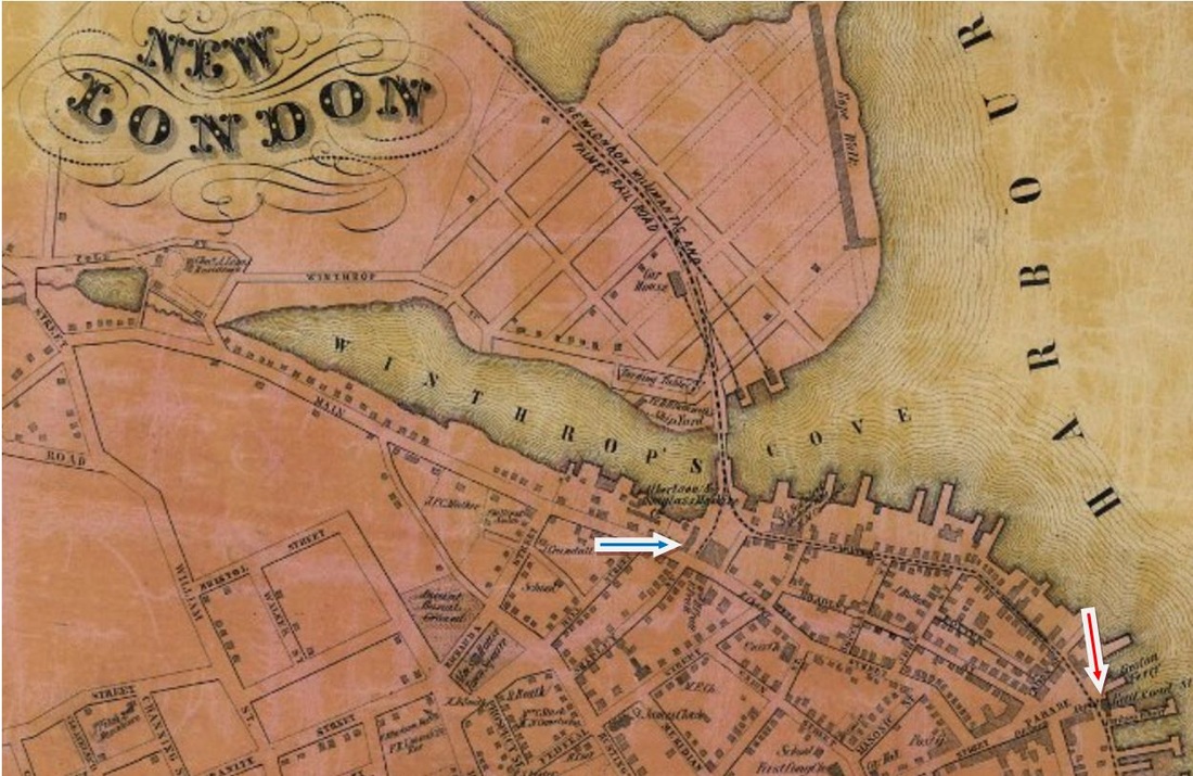
|

NEW LONDON/U1 [NH&NL, 1852]
The image at [1] is from the ca. 1854 Joseph C. Ropes landscape at CHS and shows the NH&NL depot, the Whaling City's first union station. We have added '/U' to the union stations to distinguish them from the NL&WP depots. The newspaper of 08/20/1852 said that "... the building is going up rapidly, its lower tier of window frames are in, and the fine Egyptian Door ways of Groton granite are already in their places, the walls are about half up." The fuller panorama at [2] shows a NH&NL train at the extreme left departing from the south side of the castle-like structure at The Parade where its track ends inside the station. Since this does not show the NLW&P track at the other end, Ropes presumably did this sketch between September, 1852 when the 'Egyptian' depot was finished and 10/18/1852 when the first NLW&P train ran to this station. The 1854NL map at [3] shows the location of both this station, NEW LONDON/U1 [red arrow] and NEW LONDON/W1 [blue arrow]. While many sources say that this station lasted until it burned in 1885, a contradictory article in the 1853 New York Weekly Herald relays a 3/30/1853 report headlined "Railway Station Burned At New London," going on to say that ... "the depot of the New London, Willimantic and Palmer railroad, at New London, was burned down today. The event took place about 10 o'clock. There were four passenger cars and one baggage car in it at the time." A Boston paper repeats this news and adds that the amount of the loss was $8,000 to $10,000. Both articles must refer to NEW LONDON/U1 which the two railroads were using at that time. Oddly enough, no corroborating evidence in local papers has yet been found. But further buttressing this argument is a simple comparison of the architectural styles of this depot and NEW LONDON/U2 in our next entry. As seen at [4], it has always seemed impossible to us that the Egyptian-style building on the left could have been remodeled into the Federal-style structure on the right. Until some evidence proves us wrong, we conclude that the 1852 'Egyptian' style depot, in use only for a few months, is the one that burned on 3/30/1853, apparently so badly that it was replaced on the same footprint by one in completely different Federal style. [REFS: NLDC/07/21/1852/02; NLD/10/16/1852/03; NLDC/10/19/1852/02; NLDS/10/30/1852/03; HDC/01/10/1853/02: NL&S meeting takes place here; NYWH/04/02/1853/05; NLDC/08/20/1853/02; BA10.1857.53; HDC/05/09/1864/02; NYHT/05/09/1864/04; PEP/05/09/1864/03; HDC/05/10/1864/02; CR/05/14/1864/02; R72: first union station was built by the NLW&P and survived until 1885; we do not agree][rev011315, 111322, 060723]
The image at [1] is from the ca. 1854 Joseph C. Ropes landscape at CHS and shows the NH&NL depot, the Whaling City's first union station. We have added '/U' to the union stations to distinguish them from the NL&WP depots. The newspaper of 08/20/1852 said that "... the building is going up rapidly, its lower tier of window frames are in, and the fine Egyptian Door ways of Groton granite are already in their places, the walls are about half up." The fuller panorama at [2] shows a NH&NL train at the extreme left departing from the south side of the castle-like structure at The Parade where its track ends inside the station. Since this does not show the NLW&P track at the other end, Ropes presumably did this sketch between September, 1852 when the 'Egyptian' depot was finished and 10/18/1852 when the first NLW&P train ran to this station. The 1854NL map at [3] shows the location of both this station, NEW LONDON/U1 [red arrow] and NEW LONDON/W1 [blue arrow]. While many sources say that this station lasted until it burned in 1885, a contradictory article in the 1853 New York Weekly Herald relays a 3/30/1853 report headlined "Railway Station Burned At New London," going on to say that ... "the depot of the New London, Willimantic and Palmer railroad, at New London, was burned down today. The event took place about 10 o'clock. There were four passenger cars and one baggage car in it at the time." A Boston paper repeats this news and adds that the amount of the loss was $8,000 to $10,000. Both articles must refer to NEW LONDON/U1 which the two railroads were using at that time. Oddly enough, no corroborating evidence in local papers has yet been found. But further buttressing this argument is a simple comparison of the architectural styles of this depot and NEW LONDON/U2 in our next entry. As seen at [4], it has always seemed impossible to us that the Egyptian-style building on the left could have been remodeled into the Federal-style structure on the right. Until some evidence proves us wrong, we conclude that the 1852 'Egyptian' style depot, in use only for a few months, is the one that burned on 3/30/1853, apparently so badly that it was replaced on the same footprint by one in completely different Federal style. [REFS: NLDC/07/21/1852/02; NLD/10/16/1852/03; NLDC/10/19/1852/02; NLDS/10/30/1852/03; HDC/01/10/1853/02: NL&S meeting takes place here; NYWH/04/02/1853/05; NLDC/08/20/1853/02; BA10.1857.53; HDC/05/09/1864/02; NYHT/05/09/1864/04; PEP/05/09/1864/03; HDC/05/10/1864/02; CR/05/14/1864/02; R72: first union station was built by the NLW&P and survived until 1885; we do not agree][rev011315, 111322, 060723]

|
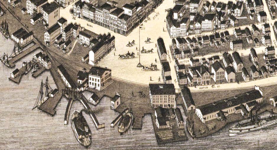
|
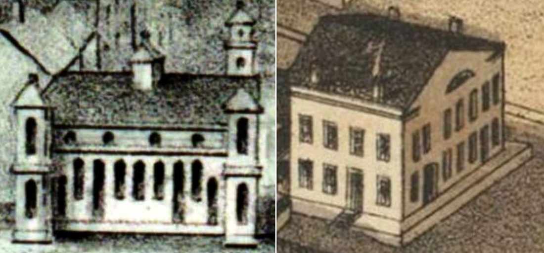
|
NEW LONDON/U2 [NHNL/NLN, 1853?]
Shots [1] and [2] are from the 1876 Bailey map and show the 'General R.R. Depot' at the time. Some sources say the 1852 'Egyptian' style 'Ropes' depot lasted until the fire of 2/5/1885. These include articles by the prolific New London Day writer Richard B. Wall who reportedly interviewed someone in the early 1900s who had worked at the station for 30 years and who vouched for the 'Egyptian' appearance in the Ropes landscape. Whatever burned in 1885, the single article we found about the event says that "few New London people are sorry, as the ancient structure had long since outlived its usefulness." A ca. 1853 date for this depot certainly makes it 'ancient' in public opinion some 30 years later. Moreover, we learn from the papers that the southern annex that survived the 1885 fire was used as the temporary station. The image at [1] shows said annex attached to the southern end of this station. Indeed, public complaint about the 'ancient' depot and its inadequacies reached the state railroad commissioners on several occasions as far back as 1859. Newspaper articles in 1874 and 1875 talk of the desire for a new or remodeled station and raised the issue enough that the commissioners in their 1877 report cite the need "to address the wholly insufficient and inconvenient accommodations" here. [REFS: HDC/12/ 09/1858/02; RRC2.1 (8/19/1859); RRC5.110 (5/26/1867); HDC/10/13/1874/04; CR/11/21/1874/01; HDC/03/30/1875/04; CRC23.1876.21; CRC24.1877.20; CRC 26.1879.31; NHER/02/06/1885/01; NHAR15.1885.11; R72; SL.12.3.8][rev011315, 111322, 060223]
Shots [1] and [2] are from the 1876 Bailey map and show the 'General R.R. Depot' at the time. Some sources say the 1852 'Egyptian' style 'Ropes' depot lasted until the fire of 2/5/1885. These include articles by the prolific New London Day writer Richard B. Wall who reportedly interviewed someone in the early 1900s who had worked at the station for 30 years and who vouched for the 'Egyptian' appearance in the Ropes landscape. Whatever burned in 1885, the single article we found about the event says that "few New London people are sorry, as the ancient structure had long since outlived its usefulness." A ca. 1853 date for this depot certainly makes it 'ancient' in public opinion some 30 years later. Moreover, we learn from the papers that the southern annex that survived the 1885 fire was used as the temporary station. The image at [1] shows said annex attached to the southern end of this station. Indeed, public complaint about the 'ancient' depot and its inadequacies reached the state railroad commissioners on several occasions as far back as 1859. Newspaper articles in 1874 and 1875 talk of the desire for a new or remodeled station and raised the issue enough that the commissioners in their 1877 report cite the need "to address the wholly insufficient and inconvenient accommodations" here. [REFS: HDC/12/ 09/1858/02; RRC2.1 (8/19/1859); RRC5.110 (5/26/1867); HDC/10/13/1874/04; CR/11/21/1874/01; HDC/03/30/1875/04; CRC23.1876.21; CRC24.1877.20; CRC 26.1879.31; NHER/02/06/1885/01; NHAR15.1885.11; R72; SL.12.3.8][rev011315, 111322, 060223]

|
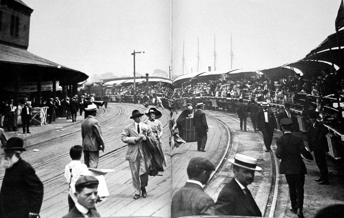
|
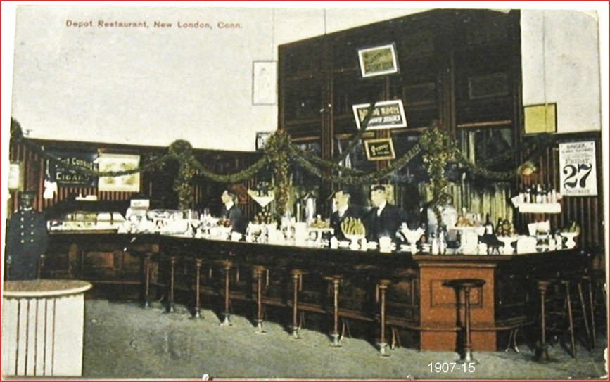
|

|

Edward J. Ozog Collection
|

|
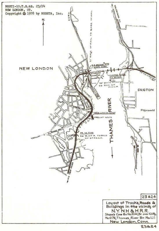
Copyright NHRHTA
NEW LONDON/U3 [CVT, 1887]
As John Roy points out, it was the CVT, lessee of the NLN, that built this station with plans drawn up by renowned architect Henry Hobson Richardson. The NYNH&H, which always had more trains using this structure on its Shore Line, was a mere tenant. This station opened on 7/1/1887, amid the hoopla of 'Boat Day' which saw the annual Yale-Harvard rowing competition that year. The boat train is seen, perhaps during the 1930s, in photo [2] and the lunch counter card [3] dates to ca. 1915. A distinguishing architectural feature of the new depot was the passenger canopy [4] that mirrored the broad curve that the tracks still take along the waterfront and had a Richardsonian raised 'eyebrow' over the State St. grade crossing. The steel footbridge was ordered by the PUC in 1912 to enable safe pedestrian traffic to the docks, an intermodal access point to Long Island still in use today. The overpass came down in 1961. Once threatened by urban renewal, the station was put on the National Register of Historic Places in 1971 and completely renovated between 1976 and 1977. After CVT passenger service ceased in 1947, the NYNH&H continued to use the building until 1968 and the structure still serves Amtrak and Shore Line East riders today. Now privately owned, this imposing structure will soon be an access point for the planned National Coast Guard Museum via a new walkway over the tracks. [REFS: NHDP/03/19/1886/04/box; NHAR16.1887.7; HC/11/07/1912/06; HC/09/09/1961/12C; NLD/09/09/1961/02; Q148k; R72][rev083116, 060223]
As John Roy points out, it was the CVT, lessee of the NLN, that built this station with plans drawn up by renowned architect Henry Hobson Richardson. The NYNH&H, which always had more trains using this structure on its Shore Line, was a mere tenant. This station opened on 7/1/1887, amid the hoopla of 'Boat Day' which saw the annual Yale-Harvard rowing competition that year. The boat train is seen, perhaps during the 1930s, in photo [2] and the lunch counter card [3] dates to ca. 1915. A distinguishing architectural feature of the new depot was the passenger canopy [4] that mirrored the broad curve that the tracks still take along the waterfront and had a Richardsonian raised 'eyebrow' over the State St. grade crossing. The steel footbridge was ordered by the PUC in 1912 to enable safe pedestrian traffic to the docks, an intermodal access point to Long Island still in use today. The overpass came down in 1961. Once threatened by urban renewal, the station was put on the National Register of Historic Places in 1971 and completely renovated between 1976 and 1977. After CVT passenger service ceased in 1947, the NYNH&H continued to use the building until 1968 and the structure still serves Amtrak and Shore Line East riders today. Now privately owned, this imposing structure will soon be an access point for the planned National Coast Guard Museum via a new walkway over the tracks. [REFS: NHDP/03/19/1886/04/box; NHAR16.1887.7; HC/11/07/1912/06; HC/09/09/1961/12C; NLD/09/09/1961/02; Q148k; R72][rev083116, 060223]

|

|

|
NEW MILFORD1 [HRR, 1840]
The HRR reached this town in 1840 as its first northern terminus and built to the state line in 1842. The Litchfield Enquirer said that trains would start running on Monday, 2/10/1840. The location of the depot in this town is seen on the 1856FC map at [1] and corresponds to the structure seen in the center of the 1882 Bailey bird's-eye map at [2]. Though the station seems disproportionately large in comparison to its surroundings, it appears to be a combination depot with the large freight door on the south end. The freight door in the photo at right seems to match what is seen in the bird's-eye image, so we think it shows NEW MILFORD1 and dates to sometime between 1840 and 1886, the latter being when the next station was built. We do not yet know the fate of this structure. On the extreme left just below center we note a water tank, what may be a stand pipe and a one-stall engine house on the other side of the track from the station. The turntable is south of the depot across Bridge St., as seen on the full Bailey map: click here. [REFS: LEN/02/06/1840/04][rev100413, 060223]
The HRR reached this town in 1840 as its first northern terminus and built to the state line in 1842. The Litchfield Enquirer said that trains would start running on Monday, 2/10/1840. The location of the depot in this town is seen on the 1856FC map at [1] and corresponds to the structure seen in the center of the 1882 Bailey bird's-eye map at [2]. Though the station seems disproportionately large in comparison to its surroundings, it appears to be a combination depot with the large freight door on the south end. The freight door in the photo at right seems to match what is seen in the bird's-eye image, so we think it shows NEW MILFORD1 and dates to sometime between 1840 and 1886, the latter being when the next station was built. We do not yet know the fate of this structure. On the extreme left just below center we note a water tank, what may be a stand pipe and a one-stall engine house on the other side of the track from the station. The turntable is south of the depot across Bridge St., as seen on the full Bailey map: click here. [REFS: LEN/02/06/1840/04][rev100413, 060223]

|
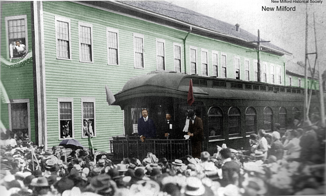
|
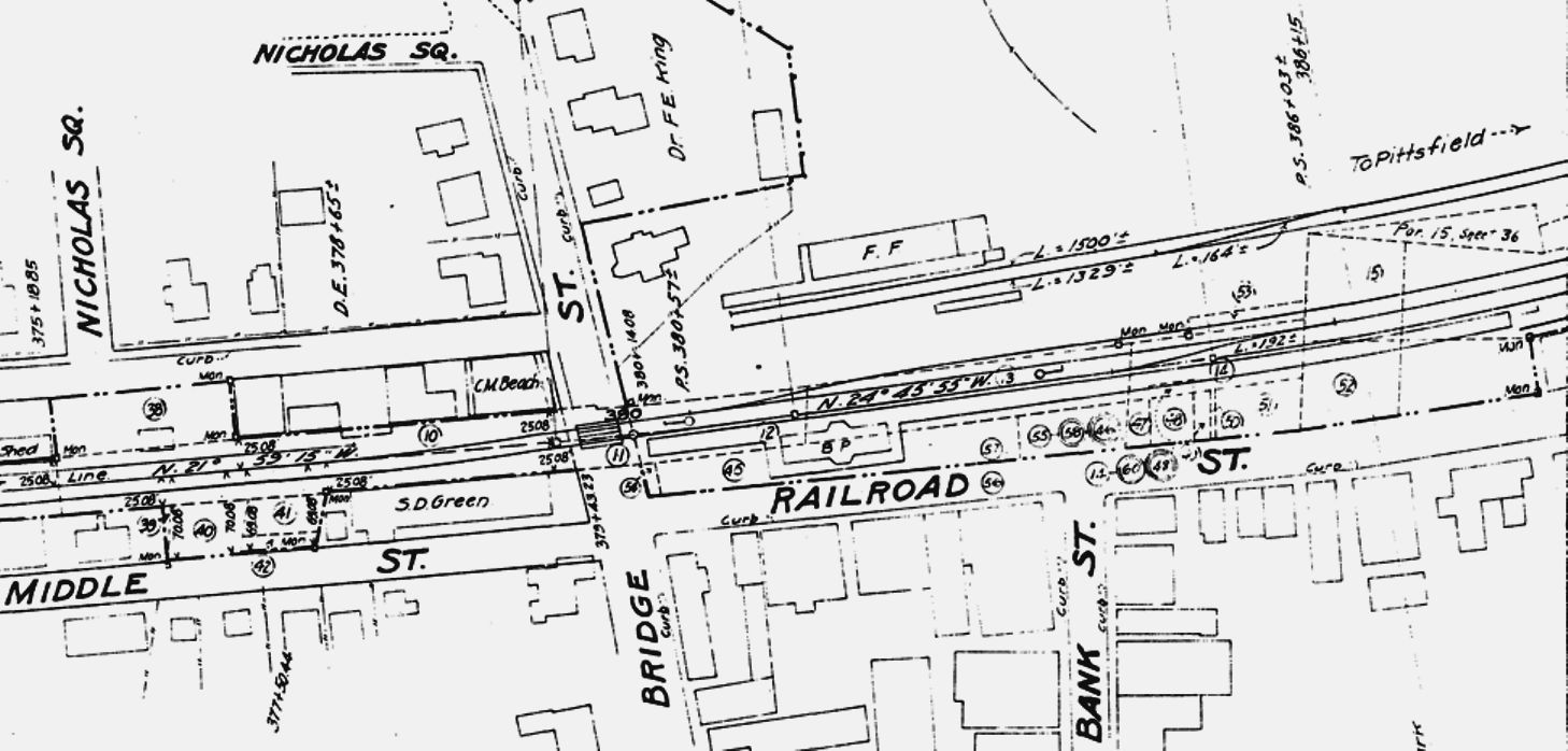
National Archives
|
|

|
landmarkhunter.com
|
NEW MILFORD2 [HRR, 1886]
The New Milford Gazette said on 8/6/1886 that, except for some finishing touches, the new station here was completed on that date. It went on to rave about the 65x23-ft structure as being "... one of the most handsome and convenient depots on the Housatonic railroad...," with a slate roof, 12-ft overhangs, platform all around, separate-sex waiting rooms, and treated inside and out with the fine products of the the Bridgeport Wood Finishing Co which was located in town. [See LANESVILLE AND STILL RIVER]. According to R&LHS notes at the Baker Library, the cost was $9093.87. It is horse-and-buggy days in the 1890s photo at [1]. Note the HRR-signature gingerbread on the station and platform canopy. The image at [2] shows Teddy Roosevelt making remarks here on 9/3/1902 wherein he lamented the death of Secret Service Agent William Craig earlier that day in a streetcar collision in Pittsfield, MA. This was the last day of a tour of New England that started on August 22; he is on his way to Bridgeport where he will board the presidential yacht for Sagamore Hill [click here], his summer home in Oyster Bay, NY. The 6/30/1915 ICC valuation map at [3] looks east and has some interesting details. The 'BP' in the center indicates a brick passenger station, apparently in error as elsewhere; most other views, including recent ones, show it to be clapboarded. The station also has agent's bays on both sides. Architectural symmetry? The 'FF' is the separate framed (wooden) freight depot. The image at [4] shows a diminutive 4-4-0 with a southbound passenger train at the station canopy; note the clerestory roofs on the cars. The shot at [5] is late New Haven-era with McGinnis/Matter block insignia on the signboard. The town bought the depot and property from Conrail on 3/11/1981 and it still stands well-preserved in 2020 as an event space and the home of the local chamber of commerce. The recent shot at [6] shows the gingerbread gone but the block insignia preserved. There is still talk here of Metro-North electrifying the Danbury Branch and extending service up to New Milford. How exciting would it be to have this stop serving passengers again! The chamber itself has been pushing and it would be a symbiotic relationship between agencies who would both benefit from increased rail traffic on a line that is now used only for the freight needs of the reborn HRR. [REFS: CWN/07/07/1886/03; NMG/08/06/1886/902; CRC34.1886.7; BH/09/03/1902/01; CRC54.1906.32; B890; DNT/03/11/1981/16; R74: $15,000(?); D60+][rev070113, 060323]
The New Milford Gazette said on 8/6/1886 that, except for some finishing touches, the new station here was completed on that date. It went on to rave about the 65x23-ft structure as being "... one of the most handsome and convenient depots on the Housatonic railroad...," with a slate roof, 12-ft overhangs, platform all around, separate-sex waiting rooms, and treated inside and out with the fine products of the the Bridgeport Wood Finishing Co which was located in town. [See LANESVILLE AND STILL RIVER]. According to R&LHS notes at the Baker Library, the cost was $9093.87. It is horse-and-buggy days in the 1890s photo at [1]. Note the HRR-signature gingerbread on the station and platform canopy. The image at [2] shows Teddy Roosevelt making remarks here on 9/3/1902 wherein he lamented the death of Secret Service Agent William Craig earlier that day in a streetcar collision in Pittsfield, MA. This was the last day of a tour of New England that started on August 22; he is on his way to Bridgeport where he will board the presidential yacht for Sagamore Hill [click here], his summer home in Oyster Bay, NY. The 6/30/1915 ICC valuation map at [3] looks east and has some interesting details. The 'BP' in the center indicates a brick passenger station, apparently in error as elsewhere; most other views, including recent ones, show it to be clapboarded. The station also has agent's bays on both sides. Architectural symmetry? The 'FF' is the separate framed (wooden) freight depot. The image at [4] shows a diminutive 4-4-0 with a southbound passenger train at the station canopy; note the clerestory roofs on the cars. The shot at [5] is late New Haven-era with McGinnis/Matter block insignia on the signboard. The town bought the depot and property from Conrail on 3/11/1981 and it still stands well-preserved in 2020 as an event space and the home of the local chamber of commerce. The recent shot at [6] shows the gingerbread gone but the block insignia preserved. There is still talk here of Metro-North electrifying the Danbury Branch and extending service up to New Milford. How exciting would it be to have this stop serving passengers again! The chamber itself has been pushing and it would be a symbiotic relationship between agencies who would both benefit from increased rail traffic on a line that is now used only for the freight needs of the reborn HRR. [REFS: CWN/07/07/1886/03; NMG/08/06/1886/902; CRC34.1886.7; BH/09/03/1902/01; CRC54.1906.32; B890; DNT/03/11/1981/16; R74: $15,000(?); D60+][rev070113, 060323]
|
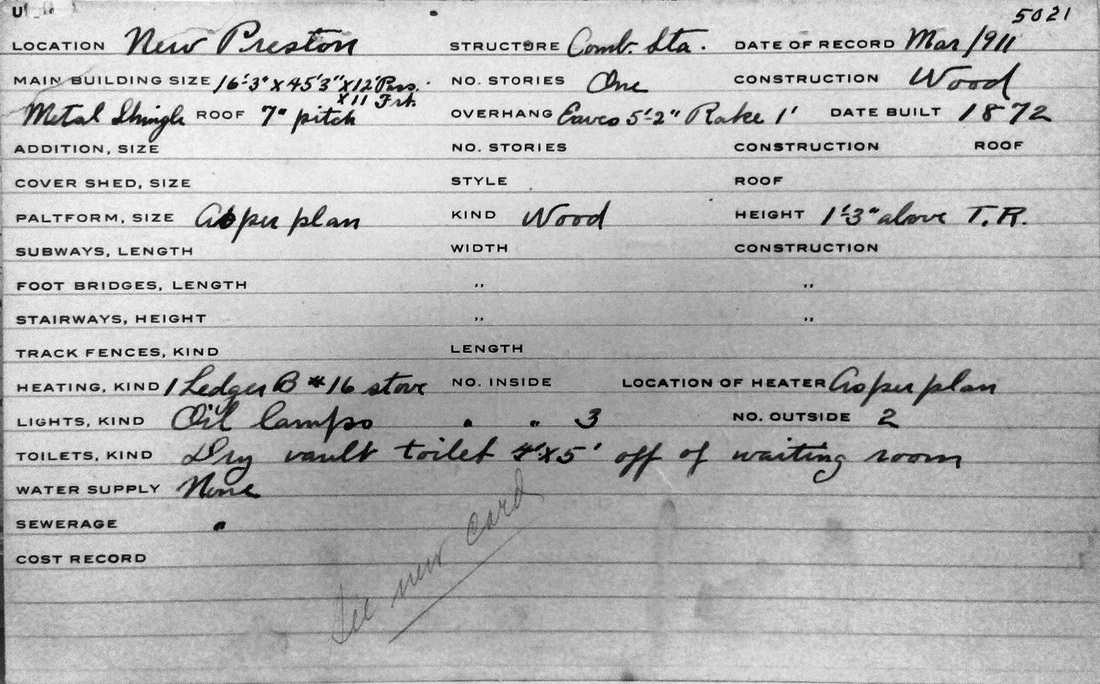
|
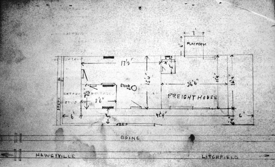
|

NEW PRESTON1 [SRR, 1872]
This stop in the town of Washington was established in 1872 with the opening of the Shepaug Valley RR. A report in the Courant in August, 1872 said "you alight on a platform, which bears resemblance to a stranded raft, just in time to see your trunk dumped out into a convenient sand-bank. But as it's only a sand-bank, its tender mercies are much to be preferred to the careful handling of the average baggagemaster." The platform, presumably between tracks, appears to have been supplemented by a structure in October, when the newspaper said that "the new depot on the Shepaug Valley R. R. at New Preston is nearly completed." The 7/19/1917 ICC valuation photo at [1] shows NEW PRESTON1, then in use as the freight depot, in the foreground and the newer passenger station in the distance. The front of the 1911 real estate card at [2] corroborates the build date as 1872 and the back side at [3] shows the floor plan of the station that then handled both freight and passengers. The ca. 1912 railroad real estate map at [4] shows the new station as well as this building designated as the 'old depot.' [REFS: MC/08/15/1872/03; WH/10/04/1872/03][rev051116, 060323]
This stop in the town of Washington was established in 1872 with the opening of the Shepaug Valley RR. A report in the Courant in August, 1872 said "you alight on a platform, which bears resemblance to a stranded raft, just in time to see your trunk dumped out into a convenient sand-bank. But as it's only a sand-bank, its tender mercies are much to be preferred to the careful handling of the average baggagemaster." The platform, presumably between tracks, appears to have been supplemented by a structure in October, when the newspaper said that "the new depot on the Shepaug Valley R. R. at New Preston is nearly completed." The 7/19/1917 ICC valuation photo at [1] shows NEW PRESTON1, then in use as the freight depot, in the foreground and the newer passenger station in the distance. The front of the 1911 real estate card at [2] corroborates the build date as 1872 and the back side at [3] shows the floor plan of the station that then handled both freight and passengers. The ca. 1912 railroad real estate map at [4] shows the new station as well as this building designated as the 'old depot.' [REFS: MC/08/15/1872/03; WH/10/04/1872/03][rev051116, 060323]
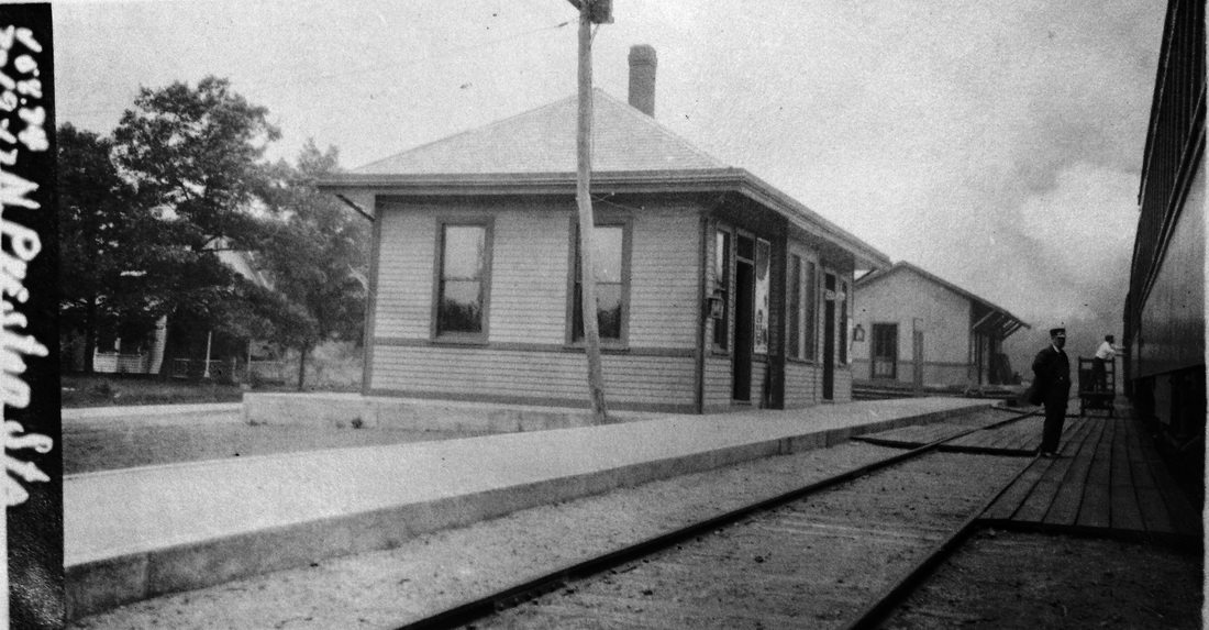
|
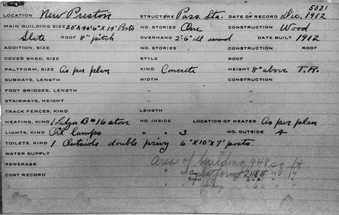
|
|
NEW PRESTON2 [NYNH&H, 1912]
Business must have been sufficient enough in 1912 for the railroad to put up a station for passengers and consign the older depot to freight. The ICC valuation photo at [1] is also dated 7/19/1917 and taken on the same day. The front of the real estate card at [2] shows this station was up by December, 1912 and the back side at [3] gives us the floor plan. At [4], Irving Drake is seated on the platform as Louis H. Benton takes photo 2654 ca. 1930. [REFS: NHAR41.1912.10; NHAR42.1913.14; D152][rev032813, 060323]
Business must have been sufficient enough in 1912 for the railroad to put up a station for passengers and consign the older depot to freight. The ICC valuation photo at [1] is also dated 7/19/1917 and taken on the same day. The front of the real estate card at [2] shows this station was up by December, 1912 and the back side at [3] gives us the floor plan. At [4], Irving Drake is seated on the platform as Louis H. Benton takes photo 2654 ca. 1930. [REFS: NHAR41.1912.10; NHAR42.1913.14; D152][rev032813, 060323]

|
|
|
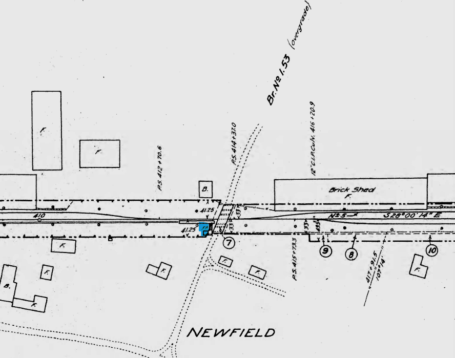
|
|

|
NEWFIELD [MRR, 1850]
This Middletown stop was probably established by the Middletown RR when it opened in 1850. We suspect that the shot at [1], the only one we have of this small depot, was cropped from a ca. 1916 ICC valuation photo. The white post at the left likely holds the paddle that waiting passengers lowered to signal trains to stop. The first appearance on a timetable or map is in the 1869 Baker & Tilden atlas at [2] and our red arrow points to the location in the northwest quadrant of the crossing. The 3/22/1850 document at [3] shows that a 71-ft bridge costing $355 dated back to the building of the railroad, although what we see looks reinforced and may be a later version. The 1915 ICC valuation map at [4] shows the small depot in the same position vis-a-vis the road which corresponds to today's Mile Lane, just east of Newfield St. The image at [5] is the 9/17/1928 PUC inspection-notes page that was accompanied by the photo at [6]. The station is barely visible at left on the far side of the bridge. Al Weaver has pointed out that Newfield St. has the distinction of being crossed by three separate railroads: the Air Line to the south, the Middletown RR as the Berlin branch just north of here, and the M&C up at West Cromwell. Interestingly, the busier Newfield St. crossing was at grade, while the less-traveled Mile Lane was on a bridge, perhaps due more to the depressed level of the rail line here rather than the need to separate the grade for traffic safety reasons. Max Miller tells us that, when the Berlin branch was cut back to a point south of here, which Karr says was in 1961, the bridge was removed and the land filled and leveled. The snippet at [7] from our Track 11 Google Earth map shows the location today. [REFS: DC/08/02/1871/02; K75][rev051116, 060323]
This Middletown stop was probably established by the Middletown RR when it opened in 1850. We suspect that the shot at [1], the only one we have of this small depot, was cropped from a ca. 1916 ICC valuation photo. The white post at the left likely holds the paddle that waiting passengers lowered to signal trains to stop. The first appearance on a timetable or map is in the 1869 Baker & Tilden atlas at [2] and our red arrow points to the location in the northwest quadrant of the crossing. The 3/22/1850 document at [3] shows that a 71-ft bridge costing $355 dated back to the building of the railroad, although what we see looks reinforced and may be a later version. The 1915 ICC valuation map at [4] shows the small depot in the same position vis-a-vis the road which corresponds to today's Mile Lane, just east of Newfield St. The image at [5] is the 9/17/1928 PUC inspection-notes page that was accompanied by the photo at [6]. The station is barely visible at left on the far side of the bridge. Al Weaver has pointed out that Newfield St. has the distinction of being crossed by three separate railroads: the Air Line to the south, the Middletown RR as the Berlin branch just north of here, and the M&C up at West Cromwell. Interestingly, the busier Newfield St. crossing was at grade, while the less-traveled Mile Lane was on a bridge, perhaps due more to the depressed level of the rail line here rather than the need to separate the grade for traffic safety reasons. Max Miller tells us that, when the Berlin branch was cut back to a point south of here, which Karr says was in 1961, the bridge was removed and the land filled and leveled. The snippet at [7] from our Track 11 Google Earth map shows the location today. [REFS: DC/08/02/1871/02; K75][rev051116, 060323]
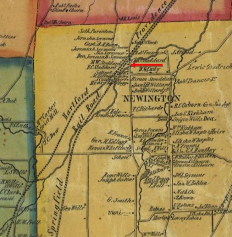
|
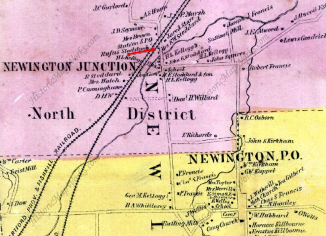
|
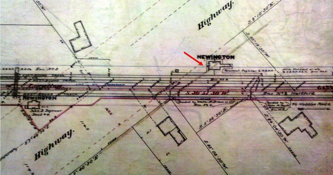
|
NEWINGTON1 [H&NH, 1850]
The 1886 Memorial History of Hartford County says that the H&NH did not build a depot here until "some years after" the 1839 opening of the railroad. It goes on to say that the HP&F established a "station" here, in fact only a stop, when it came in 1850 and that both roads shared a "common depot" [p319] even in 1886. Further research clarifies that this stop did not exist at all until the arrival of the HP&F at which time the H&NH moved its earlier station located two miles to the south, our NEW BRITAIN/H2, north to the new junction for the use of both companies. An 1869 newspaper article said that the railroad station (singular) at Newington was robbed. An 8/1/1872 receipt in the R&LHS collection at the Baker Library shows HP&F trustees paying the H&NH $50 for six months rental of depot space here at an annual rate of $100. This single-depot theory is further born out by news coverage of a train wreck on 11/29/1878, wherein it says that John C. Sternberg was the station agent, selling tickets for, and looking after the affairs, of both roads, a daunting responsibility that probably figured in the accident. He also had to handle all the freight, monitor and throw eight track switches, serve as the Adams Express agent and the postmaster, all for about $40 per month, "not enough pay to it to support two men." Perhaps not surprisingly, he lived right across the tracks, which by then numbered three, the third put in by the H&NH in 1870 and the fourth coming in 1884 when the NY&NE upgraded its line. The red arrow on the 1855 HC map at [1] looks to show the Stoddard residence where the station/post office is so-marked on the 1869 map at [2]; private homes were sometimes contracted or purchased for use as depots by railroads looking to economize. The map at [3] is from an NY&NE real estate atlas and shows the footprint and location of NEWINGTON1. The date on the map page says it is 1886, revised to 1889, but, interestingly, it also shows both the 1891 NEWINGTON3 on the left as well as this station which should have been replaced by its successor in our next entry by then. Several articles in 1865 show NEWINGTON1 being used for church services with preachers like Rev. John T. Huntington of Trinity College in Hartford coming down to officiate. These were the railroad-station beginnings of Grace Episcopal Church whose website says that parishioners had been "meeting informally for over ten years" prior to the opening of their "Grace church, Newington Junction" at Francis Ave. and Day St. in 1875. What we wonder is how religious services were fit in at an already busy and presumably crowded station serving two railroad companies. [REFS: HDC/03/01/1855/02; BA18.1865.00 (7/10/1863); HDC/02/25/1865/02 HDC/05/27/1865/02; HDC/08/28/1865/02; HDC/09/09/1865/02; HDC/04/08/1869/04; HDC/07/15/1870/02; MDC/08/21/1875/03; HDC/11/30/1878/02; HDC/07/01/ 1884/02; MHHC 2.482][rev012015, 060323]
The 1886 Memorial History of Hartford County says that the H&NH did not build a depot here until "some years after" the 1839 opening of the railroad. It goes on to say that the HP&F established a "station" here, in fact only a stop, when it came in 1850 and that both roads shared a "common depot" [p319] even in 1886. Further research clarifies that this stop did not exist at all until the arrival of the HP&F at which time the H&NH moved its earlier station located two miles to the south, our NEW BRITAIN/H2, north to the new junction for the use of both companies. An 1869 newspaper article said that the railroad station (singular) at Newington was robbed. An 8/1/1872 receipt in the R&LHS collection at the Baker Library shows HP&F trustees paying the H&NH $50 for six months rental of depot space here at an annual rate of $100. This single-depot theory is further born out by news coverage of a train wreck on 11/29/1878, wherein it says that John C. Sternberg was the station agent, selling tickets for, and looking after the affairs, of both roads, a daunting responsibility that probably figured in the accident. He also had to handle all the freight, monitor and throw eight track switches, serve as the Adams Express agent and the postmaster, all for about $40 per month, "not enough pay to it to support two men." Perhaps not surprisingly, he lived right across the tracks, which by then numbered three, the third put in by the H&NH in 1870 and the fourth coming in 1884 when the NY&NE upgraded its line. The red arrow on the 1855 HC map at [1] looks to show the Stoddard residence where the station/post office is so-marked on the 1869 map at [2]; private homes were sometimes contracted or purchased for use as depots by railroads looking to economize. The map at [3] is from an NY&NE real estate atlas and shows the footprint and location of NEWINGTON1. The date on the map page says it is 1886, revised to 1889, but, interestingly, it also shows both the 1891 NEWINGTON3 on the left as well as this station which should have been replaced by its successor in our next entry by then. Several articles in 1865 show NEWINGTON1 being used for church services with preachers like Rev. John T. Huntington of Trinity College in Hartford coming down to officiate. These were the railroad-station beginnings of Grace Episcopal Church whose website says that parishioners had been "meeting informally for over ten years" prior to the opening of their "Grace church, Newington Junction" at Francis Ave. and Day St. in 1875. What we wonder is how religious services were fit in at an already busy and presumably crowded station serving two railroad companies. [REFS: HDC/03/01/1855/02; BA18.1865.00 (7/10/1863); HDC/02/25/1865/02 HDC/05/27/1865/02; HDC/08/28/1865/02; HDC/09/09/1865/02; HDC/04/08/1869/04; HDC/07/15/1870/02; MDC/08/21/1875/03; HDC/11/30/1878/02; HDC/07/01/ 1884/02; MHHC 2.482][rev012015, 060323]

National Archives
|
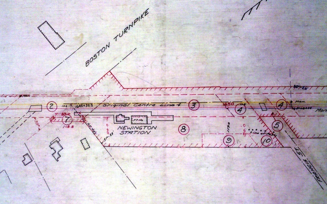
Archives & Spec. Colls, UConn
|
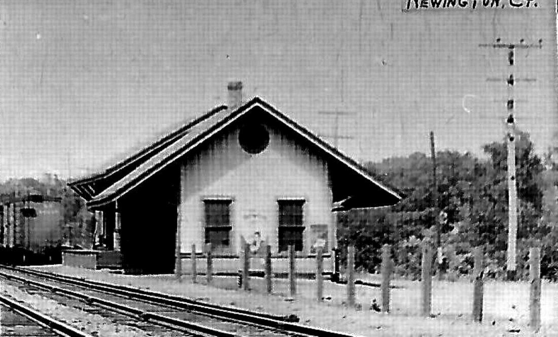
|

Richard A. Fleischer Collection
|
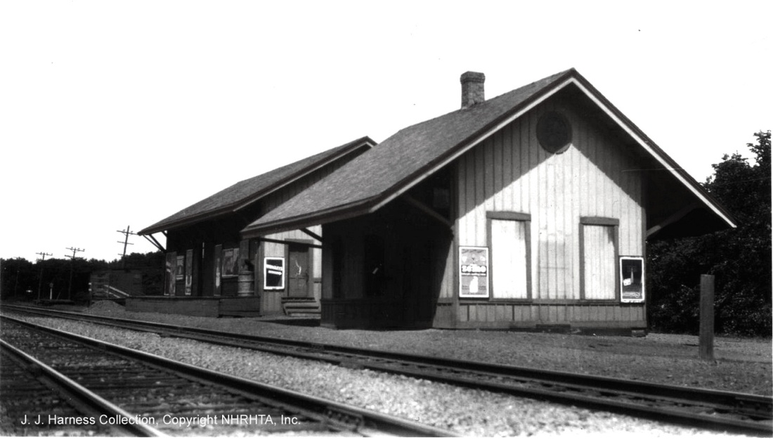
J. J. Harness Collection, NHRHTA
|
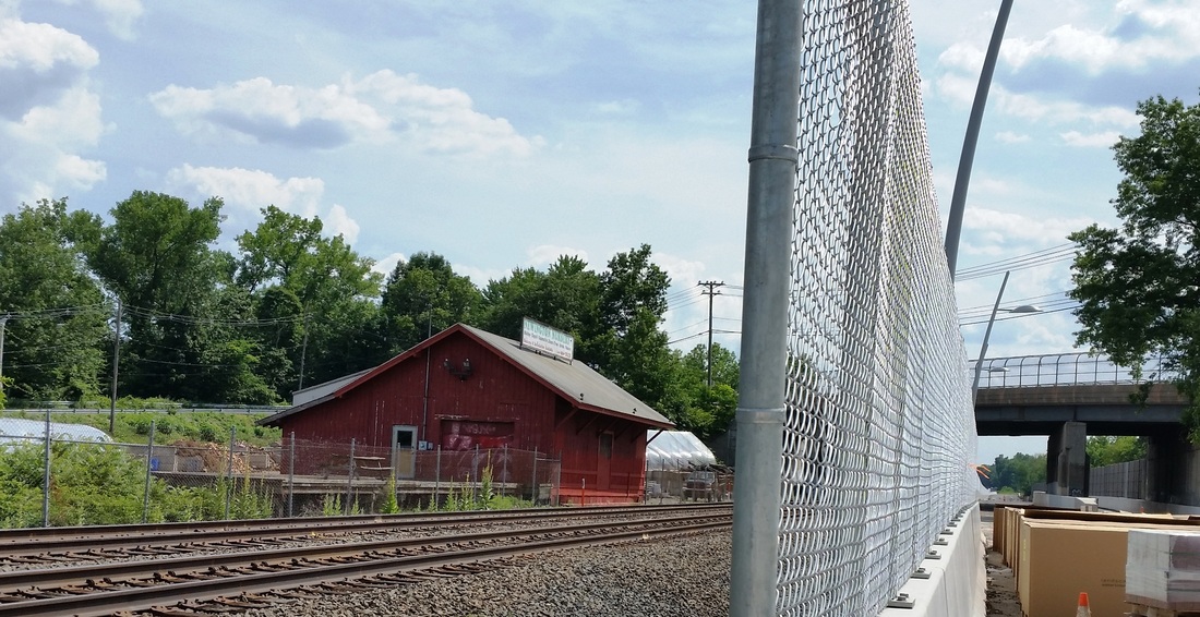
|
NEWINGTON2 [NYNH&H, 1890]
The passenger station replacing the one in our previous entry is seen here along with the companion freight depot behind it. These structures are the ones reported by the railroad commissioners as having been built for the Hartford Division of the NYNH&H in 1890, a little north of the site of the original H&NH depot, as shown on the map in our previous entry. The shot at [1] is an 8/29/1916 ICC valuation photo and the 1910 ROW map at [2] shows the location of the two buildings east of the tracks. The photo at [3] is undated. The image at [4] is a Lewis H. Benton photo from the 1930s, looking north at NEWINGTON2 east of the tracks. Also seen at left is the NY&NE depot, NEWINGTON3, built in 1891 on the west side of the tracks. The image at [5] is a 1930s valuation shot. The passenger station was up until the 3/23/1962 CT buildings inventory when it was sold along with the land. Disposition thereafter unknown. The 1890 freight house still stands here today in commercial use, as seen on 6/28/2014 at [6]. John Roy's date range of 1850-1874 for all these structures is incorrect, as is the NRHP treatment of these properties: see next entry. [REFS: CRC38.1890.19; R75][rev010518, 060323]
The passenger station replacing the one in our previous entry is seen here along with the companion freight depot behind it. These structures are the ones reported by the railroad commissioners as having been built for the Hartford Division of the NYNH&H in 1890, a little north of the site of the original H&NH depot, as shown on the map in our previous entry. The shot at [1] is an 8/29/1916 ICC valuation photo and the 1910 ROW map at [2] shows the location of the two buildings east of the tracks. The photo at [3] is undated. The image at [4] is a Lewis H. Benton photo from the 1930s, looking north at NEWINGTON2 east of the tracks. Also seen at left is the NY&NE depot, NEWINGTON3, built in 1891 on the west side of the tracks. The image at [5] is a 1930s valuation shot. The passenger station was up until the 3/23/1962 CT buildings inventory when it was sold along with the land. Disposition thereafter unknown. The 1890 freight house still stands here today in commercial use, as seen on 6/28/2014 at [6]. John Roy's date range of 1850-1874 for all these structures is incorrect, as is the NRHP treatment of these properties: see next entry. [REFS: CRC38.1890.19; R75][rev010518, 060323]
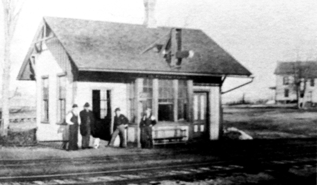
|

|

|
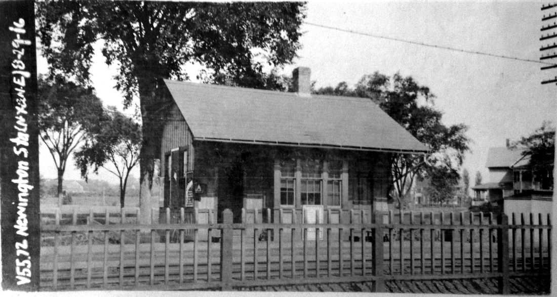
|
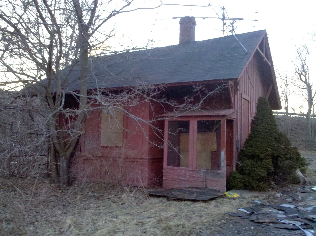
|
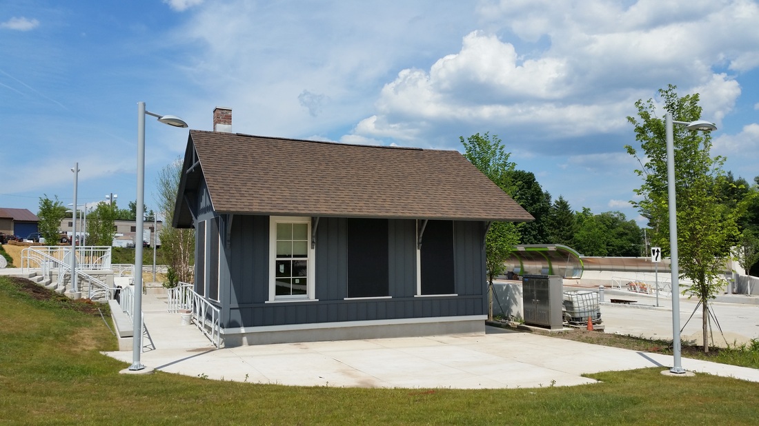
|
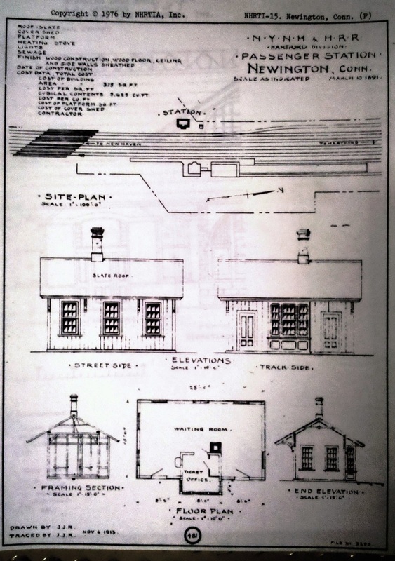
Copyright NHRHTA
NEWINGTON3 [NY&NE, 1891]
According to both the Register and the Courant, a new passenger depot "directly opposite the station of the Consolidated road" was planned and built here by the NY&NE in 1891. Its size was to be 15x25 feet, with a three-foot projection for the ticket office. The diminutive passenger station was built by Orson F. Curtis of New Britain who also was responsible for the grand union station in that city. There was to be a freight counterpart to the north if land could be obtained but it does not show up in any maps or photos. Coincidentally enough, there were complaints by September, 1891 that "... as there is no ticket agent or freight agent, the building is closed and no business done," the NY&NE insisting that a load of tobacco stems marked "Newington" but delivered to New Britain be shipped via the NYNH&H at the customers' own expense! The 3/10/1891 plans seen at [7] were traced by the NYNH&H's real estate office on 11/6/1913 which labeled the depot as belonging to the Hartford Division. The size of the passenger station is corroborated in the data for the 1986 Newington Junction listing on the National Register of Historic Places. Surprisingly and disappointingly, the NRHP documentation has no mention and no seeming awareness of the railroads involved and differing build dates for the various structures, which are casually lumped together as a single 'Multiple Resource Area' with a seemingly irrelevant date of ca. 1870. The image at [1] probably shows the quaint country depot just after it was built in 1891; the ladder to reach the roof-top order board is faintly visible. The second shot likely pre-dates 1898 when the NY&NE was fully absorbed into the NYNH&H, thereafter making this structure the accommodation for south- and west-bound passengers on the four-track, Hartford main line. The red arrow on the 6/30/1915 ICC valuation map at [3] shows the location of this structure. The 8/29/1916 ICC valuation photo at [4] labels this 'NY&NE' and shows the fencing the railroad used to attempt to keep people from crossing the busy tracks. The attractive structure survived in private hands, as seen on 1/22/2010 at [5] with Willard Ave. behind rising on the grade that has taken it over the railroad tracks since 1937. Our 6/28/2014 photo at [6] shows NEWINGTON3 refurbished as part of the busway project which from here duplicates trackage to Hartford, albeit via Berlin. It seems as though it would have been more cost-effective to route Britain-Hartford commuters on existing trackage but it is too late to rethink anything now. [REFS: NHER/03/11/1891/04; HC/03/24/1891/06; HWT/04/30/18191/05; HC/09/12/1891/06; PUC map 1113 (1936); HC/04/08/1937/24][rev010515, 122022, 060323]
According to both the Register and the Courant, a new passenger depot "directly opposite the station of the Consolidated road" was planned and built here by the NY&NE in 1891. Its size was to be 15x25 feet, with a three-foot projection for the ticket office. The diminutive passenger station was built by Orson F. Curtis of New Britain who also was responsible for the grand union station in that city. There was to be a freight counterpart to the north if land could be obtained but it does not show up in any maps or photos. Coincidentally enough, there were complaints by September, 1891 that "... as there is no ticket agent or freight agent, the building is closed and no business done," the NY&NE insisting that a load of tobacco stems marked "Newington" but delivered to New Britain be shipped via the NYNH&H at the customers' own expense! The 3/10/1891 plans seen at [7] were traced by the NYNH&H's real estate office on 11/6/1913 which labeled the depot as belonging to the Hartford Division. The size of the passenger station is corroborated in the data for the 1986 Newington Junction listing on the National Register of Historic Places. Surprisingly and disappointingly, the NRHP documentation has no mention and no seeming awareness of the railroads involved and differing build dates for the various structures, which are casually lumped together as a single 'Multiple Resource Area' with a seemingly irrelevant date of ca. 1870. The image at [1] probably shows the quaint country depot just after it was built in 1891; the ladder to reach the roof-top order board is faintly visible. The second shot likely pre-dates 1898 when the NY&NE was fully absorbed into the NYNH&H, thereafter making this structure the accommodation for south- and west-bound passengers on the four-track, Hartford main line. The red arrow on the 6/30/1915 ICC valuation map at [3] shows the location of this structure. The 8/29/1916 ICC valuation photo at [4] labels this 'NY&NE' and shows the fencing the railroad used to attempt to keep people from crossing the busy tracks. The attractive structure survived in private hands, as seen on 1/22/2010 at [5] with Willard Ave. behind rising on the grade that has taken it over the railroad tracks since 1937. Our 6/28/2014 photo at [6] shows NEWINGTON3 refurbished as part of the busway project which from here duplicates trackage to Hartford, albeit via Berlin. It seems as though it would have been more cost-effective to route Britain-Hartford commuters on existing trackage but it is too late to rethink anything now. [REFS: NHER/03/11/1891/04; HC/03/24/1891/06; HWT/04/30/18191/05; HC/09/12/1891/06; PUC map 1113 (1936); HC/04/08/1937/24][rev010515, 122022, 060323]

NEWTOWN/H1 [HRR, 1840]
As seen on the 1856FC map, this location is corroborated by the Storrs article which says the first station was about a quarter mile south of the later ones. We have no photo of this first station. The HRR must have felt it to be inadequate by 1880 and perhaps well before. The newspapers carried a brief line in March, 1880 saying merely that Newtown was to have a new station. The fate of this depot thereafter is unknown to us. [REFS: NHJC/03/20/1880/05; SL11.1.22][rev122817, 060323]
As seen on the 1856FC map, this location is corroborated by the Storrs article which says the first station was about a quarter mile south of the later ones. We have no photo of this first station. The HRR must have felt it to be inadequate by 1880 and perhaps well before. The newspapers carried a brief line in March, 1880 saying merely that Newtown was to have a new station. The fate of this depot thereafter is unknown to us. [REFS: NHJC/03/20/1880/05; SL11.1.22][rev122817, 060323]
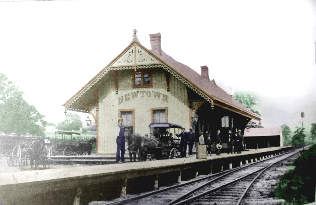
NEWTOWN/H2 [HRR, 1880]
This is quite similar in style to other HRR Victorian-style depots of the period, with gingerbread trim, finials at the peaks, arched name lettering, and double chimneys. See DANBURY4 (1882) and CORNWALL BRIDGE2 (1884). A 4/20/1880 Register article said that Pres. Barnum and other officials were in town on 4/15 to find a site for the new station, which was to be a "commodious structure, with two large waiting rooms, and will closely resemble the depot building at Canaan." How the two-story, double-winged CANAAN2 resembles this depot, we do not know. According to R&LHS notes at the Baker Library, NEWTOWN2 cost $6854.49 and together with the land for the new location north of the old one, the total price was a tidy $8,400 as stated in the 1881 HRR annual report. The 5/15/1880 Journal Courier said the frame was raised yesterday and the 8/6/1880 Register said the the depot was open and had cost $11,000(!), in details echoed by the Connecticut Western News. A Waterbury American reporter said it was first occupied on his visit of 8/9/1880. Ironically we have found no mention in The Newtown Bee, which can hardly not have noticed something right in its home town. Lightning struck the building and it burned in a spectacular fire on the morning of 6/6/1890. The best account, of course, is in the 6/13/1890 Bee, which estimated the loss to be $6,500 for a building it said "was 28x70 feet, built of hard wood with a vaulted and trussed ceiling 12 to 15 feet high... steep slate roof, and wide over-hanging eaves [which] gave it an appearance that accorded well with its surroundings..." This is the only photo we have seen and our colleague Al Weaver has dressed it liberally. The colorization may not be historically correct but it brings into sharper focus the people and the scene at this handsome structure. [REFS: NHJC/04/20/1880/04; NHER/04/23/1880/01; NHJC/05/15/1880/02; HDC/05/19/1880/01; NHER/08/06/1880/04; WAM/08/09/1880/00; CWN/08/11/1880/02; CRC28.1881.67; NHER/06/06/1890/01; CWN/06/11/1890/03; NBE/06/13/1890/05; IOA Newtown: March, 1890 is incorrect; B833; R76][rev122817, 110320, 060323]
This is quite similar in style to other HRR Victorian-style depots of the period, with gingerbread trim, finials at the peaks, arched name lettering, and double chimneys. See DANBURY4 (1882) and CORNWALL BRIDGE2 (1884). A 4/20/1880 Register article said that Pres. Barnum and other officials were in town on 4/15 to find a site for the new station, which was to be a "commodious structure, with two large waiting rooms, and will closely resemble the depot building at Canaan." How the two-story, double-winged CANAAN2 resembles this depot, we do not know. According to R&LHS notes at the Baker Library, NEWTOWN2 cost $6854.49 and together with the land for the new location north of the old one, the total price was a tidy $8,400 as stated in the 1881 HRR annual report. The 5/15/1880 Journal Courier said the frame was raised yesterday and the 8/6/1880 Register said the the depot was open and had cost $11,000(!), in details echoed by the Connecticut Western News. A Waterbury American reporter said it was first occupied on his visit of 8/9/1880. Ironically we have found no mention in The Newtown Bee, which can hardly not have noticed something right in its home town. Lightning struck the building and it burned in a spectacular fire on the morning of 6/6/1890. The best account, of course, is in the 6/13/1890 Bee, which estimated the loss to be $6,500 for a building it said "was 28x70 feet, built of hard wood with a vaulted and trussed ceiling 12 to 15 feet high... steep slate roof, and wide over-hanging eaves [which] gave it an appearance that accorded well with its surroundings..." This is the only photo we have seen and our colleague Al Weaver has dressed it liberally. The colorization may not be historically correct but it brings into sharper focus the people and the scene at this handsome structure. [REFS: NHJC/04/20/1880/04; NHER/04/23/1880/01; NHJC/05/15/1880/02; HDC/05/19/1880/01; NHER/08/06/1880/04; WAM/08/09/1880/00; CWN/08/11/1880/02; CRC28.1881.67; NHER/06/06/1890/01; CWN/06/11/1890/03; NBE/06/13/1890/05; IOA Newtown: March, 1890 is incorrect; B833; R76][rev122817, 110320, 060323]
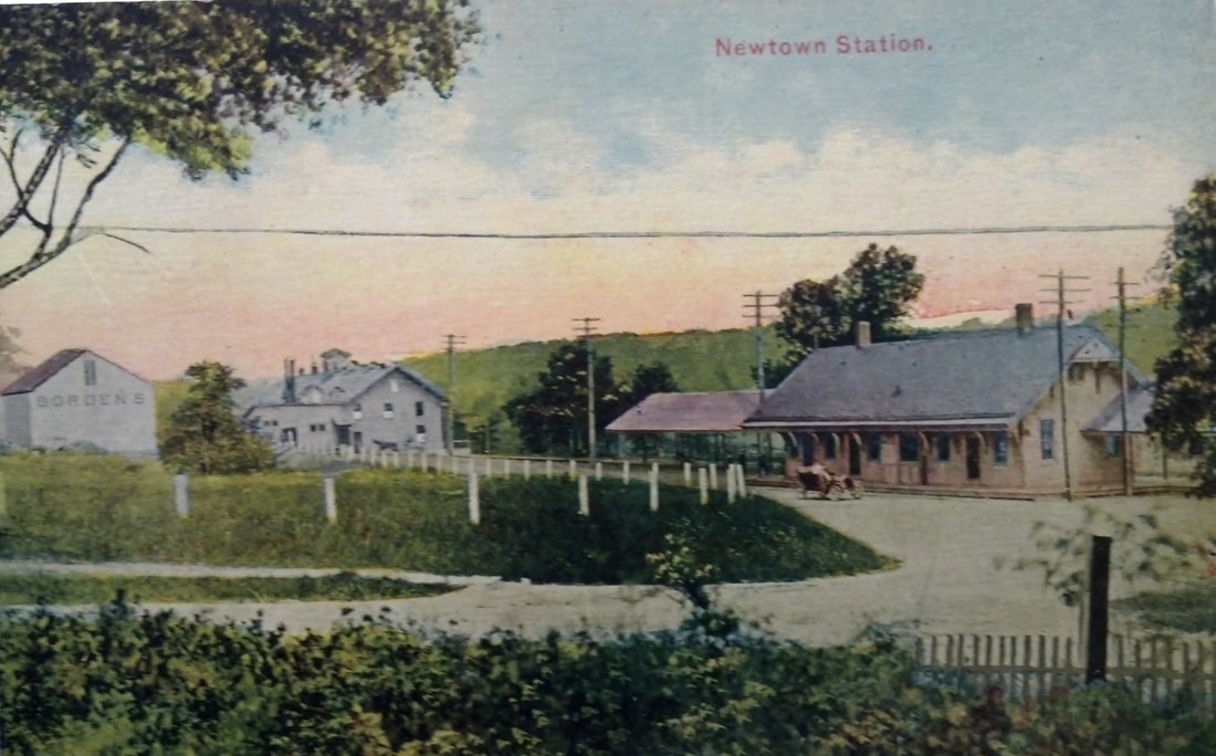
Phil Wooding Collection
|
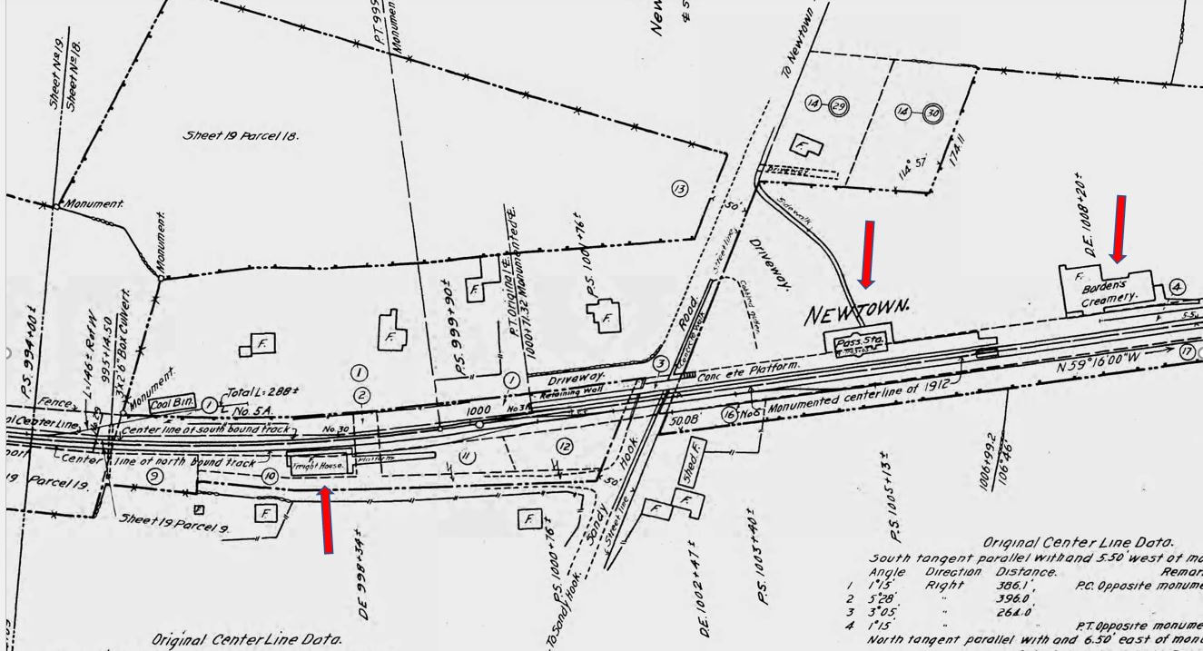
|
|
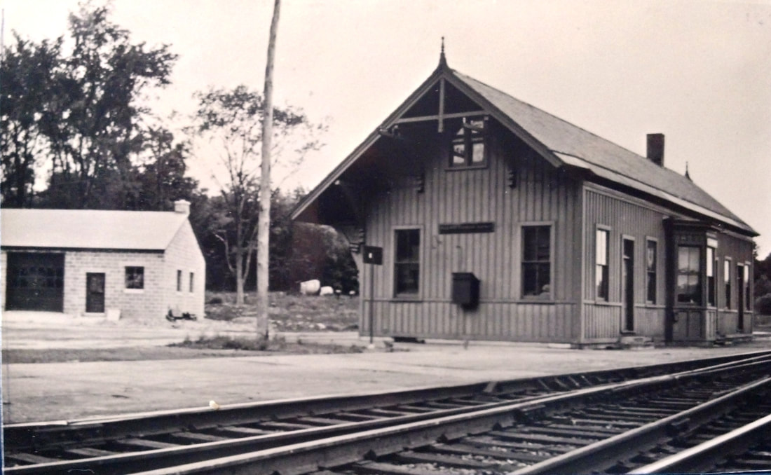
Phil Wooding Collection
|
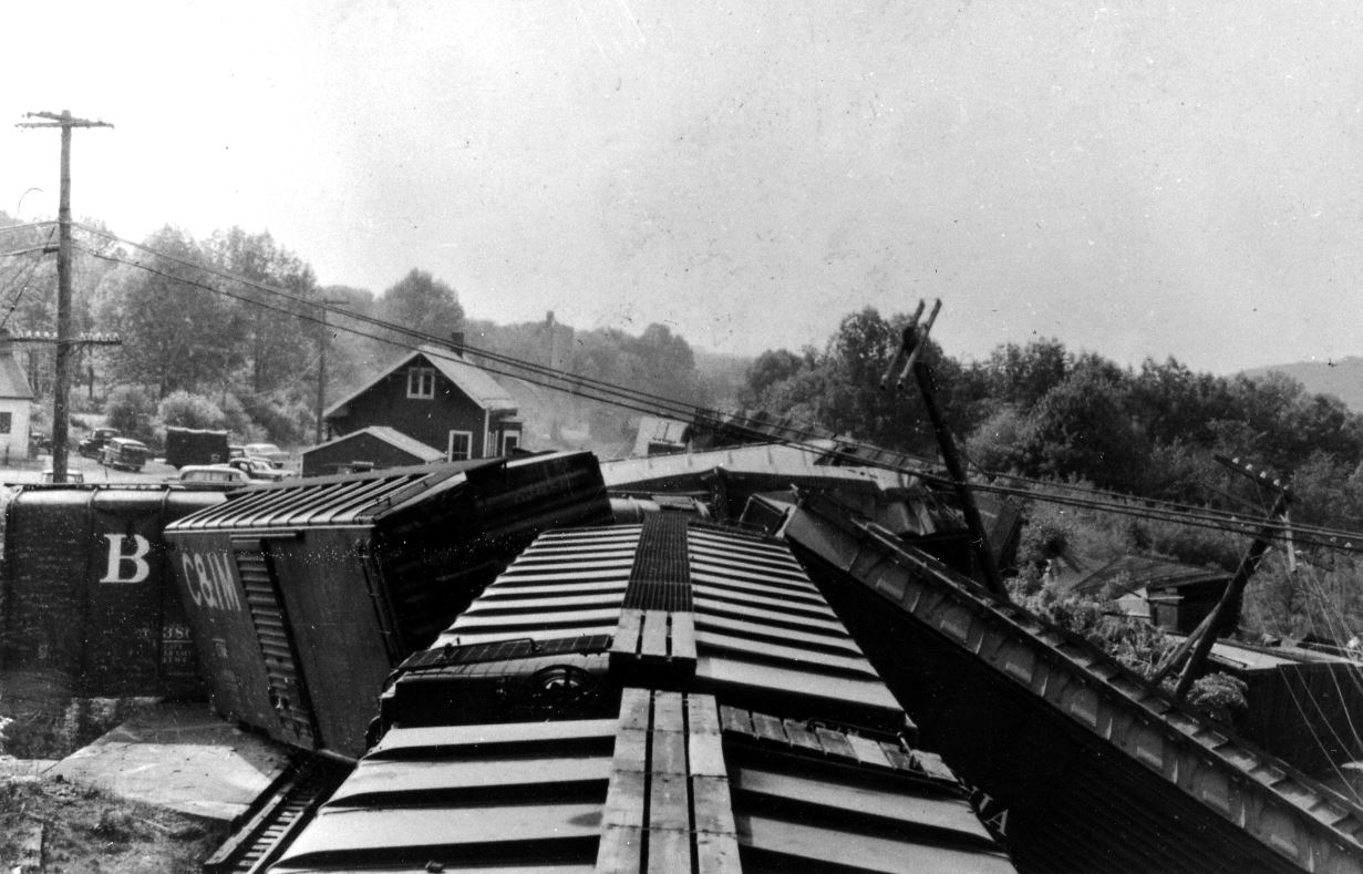
|
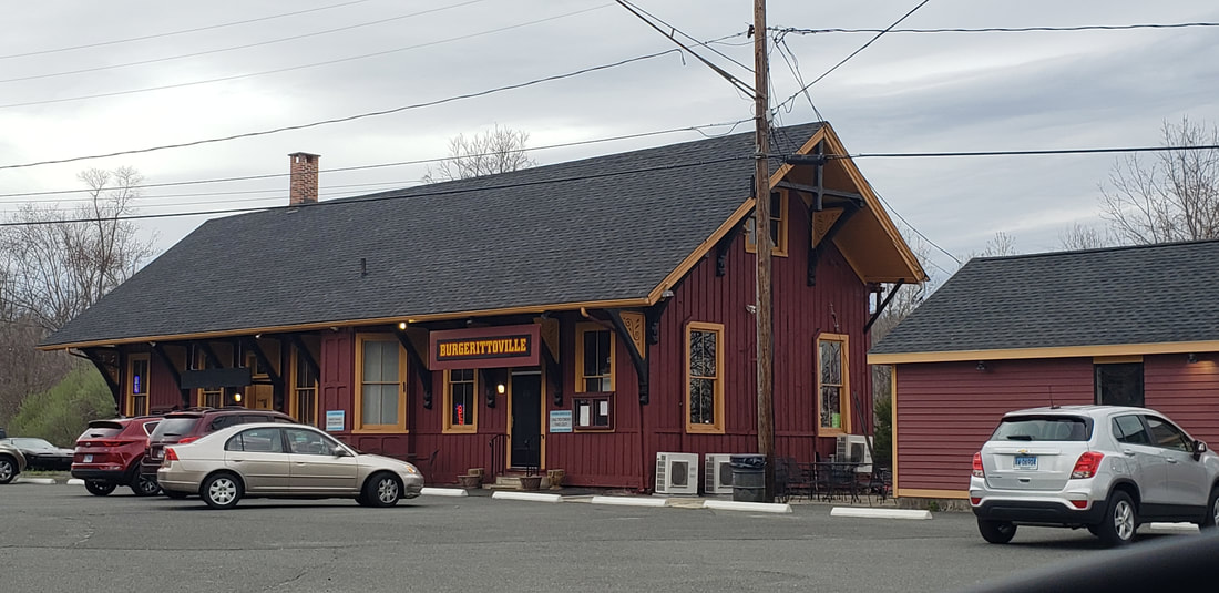
|

NEWTOWN/H3 [HRR, 1890]
The Courant reported in July, 1890, only a month after the fire, that "the new depot is rapidly assuming shape" and that, modeled after the old one and going up in exactly the same spot, it should be ready in about a month. A 14x20-ft building was put up immediately for use as a temporary station along the platform just south of the ruin and it was used until the new one was ready. In September, it was reported that " ... a few Housatonic workmen returned to Newtown and began to finish the new depot... Agent Taylor's patent roll front ticket case is here, the seats are still conspicuous by their absence and much more work remains to be done." With delays in completion, delivery of furnishings, etc., the opening would turn out to be on 10/28/1890. On that day telegraph operator W.F. Banks moved into the office, which was "... filled with local and long distance telephone and telegraph instruments...," Banks having operated at the nearby creamery until the new station was completed. Though largely similar, differences in the windows and the now-single chimney show that the station pictured here was indeed the successor structure. The colorized postcard at [1] shows the station and the Borden's creamery at left. The 6/30/1915 ICC valuation map at [2] shows the layout of the facilities at the time creamery and siding to it built 1903. The image at [3] is Lewis H. Benton's no. 2138 taken in June, 1029; fellow photographer Irving Drake's sedan, in which the duo rode, is seen at middle. The shot at [4] is undated but shows the trackside overhang, as well as the decorative trim, already gone, The photo at [4] is of the 2/28/1958 wreck when 35 cars of a 121-car Maybrook-bound freight derailed in front of the station, which, miraculously, looks unharmed. As an aside, six cars of a train derailed at New Milford on the same day. According to Karr, passenger service from BRIDGEPORT to HAWLEYVILLE ended in 1931 or 1932; we think the latter. The 1890 depot has hosted many businesses over the years and today is the Burgerittoville restaurant, as seen on 4/23/2022 in our shot at [5]. The interior is stunningly well preserved with polished wood, stained glass and walls covered with nostalgic photographs, as shown at [7]. Cozy, indeed, and the food is good. The Track 11 Google Earth map snippet at [7] shows the locations today. The town apparently appreciates its railroad history. Traveling west on Church Hill Rd., one sees the mural at left on the bridge abutment. The restaurant-entrance sign is on the right, just beyond the bridge. As we always say, support your local depot! [REFS: NHER/06/06/1890/01; NYH/06/07/1890/03; HC/07/12/1890/06; NBE/10/31/1890/05; NBE/12/19/1890/03; NBE/08/28/1903/07; 1930 0701: NETCo coach service here Waterbury-Danbury; NH 2/8/1932 Form 200 TT says see NETCo; HC/03/01/1958/18; K56: R76][rev122817, 061622, 060523]
The Courant reported in July, 1890, only a month after the fire, that "the new depot is rapidly assuming shape" and that, modeled after the old one and going up in exactly the same spot, it should be ready in about a month. A 14x20-ft building was put up immediately for use as a temporary station along the platform just south of the ruin and it was used until the new one was ready. In September, it was reported that " ... a few Housatonic workmen returned to Newtown and began to finish the new depot... Agent Taylor's patent roll front ticket case is here, the seats are still conspicuous by their absence and much more work remains to be done." With delays in completion, delivery of furnishings, etc., the opening would turn out to be on 10/28/1890. On that day telegraph operator W.F. Banks moved into the office, which was "... filled with local and long distance telephone and telegraph instruments...," Banks having operated at the nearby creamery until the new station was completed. Though largely similar, differences in the windows and the now-single chimney show that the station pictured here was indeed the successor structure. The colorized postcard at [1] shows the station and the Borden's creamery at left. The 6/30/1915 ICC valuation map at [2] shows the layout of the facilities at the time creamery and siding to it built 1903. The image at [3] is Lewis H. Benton's no. 2138 taken in June, 1029; fellow photographer Irving Drake's sedan, in which the duo rode, is seen at middle. The shot at [4] is undated but shows the trackside overhang, as well as the decorative trim, already gone, The photo at [4] is of the 2/28/1958 wreck when 35 cars of a 121-car Maybrook-bound freight derailed in front of the station, which, miraculously, looks unharmed. As an aside, six cars of a train derailed at New Milford on the same day. According to Karr, passenger service from BRIDGEPORT to HAWLEYVILLE ended in 1931 or 1932; we think the latter. The 1890 depot has hosted many businesses over the years and today is the Burgerittoville restaurant, as seen on 4/23/2022 in our shot at [5]. The interior is stunningly well preserved with polished wood, stained glass and walls covered with nostalgic photographs, as shown at [7]. Cozy, indeed, and the food is good. The Track 11 Google Earth map snippet at [7] shows the locations today. The town apparently appreciates its railroad history. Traveling west on Church Hill Rd., one sees the mural at left on the bridge abutment. The restaurant-entrance sign is on the right, just beyond the bridge. As we always say, support your local depot! [REFS: NHER/06/06/1890/01; NYH/06/07/1890/03; HC/07/12/1890/06; NBE/10/31/1890/05; NBE/12/19/1890/03; NBE/08/28/1903/07; 1930 0701: NETCo coach service here Waterbury-Danbury; NH 2/8/1932 Form 200 TT says see NETCo; HC/03/01/1958/18; K56: R76][rev122817, 061622, 060523]
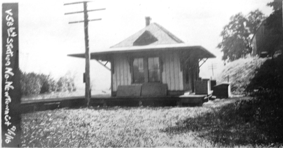
|
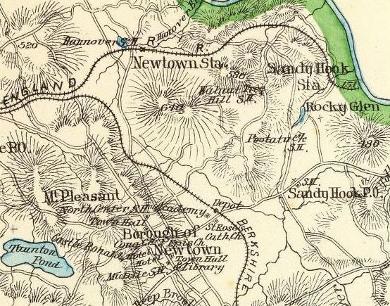
|

|

NEWTOWN/N [NY&NE, 1881]
The ICC valuation photo at [1] is dated 9/1/1916 and is the only image we have of this depot. This was the NY&NE NEWTOWN station, considerably north of the center of town, as seen on the 1893 Hurd atlas map at [2]. The HRR station, also on the map, is seen to the south. Although this depot was ready for the opening of the road in 1881, for some reason it is not found on the 1886/1889 NY&NE real estate atlas map. Most, if not all, of the depots on the NY&NE's western extension were built by Leman Oatman of Hartford; they were generally combination stations of larger type with bay windows for the agents, cupolas and separate freight rooms. Examples would be SANDY HOOK, SOUTHBURY and others. Smaller types and other designs, however, include DANBURY3, MILL PLAIN, and TOWANTIC. The ever-illuminating Newtown Bee of 10/13/1880 attributes this one to "Mr. Frank Kane, of Sandy Hook, [who] commenced work this week on the new depot in Hanover, for the N.Y. and N.E. R.R.," this section of northern Newtown so-named for the lake located just west of the station. In November, the paper said that Mr. Daniel Camp had "the contract for putting tin roofs upon six depots..." and "is at work now upon the depot at Hanover." Known as NEWTOWN for the NY&NE, this station would become NORTH NEWTOWN under the NYNH&H by complaint of locals at the confusion of the duplicate names, the Consolidated controlling the HRR since 1892 and the NY&NE since 1898. Thus the Bee buzzed "A New Place on the Map" on 2/28/1899 with a letter from Vice Pres. John M. Hall the change would be "made on the next issue of time cards... in compliance with the wishes of your people..." The Travelers' Guide in the Bee first shows the name NORTH NEWTOWN on 5/26/1899. The val map at [3] shows the layout in 1915, with the station in the southeast quadrant at the undergrade crossing of today's Echo Valley Rd. The abutment is seen at [4] on the west side of the road in2016; it still stands in 2022. Storrs's Shoreliner article about Newtown's stations says that this one was dismantled in 1931 and the wood was used to build a house in Danbury. [REFS: NBE/10/13/1880/03; NBE/11/17/1880/03: tin roof contract given; HDC/07/23/1881/02; DN/07/27/1881/01; NBE/02/28/1899/09; NBE/05/26/1899/04; SL11.1.26][rev123017, 042122, 060323]
The ICC valuation photo at [1] is dated 9/1/1916 and is the only image we have of this depot. This was the NY&NE NEWTOWN station, considerably north of the center of town, as seen on the 1893 Hurd atlas map at [2]. The HRR station, also on the map, is seen to the south. Although this depot was ready for the opening of the road in 1881, for some reason it is not found on the 1886/1889 NY&NE real estate atlas map. Most, if not all, of the depots on the NY&NE's western extension were built by Leman Oatman of Hartford; they were generally combination stations of larger type with bay windows for the agents, cupolas and separate freight rooms. Examples would be SANDY HOOK, SOUTHBURY and others. Smaller types and other designs, however, include DANBURY3, MILL PLAIN, and TOWANTIC. The ever-illuminating Newtown Bee of 10/13/1880 attributes this one to "Mr. Frank Kane, of Sandy Hook, [who] commenced work this week on the new depot in Hanover, for the N.Y. and N.E. R.R.," this section of northern Newtown so-named for the lake located just west of the station. In November, the paper said that Mr. Daniel Camp had "the contract for putting tin roofs upon six depots..." and "is at work now upon the depot at Hanover." Known as NEWTOWN for the NY&NE, this station would become NORTH NEWTOWN under the NYNH&H by complaint of locals at the confusion of the duplicate names, the Consolidated controlling the HRR since 1892 and the NY&NE since 1898. Thus the Bee buzzed "A New Place on the Map" on 2/28/1899 with a letter from Vice Pres. John M. Hall the change would be "made on the next issue of time cards... in compliance with the wishes of your people..." The Travelers' Guide in the Bee first shows the name NORTH NEWTOWN on 5/26/1899. The val map at [3] shows the layout in 1915, with the station in the southeast quadrant at the undergrade crossing of today's Echo Valley Rd. The abutment is seen at [4] on the west side of the road in2016; it still stands in 2022. Storrs's Shoreliner article about Newtown's stations says that this one was dismantled in 1931 and the wood was used to build a house in Danbury. [REFS: NBE/10/13/1880/03; NBE/11/17/1880/03: tin roof contract given; HDC/07/23/1881/02; DN/07/27/1881/01; NBE/02/28/1899/09; NBE/05/26/1899/04; SL11.1.26][rev123017, 042122, 060323]