Track 12: CT Passenger Stations, O-P
See TCS Home Page links for notes, abbreviations, and sources.
Use Track 11 map link to locate stations, rail and trolley lines, and POIs.
Use Track 11 map link to locate stations, rail and trolley lines, and POIs.
OAKVILLE1 [W&W, 1870]
This stop was established in the town of WATERTOWN in 1870 when the Waterbury and Watertown railroad opened. We have no photo yet of the first station which was reportedly near the site of the second depot.
This stop was established in the town of WATERTOWN in 1870 when the Waterbury and Watertown railroad opened. We have no photo yet of the first station which was reportedly near the site of the second depot.

|

|

|
OAKVILLE2 [NYNH&H, 1908]
[REFS: CRC56.1908.49; CRC57.1909.46; NHAR37.1908.8; D100: near O1 site]
[REFS: CRC56.1908.49; CRC57.1909.46; NHAR37.1908.8; D100: near O1 site]
|
|
OAKWOOD [NYNH&H, 1873]
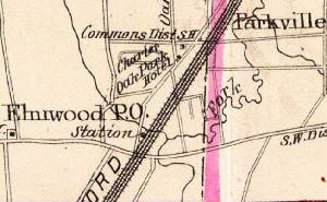
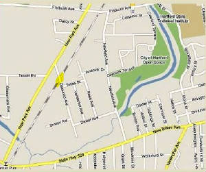
An 1873 article said that a station in HARTFORD on the H&NH was being opened here in connection with the new park and race track, their location seen somewhat later on the 1893 Hurd map at left. The map on the right shows the area today, where a Home Depot now stands. Two 1883 articles mention this station near the entrance to the park, presumably in connection with its namesake Oakwood Ave, itself an offshoot of the popular local 'Oak' motif. We do not find this station on any timetables and it may just have been the NYNH&H stop opposite the HP&F/NY&NE's CHARTER OAK PARK depot. We do not know what structure, if any, stood here. Since these two stops were in competition with each other, the redundant OAKWOOD was likely eliminated with the NYNH&H takeover of the NY&NE in 1898. [REFS: HDC/06/14/1873/02; HDC/06/18/1873/02; HDC/06/22/1880/02; NHER/01/21/1882/04; HDC/05/16/1883/01; HDC/10/17/1883/02]
An 1873 article said that a station in HARTFORD on the H&NH was being opened here in connection with the new park and race track, their location seen somewhat later on the 1893 Hurd map at left. The map on the right shows the area today, where a Home Depot now stands. Two 1883 articles mention this station near the entrance to the park, presumably in connection with its namesake Oakwood Ave, itself an offshoot of the popular local 'Oak' motif. We do not find this station on any timetables and it may just have been the NYNH&H stop opposite the HP&F/NY&NE's CHARTER OAK PARK depot. We do not know what structure, if any, stood here. Since these two stops were in competition with each other, the redundant OAKWOOD was likely eliminated with the NYNH&H takeover of the NY&NE in 1898. [REFS: HDC/06/14/1873/02; HDC/06/18/1873/02; HDC/06/22/1880/02; NHER/01/21/1882/04; HDC/05/16/1883/01; HDC/10/17/1883/02]
|
|
|

|
|

|
OAKWOOD AVENUE [NYNH&H, 1943]
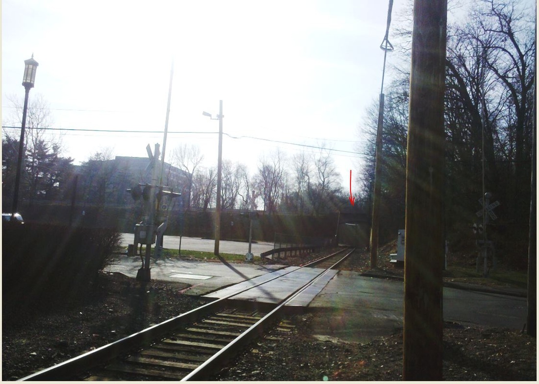
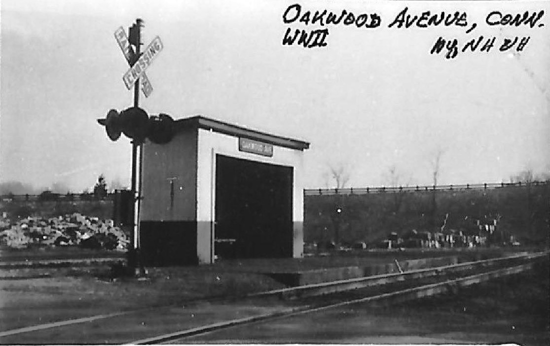
This station was in Norwalk just above WINNIPAUK on the Danbury line. Al Weaver's scrutiny clarified that the road rising behind the shelter is the Merritt Parkway. It still crosses over the track today, marked by the red arrow in the upper left shot. Ironically, the current map at bottom right shows precisely where the OAKWOOD AVENUE stop was, labeling it mistakenly as today's MERRITT 7 which is actually a bit farther north. We do not know where the street name came from; today it is Glover Ave. With the WWII clue on the photo at upper middle, we checked employee timetables for the war years to find this station shown from 1943 to 1945. The manufacturing history of this area goes back at least to the Civil War-era Norwalk Mills, which had fallen on hard times by 1912 when the 36-acre site with the buildings, canal, mill pond and water rights were rumored to be considered for purchase by the NYNH&H for the purpose of electrifying the Danbury line. The location is shown at the red arrow on the 1905 map snip at lower right. The Norwalk Tire and Rubber Co. took over the property in 1914 and began to make products for civilian and military use. The older mill complex is seen to the north in the photo at lower middle with arrows pointing out the catenary towers for the electrification that finally debuted in 1925. The lone 7:27 a.m. train, perhaps used mostly by employees while business boomed during the war, was probably complemented by an evening return trip. The tire company would tout 'Victory camelback' retreads to conserve rubber supplies during the war but would be sold in bankruptcy by 1950. This area experienced a renaissance around 1965 when a Courant article said that the property, then owned by the Armstrong Rubber Co., had been sold to the Caldor department store chain which was renovating the complex and tearing down the older buildings for its new operations base. Founded in 1951, the pioneering discount chain enjoyed phenomenal growth hereafter that would see it operating 166 stores at its height in 1994. By 1999, the pendulum would swing to bankruptcy and the chain would close all its remaining stores. Cornwall does not mention OAKWOOD AVENUE but instead calls the station in this area NORWALK MILLS. [REFS: NH/06/04/1912/01; HC/03/24/1914/03; NYT/04/03/1942/24; NYT/02/05/1949/07; NYT/07/14/1950/42; NYT/09/26/1957/25; HC/05/28/1965/47; HC/06/06/1965/23D; SL17.4.24][rev033113, 121422]
This station was in Norwalk just above WINNIPAUK on the Danbury line. Al Weaver's scrutiny clarified that the road rising behind the shelter is the Merritt Parkway. It still crosses over the track today, marked by the red arrow in the upper left shot. Ironically, the current map at bottom right shows precisely where the OAKWOOD AVENUE stop was, labeling it mistakenly as today's MERRITT 7 which is actually a bit farther north. We do not know where the street name came from; today it is Glover Ave. With the WWII clue on the photo at upper middle, we checked employee timetables for the war years to find this station shown from 1943 to 1945. The manufacturing history of this area goes back at least to the Civil War-era Norwalk Mills, which had fallen on hard times by 1912 when the 36-acre site with the buildings, canal, mill pond and water rights were rumored to be considered for purchase by the NYNH&H for the purpose of electrifying the Danbury line. The location is shown at the red arrow on the 1905 map snip at lower right. The Norwalk Tire and Rubber Co. took over the property in 1914 and began to make products for civilian and military use. The older mill complex is seen to the north in the photo at lower middle with arrows pointing out the catenary towers for the electrification that finally debuted in 1925. The lone 7:27 a.m. train, perhaps used mostly by employees while business boomed during the war, was probably complemented by an evening return trip. The tire company would tout 'Victory camelback' retreads to conserve rubber supplies during the war but would be sold in bankruptcy by 1950. This area experienced a renaissance around 1965 when a Courant article said that the property, then owned by the Armstrong Rubber Co., had been sold to the Caldor department store chain which was renovating the complex and tearing down the older buildings for its new operations base. Founded in 1951, the pioneering discount chain enjoyed phenomenal growth hereafter that would see it operating 166 stores at its height in 1994. By 1999, the pendulum would swing to bankruptcy and the chain would close all its remaining stores. Cornwall does not mention OAKWOOD AVENUE but instead calls the station in this area NORWALK MILLS. [REFS: NH/06/04/1912/01; HC/03/24/1914/03; NYT/04/03/1942/24; NYT/02/05/1949/07; NYT/07/14/1950/42; NYT/09/26/1957/25; HC/05/28/1965/47; HC/06/06/1965/23D; SL17.4.24][rev033113, 121422]
ODD FELLOWS HOME [> FAIRVIEW]
OLD GREENWICH [> SOUND BEACH]
OLD LYME [> LYME]
OLD SAYBROOK [> SAYBROOK]
OLD GREENWICH [> SOUND BEACH]
OLD LYME [> LYME]
OLD SAYBROOK [> SAYBROOK]
|
|
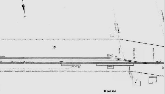
ONECO1 [HP&F, 1858?]
This stop the town of Sterling apparently was not an original one when the HP&F opened from Providence to Willimantic in 1854. The village, pronounced oh-NEE-co and named for the second son of the Pequot chieftain Uncas, is in the town of Sterling about a mile and a half from the Rhode Island border. Our red arrows show nothing at that location on the 1856WC map at left but there is a station on the 1869 map to the right and the green arrow shows STERLING to the west as well. We have no PTT earlier than a February, 1858 issue which lists this stop. The building of a depot here is not mentioned in the early annual reports, which do speak of PLAINFIELD, MOOSUP and STERLING being completed between 1855 and 1856. Based on the fact that the station in our next listing looks later to us than the 1850s, we have created this entry for ONECO1, for which no photo has been found. The stop here would soon become a busy one in this mineral-rich area. The blue arrow on the 1868 map points to the granite quarry southeast of the village. The Providence Evening Press cited the Hartford Post reporting in 1873 that marble from the quarries on the HP&F would be used for the new custom house in the Little Rhody's capital city and the Courant quotes the R.I. railroad commissioners as saying that "The Oneco Quarry branch railroad has been completed during the year. It is about one mile in length, extending from the Oneco Quarry in Sterling to Oneco Station and is now worked by the trustees of this corporation..." Indeed, a 1948 article in the Courant says that the Devil's Den Chimney, possibly related to mining and smelting activies here, was "blown up to make way for the railroad..." It sounds like the HP&F itself was in the rock business, either for internal railroad use or for income from the sale of product -- similar operations to ones seen on railroads elsewhere at LOFTY CREST and WEST NORFOLK. [REFS: PTH107.1858.11; PEP/08/17/1873/02; HDC/02/05/1874/04] [rev070313]
This stop the town of Sterling apparently was not an original one when the HP&F opened from Providence to Willimantic in 1854. The village, pronounced oh-NEE-co and named for the second son of the Pequot chieftain Uncas, is in the town of Sterling about a mile and a half from the Rhode Island border. Our red arrows show nothing at that location on the 1856WC map at left but there is a station on the 1869 map to the right and the green arrow shows STERLING to the west as well. We have no PTT earlier than a February, 1858 issue which lists this stop. The building of a depot here is not mentioned in the early annual reports, which do speak of PLAINFIELD, MOOSUP and STERLING being completed between 1855 and 1856. Based on the fact that the station in our next listing looks later to us than the 1850s, we have created this entry for ONECO1, for which no photo has been found. The stop here would soon become a busy one in this mineral-rich area. The blue arrow on the 1868 map points to the granite quarry southeast of the village. The Providence Evening Press cited the Hartford Post reporting in 1873 that marble from the quarries on the HP&F would be used for the new custom house in the Little Rhody's capital city and the Courant quotes the R.I. railroad commissioners as saying that "The Oneco Quarry branch railroad has been completed during the year. It is about one mile in length, extending from the Oneco Quarry in Sterling to Oneco Station and is now worked by the trustees of this corporation..." Indeed, a 1948 article in the Courant says that the Devil's Den Chimney, possibly related to mining and smelting activies here, was "blown up to make way for the railroad..." It sounds like the HP&F itself was in the rock business, either for internal railroad use or for income from the sale of product -- similar operations to ones seen on railroads elsewhere at LOFTY CREST and WEST NORFOLK. [REFS: PTH107.1858.11; PEP/08/17/1873/02; HDC/02/05/1874/04] [rev070313]

|
|

|
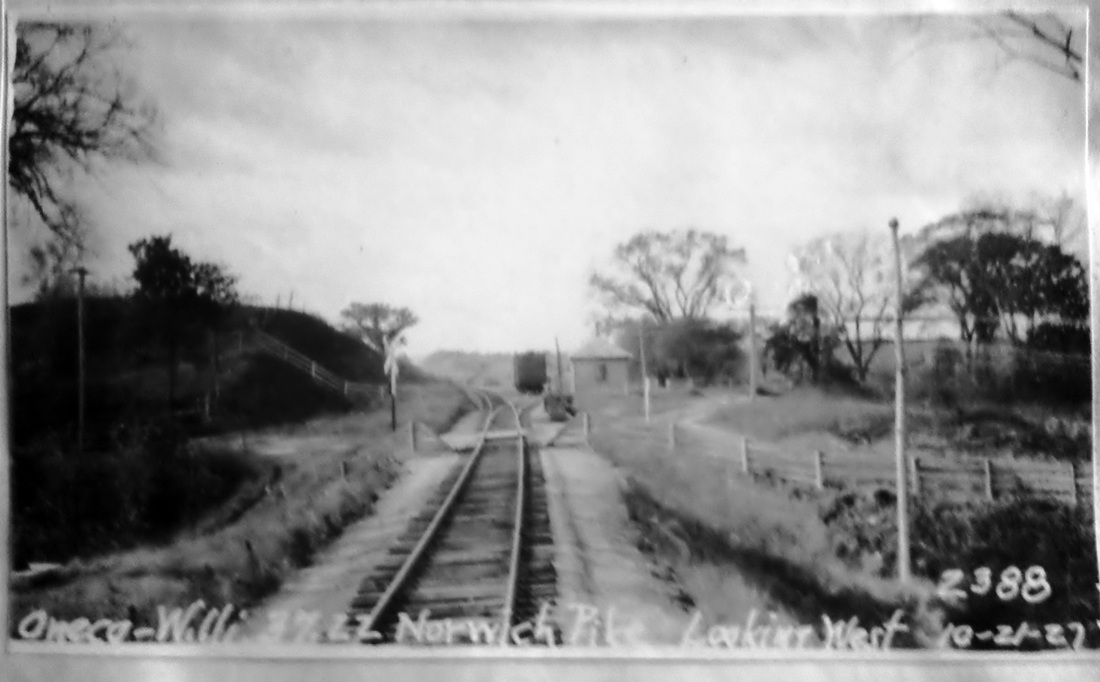
ONECO2 [NYNH&H, c1900?]
This depot is the only one ever seen for this village. While both of the photos are undated, the people look dressed for the 1900s and that is when this structure may have been built. Note that the compass arrow inicaticates that the station sat on the north side of the track. The extra tracks on the 1915 val map are atypical for a station of this size and may have had something to do with the 1873 quarry spur, although that itself is no longer seen. The granite business here predates the Civil War and, as late as 1899, the Connecticut railroad commissioners permitted a grade crossing at Norwich Tpke for a track to the quarries and stone-crushing plant of the Oneco Granite Co. The 1948 article already spoken of also bemoans the loss of this economic activity, and says mournfully that "Even the Oneco Railroad Station is gone now, as similar rural structures throughout the state have vanished, giving away [sic] to modern motor transportation." The 1938 SSRR lists this station as retired and subject to sale or removal. [REFS: NHER/04/13/1899/07; HC/02/08/1948/04][rev022421]
This depot is the only one ever seen for this village. While both of the photos are undated, the people look dressed for the 1900s and that is when this structure may have been built. Note that the compass arrow inicaticates that the station sat on the north side of the track. The extra tracks on the 1915 val map are atypical for a station of this size and may have had something to do with the 1873 quarry spur, although that itself is no longer seen. The granite business here predates the Civil War and, as late as 1899, the Connecticut railroad commissioners permitted a grade crossing at Norwich Tpke for a track to the quarries and stone-crushing plant of the Oneco Granite Co. The 1948 article already spoken of also bemoans the loss of this economic activity, and says mournfully that "Even the Oneco Railroad Station is gone now, as similar rural structures throughout the state have vanished, giving away [sic] to modern motor transportation." The 1938 SSRR lists this station as retired and subject to sale or removal. [REFS: NHER/04/13/1899/07; HC/02/08/1948/04][rev022421]

|

|
ORANGE [NH&D, 1871]
This station was built by the townspeople of Orange where the shopping center is located on today's Orange Center Rd. and presented to the NH&D in 1871. Passenger service ended in 1925 but freight operations continued. The 1938 SSRR list says it was rented at that time and later that year all railroad service ended. It reverted back to the town at that point and was used by the volunteer fire department until it was torn down in 1948. See Track 4B for more coverage. [rev010318]
This station was built by the townspeople of Orange where the shopping center is located on today's Orange Center Rd. and presented to the NH&D in 1871. Passenger service ended in 1925 but freight operations continued. The 1938 SSRR list says it was rented at that time and later that year all railroad service ended. It reverted back to the town at that point and was used by the volunteer fire department until it was torn down in 1948. See Track 4B for more coverage. [rev010318]
ORCUTTS1 [NLW&P, 1850]
This stop in the town of Stafford was established in 1850 with the opening of the NLW&P. We have no photo yet of the first depot. [REFS: HDC/01/23/1874/01]
This stop in the town of Stafford was established in 1850 with the opening of the NLW&P. We have no photo yet of the first depot. [REFS: HDC/01/23/1874/01]

|
National Archives
|
Max Miller Collection
|

|
|
John H. Roy, Jr.
|
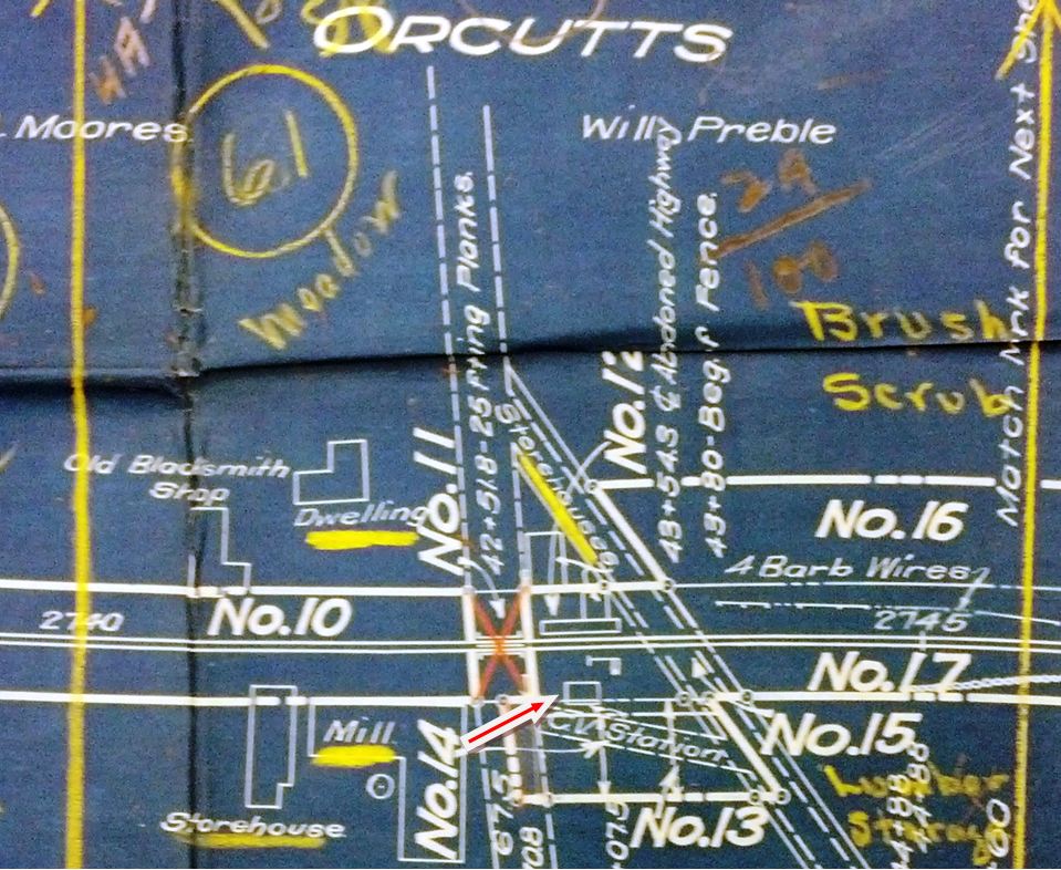
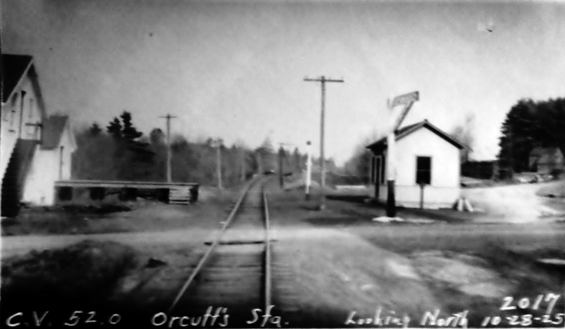
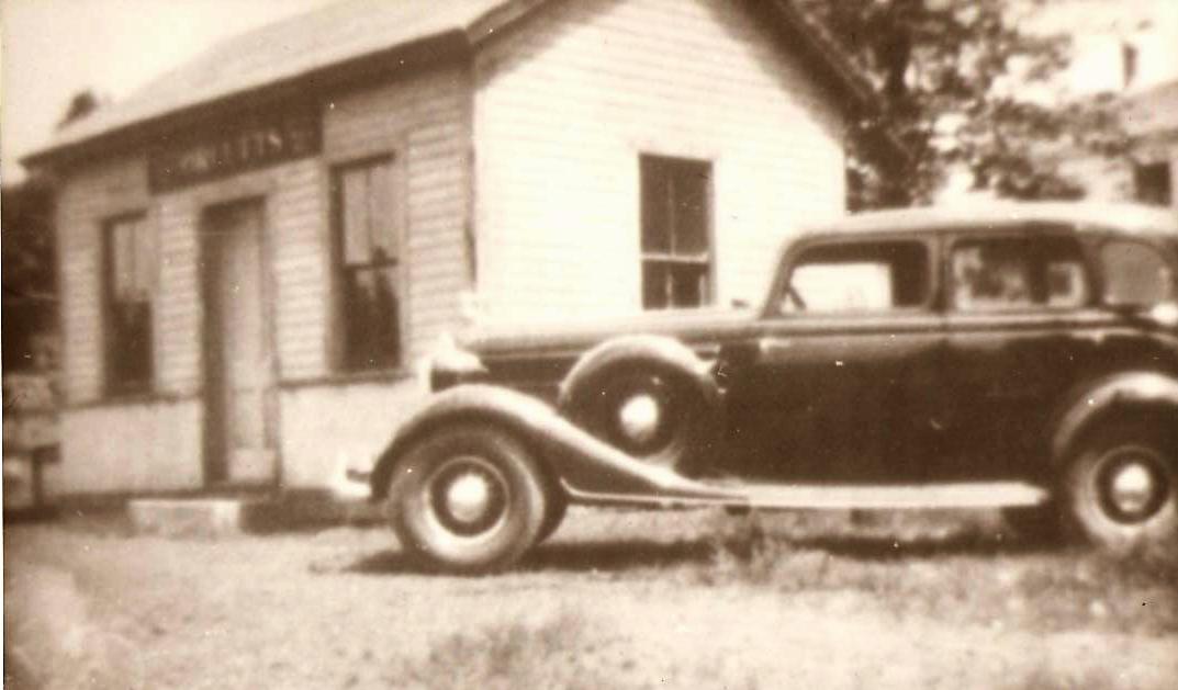
ORCUTTS2 [CVT, 1876]
The railroad commissioners note the building of a new depot here in their annual report covering the year 1876. The shot at [1] looks north toward the depot in the distance from the Orcuttville mill complex and reportedly dates to 1903. The 1917 val map at [2] shows the layout of the station area. The depot, in the northeast quadrant of the grade crossing, is shown by our red arrow. The PUC inspection photo at [3] is dated 10/28/1925. Irving Drake poses for the Lewis H. Benton shot at lower left on 10/12/1933. According to information from John Roy, this structure has been moved from its original location on Rte. 319 and is still standing nearby. It may become the property of the local historical society at a future date. His March, 2013 photo is at lower right. [REFS: CRC24.1877.18][rev090816]
The railroad commissioners note the building of a new depot here in their annual report covering the year 1876. The shot at [1] looks north toward the depot in the distance from the Orcuttville mill complex and reportedly dates to 1903. The 1917 val map at [2] shows the layout of the station area. The depot, in the northeast quadrant of the grade crossing, is shown by our red arrow. The PUC inspection photo at [3] is dated 10/28/1925. Irving Drake poses for the Lewis H. Benton shot at lower left on 10/12/1933. According to information from John Roy, this structure has been moved from its original location on Rte. 319 and is still standing nearby. It may become the property of the local historical society at a future date. His March, 2013 photo is at lower right. [REFS: CRC24.1877.18][rev090816]
Connecticut Historical Society
|
|

Connecticut Historical Society
|
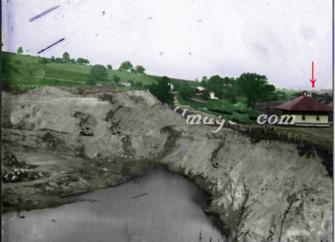
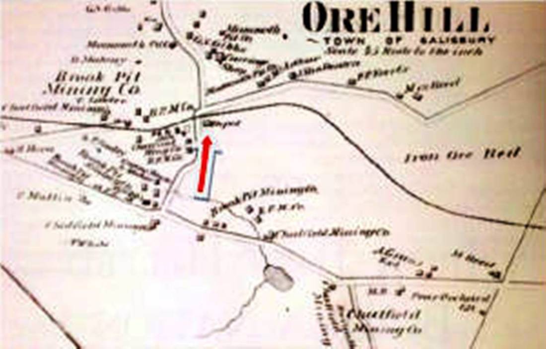
ORE HILL1 [CW, 1871 stop; depot, 1872]
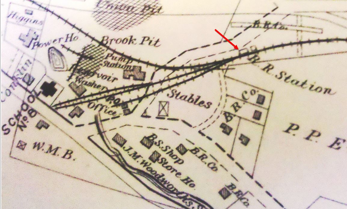
This was an original timetable stop in the town of Salisbury when the CW opened in 1871. In the photo at [1] the structure at right looks to be ORE HILL1 on the south side of the track, as shown on the 1874 map at [2]. It sits just east of the road that would become U.S. Rte 44. The full image is a stereo card and has an upside-down inscription at the top that reads Depot & PitA no. 129. It does not actually say Ore Hill but it fits here. The photographer is unknown but we assume that the 129 is the photo number in a collection owned by F.H. DeMars of Winsted CT, himself a prolific photographer. Pit A refers to the deep ravine across the street where ore was dug out of the earth. Matching it with the image at [3], the date would also then be 3/24/1877. The depot style does match TACONIC, nee CHAPINVILLE and, if the 1880 NY&NE appraisal of CW assets is taken into account, this depot is valued exactly the same at $1800. Construction reportedly started on 9/9/1872 with "... breaking ground preparatory to building a new depot. It is to be 30x40, with ore bed offices, and scales for weighing ore in the same building" and it was nearing completion by November. An 1873 Lakeville Journal article says that the "... new depot recently erected is all that could be asked for; it is a large building situated in the centre of the village, is about 40x50 feet... which gives room for a good sized store house [freight room?] and two other rooms of likewise dimensions. The one is used for the accommodation of passengers, and the other for an office for the Brook Pit Mining Co. The railroad company could well afford to give us a building like this, as we can boast of sending more freight from this place than any other station between Hartford and Millerton, during this past year." The 1874 map at [2] shows the sizeable community here and the configuration of the roads and mines. Our red arrow points to the station. The photo at [3], another stereo card in the DeMars collection, has an upside-down inscription similar to [1]; it reads Ore Hill March 24 1877 No. 128. It shows a westbound train with box car and coach crossing over the ore pit. The spectacular 300-ft long, 70-ft high bridge, noted in several newspaper articles, is first mentioned in June, 1872 when it was said that here "an opportunity is offered to inspect the depths of Mother Earth." An 1874 Winsted Herald story reported a horse making such an inspection and walking of his own accord across the bridge on the planks in the center of the rails! Tourism and animal shenanigans aside, the choice of the ROW going over the pit has to be seen as somehow necessary or advantageous for the considerable expense it must have involved. According to the Poughkeepsie Eagle, the bridge was eliminated in July, 1889 when the line was relocated around the southern side of the pit. This apparently left ORE HILL1 on the abandoned line and and it was razed in 1900 when the Lakeville Journal said "the old depot at Ore Hill has been torn down and removed by the railroad company." [REFS: HWT/06/08/1872/02; CWN/06/14/1872/02; HDC/06/18/1872/02; CWN/08/02/02/1872: new 20x100-ft platform and new side track; CWN/09/09/1872/02; LJ/05/23/1873/02; WH/11/06/1874/03; HDC/11/26/ 1874/01; CWN/01/07/1876/02; NHER/02/12/1887/04; PEA/07/17/1889/04; CRC37.1890.34: hearing last spring for new ROW to eliminate bridge; CWN/05/13/1897/03; SR/04/22/1899/12; HC/06/15/1899/05; NHER/06/15/1899/10; LJ/09/01/1900/05; HC/06/27/1937/D1][rev020918, 111822, 121322]
This was an original timetable stop in the town of Salisbury when the CW opened in 1871. In the photo at [1] the structure at right looks to be ORE HILL1 on the south side of the track, as shown on the 1874 map at [2]. It sits just east of the road that would become U.S. Rte 44. The full image is a stereo card and has an upside-down inscription at the top that reads Depot & PitA no. 129. It does not actually say Ore Hill but it fits here. The photographer is unknown but we assume that the 129 is the photo number in a collection owned by F.H. DeMars of Winsted CT, himself a prolific photographer. Pit A refers to the deep ravine across the street where ore was dug out of the earth. Matching it with the image at [3], the date would also then be 3/24/1877. The depot style does match TACONIC, nee CHAPINVILLE and, if the 1880 NY&NE appraisal of CW assets is taken into account, this depot is valued exactly the same at $1800. Construction reportedly started on 9/9/1872 with "... breaking ground preparatory to building a new depot. It is to be 30x40, with ore bed offices, and scales for weighing ore in the same building" and it was nearing completion by November. An 1873 Lakeville Journal article says that the "... new depot recently erected is all that could be asked for; it is a large building situated in the centre of the village, is about 40x50 feet... which gives room for a good sized store house [freight room?] and two other rooms of likewise dimensions. The one is used for the accommodation of passengers, and the other for an office for the Brook Pit Mining Co. The railroad company could well afford to give us a building like this, as we can boast of sending more freight from this place than any other station between Hartford and Millerton, during this past year." The 1874 map at [2] shows the sizeable community here and the configuration of the roads and mines. Our red arrow points to the station. The photo at [3], another stereo card in the DeMars collection, has an upside-down inscription similar to [1]; it reads Ore Hill March 24 1877 No. 128. It shows a westbound train with box car and coach crossing over the ore pit. The spectacular 300-ft long, 70-ft high bridge, noted in several newspaper articles, is first mentioned in June, 1872 when it was said that here "an opportunity is offered to inspect the depths of Mother Earth." An 1874 Winsted Herald story reported a horse making such an inspection and walking of his own accord across the bridge on the planks in the center of the rails! Tourism and animal shenanigans aside, the choice of the ROW going over the pit has to be seen as somehow necessary or advantageous for the considerable expense it must have involved. According to the Poughkeepsie Eagle, the bridge was eliminated in July, 1889 when the line was relocated around the southern side of the pit. This apparently left ORE HILL1 on the abandoned line and and it was razed in 1900 when the Lakeville Journal said "the old depot at Ore Hill has been torn down and removed by the railroad company." [REFS: HWT/06/08/1872/02; CWN/06/14/1872/02; HDC/06/18/1872/02; CWN/08/02/02/1872: new 20x100-ft platform and new side track; CWN/09/09/1872/02; LJ/05/23/1873/02; WH/11/06/1874/03; HDC/11/26/ 1874/01; CWN/01/07/1876/02; NHER/02/12/1887/04; PEA/07/17/1889/04; CRC37.1890.34: hearing last spring for new ROW to eliminate bridge; CWN/05/13/1897/03; SR/04/22/1899/12; HC/06/15/1899/05; NHER/06/15/1899/10; LJ/09/01/1900/05; HC/06/27/1937/D1][rev020918, 111822, 121322]
National Archives
|
|
|

|
|
|
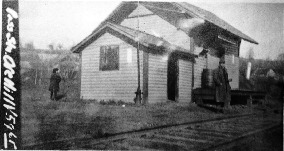
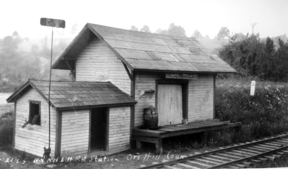
ORE HILL2 [CNE, 1890]
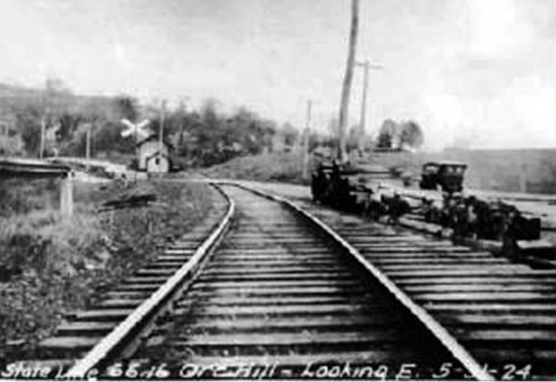
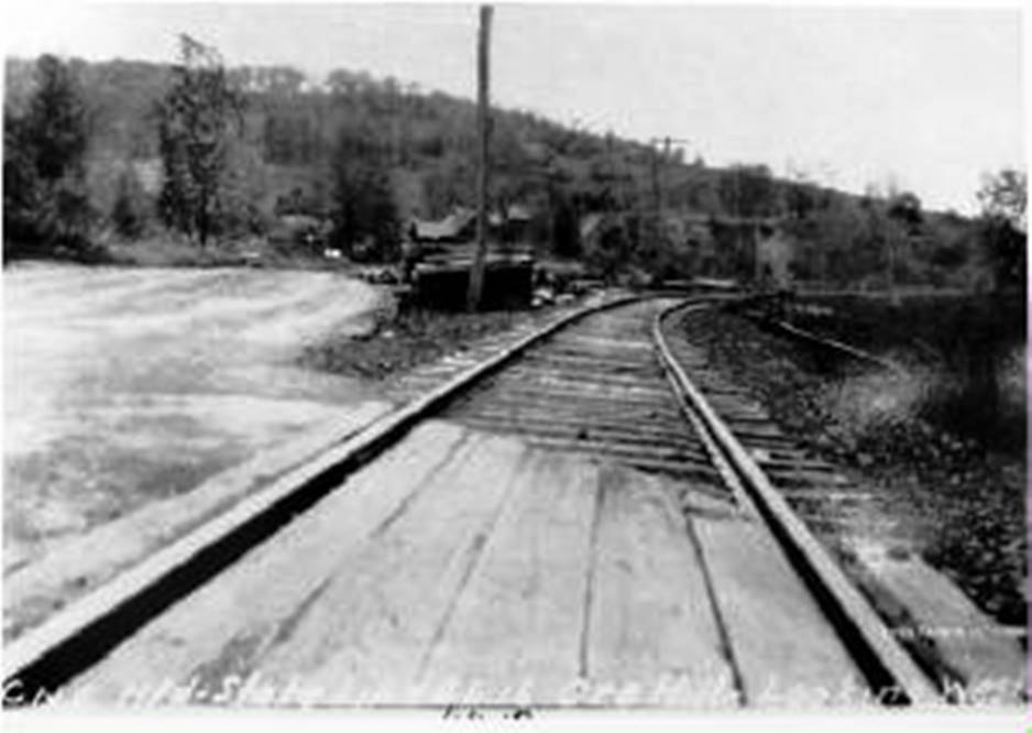
An 1890 newspaper atricle says "... a new platform and freight-house, and to all appearances a new depot, has been recently located and built at Ore Hill so now we have reason to congratulate ourselves on the accommodations furnished by the C. N. E. & W. R. R." We think that this was in conjunction with the 1889 rerouting of the track along the south side of the pit which left ORE HILL1 on the abandoned ROW. The accolades of the writer seem sincere enough but these two new buildings look pretty meager to us. Nimke's date box says 1893 for these buildings; as official as his dates look, his sources are sometimes in error. The I.C.C. valuation photo at [1] likely dates to 1916 or 1917. The 1899 map at [2] shows the layout of the mine operation at that time and our red arrow points to the location of the two new station buildings. The larger one with the platform is the freight house and the smaller one is the passenger shelter. Lewis H. Benton's shot #2145 at [3] was taken on 6/28/1928; at left you can see the paddle-on-post 'flag' atop a switch stand that waiting passengers turned to get trains to stop. We don't think that we have seen this very clever mechanism anywhere else. The red line on the 1934 aerial map at [4] shows the old ROW which was abandoned in 1889 when the main line was rerouted along the south side of the pit. Our two red Xs show the locations of the old depot, now off the right of way, and the new stations just above. This entire area was subject to sinkage because of the mines and many newspaper articles report the shoring up and reballasting the CNE had to do here. The 5/31/1924 shot at [5] looks east at the station buildings on the north side of the track and the switch for the spur into the ore-processing area. We see only a single track across Rte 44 now. The dangerous triple-track crossing on the map at [2] was eliminated by order of the railroad commissioners in 1903 after much public complaint. The view on the same date at [6] looks west along Rte 44 and shows the long switch ties for the abandoned spur. Mining operations ended in 1923 almost two centuries after ore was first discovered in 1731. The prodgious output from the mines here was used over the years in everything from Revolutionary War cannon to railroad track and car wheels. [REFS: CWN/12/31/1890/02; SR/04/22/1899/12; HC/06/15/1899/05; SR/02/15/1900/07; LJ/08/04/1900/03; LJ/09/01/1900/05; SR/11/21/1902/10; SR/11/15/1903/11; LJ/05/30/1905/03; NYT/06/26/1913/04; CWN/02/02/1905/03; D51; N3.100][rev020918, 121322]
An 1890 newspaper atricle says "... a new platform and freight-house, and to all appearances a new depot, has been recently located and built at Ore Hill so now we have reason to congratulate ourselves on the accommodations furnished by the C. N. E. & W. R. R." We think that this was in conjunction with the 1889 rerouting of the track along the south side of the pit which left ORE HILL1 on the abandoned ROW. The accolades of the writer seem sincere enough but these two new buildings look pretty meager to us. Nimke's date box says 1893 for these buildings; as official as his dates look, his sources are sometimes in error. The I.C.C. valuation photo at [1] likely dates to 1916 or 1917. The 1899 map at [2] shows the layout of the mine operation at that time and our red arrow points to the location of the two new station buildings. The larger one with the platform is the freight house and the smaller one is the passenger shelter. Lewis H. Benton's shot #2145 at [3] was taken on 6/28/1928; at left you can see the paddle-on-post 'flag' atop a switch stand that waiting passengers turned to get trains to stop. We don't think that we have seen this very clever mechanism anywhere else. The red line on the 1934 aerial map at [4] shows the old ROW which was abandoned in 1889 when the main line was rerouted along the south side of the pit. Our two red Xs show the locations of the old depot, now off the right of way, and the new stations just above. This entire area was subject to sinkage because of the mines and many newspaper articles report the shoring up and reballasting the CNE had to do here. The 5/31/1924 shot at [5] looks east at the station buildings on the north side of the track and the switch for the spur into the ore-processing area. We see only a single track across Rte 44 now. The dangerous triple-track crossing on the map at [2] was eliminated by order of the railroad commissioners in 1903 after much public complaint. The view on the same date at [6] looks west along Rte 44 and shows the long switch ties for the abandoned spur. Mining operations ended in 1923 almost two centuries after ore was first discovered in 1731. The prodgious output from the mines here was used over the years in everything from Revolutionary War cannon to railroad track and car wheels. [REFS: CWN/12/31/1890/02; SR/04/22/1899/12; HC/06/15/1899/05; SR/02/15/1900/07; LJ/08/04/1900/03; LJ/09/01/1900/05; SR/11/21/1902/10; SR/11/15/1903/11; LJ/05/30/1905/03; NYT/06/26/1913/04; CWN/02/02/1905/03; D51; N3.100][rev020918, 121322]
OSBORN [> EAST WINDSOR1]
OSBORNTOWN [> ALLERTON FARMS]
OXFORD [> SOUTHFORD]
PACKERVILLE1 [HP&F, 1854]
This stop in the town of Plainfield was established by the HP&F in 1854. We have not yet found a photo of the first station that burned in 1893. [REFS: 1872TT: no; 1878TT: yes; HC/07/15/1893/04; RRC28.329 (8/7/1893)]
OSBORNTOWN [> ALLERTON FARMS]
OXFORD [> SOUTHFORD]
PACKERVILLE1 [HP&F, 1854]
This stop in the town of Plainfield was established by the HP&F in 1854. We have not yet found a photo of the first station that burned in 1893. [REFS: 1872TT: no; 1878TT: yes; HC/07/15/1893/04; RRC28.329 (8/7/1893)]
Max Miller Collection
|

|
PACKERVILLE2 [NY&NE, 1893?]
Petition of 6/18/1893 asks for new depot after fire of 1892 burned old one down and CRC orders one. [REFS: CRC41.1893.23,39][rev121618]
Petition of 6/18/1893 asks for new depot after fire of 1892 burned old one down and CRC orders one. [REFS: CRC41.1893.23,39][rev121618]
National Archives
|
Robert C. Jones Collection
|
|
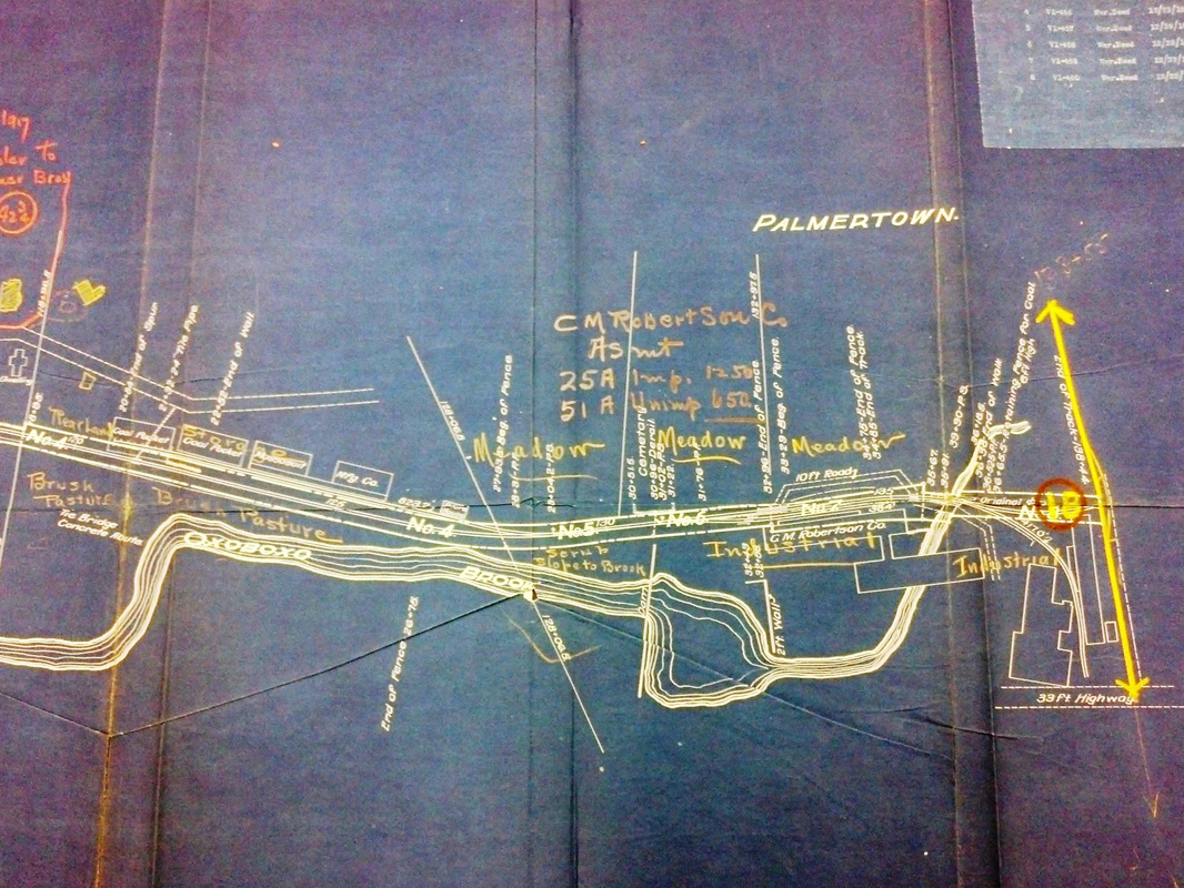
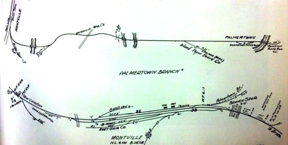
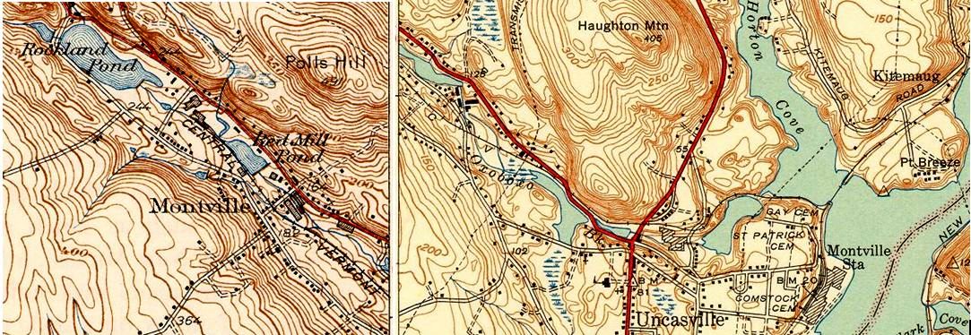
PALMERTOWN [CVT, 1899]
The 2.5-mile Palmertown branch in the town of Montville headed west from the NLN main line just above the MONTVILLE depot. The railroad commissioners noted this in their annual report of December, 1899, saying that "a spur track, 2 and 3/4 miles in length, extending from Montville station to the village of Montville, has been constructed to receive and deliver freight from and to the various manufactories near which the track has been located." The newspaper makes it sound like the work was nearly complete in March, 1899, when it said that "at the Montville depot end of the line, surveyors are at work preparing for the joining of the spur to the main track." The branch was discontinued in 1981 after flood damage and, according to Karr, these tracks were only removed in 1983. We have seen no photograph of any station that might have stood either at the junction with the main line or at the mill terminus, where both the Robertson and Montville Paper Cos. availed themselves to this industrial spur. The 1917 val map at left shows the terminus and the middle image is the schematic from Robert C. Jones, The Central Vermont: A Yankee Tradition. The spliced topo map at right is from 1941. [REFS: NLD/03/30/1899/02; CRC47.1899.33; C77; K104][rev061313, 121422]
The 2.5-mile Palmertown branch in the town of Montville headed west from the NLN main line just above the MONTVILLE depot. The railroad commissioners noted this in their annual report of December, 1899, saying that "a spur track, 2 and 3/4 miles in length, extending from Montville station to the village of Montville, has been constructed to receive and deliver freight from and to the various manufactories near which the track has been located." The newspaper makes it sound like the work was nearly complete in March, 1899, when it said that "at the Montville depot end of the line, surveyors are at work preparing for the joining of the spur to the main track." The branch was discontinued in 1981 after flood damage and, according to Karr, these tracks were only removed in 1983. We have seen no photograph of any station that might have stood either at the junction with the main line or at the mill terminus, where both the Robertson and Montville Paper Cos. availed themselves to this industrial spur. The 1917 val map at left shows the terminus and the middle image is the schematic from Robert C. Jones, The Central Vermont: A Yankee Tradition. The spliced topo map at right is from 1941. [REFS: NLD/03/30/1899/02; CRC47.1899.33; C77; K104][rev061313, 121422]

|

|
|
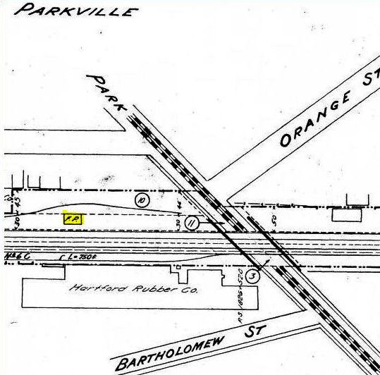
PARKVILLE [HP&F, 1871; depot 1872]
According to the newspaper, was up and five trains daily were expected to begin stopping here on November 1, 1871. This area of Hartford was a new subdivision, developed by William Francis, Esq., a lawyer and real estate investor. The Courant reported that "the most important auction sale of the season" would be taking place here on 6/4/1872 and quoted another newspaper as follows: "This morning we took a look at Parkville. It is a pretty region, and well adapted, topographically as well as by its nearness to the more central parts of the city, to the purpose of cheap and good homes. It is all finely graded, and many handsome streets, along which young shade trees have been set out, crosses [sic] the domain in ordered series. On these new streets there are already, perhaps, nearly half a hundred houses, neat and unexpensive, such as mechanics and others will want. On one side of the domain are the railroad tracks of the Hartford and New Haven, and Hartford, Providence and Fishkill roads, with the railroad station right there, newly built expressly for Parkville; also a post office so that the residents need not come to the regular Hartford postoffice [sic] every time they want a letter or newspaper. Horse cars will run there before many years – very likely within a short time. Those in the other ends of the city who do not care to walk out there can go on the excursion train which leaves the Asylum street depot on Tuesday at 11:00. There’ll be a band of music and a free lunch... This month all trains on the Waterbury road will stop at the Parkville station which will very much increase the already favorable facilities for reaching that part of Hartford." The newspaper of the following day said 140 buyers committed themselves to nearly $56,000 in lot purchases, the majority of which had 50-ft frontage. This real estate venture is not unlike our website namesake Tyler City, which was also touted as an egalitarian community with "Homes for the People" in Orange. Backing up the dating provided by the newspapers, this stop is not found on an August, 1871 timetable but does show up on one in 1872. The naming of this neighborhood appears to derive from the Park River that cuts through this western part of the capital city. [REFS: HDC/10/21/1871/02; HPFTT 9/18/1872: yes; HDC/05/29/1872/02; HDC/02/15/1872/02; HDC/06/03/1872/02; HDC/06/18/1873/02; CRC30.1883.34: closed; reopened 1/24/1883][rev033113]
According to the newspaper, was up and five trains daily were expected to begin stopping here on November 1, 1871. This area of Hartford was a new subdivision, developed by William Francis, Esq., a lawyer and real estate investor. The Courant reported that "the most important auction sale of the season" would be taking place here on 6/4/1872 and quoted another newspaper as follows: "This morning we took a look at Parkville. It is a pretty region, and well adapted, topographically as well as by its nearness to the more central parts of the city, to the purpose of cheap and good homes. It is all finely graded, and many handsome streets, along which young shade trees have been set out, crosses [sic] the domain in ordered series. On these new streets there are already, perhaps, nearly half a hundred houses, neat and unexpensive, such as mechanics and others will want. On one side of the domain are the railroad tracks of the Hartford and New Haven, and Hartford, Providence and Fishkill roads, with the railroad station right there, newly built expressly for Parkville; also a post office so that the residents need not come to the regular Hartford postoffice [sic] every time they want a letter or newspaper. Horse cars will run there before many years – very likely within a short time. Those in the other ends of the city who do not care to walk out there can go on the excursion train which leaves the Asylum street depot on Tuesday at 11:00. There’ll be a band of music and a free lunch... This month all trains on the Waterbury road will stop at the Parkville station which will very much increase the already favorable facilities for reaching that part of Hartford." The newspaper of the following day said 140 buyers committed themselves to nearly $56,000 in lot purchases, the majority of which had 50-ft frontage. This real estate venture is not unlike our website namesake Tyler City, which was also touted as an egalitarian community with "Homes for the People" in Orange. Backing up the dating provided by the newspapers, this stop is not found on an August, 1871 timetable but does show up on one in 1872. The naming of this neighborhood appears to derive from the Park River that cuts through this western part of the capital city. [REFS: HDC/10/21/1871/02; HPFTT 9/18/1872: yes; HDC/05/29/1872/02; HDC/02/15/1872/02; HDC/06/03/1872/02; HDC/06/18/1873/02; CRC30.1883.34: closed; reopened 1/24/1883][rev033113]
|

|
|
|
|
|
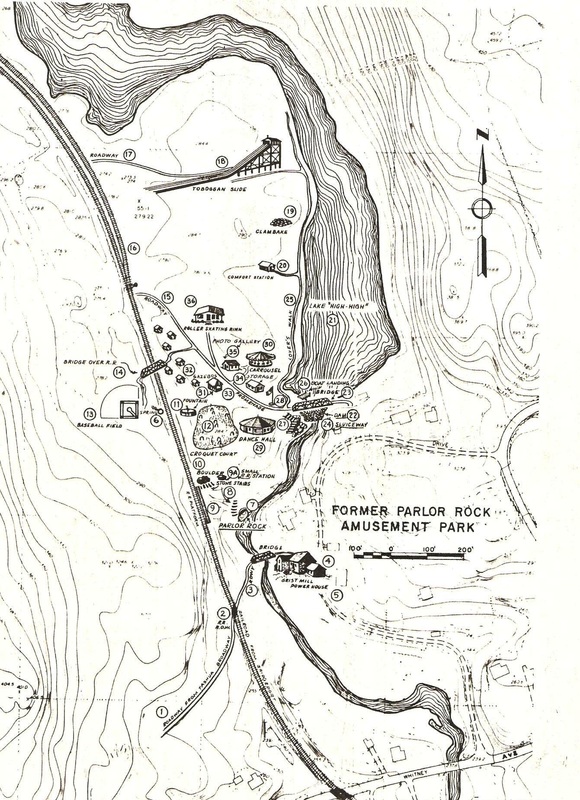
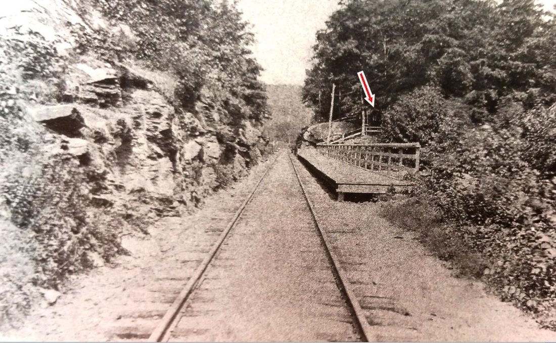
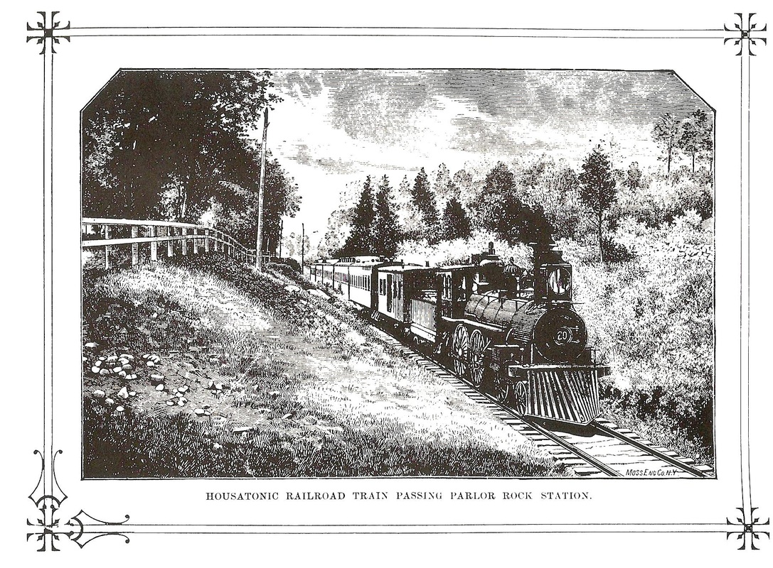
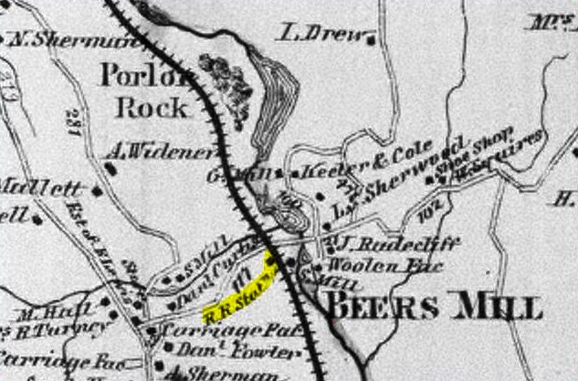
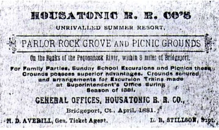
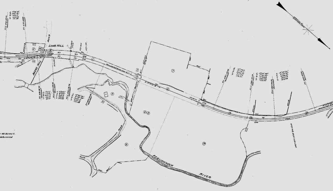
PARLOR ROCK [HRR, 1879]
Akin to the D&N's BROOKSIDE PARK and the NRR's HIGH ROCK GROVE, PARLOR ROCK in Trumbull seems to have been established by the HRR in 1879, although excursions to this rocky grotto date probably back to the beginning of the railroad; one is noted in the newspaper in 1851. Success as an official destination was immediate and trains of 10 or more cars were not uncommon, with crowds coming from as far as Pittsfield. Even more traffic was generated from New Haven and the Naugatuck Valley after the NH&D connected with the HRR at Botsford in 1888. The view at [1] looks north at the 100-ft platform and shows a small building at our red arrow, enlarged at [2], that may well be the depot. It does correspond to the 9A location on the facilities map at [7] and we can also see the banister for the stone steps leading up to station. The image at [3] shows a train passing the station area. The 1868 map at [4] shows the grove containing the namesake riverine boulder with the parlor-like seat indentation, its fame already well established. In August, 1887, a huge 28-car train brought 4,000 Elks for their state picnic and the NYNH&H held an employee outing here as well, in spite of deteriorating relations with the HRR. The piece de resistance was the announcement of "the biggest toboggan slide in New England," likely the brainchild of the industrious HRR Vice Pres. William H. Stevenson. Elevators were reportedly going to transport people to the top of the ramp that was to be lined with ice cakes cut from Lake High-High to propel people clear across the frozen lake surface. Though we note the toboggan is facing away from the lake on the facilities map(!), electric lights costing $1,500, steam heat, and refreshment stands were ready for the slide's opening on 2/9/1888. With ice skating and ice polo and heated pavilions for roller skating and dancing, Parlor Rock was made into a lucrative year-round attraction and it would continue to be popular even after the HRR was taken over by the NYNH&H in 1892. In that same year a tip from the Long Hill liquor agent led to a police raid and the confiscation of beer from outraged Knights of Pythias picnickers. Trumbull reportedly went 'dry' shortly thereafter. This, as well as dwindling crowds due to competition from Bridgeport's Pleasure Beach and West Haven's Savin Rock, persuaded the NYNH&H to close the park in 1898 and the buildings were dismantled by 1908. According to the Trumbull Historical Society, trains still brought teams to use the baseball field until 1913. By the time that the 6/30/1915 val map at [6] was drawn only the large parcels that presumbly defined the PARLOR ROCK grounds are seen. Parking for the short trek on the Pequonnock Valley Greenway, the former HRR, is available on Whitney Ave., about 1,000 feet south. This was the site of the former BEERS MILL, later LONG HILL, station, which is marked in yellow on the 1868 map. [REFS: CC/08/23/1851/02; B822 (1872); WH/09/02/1872/03; MDC/08/06/1874/02; NHER/04/17/1879/04; NHER/08/26/ 1879/01; NHER/12/24/1880/01; NHER/06/06/1885/04; NHER/06/21/1887/01; NHER/07/29/1887/04; NHER/07/30/1887/04; NHER/08/11/1887/01; NHER/ 08/31/1887/01; NHER/11/08/1887/01; NHER/02/08/1888/04; NHER/09/05/ 1888/04; NHER/07/06/1892/04; NHER/08/17/1893/04; B890; NL10.1.2][rev071415, 080622]
Akin to the D&N's BROOKSIDE PARK and the NRR's HIGH ROCK GROVE, PARLOR ROCK in Trumbull seems to have been established by the HRR in 1879, although excursions to this rocky grotto date probably back to the beginning of the railroad; one is noted in the newspaper in 1851. Success as an official destination was immediate and trains of 10 or more cars were not uncommon, with crowds coming from as far as Pittsfield. Even more traffic was generated from New Haven and the Naugatuck Valley after the NH&D connected with the HRR at Botsford in 1888. The view at [1] looks north at the 100-ft platform and shows a small building at our red arrow, enlarged at [2], that may well be the depot. It does correspond to the 9A location on the facilities map at [7] and we can also see the banister for the stone steps leading up to station. The image at [3] shows a train passing the station area. The 1868 map at [4] shows the grove containing the namesake riverine boulder with the parlor-like seat indentation, its fame already well established. In August, 1887, a huge 28-car train brought 4,000 Elks for their state picnic and the NYNH&H held an employee outing here as well, in spite of deteriorating relations with the HRR. The piece de resistance was the announcement of "the biggest toboggan slide in New England," likely the brainchild of the industrious HRR Vice Pres. William H. Stevenson. Elevators were reportedly going to transport people to the top of the ramp that was to be lined with ice cakes cut from Lake High-High to propel people clear across the frozen lake surface. Though we note the toboggan is facing away from the lake on the facilities map(!), electric lights costing $1,500, steam heat, and refreshment stands were ready for the slide's opening on 2/9/1888. With ice skating and ice polo and heated pavilions for roller skating and dancing, Parlor Rock was made into a lucrative year-round attraction and it would continue to be popular even after the HRR was taken over by the NYNH&H in 1892. In that same year a tip from the Long Hill liquor agent led to a police raid and the confiscation of beer from outraged Knights of Pythias picnickers. Trumbull reportedly went 'dry' shortly thereafter. This, as well as dwindling crowds due to competition from Bridgeport's Pleasure Beach and West Haven's Savin Rock, persuaded the NYNH&H to close the park in 1898 and the buildings were dismantled by 1908. According to the Trumbull Historical Society, trains still brought teams to use the baseball field until 1913. By the time that the 6/30/1915 val map at [6] was drawn only the large parcels that presumbly defined the PARLOR ROCK grounds are seen. Parking for the short trek on the Pequonnock Valley Greenway, the former HRR, is available on Whitney Ave., about 1,000 feet south. This was the site of the former BEERS MILL, later LONG HILL, station, which is marked in yellow on the 1868 map. [REFS: CC/08/23/1851/02; B822 (1872); WH/09/02/1872/03; MDC/08/06/1874/02; NHER/04/17/1879/04; NHER/08/26/ 1879/01; NHER/12/24/1880/01; NHER/06/06/1885/04; NHER/06/21/1887/01; NHER/07/29/1887/04; NHER/07/30/1887/04; NHER/08/11/1887/01; NHER/ 08/31/1887/01; NHER/11/08/1887/01; NHER/02/08/1888/04; NHER/09/05/ 1888/04; NHER/07/06/1892/04; NHER/08/17/1893/04; B890; NL10.1.2][rev071415, 080622]
|

|
|
|

|
Monroe Historical Society
|
 Monroe Historical Society
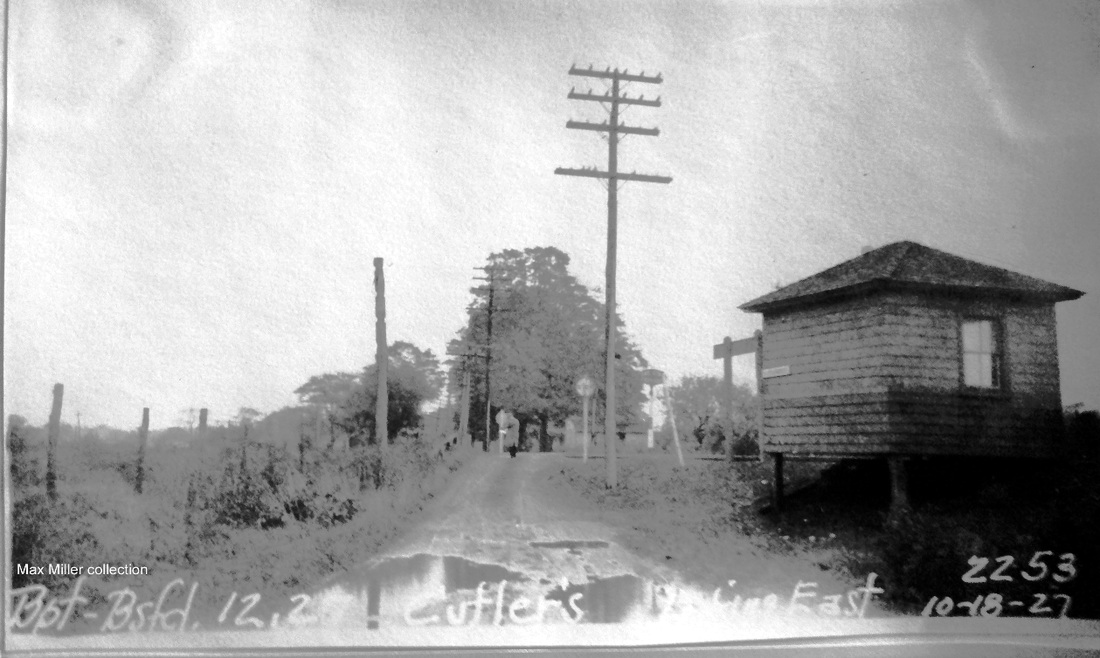
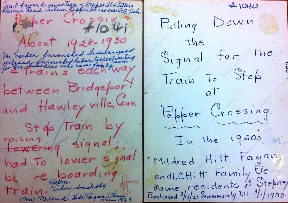
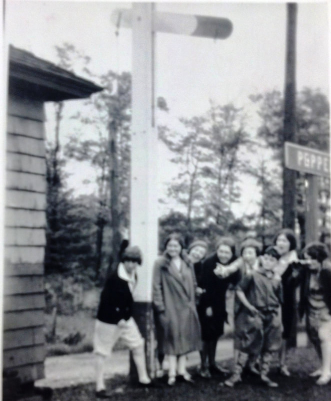
PEPPER CROSSING [NYNH&H, c1913]
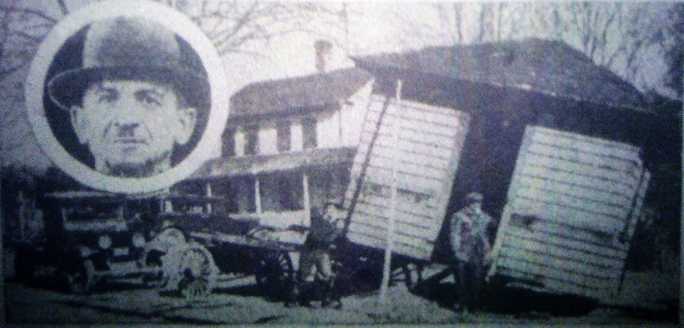
The val photo at [1] is dated 9/11/1916. There is a solitary figure seated on the steps and, though faint, you can see the paddle raised to signal the train that there is a passenger waiting. This flag station is not on our rev7/7/1912TT but does appear on the rev6/29/1914TT and the 1915 val map at [2]. Throughout its existence, no trains were scheduled to stop there. On our 11/18/1928TT, it is listed as the sole flag stop on the old HRR branch which was being served by one train daily in each direction and it is gone by the 2/8/1932TT after passenger service ended. The small shelter was put up for the comfort of visitors to the Garders, a couple who relocated here from New York and began to farm the land, sell produce, and run a modest vacation resort. Materials at the Monroe Historical Society, which has lots of railroad photos, say that the Garders bought the lumber and the NYNH&H provided the labor to build the small waiting station. An article in the Newtown Bee claiming that the station was partly dismantled and taken down in 1921 and then used as a storehouse on the farm property is only partially correct. The date is contradicted by the 10/18/1927 PUC photo at [3] and by the 1932 Bridgeport Sunday Post image at [4] showing Harry Garder (inset) reclaiming his structure to be used as "a granary" at that time. The couple is remembered today with the naming of nearby Garder Rd. Our colleague Kevin Daly at MHS has annotated the 1934 aerial map at [5] with the grade crossing and road realignments over the years at this interesting location. Locals recall taking the train to high school in Bridgeport while service still lasted. Kids gleefully raise the paddle in the 1920s photo at [7]. Just makes you want to go back to happier days! [REFS: BSP/03/13/1932/14; NB/07/08/1994/??; K56; NL22.4.9][rev061613, 101920]
The val photo at [1] is dated 9/11/1916. There is a solitary figure seated on the steps and, though faint, you can see the paddle raised to signal the train that there is a passenger waiting. This flag station is not on our rev7/7/1912TT but does appear on the rev6/29/1914TT and the 1915 val map at [2]. Throughout its existence, no trains were scheduled to stop there. On our 11/18/1928TT, it is listed as the sole flag stop on the old HRR branch which was being served by one train daily in each direction and it is gone by the 2/8/1932TT after passenger service ended. The small shelter was put up for the comfort of visitors to the Garders, a couple who relocated here from New York and began to farm the land, sell produce, and run a modest vacation resort. Materials at the Monroe Historical Society, which has lots of railroad photos, say that the Garders bought the lumber and the NYNH&H provided the labor to build the small waiting station. An article in the Newtown Bee claiming that the station was partly dismantled and taken down in 1921 and then used as a storehouse on the farm property is only partially correct. The date is contradicted by the 10/18/1927 PUC photo at [3] and by the 1932 Bridgeport Sunday Post image at [4] showing Harry Garder (inset) reclaiming his structure to be used as "a granary" at that time. The couple is remembered today with the naming of nearby Garder Rd. Our colleague Kevin Daly at MHS has annotated the 1934 aerial map at [5] with the grade crossing and road realignments over the years at this interesting location. Locals recall taking the train to high school in Bridgeport while service still lasted. Kids gleefully raise the paddle in the 1920s photo at [7]. Just makes you want to go back to happier days! [REFS: BSP/03/13/1932/14; NB/07/08/1994/??; K56; NL22.4.9][rev061613, 101920]
PEQUABUCK [> TERRYVILLE]
PEQUONNOCK [> NORTH BRIDGEPORT]
PINE GROVE1 [HRR, 1873]
According to NHRR real estate records, this station in the town of Canaan was built in 1873. It served the Methodist camp meetings that some sources say went back to 1856. The first mention we find in the newspapers is in the Courant in 1867, which said a six-day meeting would be held along the line of the HRR, midway between Falls Village and North Canaan. Many religious associations deliberately located their grounds along railroad lines to make the events accessible, like at the CAMP STATION depots in Plainville and Willimantic and at GOODSPEEDS in Haddam where Camp Bethel was served. Whenever it was built, a newspaper article in 1877 reported that "the debris of the camp meeting station building belonging to Housatonic R.R. Co. and located at the grounds of the Pine Grove Camp Meeting Society, between this place and Falls Village, and which was blown down, and blown pretty much all to pieces in a gale in the last part of December, is now entirely cleared away, and nothing but the platform and floor of the structure remains. It is presumed the building will be rebuilt before the advent of the next camp meeting at these grounds." No photo of this station, which may or may not have looked like the next one, has been identified. [REFS: HDC/08/03/1867/08; HDC/08/22/1873/04; CWN/02/23/1877/02; CWN/08/26/1885/03: 1860 first camp meeting][rev021918]
|

|

|

PINE GROVE2 [HRR, 1877]
This was the successor to the station that was blown down late in 1876. The newspaper said in August, 1877 that "the depot building at the camp grounds station, which was blown down by one of last December's gales, is again being rebuilt, and will be ready for the accommodation of the meetings next week." With eight HRR trains stopping here each way at the meetings in the previous year, there was certainly a need for the depot to be rebuilt, perhaps with larger dimensions than the original one. An 1878 article in Zion's Herald said that there were even special trains running down from Canaan that attendees arriving on both the HRR and CW had access to and that there was a post office, telegraph service and "a daily paper printed on the ground (sic) reporting all the sermons." That paper appears to have been a special edition of the Connecticut Western News, which the Canaan-based outfit took special pride in issuing beyond the weekly edition. The station here was only open during the summer when the post office handled up to four deliveries per day. Seasonal attendance reportedly peaked at 7,000 persons, but with religious fervor ebbing, the last revival meeting was held in 1912. In 1920, the old camp meeting constituency morphed into the current Pine Grove Association. The Victorian cottages still stand today and are colorful reminders of the history here. According to NHRR real estate records, the station was sold on 12/28/1929. The photo at upper left looks east toward Canaan Mountain and shows the unusual design of this depot that had sliding doors so the structure could be open on both sides in good weather. The val photo at middle is dated 9/25/1916. [REFS: CWN/08/25/1876/02; ZH/09/05/1878/55,36, American Periodicals Series, p282; D89; CWN/08/29/1907/01; LJ/04/20/1989/D6/supp.][rev033113]
This was the successor to the station that was blown down late in 1876. The newspaper said in August, 1877 that "the depot building at the camp grounds station, which was blown down by one of last December's gales, is again being rebuilt, and will be ready for the accommodation of the meetings next week." With eight HRR trains stopping here each way at the meetings in the previous year, there was certainly a need for the depot to be rebuilt, perhaps with larger dimensions than the original one. An 1878 article in Zion's Herald said that there were even special trains running down from Canaan that attendees arriving on both the HRR and CW had access to and that there was a post office, telegraph service and "a daily paper printed on the ground (sic) reporting all the sermons." That paper appears to have been a special edition of the Connecticut Western News, which the Canaan-based outfit took special pride in issuing beyond the weekly edition. The station here was only open during the summer when the post office handled up to four deliveries per day. Seasonal attendance reportedly peaked at 7,000 persons, but with religious fervor ebbing, the last revival meeting was held in 1912. In 1920, the old camp meeting constituency morphed into the current Pine Grove Association. The Victorian cottages still stand today and are colorful reminders of the history here. According to NHRR real estate records, the station was sold on 12/28/1929. The photo at upper left looks east toward Canaan Mountain and shows the unusual design of this depot that had sliding doors so the structure could be open on both sides in good weather. The val photo at middle is dated 9/25/1916. [REFS: CWN/08/25/1876/02; ZH/09/05/1878/55,36, American Periodicals Series, p282; D89; CWN/08/29/1907/01; LJ/04/20/1989/D6/supp.][rev033113]
|
|
|
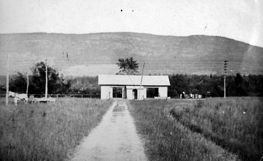
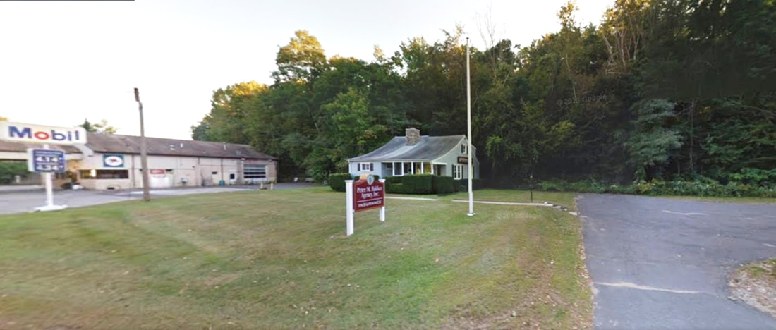
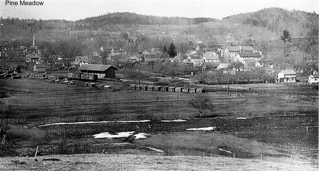
PINE MEADOW/N1 [NH&N, 1870]
The first station in the town of New Hartford was established in 1870 when the Canal railroad extended the Collinsville branch six miles up to Pine Meadow. Work on the extension had been commenced in 1868 by a resurgent NH&N which was about to be free of its lease to the NY&NH and was determined to expand to new markets. Though it had the legal right dating back to 1848 to build to the state line, the NH&N stopped short of bridging the Farmington River at this time and established a temporary terminus here. The 1874 Beers map at [1] shows the depot, engine and freight houses about where the Mobil gas station and the adjacent house stand today [3]. Mr. Bailey's birds-eye map [2] dates to 1878 and gives a fine view of all the railroad facilities; click here for the full map. The first train ran on 5/23/1870 and the Courant reported in July, 1870 that "three regular passenger trains now run daily over the new railroad from Collinsville to New Hartford." That actually meant, of course, from PINE MEADOW down to the FARMINGTON junction with the NH&N main line. While a newspaper article in May, 1870 said there was no structure here, by November, 1871 there is a report that a "town road to the depot is now being built in Pine Meadow." That road, seen as High St. on the Bailey map, goes down to the depot site where stands the house that may be the same one seen today. Could this have been used as the first station? Otherwise we have no actual photo and do know only from the railroad's 1876 annual report that "the temporary terminus and stations outside the village and inconvenient of access to the business" had been superceded by a depot at 'the business,' meaning the Greenwoods Co. north of the Farmington River. Two other things to note on the Bailey map. His placement of the CW/NH&N crossover at the first depot site is incorrect because we know it was farther east. Assuming his customary accuracy otherwise, his portrayal of the stone abutments at Albany Tpke. is interesting because it has one of them in the middle of the road! The railroad commissioners mention the town's unhappiness with the construction but they dodged that issue and just did their job certifying the work as safe on 10/27/1876. [REFS: CC12/26/1868/02; HDC/07/30/1869/04; WH/05/27/1870/02; HDC/07/21/1870/04; WH/11/03/1871/02; DC/04/08/1874 /02; CRC23.1876.17; NHNAR40.1876.5; RRC24.30 (10/27/1876)][rev062715; rrd010518]
_
|

|
|
|

|
|
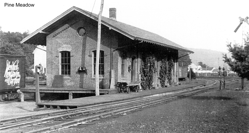
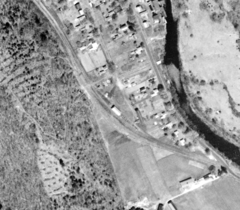
PINE MEADOW/N2 [NH&N, 1877]
In their report of January, 1877, the railroad commissioners said that "the two new passenger depots at New Hartford and Pine Meadow, now nearly completed, promise to be models of their kind," thus amending Lord's early 1870s date for the building of this depot. The railroad's 1878 annual report says that "a brick passenger and freight building has been erected at the junction with the Connecticut Western R.R. at New Hartford..." meaning the combination station that we see in these photos, an Italianate brick structure with the 'porthole' window in the NH&N style of the period. The sharing of this station by the CW and the NH&N, perhaps foreshadowed by its location at the crossing of the two roads, is uncorroborated in the sources thus far and probably did not come about until 1895, as is discussed under PINE MEADOW/C1. The view at [1] looks railroad-east. The image at [2] looks railroad-west with a train, perhaps PR&NE in the 1890s, approaching the double switches for the crossover right at the station. The val map at [3] is from 1916. The elevated views at [4] look northwest [4] and northeast [5], the latter showing the crossover relocated farther east and the Canal line track ending at the depot. Access to New Hartford across the river by now by the CW track. This was probably done after NYNH&H control in 1904 to link the two railroads that met here. The 1934 aerial at [6] shows the depot footprint at that time and Nimke has a 1937 photo showing it still standing then. The 1938 SSRR list says it was sold presumably in that year, "with the stone in Turn Table... $40... to Charles Hall." Further disposition is unknown. [REFS: CWN/01/28/1876/2; CRC24.1877.17; D26,120; N3.33][rev010518; 030320]
In their report of January, 1877, the railroad commissioners said that "the two new passenger depots at New Hartford and Pine Meadow, now nearly completed, promise to be models of their kind," thus amending Lord's early 1870s date for the building of this depot. The railroad's 1878 annual report says that "a brick passenger and freight building has been erected at the junction with the Connecticut Western R.R. at New Hartford..." meaning the combination station that we see in these photos, an Italianate brick structure with the 'porthole' window in the NH&N style of the period. The sharing of this station by the CW and the NH&N, perhaps foreshadowed by its location at the crossing of the two roads, is uncorroborated in the sources thus far and probably did not come about until 1895, as is discussed under PINE MEADOW/C1. The view at [1] looks railroad-east. The image at [2] looks railroad-west with a train, perhaps PR&NE in the 1890s, approaching the double switches for the crossover right at the station. The val map at [3] is from 1916. The elevated views at [4] look northwest [4] and northeast [5], the latter showing the crossover relocated farther east and the Canal line track ending at the depot. Access to New Hartford across the river by now by the CW track. This was probably done after NYNH&H control in 1904 to link the two railroads that met here. The 1934 aerial at [6] shows the depot footprint at that time and Nimke has a 1937 photo showing it still standing then. The 1938 SSRR list says it was sold presumably in that year, "with the stone in Turn Table... $40... to Charles Hall." Further disposition is unknown. [REFS: CWN/01/28/1876/2; CRC24.1877.17; D26,120; N3.33][rev010518; 030320]
|

|
|
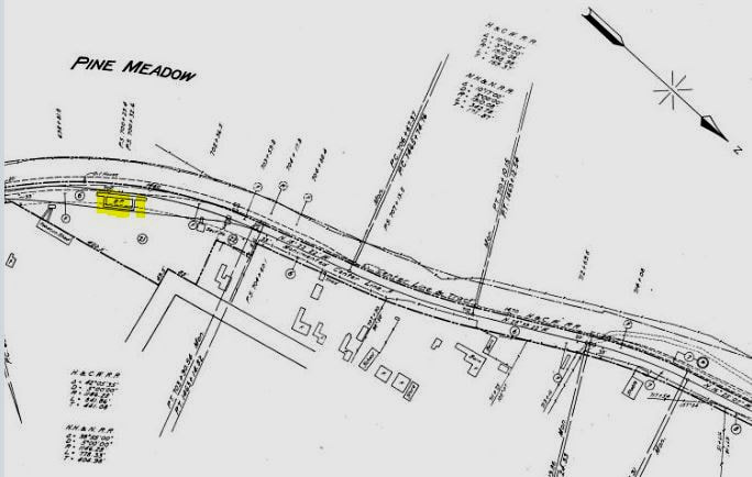
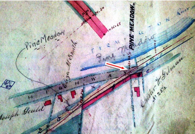
PINE MEADOW/C1 [CW, 1871]
Chronologically, the second station in this village was built by the CW. The Courant said this was a flag stop initially but the Winsted Herald reported that a depot here was almost complete late in 1871 when the railroad opened. The real estate map of that same date at [1] seems to show the location right at the Albany Tpke., as Bob Lord asserts, though with no building shown yet. A 1937 newspaper article verifies this as Gilman Crossing and that surname is seen on the map. Note that an arrow points to the 1877 NH&N depot pencilled in a little farther to the west. By the 1874 Beers map at [2] the CW depot is clearly indicated but actually on the wrong track. The swapping of ROWs between the CW and the NH&N, both building in 1870, is mentioned in the newspapers and may be responsible for confusion on the map, which also does not indicate the crossover. Mr Bailey's 1878 map at [3] does us an unfortunate injustice here by cutting off the building that might have been PINE MEADOW/C1 depot where our arrow points at middle left. The 1880 NY&NE appraisal of CW property said there was a small structure here to serve both passengers and freight valued at $175, compared to BLOOMFIELD which it appraised at $1500. The fate of this station, when it was replaced by PINE MEADOW/C2 in 1894, is unknown.
Chronologically, the second station in this village was built by the CW. The Courant said this was a flag stop initially but the Winsted Herald reported that a depot here was almost complete late in 1871 when the railroad opened. The real estate map of that same date at [1] seems to show the location right at the Albany Tpke., as Bob Lord asserts, though with no building shown yet. A 1937 newspaper article verifies this as Gilman Crossing and that surname is seen on the map. Note that an arrow points to the 1877 NH&N depot pencilled in a little farther to the west. By the 1874 Beers map at [2] the CW depot is clearly indicated but actually on the wrong track. The swapping of ROWs between the CW and the NH&N, both building in 1870, is mentioned in the newspapers and may be responsible for confusion on the map, which also does not indicate the crossover. Mr Bailey's 1878 map at [3] does us an unfortunate injustice here by cutting off the building that might have been PINE MEADOW/C1 depot where our arrow points at middle left. The 1880 NY&NE appraisal of CW property said there was a small structure here to serve both passengers and freight valued at $175, compared to BLOOMFIELD which it appraised at $1500. The fate of this station, when it was replaced by PINE MEADOW/C2 in 1894, is unknown.

|

|

|
Just east of here was the fearful canyon known as Satan's Kingdom, which both railroads had to blast ledges through. Trains are heading to Collinsville in both photos; a Canal line train is seen in [1] on the west bank of the Farmington River and at [2] a CW consist is taking the east bank. Oh, how we wish we could have ridden across that bridge! On several occasions, the Hartford Camera Club 'took the cars' to capture images of exotic locales along rail lines and this one certainly qualified, probably on 5/30/1892 when a stop was made enroute to TWIN LAKES. The men are walking east on the Canal line in [3], the one in the center carrying the equipment is reportedly F.H. DeMars, noted Winsted photographer. [REFS: HDC/11/14/1871/04; WH/12/15/1871/02; HDC/12/21/1871/02; CW/NYNE1880; HC/05/31/1892/05; WH/11/20/1895/08; FVH/12/30/ 1937/01; D26][rev062715, 021520]
PINE MEADOW/C2 [PR&NE, 1894]
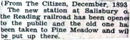
The Winsted Citizen article at left tells us that a new station at Salisbury opened in December, 1893 and an "old one has been taken to Pine Meadow to be put up there." It may be recalled that, when SALISBURY1 burned in January, 1893 the paper said that "a small building has been erected for present use." This must have been what was moved to become PINE MEADOW/C2. Factoring in a February, 1894 article that says this station is being closed and the operator is out of a job and a more telling the report in 1895 that "the Pine Meadow depot erected some years ago by the P.R. & N.E. people is being torn down." Taking everything into consideration, we are inclined to think that the elimination of this PR&NE agency position early in 1894 and the tearing down of the "small building" late in 1895 may have based on the agreement that the NH&N's PINE MEADOW/N2 was to be shared by both roads thereafter. It, of course, is also possible that the sharing started in 1904 when the NYNH&H got stock control of what was by then the CNE. [REFS: CWN/01/19/1893/02; WC/00/12/1893/00; CWN/02/15/ 1894/03; WH/11/20/1895/08][rev062315]
The Winsted Citizen article at left tells us that a new station at Salisbury opened in December, 1893 and an "old one has been taken to Pine Meadow to be put up there." It may be recalled that, when SALISBURY1 burned in January, 1893 the paper said that "a small building has been erected for present use." This must have been what was moved to become PINE MEADOW/C2. Factoring in a February, 1894 article that says this station is being closed and the operator is out of a job and a more telling the report in 1895 that "the Pine Meadow depot erected some years ago by the P.R. & N.E. people is being torn down." Taking everything into consideration, we are inclined to think that the elimination of this PR&NE agency position early in 1894 and the tearing down of the "small building" late in 1895 may have based on the agreement that the NH&N's PINE MEADOW/N2 was to be shared by both roads thereafter. It, of course, is also possible that the sharing started in 1904 when the NYNH&H got stock control of what was by then the CNE. [REFS: CWN/01/19/1893/02; WC/00/12/1893/00; CWN/02/15/ 1894/03; WH/11/20/1895/08][rev062315]
|
|
|
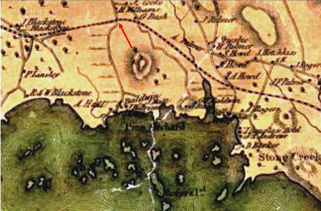
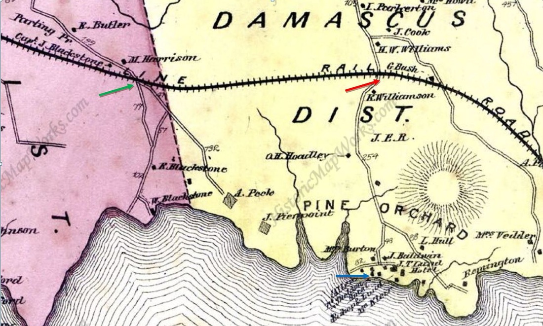
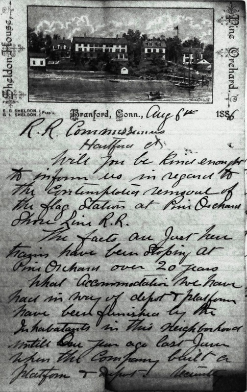
PINE ORCHARD1 [SL, c1865?]
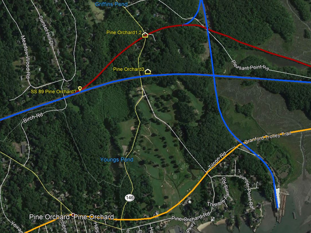
Though people had been vacationing at Sheldon's cottages among the pine trees since the 1830s, this was not an original stop in 1852 when the NH&NL opened. Unscheduled, seasonal service, however, dates at least to 1870 when an article says that "if [a party of] ten or a dozen desire to visit some special place, the train will drop them at the nearest point, and the evening train will stop for parties, so that they may be certain of returning the same day." Shedding more light on the history here is a very valuable letter that the Sheldon Bros. wrote in 1886 to the railroad commissioners concerning the "contemplated removal [actually a relocation] of the flag station at Pine Orchard" where it claims trains had been stopping "for over 20 years" at a "depot and platform" provided by locals. The location of the flag station is seen at the red arrow on on both the 1852NH map at [1] and the 1868 Beers map at [2]; the latter also shows the Sheldon House at the blue arrow all the way at the bottom and the proposed relocation point at the green arrow, a mile west at Blackstone's crossing. The people in favor of the change were an upstart cottage colony, derisively called 'Woodchuck.' The old guard apparently won the day. The newspaper said in 1886 the 'orchard' pines were in bad shape but the spot was still very popular" as it would be for years to come "... about two miles and a half from Stony Creek as the crow flies, or rather more correctly, as the mosquito flies, for one million mosquitos fly to every one crow in this section of the world. Pine Orchard itself has not more than 20 cottages in it. It is the quietest place one can imagine. People go there to loaf away the summer..." We have no photo yet of PINE ORCHARD1. The snippet at [3] is from our Track 11 Google Earth map showing the original NH&NL abandoned in red and the connection made later going north still in service today as the Branford Steam RR: see BRANFORD DRIVING PARK for the fascinating evolution of that line. The orange line at bottom is the Shore Line Electric Rwy. [REFS: CR/07/16/1870/02; SR/06/09/1876/02; NHER/07/09/1886/01; RRL /8/6/1886 in CSLIB RG041:001, Ser. 3, Shore Line Rwy, 1886-1887; Carr, History of Early Branford, p48][add022715, rev123118]
Though people had been vacationing at Sheldon's cottages among the pine trees since the 1830s, this was not an original stop in 1852 when the NH&NL opened. Unscheduled, seasonal service, however, dates at least to 1870 when an article says that "if [a party of] ten or a dozen desire to visit some special place, the train will drop them at the nearest point, and the evening train will stop for parties, so that they may be certain of returning the same day." Shedding more light on the history here is a very valuable letter that the Sheldon Bros. wrote in 1886 to the railroad commissioners concerning the "contemplated removal [actually a relocation] of the flag station at Pine Orchard" where it claims trains had been stopping "for over 20 years" at a "depot and platform" provided by locals. The location of the flag station is seen at the red arrow on on both the 1852NH map at [1] and the 1868 Beers map at [2]; the latter also shows the Sheldon House at the blue arrow all the way at the bottom and the proposed relocation point at the green arrow, a mile west at Blackstone's crossing. The people in favor of the change were an upstart cottage colony, derisively called 'Woodchuck.' The old guard apparently won the day. The newspaper said in 1886 the 'orchard' pines were in bad shape but the spot was still very popular" as it would be for years to come "... about two miles and a half from Stony Creek as the crow flies, or rather more correctly, as the mosquito flies, for one million mosquitos fly to every one crow in this section of the world. Pine Orchard itself has not more than 20 cottages in it. It is the quietest place one can imagine. People go there to loaf away the summer..." We have no photo yet of PINE ORCHARD1. The snippet at [3] is from our Track 11 Google Earth map showing the original NH&NL abandoned in red and the connection made later going north still in service today as the Branford Steam RR: see BRANFORD DRIVING PARK for the fascinating evolution of that line. The orange line at bottom is the Shore Line Electric Rwy. [REFS: CR/07/16/1870/02; SR/06/09/1876/02; NHER/07/09/1886/01; RRL /8/6/1886 in CSLIB RG041:001, Ser. 3, Shore Line Rwy, 1886-1887; Carr, History of Early Branford, p48][add022715, rev123118]
|
|

|
 Conn. State Library
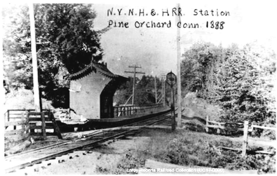
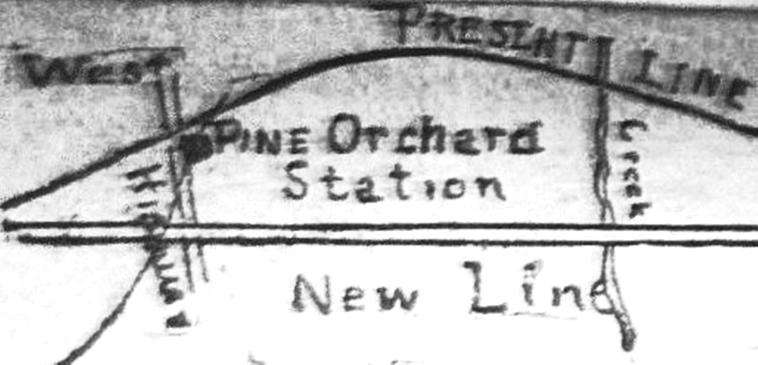
PINE ORCHARD2 [NYNH&H, 1885]
However trains had been serving people here "for over 20 years," the earliest newspaper mention we have found for this stop is in an 1880 list of stations though it is not seen in the travel guides or railroad timetables. The RRMs first show it in 1884 and the GHD in 1885. The 1886 Sheldon correspondence, seen at [4], says that locals had provided the first "depot and platform... until one year ago last June [1885] when the Company built a platform and depot," likely the one pictured in 1888 at [1]. A Register article verified that when it said that... "The new station on the Shore Line road at Pine Orchard has just been completed. It is conveniently arranged and the people at the Orchard are quite proud of it." Material gathered in August, 1886 for the first Connecticut State Register and Manual publishing such data was synopsized in the newspaper, saying that there were for this town stations at Branford and Stony Creek and that "... some trains stopped at Pine Orchard during the summer..." We also read in July, 1886 that hotel proprietors had met with railroad officials in hopes that Pine Orchard would be made a "regular way station during the summer months, where tickets can be bought and trunks checked, which cannot be done at present. It is thought that many more passengers are carried to and from this place than at other stations with much better facilities." According to timetables and newspaper reports that 'regular' status during the four-month season was not achieved until 1897. The 1892 newspaper map at [2] shows the station in the southeast quadrant of the old grade crossing. The red arrow on the real estate atlas snippet at [3] shows the location in the northeast quadrant on the new ROW, some 800 feet south of the old location at the blue arrow. While we have not found written proof of this yet, the NYNH&H seems to have taken this opportunity to abandon PINE ORCHARD2 and build the decent-sized depot in our next entry. [REFS: 1871-1881TTs; NHER/04/01/1880/01; NHER/07/09/1886/01; NHER/07/30/1886/03; RRL:8/6/1886; NHER/08/10/1886/04; NHER/08/10/1886/04; NHER/11/17/1887/01; NHER/07/26/1892/01; NHER/06/02/1897/05; NHER/06/02/1899/08; R2.30][rev0227 15, 123118]
However trains had been serving people here "for over 20 years," the earliest newspaper mention we have found for this stop is in an 1880 list of stations though it is not seen in the travel guides or railroad timetables. The RRMs first show it in 1884 and the GHD in 1885. The 1886 Sheldon correspondence, seen at [4], says that locals had provided the first "depot and platform... until one year ago last June [1885] when the Company built a platform and depot," likely the one pictured in 1888 at [1]. A Register article verified that when it said that... "The new station on the Shore Line road at Pine Orchard has just been completed. It is conveniently arranged and the people at the Orchard are quite proud of it." Material gathered in August, 1886 for the first Connecticut State Register and Manual publishing such data was synopsized in the newspaper, saying that there were for this town stations at Branford and Stony Creek and that "... some trains stopped at Pine Orchard during the summer..." We also read in July, 1886 that hotel proprietors had met with railroad officials in hopes that Pine Orchard would be made a "regular way station during the summer months, where tickets can be bought and trunks checked, which cannot be done at present. It is thought that many more passengers are carried to and from this place than at other stations with much better facilities." According to timetables and newspaper reports that 'regular' status during the four-month season was not achieved until 1897. The 1892 newspaper map at [2] shows the station in the southeast quadrant of the old grade crossing. The red arrow on the real estate atlas snippet at [3] shows the location in the northeast quadrant on the new ROW, some 800 feet south of the old location at the blue arrow. While we have not found written proof of this yet, the NYNH&H seems to have taken this opportunity to abandon PINE ORCHARD2 and build the decent-sized depot in our next entry. [REFS: 1871-1881TTs; NHER/04/01/1880/01; NHER/07/09/1886/01; NHER/07/30/1886/03; RRL:8/6/1886; NHER/08/10/1886/04; NHER/08/10/1886/04; NHER/11/17/1887/01; NHER/07/26/1892/01; NHER/06/02/1897/05; NHER/06/02/1899/08; R2.30][rev0227 15, 123118]
|

|
|
|
Dave Peters Collection
|
Richard A. Fleischer Collection
|
 Dave Peters Collection
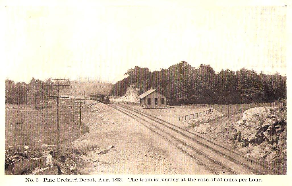
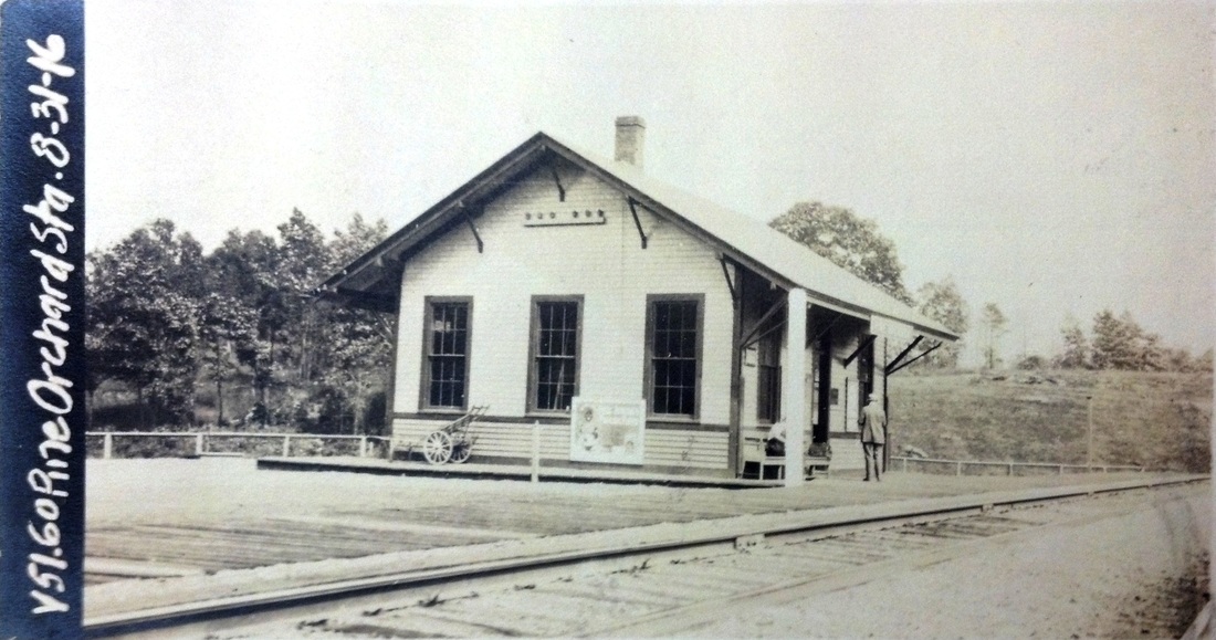
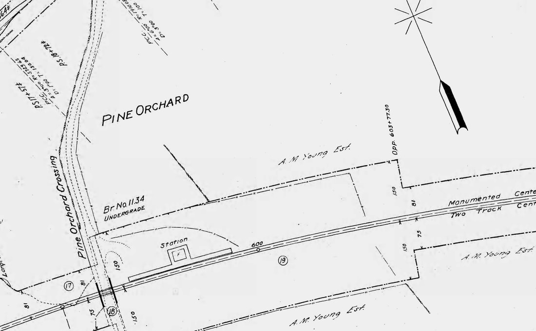
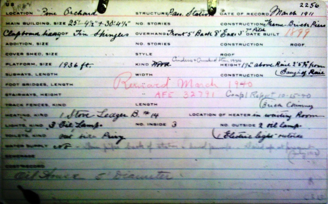
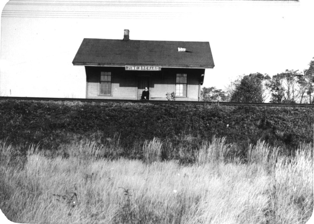
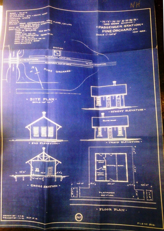
PINE ORCHARD3 [NYNH&H, 1893]
An April, 1893 Courant article says "the Shore Line railroad has... built a new fine depot" that "brings the shore within ten minutes walk of the station...," thus contributing to "quite a boom" in this beach-cottage community. PINE ORCHARD3 is shown at [1] with a 50-mph eastbound train passing it in August, 1893 on the new double-tracked ROW. The May, 1890 design drawings are seen at [7]. The shot at [2] looks east and shows one of the "immense rock cuttings" that the new ROW required. The ICC valuation photo at [3] is dated 8/31/1916 and the 6/30/1915 ICC valuation map at [4] shows the layout of the grounds. This was still, of course, a seasonal operation, usually opening in early June and being boarded up in late September, the seasonal post office more or less following suit. Supplications in 1900 to have the station open year-round were successful at least by October, 1903 when we read that O.E. Hoadley was appointed stationmaster. A March, 1906 winter burglary while Hoadley was at lunch would seem to testify to indicate year-round operation. A vigilant constable gave chase by carriage, held the thieves at pistol point and single-handedly marched them to the clink in Branford. The real estate record card at [5] gives an 1899 build date but apparently is in error, the like of which we have seen before on these cards. The removal date of March, 1940 per AFE 32791 does seem to be correct, however, as the newspapers in August, 1940 make reference to the 'former' station. The photo at [6] is dated 10/22/1938, likely the last ever taken of this depot. The ultimate fate of PINE ORCHARD3 is not known but this was at the same time the General House Wrecking Co. was taking down BRANFORD3 and selling it 'for parts.' Maybe they got the 'honors' here as well. Service, however depot-less, lasted though the NH era and Penn Central until 1/28/1972 when Amtrak canceled the Clamdigger that PC was running on its behalf. [REFS: HC/04/14/1893/06; NHER/06/10/1893/10; NHER/06/02/1899/08; NHER/08/22/1900/09; NHER/10/13/1900/08; HC/03/17/1906/08; NHJC/03/17/1906/02; NB/03/15/1919/01: slow business, closing March-June; NHER, NHJC/08/08/1940/00 per BSCRP][rev022715, 011019, 042523]
An April, 1893 Courant article says "the Shore Line railroad has... built a new fine depot" that "brings the shore within ten minutes walk of the station...," thus contributing to "quite a boom" in this beach-cottage community. PINE ORCHARD3 is shown at [1] with a 50-mph eastbound train passing it in August, 1893 on the new double-tracked ROW. The May, 1890 design drawings are seen at [7]. The shot at [2] looks east and shows one of the "immense rock cuttings" that the new ROW required. The ICC valuation photo at [3] is dated 8/31/1916 and the 6/30/1915 ICC valuation map at [4] shows the layout of the grounds. This was still, of course, a seasonal operation, usually opening in early June and being boarded up in late September, the seasonal post office more or less following suit. Supplications in 1900 to have the station open year-round were successful at least by October, 1903 when we read that O.E. Hoadley was appointed stationmaster. A March, 1906 winter burglary while Hoadley was at lunch would seem to testify to indicate year-round operation. A vigilant constable gave chase by carriage, held the thieves at pistol point and single-handedly marched them to the clink in Branford. The real estate record card at [5] gives an 1899 build date but apparently is in error, the like of which we have seen before on these cards. The removal date of March, 1940 per AFE 32791 does seem to be correct, however, as the newspapers in August, 1940 make reference to the 'former' station. The photo at [6] is dated 10/22/1938, likely the last ever taken of this depot. The ultimate fate of PINE ORCHARD3 is not known but this was at the same time the General House Wrecking Co. was taking down BRANFORD3 and selling it 'for parts.' Maybe they got the 'honors' here as well. Service, however depot-less, lasted though the NH era and Penn Central until 1/28/1972 when Amtrak canceled the Clamdigger that PC was running on its behalf. [REFS: HC/04/14/1893/06; NHER/06/10/1893/10; NHER/06/02/1899/08; NHER/08/22/1900/09; NHER/10/13/1900/08; HC/03/17/1906/08; NHJC/03/17/1906/02; NB/03/15/1919/01: slow business, closing March-June; NHER, NHJC/08/08/1940/00 per BSCRP][rev022715, 011019, 042523]
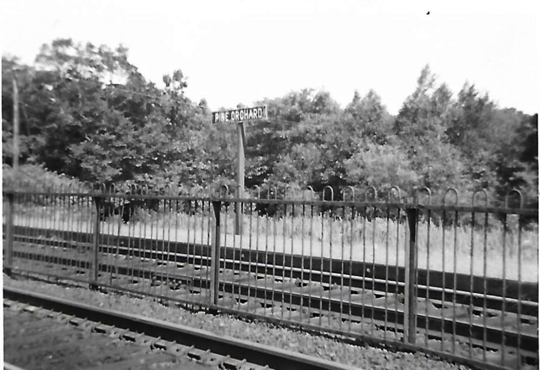
Paul Beattie photo
|
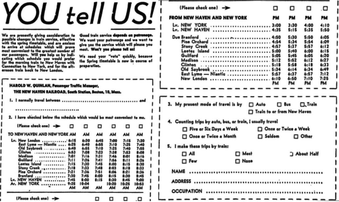
|

David Plowden photo
|
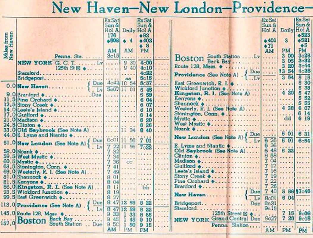
PINE ORCHARD4 [NYNHH, 1940]
There appears to have been no structure here after PINE ORCHARD3 was removed. PINE ORCHARD4 consisted of cinder platforms and signs on both the eastbound and westbound tracks. The northward-looking shot at [1] was taken in summer, 1960. Mid-track fencing would remain until spring, 1964. Perhaps the results of the 1949 newspaper survey at [2] indicated low ridership potential at this station, yet there must have been reason enough to retain it as a stop all the way through the 1/28/1972 cancellation of the Clamdigger. The image at [3] appeared in Model Railroader of January, 1976 in an article entitled "New Haven's streamlined passenger fleet" and shows the eastbound Colonial passing PINE ORCHARD4 in 1954. The 2/2/1969 Penn Central timetable at [4] shows this and virtually all the other local points between New Haven and New London as flag stops. We do not often give separate entries for platform-only stations of short duration but 32 years seemed to more than qualify here. It is surprising that in its rebounding days just after WWII the railroad would not have thought well enough to put a small shelter here like LEETES ISLAND3. All the other Shore Line stations had structures, but taking the train from here ment standing out in the rain. [REFS: NLD/03/29/1949/05][rev 042523]
There appears to have been no structure here after PINE ORCHARD3 was removed. PINE ORCHARD4 consisted of cinder platforms and signs on both the eastbound and westbound tracks. The northward-looking shot at [1] was taken in summer, 1960. Mid-track fencing would remain until spring, 1964. Perhaps the results of the 1949 newspaper survey at [2] indicated low ridership potential at this station, yet there must have been reason enough to retain it as a stop all the way through the 1/28/1972 cancellation of the Clamdigger. The image at [3] appeared in Model Railroader of January, 1976 in an article entitled "New Haven's streamlined passenger fleet" and shows the eastbound Colonial passing PINE ORCHARD4 in 1954. The 2/2/1969 Penn Central timetable at [4] shows this and virtually all the other local points between New Haven and New London as flag stops. We do not often give separate entries for platform-only stations of short duration but 32 years seemed to more than qualify here. It is surprising that in its rebounding days just after WWII the railroad would not have thought well enough to put a small shelter here like LEETES ISLAND3. All the other Shore Line stations had structures, but taking the train from here ment standing out in the rain. [REFS: NLD/03/29/1949/05][rev 042523]
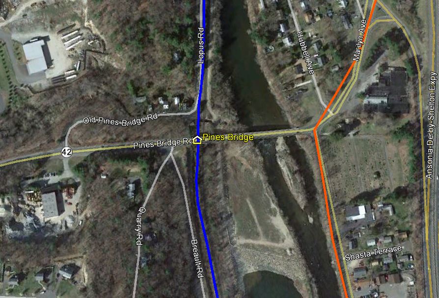
PINES BRIDGE [NRR, 1849]
This was an early and probably short-lived station above SEYMOUR. It is mentioned as a July, 4 excursion train stop in 1849 on the NRR which was still in the process of building north of Waterbury. It never appears on any timetable we have seen. [REFS: RF/06/26/1849/03]
This was an early and probably short-lived station above SEYMOUR. It is mentioned as a July, 4 excursion train stop in 1849 on the NRR which was still in the process of building north of Waterbury. It never appears on any timetable we have seen. [REFS: RF/06/26/1849/03]
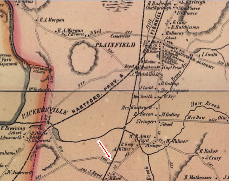
|

|
PLAINFIELD/N [N&W, 1840]
The N&W stop, designated by the '/N', in this village was established in 1840. The first station structure was undoubtedly among the ten "way-depots" the New York Spectator reported the railroad had built on opening, in addition to stations at its northern and southern termini. Specific references in out-of-state newspapers like the Spectator and the Daily National Intelligencer have been found verifying the existence of a station here but no photo has come to our attention. A Courant article in 1852, which tells of the coming of the HP&F, says that the new road will go "to the point of intersection with the Norwich and Worcester Railroad about one mile above the Plainfield Depot..." and thus corroborates a location south of the junction. Our red arrow on the 1856WC map at left points to the most likely spot and the snippet at right from the Google Earth map on Track 11 shows it in 2013. [REFS: NYS/12/16/1840/02; NYS/10/01/1842/01; DNI/11/29/1843/03; HDC/07/03/1852/02] [rev020313]
The N&W stop, designated by the '/N', in this village was established in 1840. The first station structure was undoubtedly among the ten "way-depots" the New York Spectator reported the railroad had built on opening, in addition to stations at its northern and southern termini. Specific references in out-of-state newspapers like the Spectator and the Daily National Intelligencer have been found verifying the existence of a station here but no photo has come to our attention. A Courant article in 1852, which tells of the coming of the HP&F, says that the new road will go "to the point of intersection with the Norwich and Worcester Railroad about one mile above the Plainfield Depot..." and thus corroborates a location south of the junction. Our red arrow on the 1856WC map at left points to the most likely spot and the snippet at right from the Google Earth map on Track 11 shows it in 2013. [REFS: NYS/12/16/1840/02; NYS/10/01/1842/01; DNI/11/29/1843/03; HDC/07/03/1852/02] [rev020313]
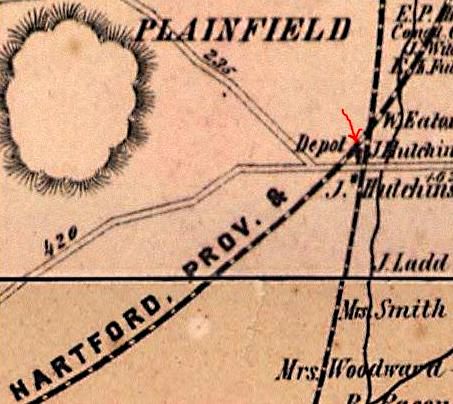
PLAINFIELD/H1 [HP&F, 1854; depot, 1856]
The first station that the HP&F built here was in 1856, just after the railroad opened, along with MOOSUP1 and STERLING1, all three mentioned in the early annual reports. As shown on the 1856WC, the new depot was at the junction where the new road crossed the N&W on the western outskirts of the village. This important junction was brought under the full control of a single company when the HP&F leased the N&W in 1869 and we assume that the earlier N&W depot was then given up and this one at the junction was shared thereafter by both lessor and lessee. While we do not yet know the fate of this depot, it would be replaced in 1881. [REFS: HPFAR6.1855.7; HPFAR7.1856.9; NA/06/03/1868/04][rev020313]
The first station that the HP&F built here was in 1856, just after the railroad opened, along with MOOSUP1 and STERLING1, all three mentioned in the early annual reports. As shown on the 1856WC, the new depot was at the junction where the new road crossed the N&W on the western outskirts of the village. This important junction was brought under the full control of a single company when the HP&F leased the N&W in 1869 and we assume that the earlier N&W depot was then given up and this one at the junction was shared thereafter by both lessor and lessee. While we do not yet know the fate of this depot, it would be replaced in 1881. [REFS: HPFAR6.1855.7; HPFAR7.1856.9; NA/06/03/1868/04][rev020313]

|

|

|
PLAINFIELD/H2 [NY&NE, 1881]
According to NY&NE annual reports recently viewed at the Peters Railroad Museum, a new station was built here in 1881. That important date was previously lacking for what we have to assume is the two-story structure seen in virtually every photograph taken at this junction. We had always thought that this station was too substantial to be built in 1854 when the HP&F opened and we now are inclined to think that similar stations at BALTIC and SOUTH WINDHAM and possibly the one at HOP RIVER also came in the 1880s, not the 1850s. The exact date of the demise of this structure is not yet known. It is not visible in the confrontation scene of the movie It Happened to Jane, filmed on June 28 and 29, 1958. It likely came down in the 1950s, perhaps due to hurricanes of 1955. Passenger service on the N&W was eliminated in 1946 and restored with Budd cars from 1952 to 1971 when Amtrak declined to include the line in its system. This raises the interesting question of what was used as a station during that two-decade period. Perhaps just a small shelter or a waiting room was arranged in the freight house like BRISTOL4. An undated Penn Central property list, likely ca. 1969, shows only a freight house here and the agency was eliminated by them on 12/31/1975 with E.E. Williams, Jr. closing out the job. [REFS: NYNEAR6.1881.19][rev021617]
According to NY&NE annual reports recently viewed at the Peters Railroad Museum, a new station was built here in 1881. That important date was previously lacking for what we have to assume is the two-story structure seen in virtually every photograph taken at this junction. We had always thought that this station was too substantial to be built in 1854 when the HP&F opened and we now are inclined to think that similar stations at BALTIC and SOUTH WINDHAM and possibly the one at HOP RIVER also came in the 1880s, not the 1850s. The exact date of the demise of this structure is not yet known. It is not visible in the confrontation scene of the movie It Happened to Jane, filmed on June 28 and 29, 1958. It likely came down in the 1950s, perhaps due to hurricanes of 1955. Passenger service on the N&W was eliminated in 1946 and restored with Budd cars from 1952 to 1971 when Amtrak declined to include the line in its system. This raises the interesting question of what was used as a station during that two-decade period. Perhaps just a small shelter or a waiting room was arranged in the freight house like BRISTOL4. An undated Penn Central property list, likely ca. 1969, shows only a freight house here and the agency was eliminated by them on 12/31/1975 with E.E. Williams, Jr. closing out the job. [REFS: NYNEAR6.1881.19][rev021617]

Yale University
|
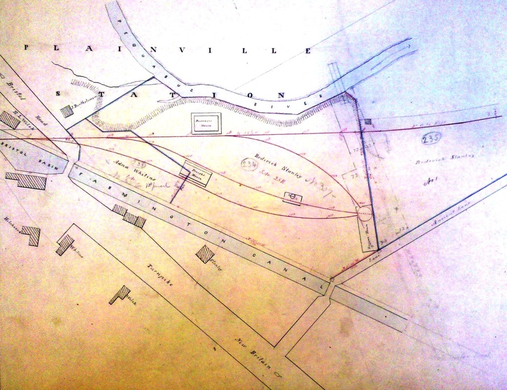
New Haven Museum
|
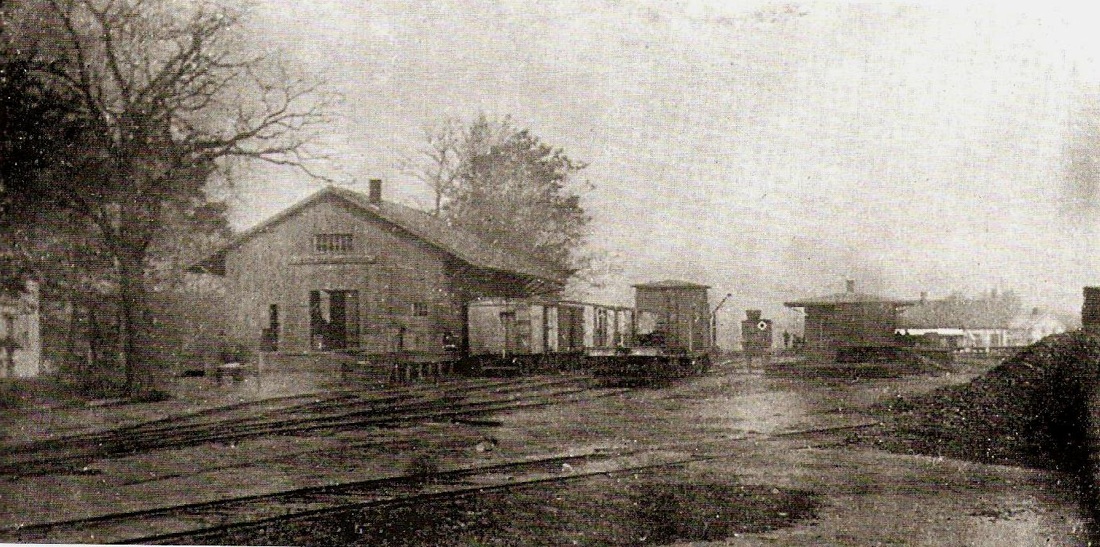
Plainville Historical Society
|
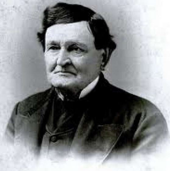 Architect Henry Austin
PLAINVILLE1 [NH&N, 1848]
Built for the Canal line's opening in 1848, this was one of the three depots that were designed by Henry Austin for the NH&N and its lessee, the NY&NH. The others were the grandiose 1848 union station in the Elm City, our NEW HAVEN3, and COLLINSVILLE1 in the town of Canton. PLAINVILLE1 first stood west of the track opposite the freight house. It was moved to the southeast quadrant of the junction created with the coming of the HP&F so it could serve both railroads. The first newspaper timetable we find showing cars from Hartford running to Plainville was placed on 1/7/1850. The design of this station is seen in the Austin drawing at [1]. The smaller rectangle to the right is the 'earth-closet' that served as rest room facilities. The 1848 map at [2] shows the Canal line as well as the namesake waterway it supplanted and the original configuration of the depots and yard. The glass plate at [3] reflects the arrangement in 1853. The passenger station is up at the junction adjacent to the engine house and turntable. The water tank is dead center and the freight house is at middle left. This passenger station was the simplest of the three Austin offerings, having a shallow hipped roof supported by posts all around. The building measured 20x40 feet and the interior was divided into separate waiting rooms for men and women with a vestibule and small office in the middle. Nevertheless, it was a handsome structure and, according to Henry Castle, it was "elaborately furnished, there was a carpet on the floor and the waiting room was supplied with rocking and other easy chairs..." It was also used for fairs and other social events until it was destroyed by fire on 4/20/1859. [REFS: HDC/01/02/1850/02; HTI/01/26/1850/04; HDC/04/30/1859/02; D107; Castle, History of Plainville, p102-103][rev020117, 110420]
Built for the Canal line's opening in 1848, this was one of the three depots that were designed by Henry Austin for the NH&N and its lessee, the NY&NH. The others were the grandiose 1848 union station in the Elm City, our NEW HAVEN3, and COLLINSVILLE1 in the town of Canton. PLAINVILLE1 first stood west of the track opposite the freight house. It was moved to the southeast quadrant of the junction created with the coming of the HP&F so it could serve both railroads. The first newspaper timetable we find showing cars from Hartford running to Plainville was placed on 1/7/1850. The design of this station is seen in the Austin drawing at [1]. The smaller rectangle to the right is the 'earth-closet' that served as rest room facilities. The 1848 map at [2] shows the Canal line as well as the namesake waterway it supplanted and the original configuration of the depots and yard. The glass plate at [3] reflects the arrangement in 1853. The passenger station is up at the junction adjacent to the engine house and turntable. The water tank is dead center and the freight house is at middle left. This passenger station was the simplest of the three Austin offerings, having a shallow hipped roof supported by posts all around. The building measured 20x40 feet and the interior was divided into separate waiting rooms for men and women with a vestibule and small office in the middle. Nevertheless, it was a handsome structure and, according to Henry Castle, it was "elaborately furnished, there was a carpet on the floor and the waiting room was supplied with rocking and other easy chairs..." It was also used for fairs and other social events until it was destroyed by fire on 4/20/1859. [REFS: HDC/01/02/1850/02; HTI/01/26/1850/04; HDC/04/30/1859/02; D107; Castle, History of Plainville, p102-103][rev020117, 110420]
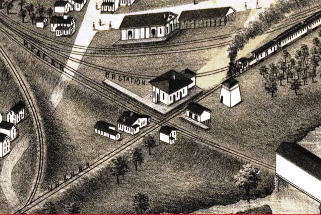
|
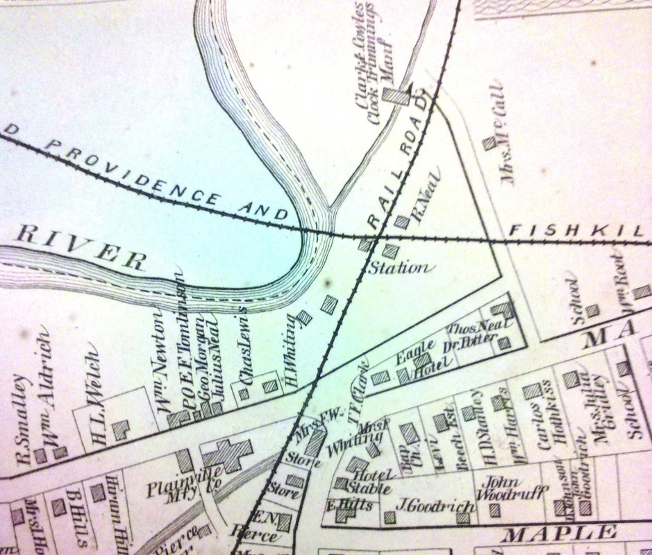
|

|
PLAINVILLE2 [NH&N, 1859]
The newspaper reported in May, 1859 that "the New York and New Haven railroad company are about to erect a new depot in Plainville, on the Canal railroad, in place of the one recently destroyed by fire. It will be similar in style to those on the former road, and will be much more convenient than the old one." Actually, neither of those statements are true. The NY&NH, of course, had leased the NH&N from 1848 until 1869. The snippet at [1] is from the 1878 Bailey bird's-eye map [click here] and shows the new depot looking very much like its predecessor and not like the other Canal line depots. Comparing the images at [1] and [3], we see that the Mr. B. caught the details of the station quite accurately. The train is heading north so the new station is in the southeast quadrant of the junction, same as its predecessor's relocated position. The image at [2] from the 1869 Baker and Tilden atlas of Hartford County confirms the location. A receipt in the R&LHS Collection at the Baker Library shows the HP&F paying $225 per month in 1871 for use of the station, tracks and facilities here, as well as for the services of the Canal line personnel. If the new station was ever deemed 'convenient' by locals, it certainly waned over time. The image at [3] appeared in an 1890s newspaper article that castigated the decaying condition of PLAINVILLE2, this even after refurbishment earlier in the decade. "Left At The Junction: A Study In Railway Architectural Magnificence" went on to call this station "an unequaled antique edifice which is the sepulchre of many wasted hours." Time and space do not allow us to revel in more of the choice words used to describe this aging depot. At one point, it was lamented that this station did not catch fire in 1893 when some nearby buildings did, though the wish came true when this depot, in fact, burned on 7/4/1900, "in a peculiarly mysterious way," connected to Fourth of July festivities. Apparently a bonfire had been built deliberately close and an injunction by the water company did not allow firefighters to douse the blaze. The people got their way! [REFS: HDC/05/13/1859/02: msg; SR/05/27/1859/04; B745 (1871); HDC/11/29/1877/04; NHER/07/04/1900/09; PNE/07/05/1900/00; HC/07/06/1900/12; NHER/07/11/1900/01; BA55.1902.47; D107] [rev020117, 042123]
The newspaper reported in May, 1859 that "the New York and New Haven railroad company are about to erect a new depot in Plainville, on the Canal railroad, in place of the one recently destroyed by fire. It will be similar in style to those on the former road, and will be much more convenient than the old one." Actually, neither of those statements are true. The NY&NH, of course, had leased the NH&N from 1848 until 1869. The snippet at [1] is from the 1878 Bailey bird's-eye map [click here] and shows the new depot looking very much like its predecessor and not like the other Canal line depots. Comparing the images at [1] and [3], we see that the Mr. B. caught the details of the station quite accurately. The train is heading north so the new station is in the southeast quadrant of the junction, same as its predecessor's relocated position. The image at [2] from the 1869 Baker and Tilden atlas of Hartford County confirms the location. A receipt in the R&LHS Collection at the Baker Library shows the HP&F paying $225 per month in 1871 for use of the station, tracks and facilities here, as well as for the services of the Canal line personnel. If the new station was ever deemed 'convenient' by locals, it certainly waned over time. The image at [3] appeared in an 1890s newspaper article that castigated the decaying condition of PLAINVILLE2, this even after refurbishment earlier in the decade. "Left At The Junction: A Study In Railway Architectural Magnificence" went on to call this station "an unequaled antique edifice which is the sepulchre of many wasted hours." Time and space do not allow us to revel in more of the choice words used to describe this aging depot. At one point, it was lamented that this station did not catch fire in 1893 when some nearby buildings did, though the wish came true when this depot, in fact, burned on 7/4/1900, "in a peculiarly mysterious way," connected to Fourth of July festivities. Apparently a bonfire had been built deliberately close and an injunction by the water company did not allow firefighters to douse the blaze. The people got their way! [REFS: HDC/05/13/1859/02: msg; SR/05/27/1859/04; B745 (1871); HDC/11/29/1877/04; NHER/07/04/1900/09; PNE/07/05/1900/00; HC/07/06/1900/12; NHER/07/11/1900/01; BA55.1902.47; D107] [rev020117, 042123]
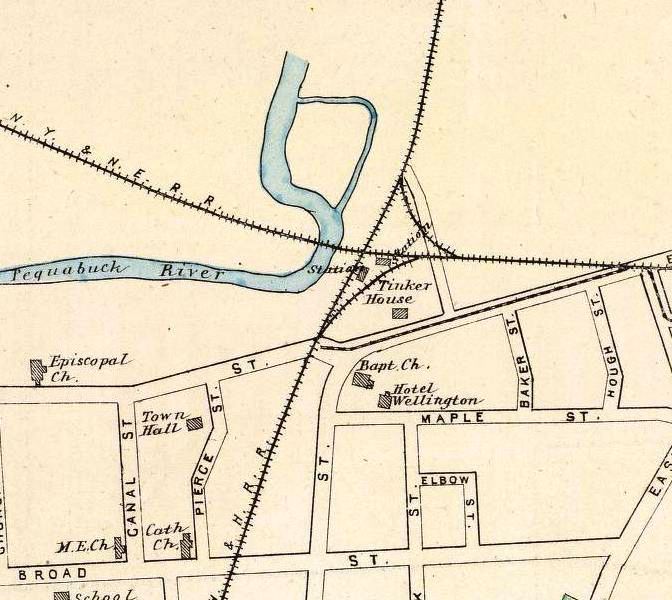
|
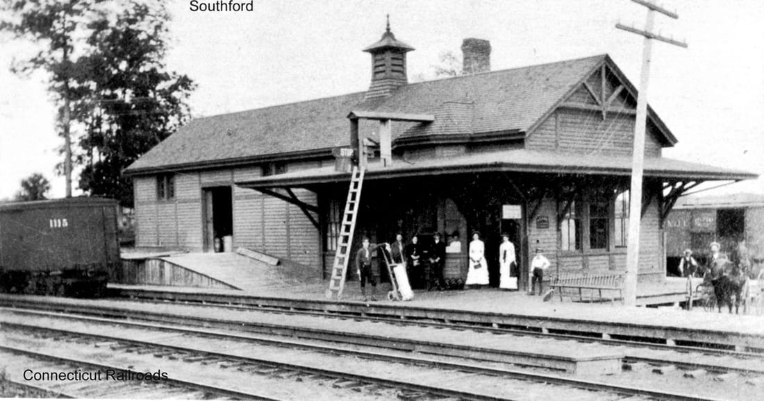
|
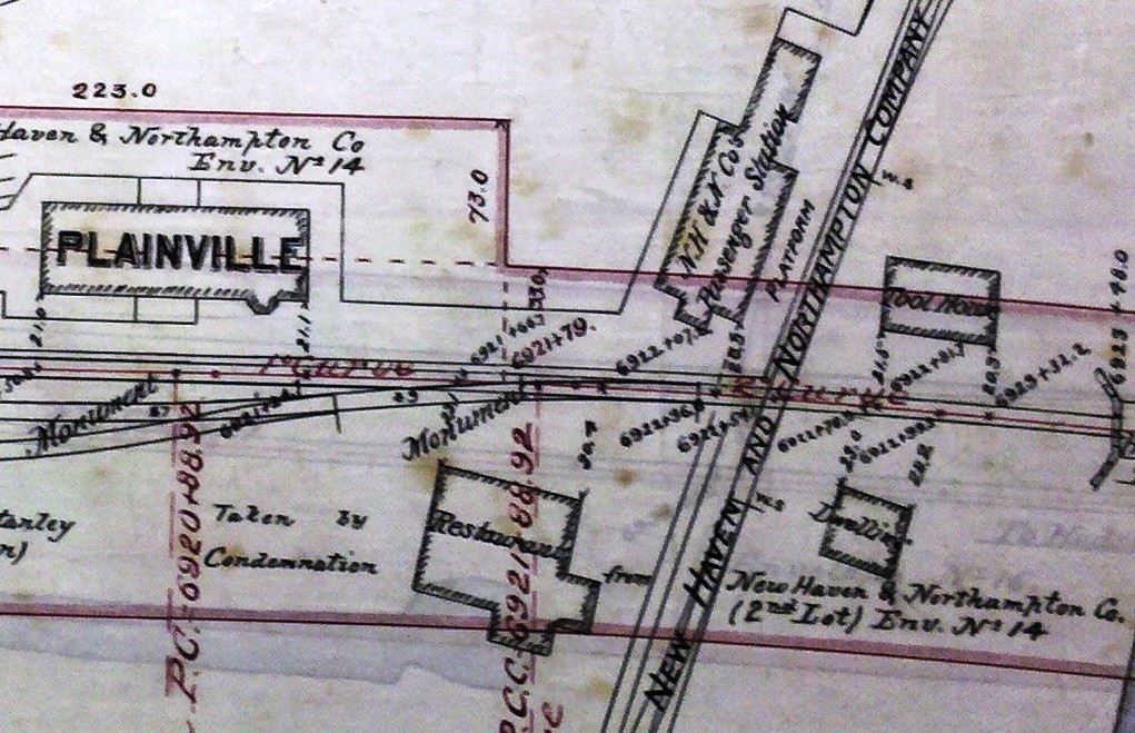
|
PLAINVILLE3 [NY&NE, 1881]
According to an article from an unidentified newspaper, most likely the New Britain Herald, this depot debuted on 6/1/1881. The dating is corroborated by the Courant report on June 10 saying that it had opened last week. The Register had noted in August, 1880 that the NY&NE planned to build a substantial combination station about 200 feet east of PLAINVILLE2 and that it was to be a union depot with the Canal road but "satisfactory arrangements could not be arrived at." The map at [1] is from 1893. The other maps are from an NY&NE real estate atlas that likely dates to the late 1880s. The footprint of the NY&NE depot at [3], a zoom of which is at [4], is the same as other large combination stations along the line and so we have copied the SOUTHBURY photo at [2] here as what PLAINVILLE3 undoubtedly looked like. Most, if not all, of the NY&NE 1881 depots were built by the prolific Hartford contractor, Leman Oatman. The maps show the arrangement of the platforms and buildings that included a restaurant, the two stations forming an L that foreshadowed the next depot. The NYNH&H got stock control of the NY&NE in 1895 and took it over completely in 1898. PLAINVILLE3, being the more expansive of the two structures, likely was retained for use of Highland Division passengers. This structure still stood in 1900 and resisted the July 4 fire that took down PLAINVILLE2. Thereafter it took over duties for both the Canal and Highland lines until PLAINVILLE4 opened. A Courant article of October, 1901 said that PLAINVILLE3 was "being torn down and carted away." [REFS: NHER/08/18/1880/04; NHER/11/02/1880/01; HDC/06/10/1881/04; CRC29.1882.34; HC/10/18/1901/12][rev020117, 042123]
According to an article from an unidentified newspaper, most likely the New Britain Herald, this depot debuted on 6/1/1881. The dating is corroborated by the Courant report on June 10 saying that it had opened last week. The Register had noted in August, 1880 that the NY&NE planned to build a substantial combination station about 200 feet east of PLAINVILLE2 and that it was to be a union depot with the Canal road but "satisfactory arrangements could not be arrived at." The map at [1] is from 1893. The other maps are from an NY&NE real estate atlas that likely dates to the late 1880s. The footprint of the NY&NE depot at [3], a zoom of which is at [4], is the same as other large combination stations along the line and so we have copied the SOUTHBURY photo at [2] here as what PLAINVILLE3 undoubtedly looked like. Most, if not all, of the NY&NE 1881 depots were built by the prolific Hartford contractor, Leman Oatman. The maps show the arrangement of the platforms and buildings that included a restaurant, the two stations forming an L that foreshadowed the next depot. The NYNH&H got stock control of the NY&NE in 1895 and took it over completely in 1898. PLAINVILLE3, being the more expansive of the two structures, likely was retained for use of Highland Division passengers. This structure still stood in 1900 and resisted the July 4 fire that took down PLAINVILLE2. Thereafter it took over duties for both the Canal and Highland lines until PLAINVILLE4 opened. A Courant article of October, 1901 said that PLAINVILLE3 was "being torn down and carted away." [REFS: NHER/08/18/1880/04; NHER/11/02/1880/01; HDC/06/10/1881/04; CRC29.1882.34; HC/10/18/1901/12][rev020117, 042123]

|
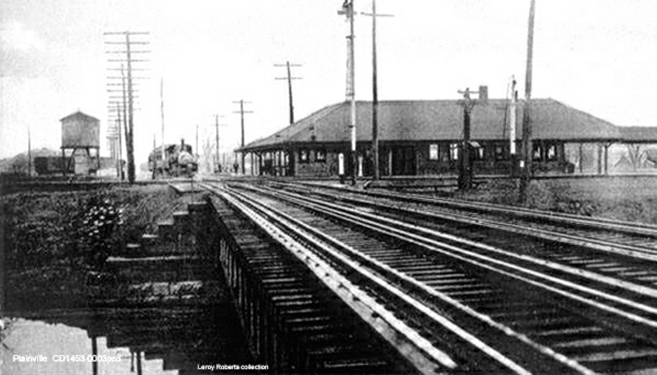
|
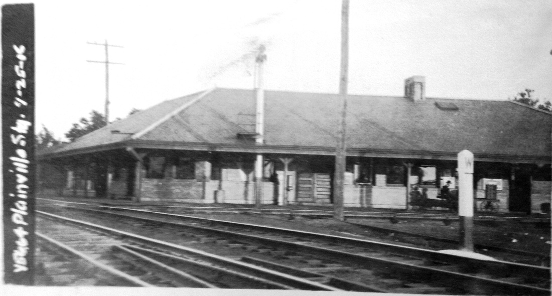
National Archives
|

|

T.J. Donahue photo. Copyright, NHRHTA
|
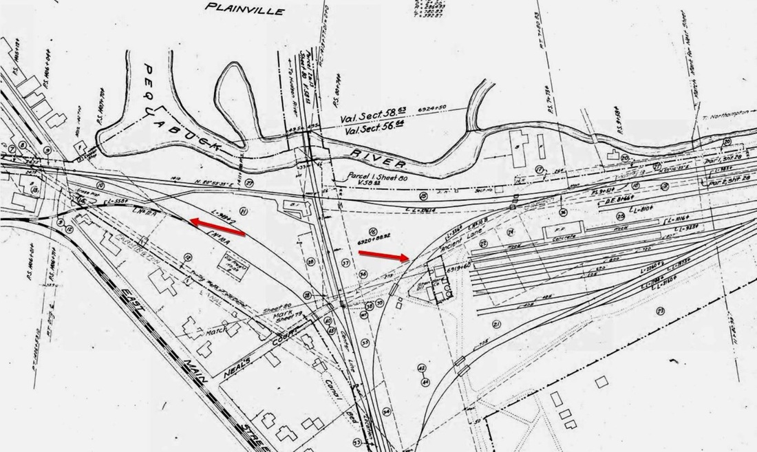
PLAINVILLE4 [NYNH&H, 1901]
With work begun on a replacement as soon as the debris from the fire of 7/4/1900 was cleared, this L-shaped, brick station opened on 10/8/1901, once more in the junction's southeast quadrant, to serve both the Canal line and the Highland Division. The "pretty new depot" was described as being "of cream colored brick, with slate roof, and covered approaches that nearly surround it... The interior is finished in hard wood. The waiting room is large and convenient, with toilet rooms adjoining. An artistic mantel and fireplace occupies a prominent position..." Electricity, steam heat and running water rounded out the attributions. It was razed after almost 90 years of service on 9/11/1989, its final incarnation as a flea market and haven for the homeless. On 6/30/1958, the depot's Hollywood moment came as Doris Day, Jack Lemmon were here for the filming of It Happened to Jane; Ernie Kovacs reportedly was playing cards with members of the film crew all day at the depot while Doris and Jack and Doris were down at MILLDALE2 shooting a scene there.. The evocative postcard view at [1] looks northeast with the bridge over the Pequabuck River to the left on the NY&NE line to Waterbury. A westbound train passes the big water tank in the shot at [2]. The ICC val photo at [3] looks southeast and was taken on 4/25/1916. The southwesterly view at [4] shows the street side of the depot, with passengers on the platform and autos parked in the rear. The shiny new DERS-1 #0664 in [5] is leading a Hartford-Waterbury train west over the Pequabuck River bridge in 1948. The 1915 val map at [6] shows the junction, yards, and a connection to the Conn. Co. trolley line [left arrow]. Also seen is a northeast quadrant track [right arrow], installed by the NYNH&H after it gained stock control of the CNE in 1904, the primary goal being the routing CNE passenger trains through here to Winsted via the New Hartford Branch. This was a busy railroad junction into the 1960s and, capturing some of the action, is an accident log book that we just donated to the Plainville Historical Society [click here]. Kept by the station agent, name still unknown, it records incidents and other operational details during the 1920s and 1930s. It is sure to be of interest to locals and railroaders alike. Dr. J.C. Tanner is mentioned as the on-call physician for the railroad at this station; apparently it was custom on the NYNH&H and many other railroads to have a local doctor designated in case of injury or emergency. [REFS: HC/10/04/1900/10; HC/09/06/1901/12; NBH/10/08/1901/05; HC/10/18/1901/12; HC/10/29/1901/05; SR/10/31/1901/12; CRC49.1901.19; HC/04/26/1904/13; CRC52.1904.22; TSN/07/01/1958/01; HC/09/12/1989/C4; NL10.3.6][rev071716]
PLAINVILLE CAMP STATION [> CAMP STATION/PLAINVILLE]
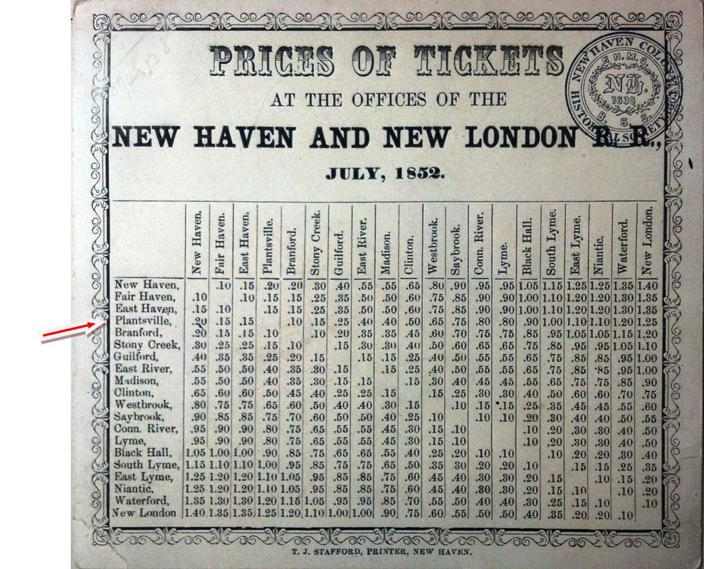
|

|
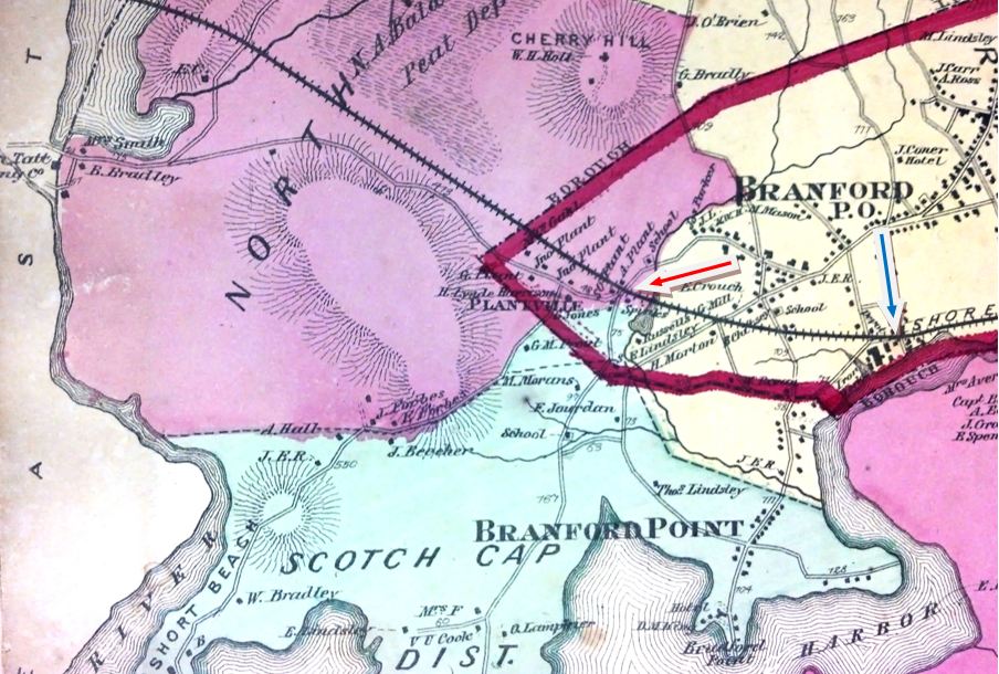
|
PLANTSVILLE/BRANFORD [NH&NL, 1852]
This was a hitherto unknown stop, presumably short-lived, in Branford. The NH&NL opened in July, 1852 and the image at left may be its first timetable. Neither the 1852NH map at middle nor the 1868 Beers map at right show a depot in the village that was just west of the Branford station. What structure stood here, if any, and how long the stop was in use are unknown. It is seen on no other timetable or map. [rev082913]
This was a hitherto unknown stop, presumably short-lived, in Branford. The NH&NL opened in July, 1852 and the image at left may be its first timetable. Neither the 1852NH map at middle nor the 1868 Beers map at right show a depot in the village that was just west of the Branford station. What structure stood here, if any, and how long the stop was in use are unknown. It is seen on no other timetable or map. [rev082913]
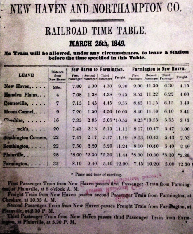
PLANTSVILLE1 [NH&N, 1848; opens as SOUTHINGTON CORNERS]
This station appears on the earliest Canal road timetable we have seen, shown at left, as SOUTHINGTON CORNERS. According to the newspaper, the depot facilities were in the Plant Manufacturing Co., which began making carriage bolts in 1842. A "Great Fire in Plantsville" burned the large wooden factory to the ground in 1859 and also took "the depot of the Canal R.R.... in the building... [though] the contents were mostly saved." The fire, which broke out "in several places at the same time" was thought to be arson. Proprietor A.P. Plant quickly vowed to rebuild and his products would grow thereafter to become nationally known in the next half century. [REFS: CR/02/05/1859/02; HDC/03/11/1859/02]
This station appears on the earliest Canal road timetable we have seen, shown at left, as SOUTHINGTON CORNERS. According to the newspaper, the depot facilities were in the Plant Manufacturing Co., which began making carriage bolts in 1842. A "Great Fire in Plantsville" burned the large wooden factory to the ground in 1859 and also took "the depot of the Canal R.R.... in the building... [though] the contents were mostly saved." The fire, which broke out "in several places at the same time" was thought to be arson. Proprietor A.P. Plant quickly vowed to rebuild and his products would grow thereafter to become nationally known in the next half century. [REFS: CR/02/05/1859/02; HDC/03/11/1859/02]
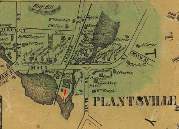
|
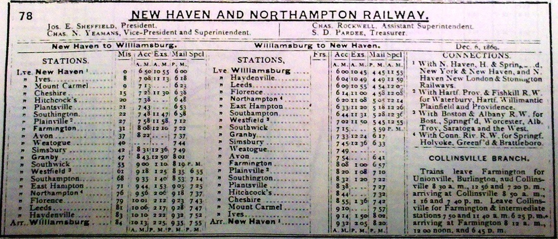
|
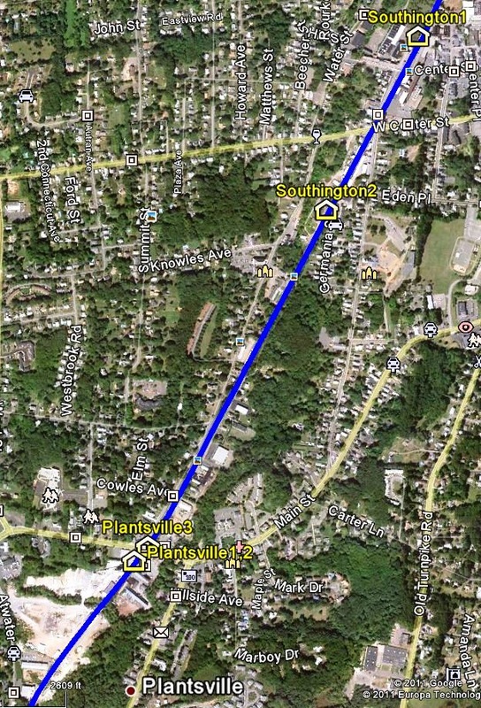
PLANTSVILLE2 [NH&N, 1859]
This station was also at the Plant Manufacturing Co. which was to suffer two more fires, the latter of which was in 1874, when the Columbian Register said "the telegraph office and the Canal railroad depot were located in the factory buildings and, of course, were destroyed." The 1855HC map at [1] shows the footprint of the factory complex. By some odd coincidence, the NH&N was at this very time in the process of trying to eliminate this stop in a series of closures at ALLENS, BROOKS, and MOUNT CARMEL to cut costs and increase profitability. Some suspected that these moves, to the detriment of customers in its home state, were part of an effort to increase its through traffic to Massachusetts and to better compete with the NYNH&H. Ironically, that road, in its former incarnation as the NY&NH when it was leasing the Canal line, was blamed by some for saddling the NH&N with the unprofitable, small stops that now made it less competitive. With HITCHCOCKS, PLANTSVILLE and SOUTHINGTON within three miles of each other, as seen on the 1869TT at [2], this one was thought the logical choice to put on the chopping block, in spite of its considerable traffic in metals which were so much heavier to haul any extra distance. Over vociferous public objection in both communities, the railroad commissioners permitted the abandonment of PLANTSVILLE as well as SOUTHINGTON on the promise of a newer station at an intermediate point. The NH&N then proceeded to build SOUTHINGTON2 at the location indicated on the snippet from our CTTRAXMAP at [3]. With at least one source saying the construction was rushed or done clandestinely, no doubt on account of the impending controversy, the new station opened on 5/6/1874 and trains ceased stopping at PLANTSVILLE2 at that time. With the handsome new brick passenger station in service to complement the new brick freight house, Southington folk quickly accepted its new location and grew less sympathetic to those who had lost their station in the southern part of town. [REFS: DC/01/08/1874/02; CR/01/10/1874/03; RRC8.398 (2/3/1874); HDC/02/05/1874/04; HDC/02/07/1874/01; HDC/02/28/1874/02; HDC/03/25/1874/01; CR/03/28/1874/03; HDC/05/06/1874/04; HDC/05/28/1874/01; HDC/06/10/1874/02; HDC/07/03/1874/01][rev080917, 042523]
This station was also at the Plant Manufacturing Co. which was to suffer two more fires, the latter of which was in 1874, when the Columbian Register said "the telegraph office and the Canal railroad depot were located in the factory buildings and, of course, were destroyed." The 1855HC map at [1] shows the footprint of the factory complex. By some odd coincidence, the NH&N was at this very time in the process of trying to eliminate this stop in a series of closures at ALLENS, BROOKS, and MOUNT CARMEL to cut costs and increase profitability. Some suspected that these moves, to the detriment of customers in its home state, were part of an effort to increase its through traffic to Massachusetts and to better compete with the NYNH&H. Ironically, that road, in its former incarnation as the NY&NH when it was leasing the Canal line, was blamed by some for saddling the NH&N with the unprofitable, small stops that now made it less competitive. With HITCHCOCKS, PLANTSVILLE and SOUTHINGTON within three miles of each other, as seen on the 1869TT at [2], this one was thought the logical choice to put on the chopping block, in spite of its considerable traffic in metals which were so much heavier to haul any extra distance. Over vociferous public objection in both communities, the railroad commissioners permitted the abandonment of PLANTSVILLE as well as SOUTHINGTON on the promise of a newer station at an intermediate point. The NH&N then proceeded to build SOUTHINGTON2 at the location indicated on the snippet from our CTTRAXMAP at [3]. With at least one source saying the construction was rushed or done clandestinely, no doubt on account of the impending controversy, the new station opened on 5/6/1874 and trains ceased stopping at PLANTSVILLE2 at that time. With the handsome new brick passenger station in service to complement the new brick freight house, Southington folk quickly accepted its new location and grew less sympathetic to those who had lost their station in the southern part of town. [REFS: DC/01/08/1874/02; CR/01/10/1874/03; RRC8.398 (2/3/1874); HDC/02/05/1874/04; HDC/02/07/1874/01; HDC/02/28/1874/02; HDC/03/25/1874/01; CR/03/28/1874/03; HDC/05/06/1874/04; HDC/05/28/1874/01; HDC/06/10/1874/02; HDC/07/03/1874/01][rev080917, 042523]
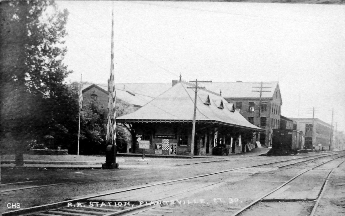
|
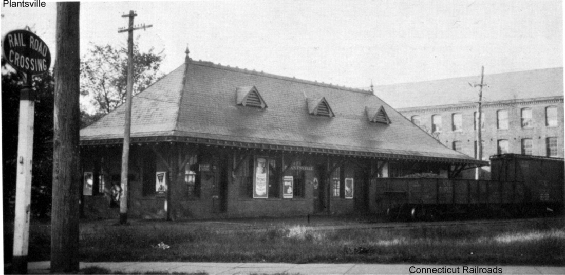
|
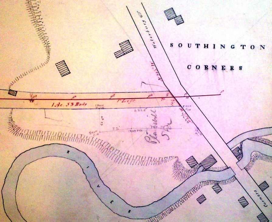
|
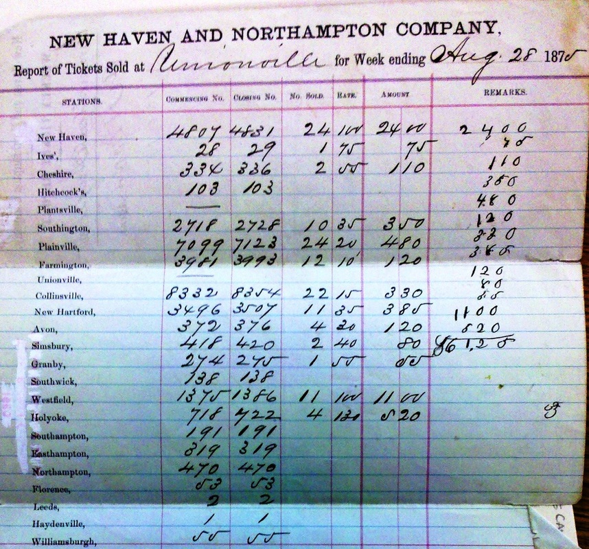
|
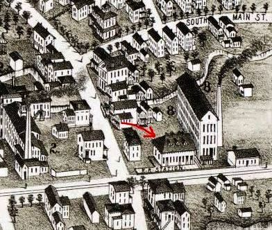
|
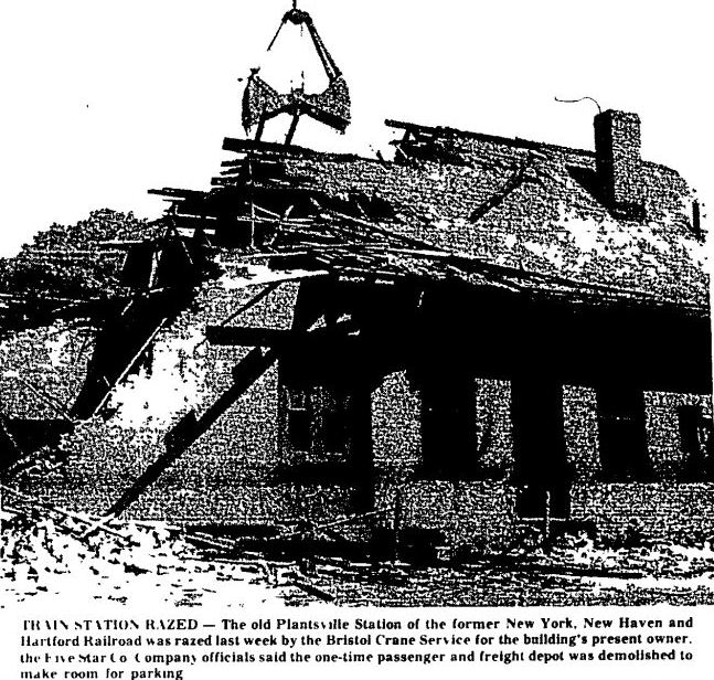
PLANTSVILLE3 [NH&N, 1875]
Of course, the loss of their station was unacceptable to the Plantsville people who, as the Southington Reporter said, began a determined effort to stem the tide of closure for smaller stations everywhere. The cause was carried to the state legislature which passed a law in July, 1875 amending the NH&N charter to read that, if locals provided a depot here within six months, the railroad would have to accept it. Faced with this prospect, the railroad offered to serve the coming new depot if it was built below Plant's pond and if the HITCHCOCKS station was eliminated as part of the deal, but the Plantsville people were not about to sacrifice one station for another. They purchased land and, undeterred by a short-lived injunction, broke ground with the Courant reporting in September of 1875 that the foundation had been laid and that the new station was going up "close by the site of the old one, which was removed by the railroad authorities." The location is pencilled in on the NH&N real estate map at lower left. While construction was in progress, the local paper reported that the work was cheered on by a straw effigy with a cabbage for a head. It wielded a cane pointing at the new depot site and held a placard saying "I gave the land" with a paper inscribed as "Deed - $2500" sticking out of his pocket. Profuse denials were made that any particular railroad magnate was being vilified, but Canal road Pres. Charles Yeamans was the likely target. The image at lower middle is a sales tally from the Unionville station showing no tickets being sold to Plantsville in August, 1875, and it was no surprise that when the new station was "about completed" by the end of November, the railroad refused to take possession of it. Further NH&N foot-dragging led to a ruling in favor of the citizens by the Connecticut Supreme Court of Errors in May, 1876, after which the townspeople were said to be "in a 'high daddy' glee" at the news. PLANTSVILLE3 was festooned with flags and bunting and "all work was suspended [i.e., the factories closed], bells rung and cannon fired" as Canal line trains roared by, still not stopping but soon expected to do so. So elated were the Plantsville people and so divisive had the controversy become, it was reported that "yesterday [Sunday] at church they would not fellowship with Southington folk... [because] they have a depot of their own now, and will neither borrow or lend." It was also said that real estate values skyrocketed, seemingly overnight, based on the prospect of restored rail service. Trains, in fact, would not stop for a while yet and not before the arrest and release of Yeamans and the threat of the same for all the directors. At long last, a brief mention in the Courant on 4/2/1877 said simply that "the trains on the Canal road will stop at Plantsville to-day and hereafter." The NH&N ultimately appealed to the U.S. Supreme Court [click here] which in 1881 affirmed the lower court rulings. While we had previously assumed that the triple-dormered depot in the photos seen above was a NYNH&H, ca. 1900 structure, the 1878 bird's-eye map of Southington [lower right] shows that this in fact was the station built by the residents and given to the railroad in 1875. It seems we can never thank Mr. Bailey enough for preserving these images! PLANTSVILLE3 would retain passenger service with the rest of the Canal line until 1925 and track would be removed in 1987. Rail is still in the ground from Plainville south to the I-84 overpass at Queen St. though service stops well north of that point. PLANTSVILLE3 was demolished sadly and without ceremony late in May, 1970 to make way for parking. According to some recollections, the property owner offered to sell the building to the town for $7,500, his cost to rehabilitate the site, but the town did not go forward on the deal. [REFS: 42 Conn. 57 (1875) and 43 Conn. 351 (1876), both State v. New Haven and Northampton Co.; HDC/05/29/1875/02; SRP/06/18/1875/02; HDC/06/24/1875 /02; HDC/06/30/1875/02; HDC/07/08/1875/02; HDC/07/29/1875/02; HDC/08/13/1875/02; HDC/08/18/1875/02 HDC/09/14/1875/04; HDC/09/22/1875/02; HDC/09/23/1875/02; HDC/09/29/1875/02; SRP/10/01/1875/04; HDC/11/30/1875/02; HDC03/21/1877/02; HDC/03/22/1877/02; HDC/04/02/1877/01; 104 U.S. 1, Railroad Co. v. Hamersly (1881)][rev090213, 042324]
Of course, the loss of their station was unacceptable to the Plantsville people who, as the Southington Reporter said, began a determined effort to stem the tide of closure for smaller stations everywhere. The cause was carried to the state legislature which passed a law in July, 1875 amending the NH&N charter to read that, if locals provided a depot here within six months, the railroad would have to accept it. Faced with this prospect, the railroad offered to serve the coming new depot if it was built below Plant's pond and if the HITCHCOCKS station was eliminated as part of the deal, but the Plantsville people were not about to sacrifice one station for another. They purchased land and, undeterred by a short-lived injunction, broke ground with the Courant reporting in September of 1875 that the foundation had been laid and that the new station was going up "close by the site of the old one, which was removed by the railroad authorities." The location is pencilled in on the NH&N real estate map at lower left. While construction was in progress, the local paper reported that the work was cheered on by a straw effigy with a cabbage for a head. It wielded a cane pointing at the new depot site and held a placard saying "I gave the land" with a paper inscribed as "Deed - $2500" sticking out of his pocket. Profuse denials were made that any particular railroad magnate was being vilified, but Canal road Pres. Charles Yeamans was the likely target. The image at lower middle is a sales tally from the Unionville station showing no tickets being sold to Plantsville in August, 1875, and it was no surprise that when the new station was "about completed" by the end of November, the railroad refused to take possession of it. Further NH&N foot-dragging led to a ruling in favor of the citizens by the Connecticut Supreme Court of Errors in May, 1876, after which the townspeople were said to be "in a 'high daddy' glee" at the news. PLANTSVILLE3 was festooned with flags and bunting and "all work was suspended [i.e., the factories closed], bells rung and cannon fired" as Canal line trains roared by, still not stopping but soon expected to do so. So elated were the Plantsville people and so divisive had the controversy become, it was reported that "yesterday [Sunday] at church they would not fellowship with Southington folk... [because] they have a depot of their own now, and will neither borrow or lend." It was also said that real estate values skyrocketed, seemingly overnight, based on the prospect of restored rail service. Trains, in fact, would not stop for a while yet and not before the arrest and release of Yeamans and the threat of the same for all the directors. At long last, a brief mention in the Courant on 4/2/1877 said simply that "the trains on the Canal road will stop at Plantsville to-day and hereafter." The NH&N ultimately appealed to the U.S. Supreme Court [click here] which in 1881 affirmed the lower court rulings. While we had previously assumed that the triple-dormered depot in the photos seen above was a NYNH&H, ca. 1900 structure, the 1878 bird's-eye map of Southington [lower right] shows that this in fact was the station built by the residents and given to the railroad in 1875. It seems we can never thank Mr. Bailey enough for preserving these images! PLANTSVILLE3 would retain passenger service with the rest of the Canal line until 1925 and track would be removed in 1987. Rail is still in the ground from Plainville south to the I-84 overpass at Queen St. though service stops well north of that point. PLANTSVILLE3 was demolished sadly and without ceremony late in May, 1970 to make way for parking. According to some recollections, the property owner offered to sell the building to the town for $7,500, his cost to rehabilitate the site, but the town did not go forward on the deal. [REFS: 42 Conn. 57 (1875) and 43 Conn. 351 (1876), both State v. New Haven and Northampton Co.; HDC/05/29/1875/02; SRP/06/18/1875/02; HDC/06/24/1875 /02; HDC/06/30/1875/02; HDC/07/08/1875/02; HDC/07/29/1875/02; HDC/08/13/1875/02; HDC/08/18/1875/02 HDC/09/14/1875/04; HDC/09/22/1875/02; HDC/09/23/1875/02; HDC/09/29/1875/02; SRP/10/01/1875/04; HDC/11/30/1875/02; HDC03/21/1877/02; HDC/03/22/1877/02; HDC/04/02/1877/01; 104 U.S. 1, Railroad Co. v. Hamersly (1881)][rev090213, 042324]
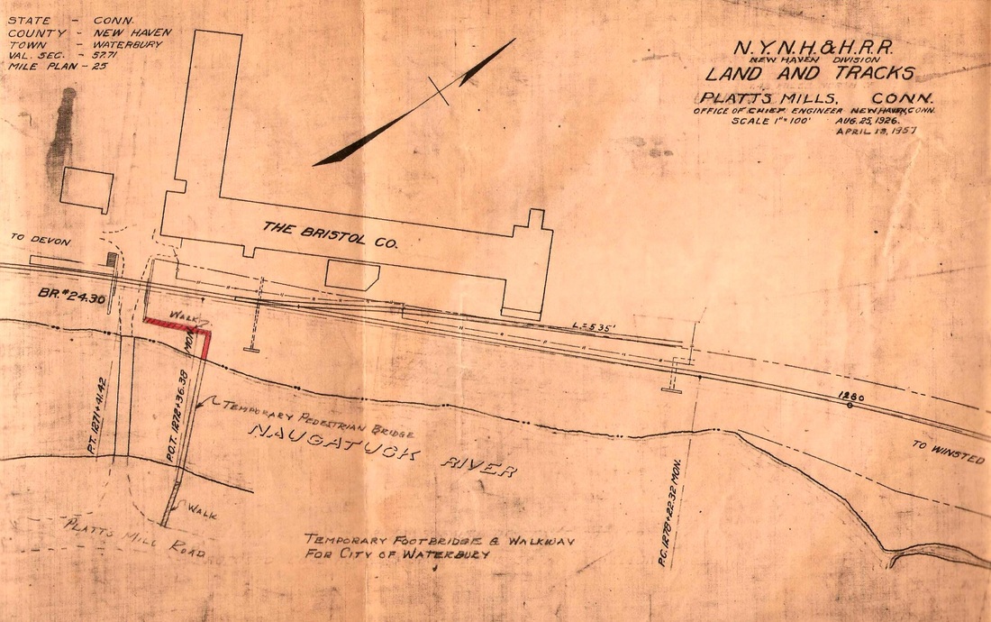
|

|
|
Scripophily.com
|

|

|
PLATTS MILLS [NRR, c1895]
This was an NRR station in Waterbury just above its southern border with Naugatuck. It is not on our 1894 timetable but it does appear by 1902 on railroad commissioners' maps. Although the namesake mills predated the later manufacturing activity here by a half century, the stop was probably established for employees of the Bristol Company which began in 1889 and produced a number of innovative industrial instruments as noted successively in Scientific American. In 1915 Professor Bristol introduced the Bristolphone which synchronized amplified sound with motion picture action. The invention led to the formation of the William H. Bristol Talking Picture Corp. where one of the first full-length motion pictures with sound was created. The facilities here included stages, sets, dressing rooms for actors, camera booths, microphones, control rooms, a theater for the showing of finished films and vaults for storing them. This was not in Hollywood CA but in Waterbury CT! The Bristolphone would soon be utilized in theaters across the U.S. where real sound equipment was installed for the first time. Bristol's Audiophone would be used in public address systems at Yankee Stadium and Grand Central Station. Railroad-wise there was only a platform here as far as we know Seen on the map at [1], it is below the "TO DEVON" in the middle left. Note the dates, the original being 8/25/1926. The 1957 update shows the railroad line having reverted to single track but the platform and steps down to the street still in place, as well as the 535-ft siding that once served the plant and perhaps other local shippers as well. PLATTS MILLS is listed as a freight stop in 1927 and 1944 but is gone by 1965. The card at [2] is dated July, 1917 and shows the bridge over Bristol St, the platform and the stairs in the southwest corner of the overpass. We think the view at [3] is from the same angle and shows a much fancier office building from a later date; the abutment stones in the extreme lower right corner hint of the overpass being there. The image at [4] is a 'specimen' stock certificate. As a flag stop for just a morning train and an evening train, this station seems to have primarily served commuting factory workers. This stop is still listed in 1917 but is gone by the 1923 timetable we have. As with other factory stops it may still have served passengers as a non-timetable stop. The Bristol Co., later Bristol-Babcock and still in business today, closed this factory around 2005. After a fire in 2015, the complex is still standing and the buildings are eerily silent today where music once rocked the film industry. Our 6/12/2010 photo captures the Bristol name and the word 'Recording' in faded letters. Our Track 11 Google Earth map at [6] shows the location. The image at [7] is a 1927 ad for the Bristolphone. [REFS: SAM/04/14/1894/230; HC/03/11/1908/15; rev4/1/1917TT: yes; 12/2/1923TT: no; HC/09/20/1928/02; HC/12/30/1928/E13; HC/05/09/1930/23; HC/06/19/1930/04][rev081913, 021823]
This was an NRR station in Waterbury just above its southern border with Naugatuck. It is not on our 1894 timetable but it does appear by 1902 on railroad commissioners' maps. Although the namesake mills predated the later manufacturing activity here by a half century, the stop was probably established for employees of the Bristol Company which began in 1889 and produced a number of innovative industrial instruments as noted successively in Scientific American. In 1915 Professor Bristol introduced the Bristolphone which synchronized amplified sound with motion picture action. The invention led to the formation of the William H. Bristol Talking Picture Corp. where one of the first full-length motion pictures with sound was created. The facilities here included stages, sets, dressing rooms for actors, camera booths, microphones, control rooms, a theater for the showing of finished films and vaults for storing them. This was not in Hollywood CA but in Waterbury CT! The Bristolphone would soon be utilized in theaters across the U.S. where real sound equipment was installed for the first time. Bristol's Audiophone would be used in public address systems at Yankee Stadium and Grand Central Station. Railroad-wise there was only a platform here as far as we know Seen on the map at [1], it is below the "TO DEVON" in the middle left. Note the dates, the original being 8/25/1926. The 1957 update shows the railroad line having reverted to single track but the platform and steps down to the street still in place, as well as the 535-ft siding that once served the plant and perhaps other local shippers as well. PLATTS MILLS is listed as a freight stop in 1927 and 1944 but is gone by 1965. The card at [2] is dated July, 1917 and shows the bridge over Bristol St, the platform and the stairs in the southwest corner of the overpass. We think the view at [3] is from the same angle and shows a much fancier office building from a later date; the abutment stones in the extreme lower right corner hint of the overpass being there. The image at [4] is a 'specimen' stock certificate. As a flag stop for just a morning train and an evening train, this station seems to have primarily served commuting factory workers. This stop is still listed in 1917 but is gone by the 1923 timetable we have. As with other factory stops it may still have served passengers as a non-timetable stop. The Bristol Co., later Bristol-Babcock and still in business today, closed this factory around 2005. After a fire in 2015, the complex is still standing and the buildings are eerily silent today where music once rocked the film industry. Our 6/12/2010 photo captures the Bristol name and the word 'Recording' in faded letters. Our Track 11 Google Earth map at [6] shows the location. The image at [7] is a 1927 ad for the Bristolphone. [REFS: SAM/04/14/1894/230; HC/03/11/1908/15; rev4/1/1917TT: yes; 12/2/1923TT: no; HC/09/20/1928/02; HC/12/30/1928/E13; HC/05/09/1930/23; HC/06/19/1930/04][rev081913, 021823]
PLYMOUTH [> THOMASTON]
POMFRET/N [> PUTNAM]
POMFRET/N [> PUTNAM]
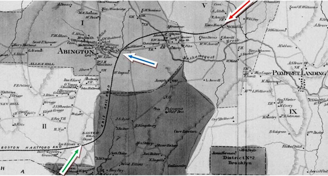
POMFRET1 [BH&E, 1872]
A 5/9/1877 letter to the NY&NE after the railroad commissioners' semi-annual inspection says that they noted with pleasure "the proposed erection of stations at POMFRET, ABINGTON and ELLIOTTS. Since we would find it hard to believe that there was no station structure here for the first five years of railroad service, we think that there may have been something minimal like the 8x8-ft shanty at HAMPTON that the commissioners had noted more than once needed upgrading and, hence, they were applauding the plan to put up a real depot here as well. Local lore acknowledges no such early structure so there may have only a gravel or wooden platform. The 1869 map already shows the route of the BH&E which was not to open for three years. The arrows point to the locations where stations would stand at POMFRET (red), ABINGTON (blue) and ELLIOTTS (green), the latter already with 'Depot' on the map. [REFS: RRC8.388 (10/27/1873); RRC26.3 (1/5/1876)][rev121613; 052120]
A 5/9/1877 letter to the NY&NE after the railroad commissioners' semi-annual inspection says that they noted with pleasure "the proposed erection of stations at POMFRET, ABINGTON and ELLIOTTS. Since we would find it hard to believe that there was no station structure here for the first five years of railroad service, we think that there may have been something minimal like the 8x8-ft shanty at HAMPTON that the commissioners had noted more than once needed upgrading and, hence, they were applauding the plan to put up a real depot here as well. Local lore acknowledges no such early structure so there may have only a gravel or wooden platform. The 1869 map already shows the route of the BH&E which was not to open for three years. The arrows point to the locations where stations would stand at POMFRET (red), ABINGTON (blue) and ELLIOTTS (green), the latter already with 'Depot' on the map. [REFS: RRC8.388 (10/27/1873); RRC26.3 (1/5/1876)][rev121613; 052120]
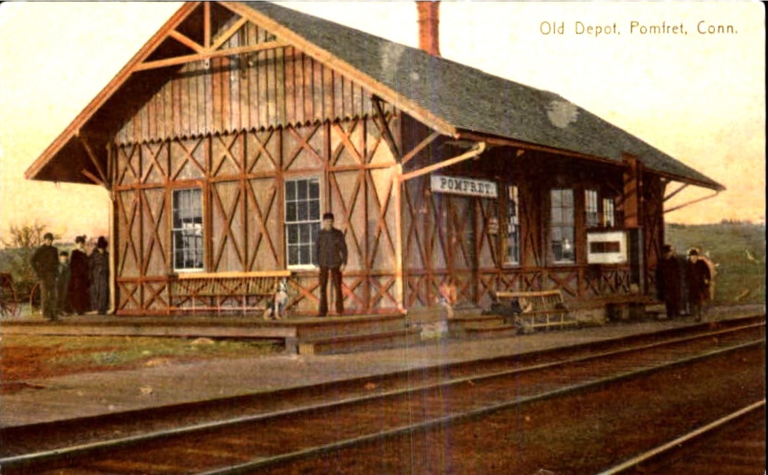
|
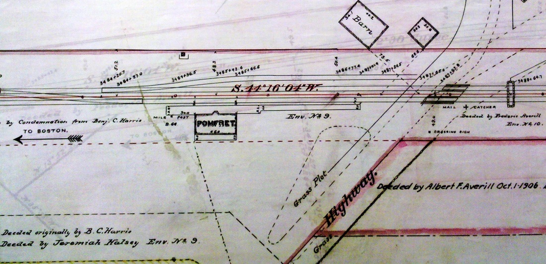
UConn Archives & Spec. Colls.
|
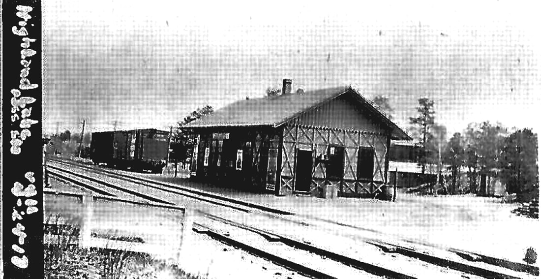
|
 Pomfret School Archives
POMFRET2 [NY&NE, 1877]
The postcard at left [1] shows this structure as the 'Old Depot' here. It must be the NY&NE's "proposed erection" that the railroad commissioners refer to in the letter cited above. The 1890 real estate map at [2] shows its location on the north side of the track at the end of Railroad St. The highway to the east is Pomfret Street, today's U.S. 44 and Conn. 169. This is the only place in the state where we have come across this 'stick style' depot but it has been seen at another NY&NE station in Highland Lakes, Mass., as shown at [3]. While this fact never impressed us in the past, we are learning that this special location may have elicited this architectural uniqueness. An 1899 Courant article described this structure as ... "The pretty depot on the New York & New England Road..." used by the wealthy who summered here from Boston, New York and Washington. With the "millionaire mansions" along Pomfret Street, this was one busy place, at least in high season. The prestigious Pomfret School was established in 1894 and thrives today. Gen. Putnam and the famed Wolf Den add to the historical significance of the town in the northeast corner of the state. This depot served for three decades before it fell victim to fire. A 2/24/1905 newspaper article said: "POMFRET (CT.) DEPOT BURNED. The New York, New Haven and Hartford railroad station at Pomfret, Ct., was totally destroyed by fire about 1 yesterday morning, and considerable freight and express matter was burned. The fire was not discovered until it was almost out, a passing train giving the alarm. The origin of the fire is not known." The Modern History of Windham County gives 2/22/1905 as the date of the fire. [REFS: HC/06/14/1899/06; NHER/02/24/1905/04; SR/02/24/1905/03; MHWC2.1542][rev071613; 052120]
The postcard at left [1] shows this structure as the 'Old Depot' here. It must be the NY&NE's "proposed erection" that the railroad commissioners refer to in the letter cited above. The 1890 real estate map at [2] shows its location on the north side of the track at the end of Railroad St. The highway to the east is Pomfret Street, today's U.S. 44 and Conn. 169. This is the only place in the state where we have come across this 'stick style' depot but it has been seen at another NY&NE station in Highland Lakes, Mass., as shown at [3]. While this fact never impressed us in the past, we are learning that this special location may have elicited this architectural uniqueness. An 1899 Courant article described this structure as ... "The pretty depot on the New York & New England Road..." used by the wealthy who summered here from Boston, New York and Washington. With the "millionaire mansions" along Pomfret Street, this was one busy place, at least in high season. The prestigious Pomfret School was established in 1894 and thrives today. Gen. Putnam and the famed Wolf Den add to the historical significance of the town in the northeast corner of the state. This depot served for three decades before it fell victim to fire. A 2/24/1905 newspaper article said: "POMFRET (CT.) DEPOT BURNED. The New York, New Haven and Hartford railroad station at Pomfret, Ct., was totally destroyed by fire about 1 yesterday morning, and considerable freight and express matter was burned. The fire was not discovered until it was almost out, a passing train giving the alarm. The origin of the fire is not known." The Modern History of Windham County gives 2/22/1905 as the date of the fire. [REFS: HC/06/14/1899/06; NHER/02/24/1905/04; SR/02/24/1905/03; MHWC2.1542][rev071613; 052120]

|
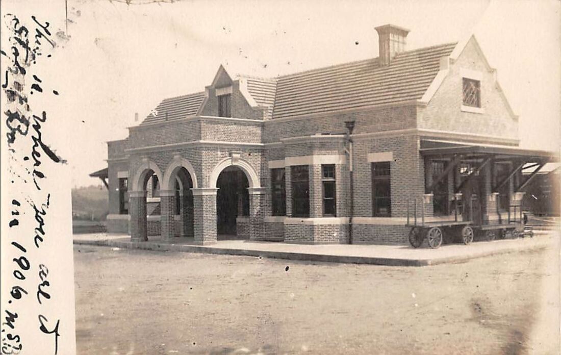
|
|
|
Max Miller Collection
|
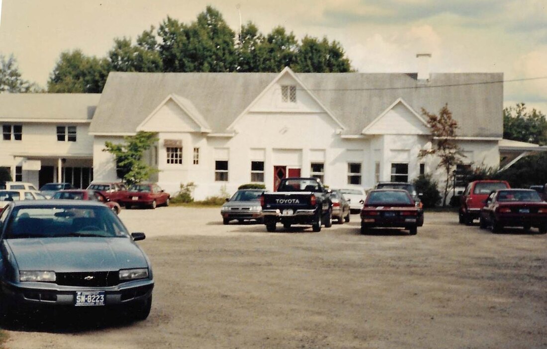
Pomfret Historical Society Archives
|
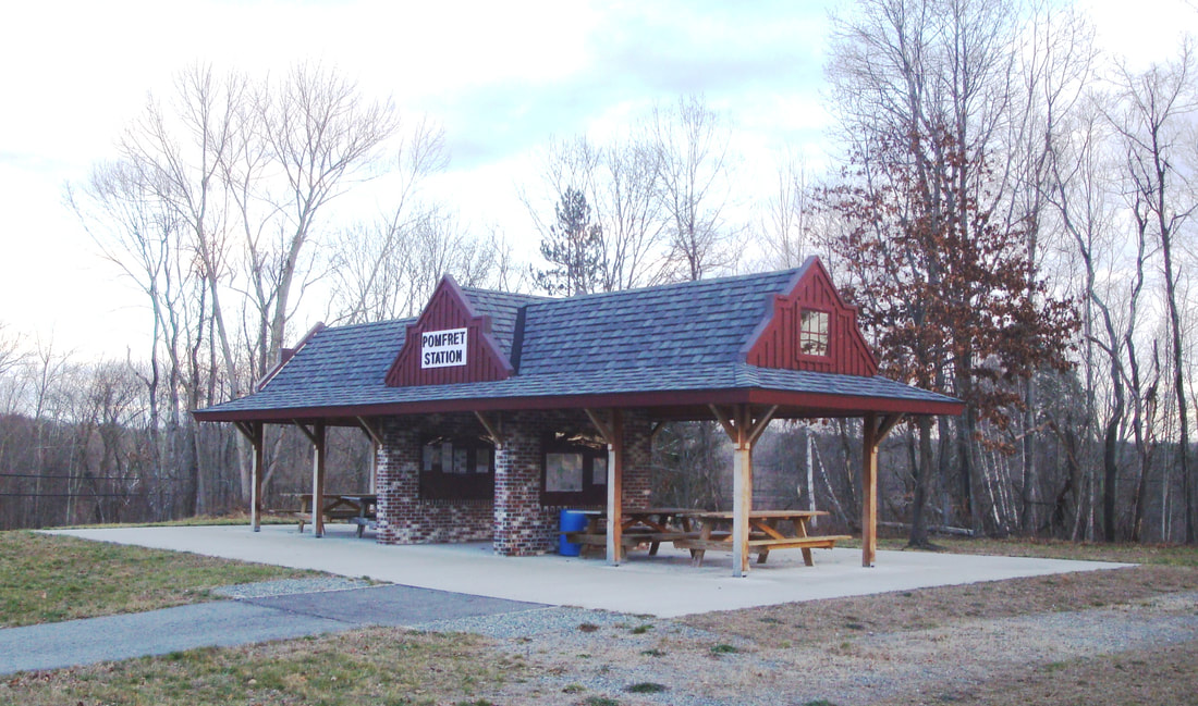
POMFRET3 [NYNH&H, 1906]
An August, 1905 Courant article said the NYNH&H had begun work on a new station here to replace the one that burned in February. It said that the "handsome" new one would be 85 feet long and cost about $18,000. Other sources add details and tell us that sizeable new station was constructed of Harvard brick by Hartford contractor William Patterson at a cost of $16,019 and that it measured 82x25 feet. Patterson, by the way, was working on the larger PUTNAM4 simultaneously which, similar in appearance, handled far more traffic at the junction of the N&W and NY&NE lines. The photo at [1] looks north and shows the intricate stone facade. The baggage room was in the west end of the building and express was handled at the other end. There was a large waiting room furnished with a hearth inscribed with NYNH&H RR, and six settees, separate water closets for men and women and the agent's office in the bay. We have always wondered about the elegance of this depot at what was otherwise a lightly patronized stop. According to town historian Walter Hinchman, the story is that, when the "pretty little" POMFRET2 burned down, Mrs. T. Morris Murray (Eleanor Vinton Clark) donated funds for a grander edifice. While there is no written record of this transaction, wealth was not an issue. She and her husband owned properties in Boston and New York and their 200-acre estate Elsinore here was home to a flock of peacocks and she rented an elephant in the summers to amuse her grandchildren! The railroad commissioners say without elaboration in their December-issued, 1905 annual report that "a new passenger station is also being erected at Pomfret in the place of one which burned..." and the December, 1906 report says that it has been completed, which we figure took place early in 1906. The card at [2], postmarked 9/24/1906, must be right after the opening. It shows that the street-side entrance was graced with a porte cochere. The 6/8/1917 ICC valuation photo at [3] looks east with the new freight house in the foreground. The ICC valuation map at [4] shows the station layout in 1915. The 9/18/1928 PUC photo at [5] shows the bridge that eliminated the dangerous Pomfret Street grade crossing as a part of the new station project in 1906. Passenger service ended after the floods of 1955 and freight abandonment came 10 years later. A 3/23/1962 report to Gov. Dempsey concerning closed railroad structures in the state said the station building and land had been sold. The structure went on to be used in 1965 by The Communicators, a group that produced commercial and educational films, with the Community Health and Home Care Agency sharing the building in 1979. The 1960s shot at [6] shows a wing added on the west end and other architectural changes that considerably reduced the beauty and symmetry of the original building. POMFRET3 burned on 10/27/2000 and was torn down shortly thereafter. A facsimile structure opened ten years later on 10/09/2010 and serves as a pavilion for Air Line Rail Trail patrons. [REFS: CRC53.1905.28; SR/08/10/1905/11; CRC54.1906.35; NHAR36.1907.5: new freight house only!; HC/07/20/1966/13B; HC/04/13/1979/E36; NBU/10/09/2010/00; R308: 10/27/2010][rev010518, 052120]
An August, 1905 Courant article said the NYNH&H had begun work on a new station here to replace the one that burned in February. It said that the "handsome" new one would be 85 feet long and cost about $18,000. Other sources add details and tell us that sizeable new station was constructed of Harvard brick by Hartford contractor William Patterson at a cost of $16,019 and that it measured 82x25 feet. Patterson, by the way, was working on the larger PUTNAM4 simultaneously which, similar in appearance, handled far more traffic at the junction of the N&W and NY&NE lines. The photo at [1] looks north and shows the intricate stone facade. The baggage room was in the west end of the building and express was handled at the other end. There was a large waiting room furnished with a hearth inscribed with NYNH&H RR, and six settees, separate water closets for men and women and the agent's office in the bay. We have always wondered about the elegance of this depot at what was otherwise a lightly patronized stop. According to town historian Walter Hinchman, the story is that, when the "pretty little" POMFRET2 burned down, Mrs. T. Morris Murray (Eleanor Vinton Clark) donated funds for a grander edifice. While there is no written record of this transaction, wealth was not an issue. She and her husband owned properties in Boston and New York and their 200-acre estate Elsinore here was home to a flock of peacocks and she rented an elephant in the summers to amuse her grandchildren! The railroad commissioners say without elaboration in their December-issued, 1905 annual report that "a new passenger station is also being erected at Pomfret in the place of one which burned..." and the December, 1906 report says that it has been completed, which we figure took place early in 1906. The card at [2], postmarked 9/24/1906, must be right after the opening. It shows that the street-side entrance was graced with a porte cochere. The 6/8/1917 ICC valuation photo at [3] looks east with the new freight house in the foreground. The ICC valuation map at [4] shows the station layout in 1915. The 9/18/1928 PUC photo at [5] shows the bridge that eliminated the dangerous Pomfret Street grade crossing as a part of the new station project in 1906. Passenger service ended after the floods of 1955 and freight abandonment came 10 years later. A 3/23/1962 report to Gov. Dempsey concerning closed railroad structures in the state said the station building and land had been sold. The structure went on to be used in 1965 by The Communicators, a group that produced commercial and educational films, with the Community Health and Home Care Agency sharing the building in 1979. The 1960s shot at [6] shows a wing added on the west end and other architectural changes that considerably reduced the beauty and symmetry of the original building. POMFRET3 burned on 10/27/2000 and was torn down shortly thereafter. A facsimile structure opened ten years later on 10/09/2010 and serves as a pavilion for Air Line Rail Trail patrons. [REFS: CRC53.1905.28; SR/08/10/1905/11; CRC54.1906.35; NHAR36.1907.5: new freight house only!; HC/07/20/1966/13B; HC/04/13/1979/E36; NBU/10/09/2010/00; R308: 10/27/2010][rev010518, 052120]
POMPERAUG VALLEY [> SOUTHBURY]
PONEMAH MILLS [> TAFTS]
PONEMAH MILLS [> TAFTS]

POQUETANUCK [NYNH&H, c1920?]
We don't know much about this stop yet but it appears on this ca. 1920 NYNH&H system map. Whether it actually qualifies as a passenger station is yet to be determined. [rev123114]
We don't know much about this stop yet but it appears on this ca. 1920 NYNH&H system map. Whether it actually qualifies as a passenger station is yet to be determined. [rev123114]
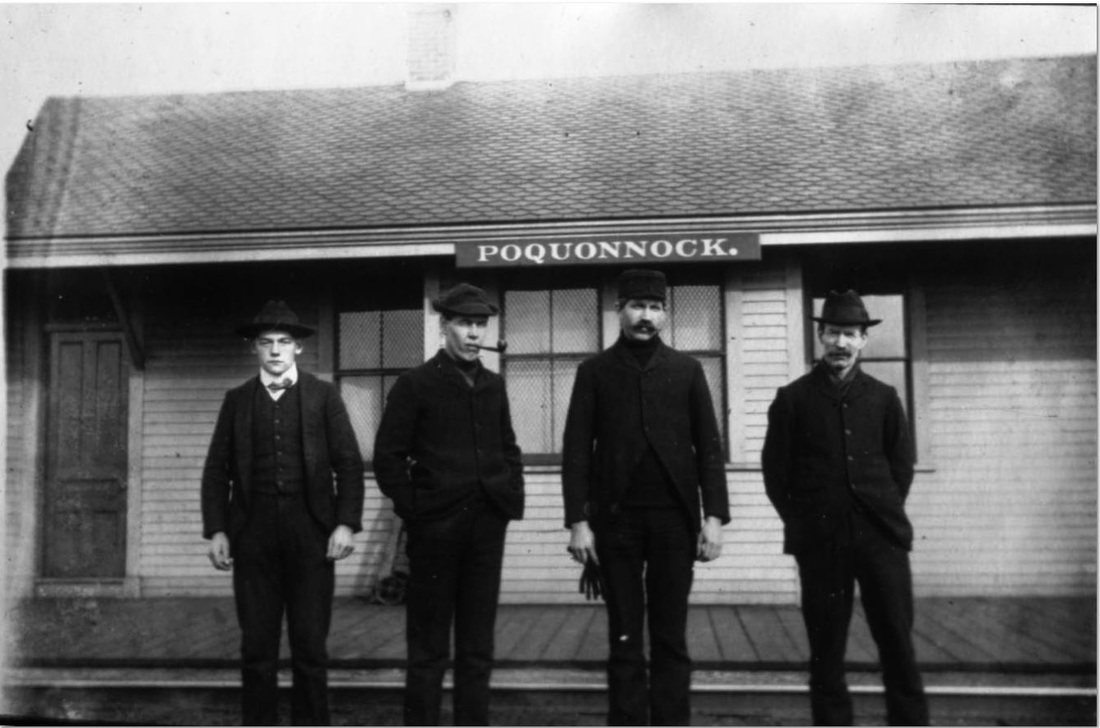
|
|
|
POQUONNOCK1 [NL&S, 1858]
This stop in the town of Groton was established in 1858 when the NL&S opened from Stonington Jct. to Groton Bank. The village was named for the river that empties into Long Island Sound to the south, the community of Poquonnock Bridge located where the river was crossed to the north of the railroad. The rare photo at [1] shows the early station as POQUONNOCK, though the name is spelled variously on different timetables and maps. The 1860 map at [2] shows the stop to be three miles east of New London and that distance is corroborated by the 1866 timetable at [3], which labels the stop as POQUONNOCK S. (for Station). In 1889 trackage was built from just east of this station to the first Thames River bridge. All passenger traffic was transferred thereafter to the new main line at a point that became known as Poquonnock Switch. At that time either the old POQUONNOCK station was moved up or a new station was built, west of Depot Rd on the east bank of the river. The red arrow on the 1893 Hurd map at [4] shows where we think the station first stood along the original 1858 line. Esteemed local historian Carol Kimball may be correct in saying the depot stood east of the river, but old maps show no road leading down on that side. As to the fate of the older station, Kimball tells us that it burned on 12/19/1900. A 5:00 a.m. train noticed the roof ablaze, probably sparked by the previous passage of a train. The crew stopped and helped agent Nelson Morgan rescue ledgers, tickets and furniture but the depot burned to the ground. Loss: $1500. Most of these details are corroborated in a Register article. Later that day, she continues, a gang from Groton built a chimney on the nearby freight house for use as a temporary passenger station until a new one could be built. [REFS: NHER/12/20/1900/03; CRC49.1901.19; Kimball, The Poquonnock Bridge Story, p59,63][rev121216]
This stop in the town of Groton was established in 1858 when the NL&S opened from Stonington Jct. to Groton Bank. The village was named for the river that empties into Long Island Sound to the south, the community of Poquonnock Bridge located where the river was crossed to the north of the railroad. The rare photo at [1] shows the early station as POQUONNOCK, though the name is spelled variously on different timetables and maps. The 1860 map at [2] shows the stop to be three miles east of New London and that distance is corroborated by the 1866 timetable at [3], which labels the stop as POQUONNOCK S. (for Station). In 1889 trackage was built from just east of this station to the first Thames River bridge. All passenger traffic was transferred thereafter to the new main line at a point that became known as Poquonnock Switch. At that time either the old POQUONNOCK station was moved up or a new station was built, west of Depot Rd on the east bank of the river. The red arrow on the 1893 Hurd map at [4] shows where we think the station first stood along the original 1858 line. Esteemed local historian Carol Kimball may be correct in saying the depot stood east of the river, but old maps show no road leading down on that side. As to the fate of the older station, Kimball tells us that it burned on 12/19/1900. A 5:00 a.m. train noticed the roof ablaze, probably sparked by the previous passage of a train. The crew stopped and helped agent Nelson Morgan rescue ledgers, tickets and furniture but the depot burned to the ground. Loss: $1500. Most of these details are corroborated in a Register article. Later that day, she continues, a gang from Groton built a chimney on the nearby freight house for use as a temporary passenger station until a new one could be built. [REFS: NHER/12/20/1900/03; CRC49.1901.19; Kimball, The Poquonnock Bridge Story, p59,63][rev121216]
|
|
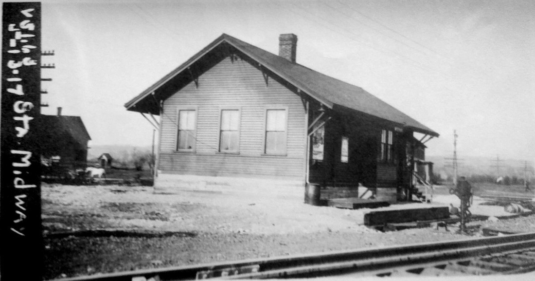
|
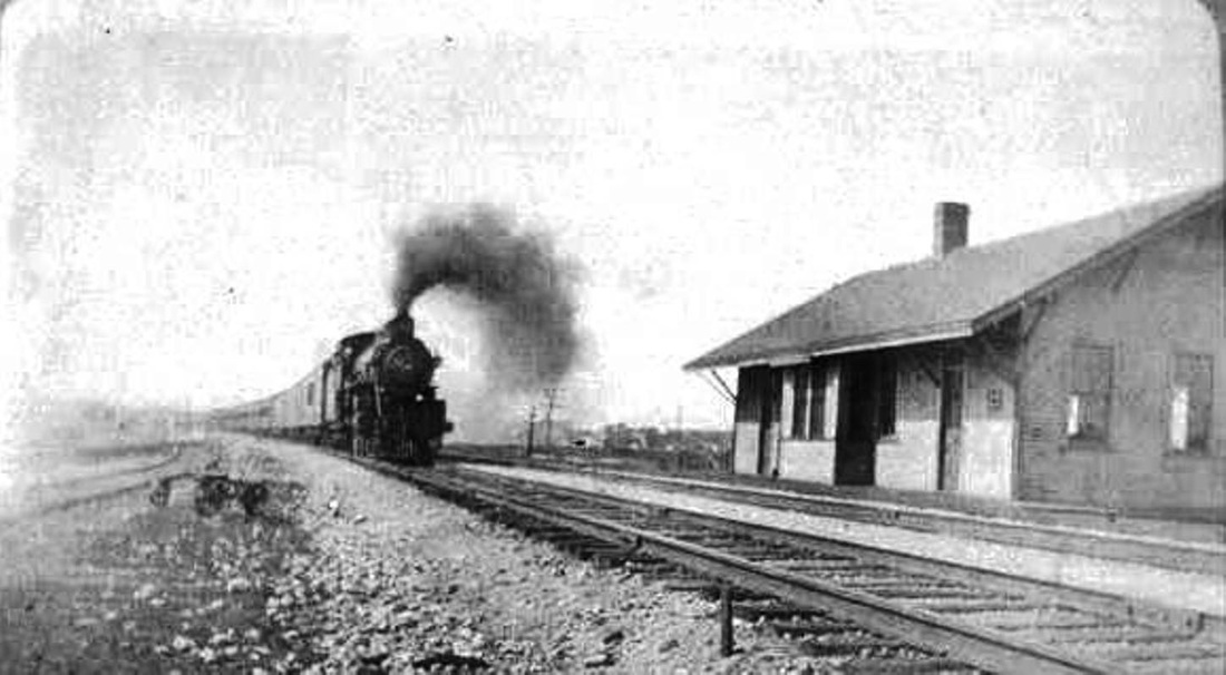
|

|
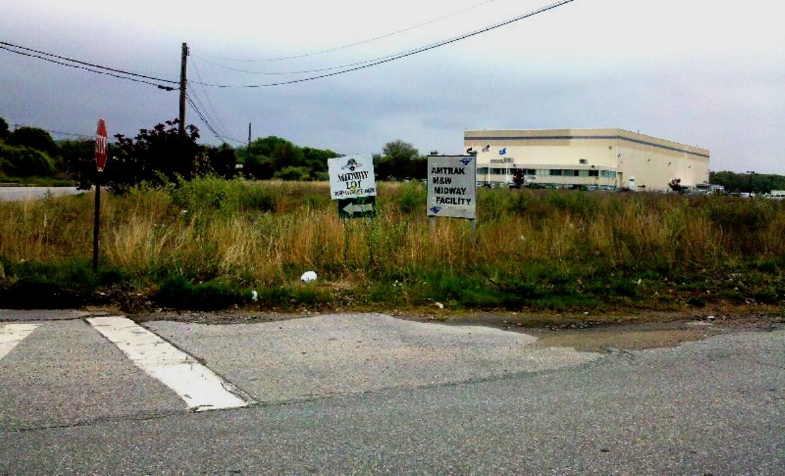
|

POQUONNOCK2 [NYNH&H, 1901]
According to the railroad commissioners, this depot was built in 1901 to replace the earlier one that had burned. They also reported that an extensive icing plant was put up at this time, a forerunner of the expansion of facilities to come. The image at [1] says correctly that the name was changed to MIDWAY after 10/28/1902. In fact, the renaming occurred in December, 1904 when the NYNH&H completed a major freight yard and engine facility at this half-way point between Boston and New York. MIDWAY station is seen at [2] on the north side of the tracks and east of Depot Rd. with the railroad hotel behind it. The ICC valuation photo at [3] is dated 5/13/1917. The station site today is where the electrical box [4] is along the NEC main. Today, an Amtrak maintenance plant occupies some of the land and some has been sold off for residential development, with telling street names like Midway Oval [6]. The undated map sheet at [7] shows the station west of the village road. A 1935 map in Ed Ozog's 1981 Shoreliner article [p18] shows the station on the west side of the road. According to a New London Day article of January, 1917, the station was being moved at that time as part of an expansion of tracks and facilities. According to Carol Kimball, the depot was jacked up and moved eastward across Depot Rd., workers accessing the structure with a 12-ft ladder while it was up in the air. Kimball says further that the MIDWAY station was boarded up early in 1926 due to declining passenger traffic and it was "later taken down." A 1939 Day article was headlined "Midway Yard Now in Hands of Wreckers" and so progress made by electrification in the West End had made this steam-era 'midway' stop a thing of the past. [REFS: 1858TT; 1871TT; CRC49.1901.19; CRC51.1903.20; NHAR33.1904.6; HC/12/02/1904/02; NHAR34.1905.7; NLD/01/15/1917/08; NLD/07/16/1917/08; NLD/02/04/1939/09; SL12.2.15; NL10.1.10; C171; Kimball, The Poquonnock Bridge Story, p76,77][rev121216, 042523]
According to the railroad commissioners, this depot was built in 1901 to replace the earlier one that had burned. They also reported that an extensive icing plant was put up at this time, a forerunner of the expansion of facilities to come. The image at [1] says correctly that the name was changed to MIDWAY after 10/28/1902. In fact, the renaming occurred in December, 1904 when the NYNH&H completed a major freight yard and engine facility at this half-way point between Boston and New York. MIDWAY station is seen at [2] on the north side of the tracks and east of Depot Rd. with the railroad hotel behind it. The ICC valuation photo at [3] is dated 5/13/1917. The station site today is where the electrical box [4] is along the NEC main. Today, an Amtrak maintenance plant occupies some of the land and some has been sold off for residential development, with telling street names like Midway Oval [6]. The undated map sheet at [7] shows the station west of the village road. A 1935 map in Ed Ozog's 1981 Shoreliner article [p18] shows the station on the west side of the road. According to a New London Day article of January, 1917, the station was being moved at that time as part of an expansion of tracks and facilities. According to Carol Kimball, the depot was jacked up and moved eastward across Depot Rd., workers accessing the structure with a 12-ft ladder while it was up in the air. Kimball says further that the MIDWAY station was boarded up early in 1926 due to declining passenger traffic and it was "later taken down." A 1939 Day article was headlined "Midway Yard Now in Hands of Wreckers" and so progress made by electrification in the West End had made this steam-era 'midway' stop a thing of the past. [REFS: 1858TT; 1871TT; CRC49.1901.19; CRC51.1903.20; NHAR33.1904.6; HC/12/02/1904/02; NHAR34.1905.7; NLD/01/15/1917/08; NLD/07/16/1917/08; NLD/02/04/1939/09; SL12.2.15; NL10.1.10; C171; Kimball, The Poquonnock Bridge Story, p76,77][rev121216, 042523]

|

|
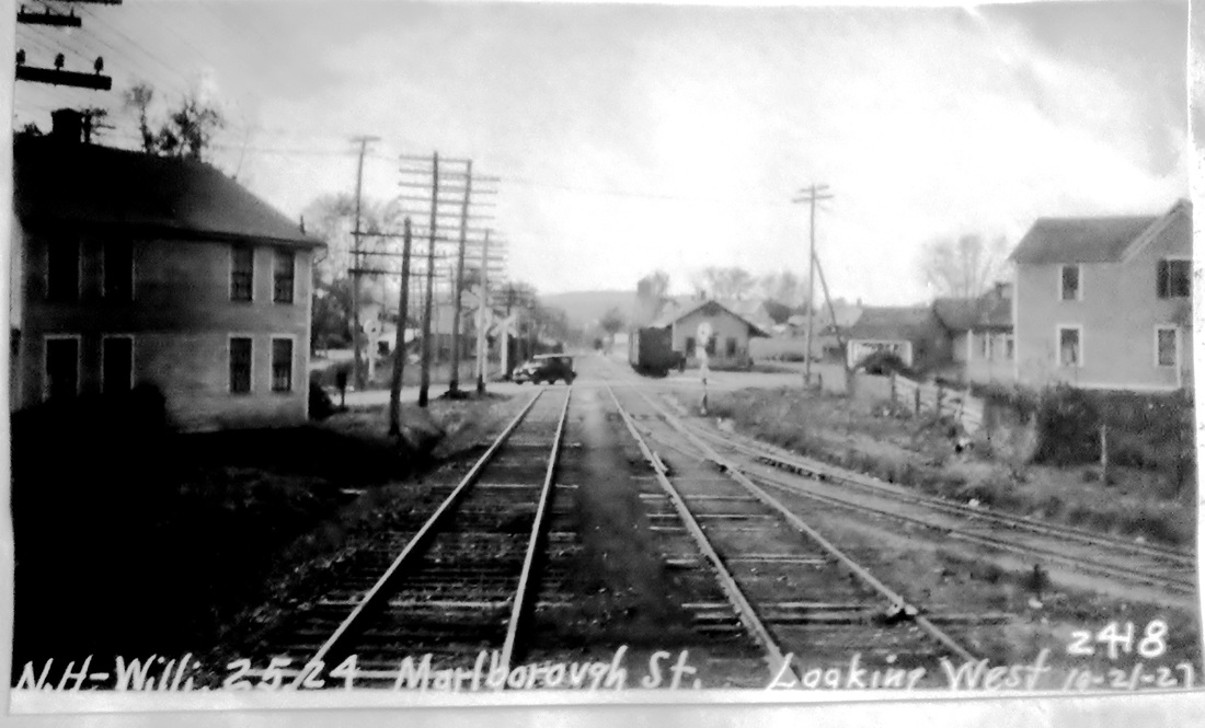
|
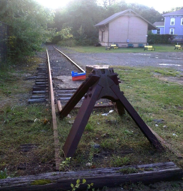
|
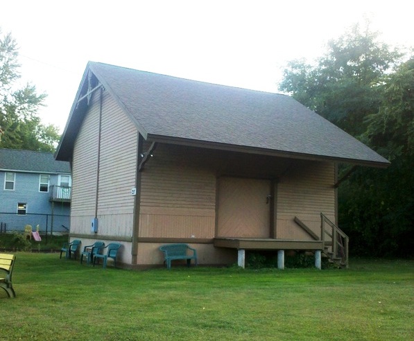
|
PORTLAND [NHM&W, 1873]
The lower right photos show the freight portion of the depot, the only extant part, on the remaining depot property. We do not know what happened to the passenger portion, the eastern two thirds of the original combination station. The stub-ended Air Line now stops here also, just west of the former Rte. 66 crossing. The shots all look back toward Middletown and the Connecticut River bridge that is just out of sight in the distance. According to John Roy, this station was 'downsized' sometime after 1931 and restored after 1996. [REFS: R82]
The lower right photos show the freight portion of the depot, the only extant part, on the remaining depot property. We do not know what happened to the passenger portion, the eastern two thirds of the original combination station. The stub-ended Air Line now stops here also, just west of the former Rte. 66 crossing. The shots all look back toward Middletown and the Connecticut River bridge that is just out of sight in the distance. According to John Roy, this station was 'downsized' sometime after 1931 and restored after 1996. [REFS: R82]
|
Archives & Special Collections, UConn Libraries
|
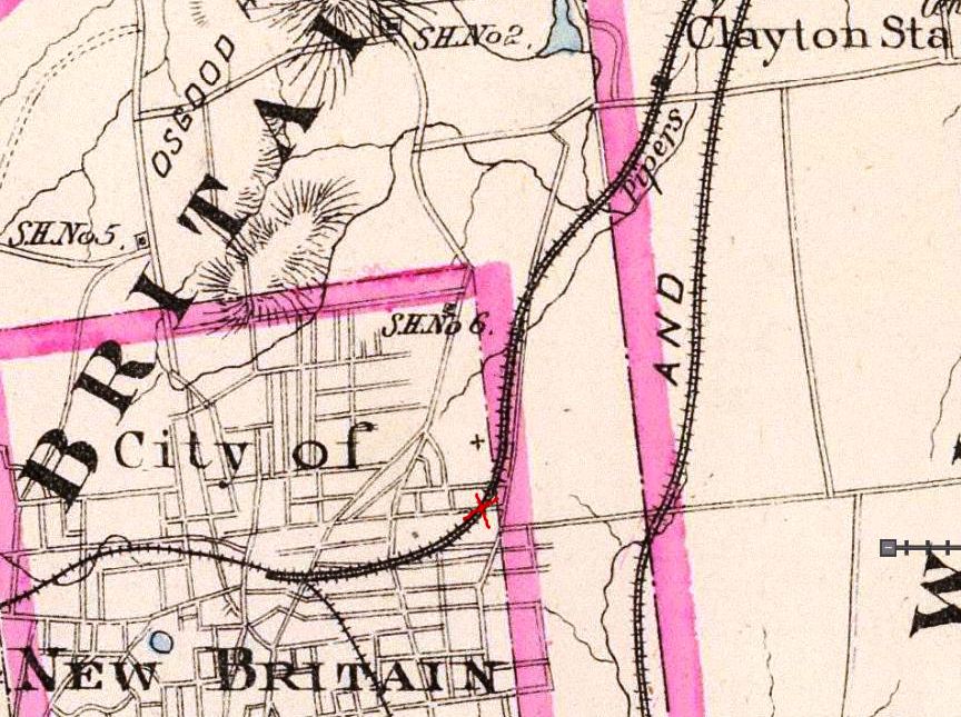
|
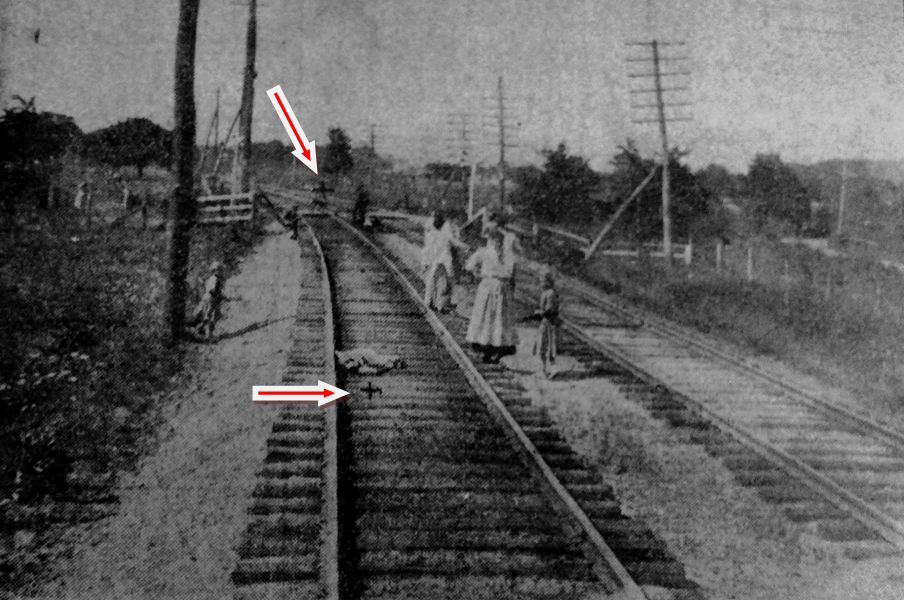
PRATTS [HP&F, c1860?]
There are numerous mentions of this New Britain stop which was just west of CLAYTONS, the first of which references is the 1860 HP&F timetable shown at upper left. An 1867 article reported that the First Regiment arrived by train at this station and proceeded to set up their encampment tents a quarter mile east where they were visible also to the H&NH, a quarter mile further east. A 1/14/1873 NY&NE timetable shows regular- and flag-stop status for this station. The 1888-revised property map [middle] of later owner NY&NE shows a small structure in the southwest quadrant of the grade crossing at today's Allen St., just west of East St. We have put the red X there on the 1893 map at right. The newspapers reported a variety of incidents here and accidents at this busy intersection occurred in 1882, 1885 and 1897, the middle one saying that a woman was struck by a train and "thrown under the depot." The photo at lower left is from an 8/3/1908 newspaper article about yet more fatalities, this one claiming three lives with the mutilated bodies found at the Xs which our red arrows point to. The last listing for PRATTS as a station is in the 1886 NY&NE A Book of Useful Information in Regard to the Cities and Towns on its Line and it does not appear on an 1891TT, the next we have access to. It probably was superceded by the CLAYTONS station, which was .8 miles east and just across the line in Newington. We have no photo of whatever structure stood at PRATTS. [REFS: CC/08/31/1867/02; CC/12/04/1869/04; HPF 9/18/1872TT; HDC/04/23/1873/02; HDC/08/17/1871/01; HDC/09/29/1882/04; HDC/08/25/1885/02; HDC/11/11/1886/03; HC/12/31/1897/08; SR/06/30/1905/12][rev091813]
There are numerous mentions of this New Britain stop which was just west of CLAYTONS, the first of which references is the 1860 HP&F timetable shown at upper left. An 1867 article reported that the First Regiment arrived by train at this station and proceeded to set up their encampment tents a quarter mile east where they were visible also to the H&NH, a quarter mile further east. A 1/14/1873 NY&NE timetable shows regular- and flag-stop status for this station. The 1888-revised property map [middle] of later owner NY&NE shows a small structure in the southwest quadrant of the grade crossing at today's Allen St., just west of East St. We have put the red X there on the 1893 map at right. The newspapers reported a variety of incidents here and accidents at this busy intersection occurred in 1882, 1885 and 1897, the middle one saying that a woman was struck by a train and "thrown under the depot." The photo at lower left is from an 8/3/1908 newspaper article about yet more fatalities, this one claiming three lives with the mutilated bodies found at the Xs which our red arrows point to. The last listing for PRATTS as a station is in the 1886 NY&NE A Book of Useful Information in Regard to the Cities and Towns on its Line and it does not appear on an 1891TT, the next we have access to. It probably was superceded by the CLAYTONS station, which was .8 miles east and just across the line in Newington. We have no photo of whatever structure stood at PRATTS. [REFS: CC/08/31/1867/02; CC/12/04/1869/04; HPF 9/18/1872TT; HDC/04/23/1873/02; HDC/08/17/1871/01; HDC/09/29/1882/04; HDC/08/25/1885/02; HDC/11/11/1886/03; HC/12/31/1897/08; SR/06/30/1905/12][rev091813]
National Archives
|
|
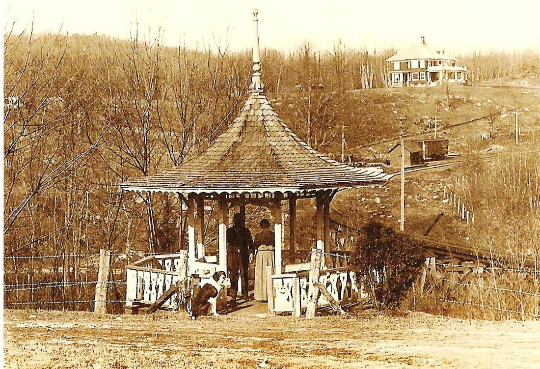
|
PROSPECT [M&W, 1888]
This station on the MW&CR is shown by the blue arrow on the 1892 topographic map in between WEST CHESHIRE and SUMMIT. We are pretty sure that the tick mark is a bit misplaced since the property owner across what is now Rte. 68 testifies to the fact that the station was on his land. It stood where the capital on the letter C is on the map. In the 8/30/1916 val photo at left, the corner of his 1900s-era home is visible and it still looks out over the former station site today. Closer examination of this photo leads us to believe that the valuation photographer has caught the station up on some kind of moving device about to be shunted perhaps onto a flat car. Passenger service would end in 1917. The coach is actually on the stub-ended siding behind the station, where the box car appears in the panoramic photo at right. That shot looks north from the Laurel Grove hotel resort, known earlier as Dunham's Grove, a popular picnic spot that generated some traffic for the railroad. Perhaps the blue arrow indicates a flag stop for the grove that was perched on a high bluff and separated from the PROSPECT station by a deep ravine that the railroad crossed on the curved trestle seen in the photo.
This station on the MW&CR is shown by the blue arrow on the 1892 topographic map in between WEST CHESHIRE and SUMMIT. We are pretty sure that the tick mark is a bit misplaced since the property owner across what is now Rte. 68 testifies to the fact that the station was on his land. It stood where the capital on the letter C is on the map. In the 8/30/1916 val photo at left, the corner of his 1900s-era home is visible and it still looks out over the former station site today. Closer examination of this photo leads us to believe that the valuation photographer has caught the station up on some kind of moving device about to be shunted perhaps onto a flat car. Passenger service would end in 1917. The coach is actually on the stub-ended siding behind the station, where the box car appears in the panoramic photo at right. That shot looks north from the Laurel Grove hotel resort, known earlier as Dunham's Grove, a popular picnic spot that generated some traffic for the railroad. Perhaps the blue arrow indicates a flag stop for the grove that was perched on a high bluff and separated from the PROSPECT station by a deep ravine that the railroad crossed on the curved trestle seen in the photo.
|

|
|
PUTNAM1 [N&W, 1840; opens as POMFRET]
The image at [1] is a side panel on the 1856 Windham County map. It suggests that the Quinebaug House served as first station here, for passengers at least. Early railroads often did this to save the cost of building their own depots, as we have seen at STEPNEY, MERWINSVILLE, CANAAN and elsewhere. The N&W arrived here late in 1839 when the event was joyfully welcomed by the village "... though little foreseeing the revolution it would bring about. The first depot master at the Pomfret Factory was Mr. John O. Fox, removing thither from West Thompson. Amasa Carpenter, from North Woodstock, occupied part of the building, carrying on with John O. Fox a thriving business of grain and groceries." Early timetables such as the 1851 American Railway Guide at [3] show this stop as POMFRET or POMFRET FACTORY for the manufacturing enclave adjacent to the township to the west. This hamlet was originally known as Rhodesville and was actually in the southernmost part of Thompson until the township of Putnam was created in 1855 out of lands from Pomfret and Killingly. The N&W was the sole railroad serving this locale until the arrival of the BH&E in 1868. The Courant reported in April that there seemed to be no cooperation with the N&W "... in the rection (sic) of a [union] depot in Putnam," and the BH&E's 1868 freight depot was used temporarily as that road's passenger station. Cooperation was secured with the BH&E lease of the N&W, effective 2/1/1869 and by March it was reported that "the railroad business at Putnam is to be consolidated. The passenger and express business is to be done at the lower, or N. W. depot, and the freight business at the new Boston, Hartford and Erie depot." Our red arrow on the snippet from the 1877 Bailey map at [4] shows this freight structure just below May St. Many thanks to local historian Bill Zamagni of Putnam for help with this entry and continuing contributions to TCS. [REFS: HDC/04/04/1868/04; HDC/07/24/1868/02; HDC/08/07/1868/02; HDC/09/05/1868/02; CC/02/13/1869/02; HDC/03/06/1869/04][rev071317, 122422]
The image at [1] is a side panel on the 1856 Windham County map. It suggests that the Quinebaug House served as first station here, for passengers at least. Early railroads often did this to save the cost of building their own depots, as we have seen at STEPNEY, MERWINSVILLE, CANAAN and elsewhere. The N&W arrived here late in 1839 when the event was joyfully welcomed by the village "... though little foreseeing the revolution it would bring about. The first depot master at the Pomfret Factory was Mr. John O. Fox, removing thither from West Thompson. Amasa Carpenter, from North Woodstock, occupied part of the building, carrying on with John O. Fox a thriving business of grain and groceries." Early timetables such as the 1851 American Railway Guide at [3] show this stop as POMFRET or POMFRET FACTORY for the manufacturing enclave adjacent to the township to the west. This hamlet was originally known as Rhodesville and was actually in the southernmost part of Thompson until the township of Putnam was created in 1855 out of lands from Pomfret and Killingly. The N&W was the sole railroad serving this locale until the arrival of the BH&E in 1868. The Courant reported in April that there seemed to be no cooperation with the N&W "... in the rection (sic) of a [union] depot in Putnam," and the BH&E's 1868 freight depot was used temporarily as that road's passenger station. Cooperation was secured with the BH&E lease of the N&W, effective 2/1/1869 and by March it was reported that "the railroad business at Putnam is to be consolidated. The passenger and express business is to be done at the lower, or N. W. depot, and the freight business at the new Boston, Hartford and Erie depot." Our red arrow on the snippet from the 1877 Bailey map at [4] shows this freight structure just below May St. Many thanks to local historian Bill Zamagni of Putnam for help with this entry and continuing contributions to TCS. [REFS: HDC/04/04/1868/04; HDC/07/24/1868/02; HDC/08/07/1868/02; HDC/09/05/1868/02; CC/02/13/1869/02; HDC/03/06/1869/04][rev071317, 122422]
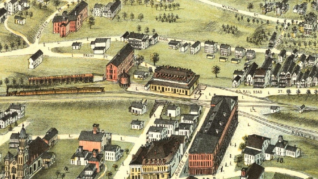
|
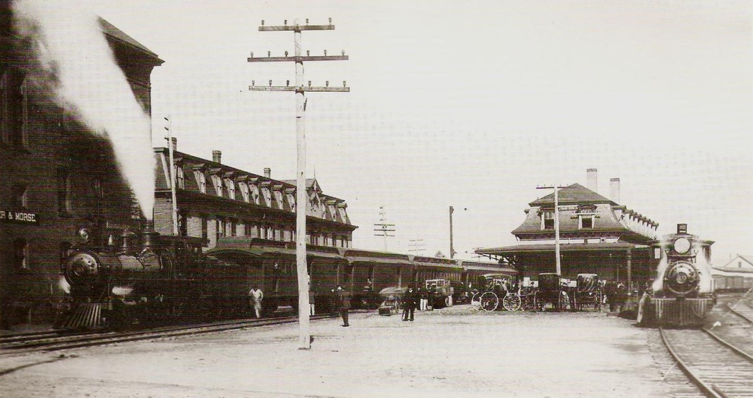
|
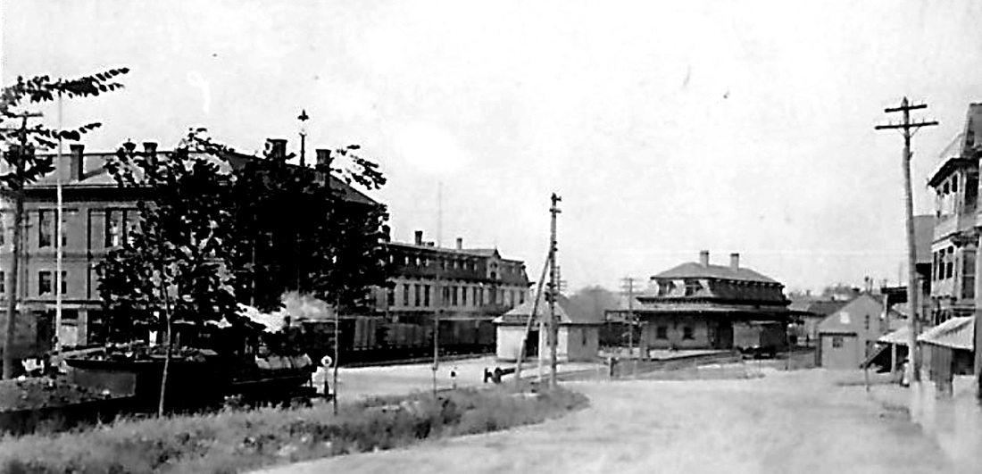
|
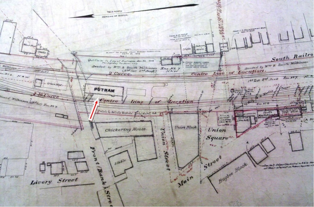
|
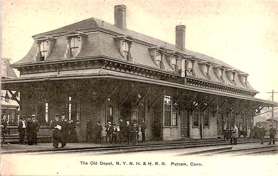
|
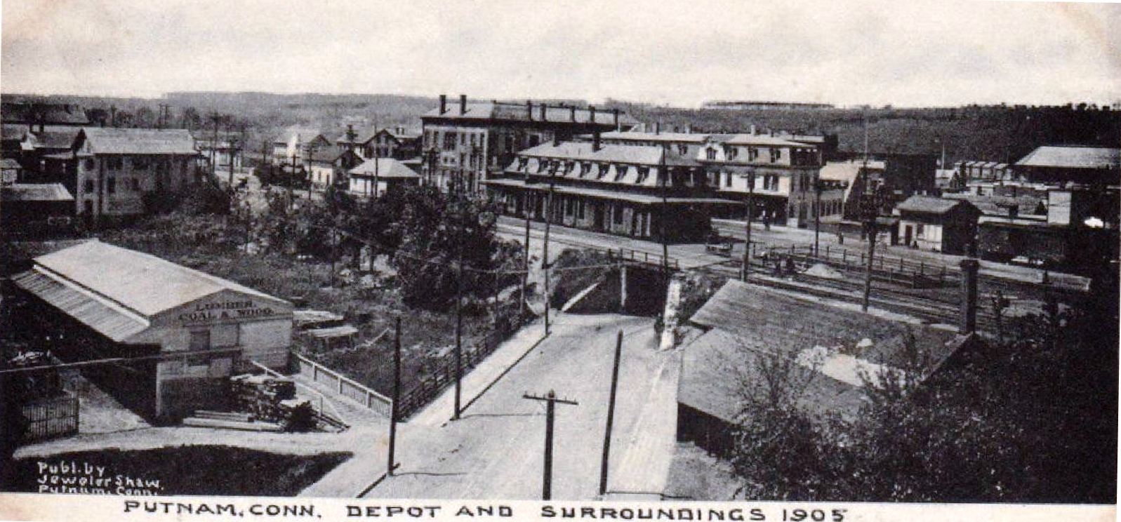
|
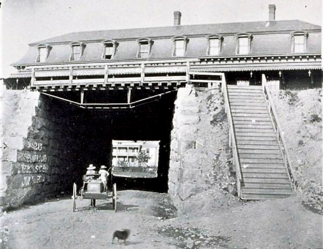
PUTNAM2 [BH&E, 1869]
The Springfield Republican tells us on 11/15/1869 that this station had just been completed. An 11/20/1869 Hartford Weekly Times piece relays accolades, probably with a slight delay from the newspaper it quotes: "The new depot of the Boston, Hartford and Erie railroad at Putnam will be completed and occupied in two or three weeks. The [Windham County?] Transcript says of it: -- 'It is the most beautiful structure of the kind in Eastern Connecticut, and the finest architectural ornament of our village. It is not only tasteful in style, but commodious in all its internal and external arrangements, and the Boston Hartford & Erie Railroad Company have gained the gratitude of the people of Putnam and vicinity for this generous contribution to the material beauty of the place and to the convenience and comfort of the public.'" The handsome Second Empire, Mansard-roofed station had dormers and a bracketed cornice outside and, in addition to the usual ticket office and waiting rooms, a restaurant on the north end inside. The 1877 Bailey bird's-eye map at [1] portrays it correctly as sitting atop Front St. The shot at [2] looks north with locomotive #169 of the NY&NE, BH&E successor as of 1873, letting off steam at left as it waits with a train heading for Willimantic. N&W #20 also chuffs at right as it is about to head south for Norwich. The same view at [3] shows the ca. 1895 Adams Express building at the Main St. crossing. The 1890 real estate map at [4] shows the depot between the tracks of the BH&E and N&W. The great postcard image at [5] captures the "Old Depot" as a pretty busy place; note the NY&NE locomotive at extreme right. The 1905 view at [6] shows the Front St. 'tunnel' under the two widely separated sets of double tracks. Plans were drawn up in 1904 to widen the underpass from 18 to 50 feet and to realign the four tracks onto a narrower overgrade bridge, watertight so that "people passing under shall in no way be inconvenienced by drip or filth." The potential for that drip is seen in the photo at [7] which pictures a buggy headed east under PUTNAM2. Work began in June and "the old railroad station, which has been in use for thirty or more years, was closed for good..." on 7/3/1905. [REFS: WCT/11/11/1869/00 - need to get; SR/11/15/1869/08; WMS/12/10/1869/04; CC/11/20/1869/04; HWT/11/20/1869/02; HC/02/04/1904/02; HC/11/29/1904/02; HC/02/27/1905/13; HC/05/26/1905/14; HC/07/04/1905/14; K107] [rev102917, 061319]
The Springfield Republican tells us on 11/15/1869 that this station had just been completed. An 11/20/1869 Hartford Weekly Times piece relays accolades, probably with a slight delay from the newspaper it quotes: "The new depot of the Boston, Hartford and Erie railroad at Putnam will be completed and occupied in two or three weeks. The [Windham County?] Transcript says of it: -- 'It is the most beautiful structure of the kind in Eastern Connecticut, and the finest architectural ornament of our village. It is not only tasteful in style, but commodious in all its internal and external arrangements, and the Boston Hartford & Erie Railroad Company have gained the gratitude of the people of Putnam and vicinity for this generous contribution to the material beauty of the place and to the convenience and comfort of the public.'" The handsome Second Empire, Mansard-roofed station had dormers and a bracketed cornice outside and, in addition to the usual ticket office and waiting rooms, a restaurant on the north end inside. The 1877 Bailey bird's-eye map at [1] portrays it correctly as sitting atop Front St. The shot at [2] looks north with locomotive #169 of the NY&NE, BH&E successor as of 1873, letting off steam at left as it waits with a train heading for Willimantic. N&W #20 also chuffs at right as it is about to head south for Norwich. The same view at [3] shows the ca. 1895 Adams Express building at the Main St. crossing. The 1890 real estate map at [4] shows the depot between the tracks of the BH&E and N&W. The great postcard image at [5] captures the "Old Depot" as a pretty busy place; note the NY&NE locomotive at extreme right. The 1905 view at [6] shows the Front St. 'tunnel' under the two widely separated sets of double tracks. Plans were drawn up in 1904 to widen the underpass from 18 to 50 feet and to realign the four tracks onto a narrower overgrade bridge, watertight so that "people passing under shall in no way be inconvenienced by drip or filth." The potential for that drip is seen in the photo at [7] which pictures a buggy headed east under PUTNAM2. Work began in June and "the old railroad station, which has been in use for thirty or more years, was closed for good..." on 7/3/1905. [REFS: WCT/11/11/1869/00 - need to get; SR/11/15/1869/08; WMS/12/10/1869/04; CC/11/20/1869/04; HWT/11/20/1869/02; HC/02/04/1904/02; HC/11/29/1904/02; HC/02/27/1905/13; HC/05/26/1905/14; HC/07/04/1905/14; K107] [rev102917, 061319]
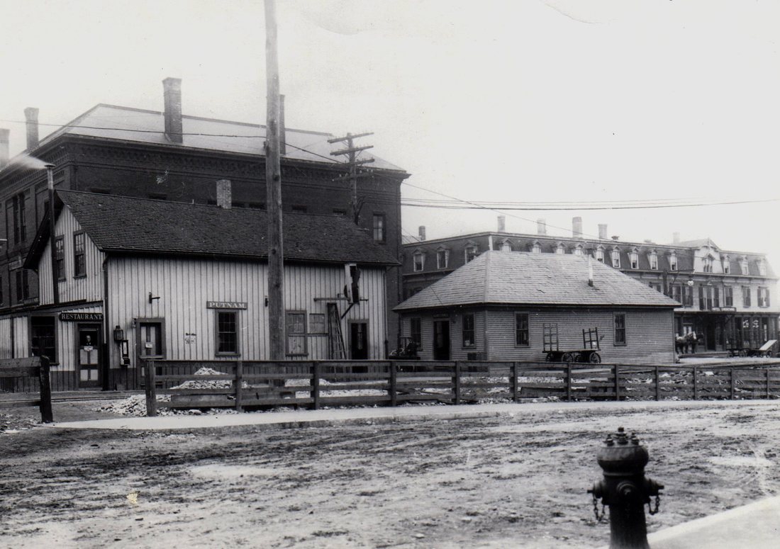
Aspinock Historical Society
|
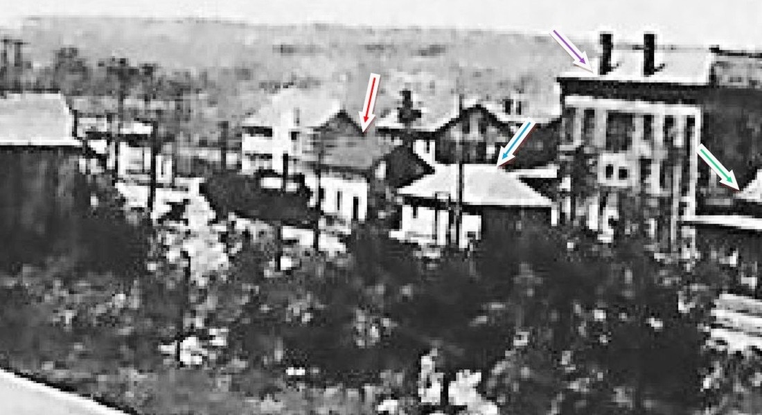
|

Aspinock Historical Society
|
PUTNAM3 [NYNH&H, 1904]
The newspaper said that, upon the 7/3/1905 closing of the old station, that now the "baggage room will be found in the Adams Express Company's building and in the tinsmith building a few feet below, the Western Union and ticket offices and a small waiting room for both sexes." The great image at [1] shows PUTNAM3 in the tinsmith shop, restaurant sign at left, station signboard at center and order board apparatus at right. The hip-roofed Adams building is next north and the Mansard-roofed Chickering House is behind. In the overview image at [2] our red arrow points to the tinsmith shop depot, the blue arrow points to the Adams office, the green arrow points to the overhang at the old depot and the purple arrow shows the Union Block, a building which which stood until 1966. The view at [3] looks at the Union Block from the Main St. crossing; note the Putnam Patriot newspaper's sign on the second floor. Also seen are the guard shanty, a Great Western Dispatch 'fast freight' car, lettered TH&L likely for the Terre Haute and Logansport RR, and the man atop the telegraph pole in front of the car! This depot arrangement served for three years until 6/16/1907 when the paper said that "railroad men were busy today moving from the temporary station into the new station." Construction challenges and a court injunctions over cost overruns were responsible for the delayed opening. Many thanks to Bill Zamagni for his clarifications and for bringing the AHS photos to our attention. [REFS: HC/07/04/1904/14; HC/04/20/1906/18; HC/06/11/1906/17; HC/06/20/1906/18; HC/08/01/1906/12; HC/01/17/1907/15; HC/01/ 23/1907/18][rev061117]
The newspaper said that, upon the 7/3/1905 closing of the old station, that now the "baggage room will be found in the Adams Express Company's building and in the tinsmith building a few feet below, the Western Union and ticket offices and a small waiting room for both sexes." The great image at [1] shows PUTNAM3 in the tinsmith shop, restaurant sign at left, station signboard at center and order board apparatus at right. The hip-roofed Adams building is next north and the Mansard-roofed Chickering House is behind. In the overview image at [2] our red arrow points to the tinsmith shop depot, the blue arrow points to the Adams office, the green arrow points to the overhang at the old depot and the purple arrow shows the Union Block, a building which which stood until 1966. The view at [3] looks at the Union Block from the Main St. crossing; note the Putnam Patriot newspaper's sign on the second floor. Also seen are the guard shanty, a Great Western Dispatch 'fast freight' car, lettered TH&L likely for the Terre Haute and Logansport RR, and the man atop the telegraph pole in front of the car! This depot arrangement served for three years until 6/16/1907 when the paper said that "railroad men were busy today moving from the temporary station into the new station." Construction challenges and a court injunctions over cost overruns were responsible for the delayed opening. Many thanks to Bill Zamagni for his clarifications and for bringing the AHS photos to our attention. [REFS: HC/07/04/1904/14; HC/04/20/1906/18; HC/06/11/1906/17; HC/06/20/1906/18; HC/08/01/1906/12; HC/01/17/1907/15; HC/01/ 23/1907/18][rev061117]
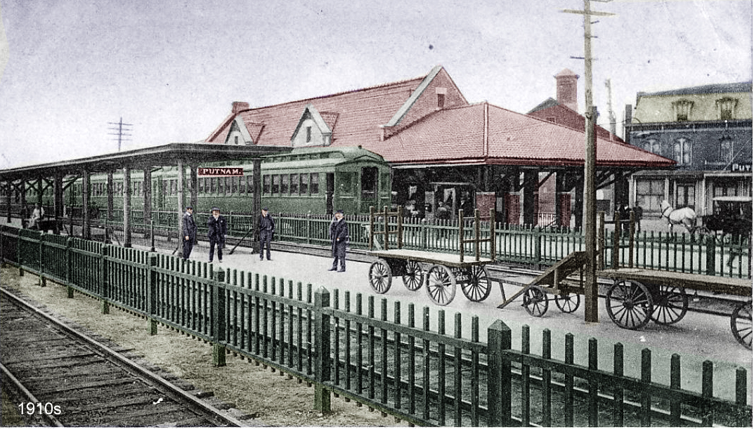
|

|
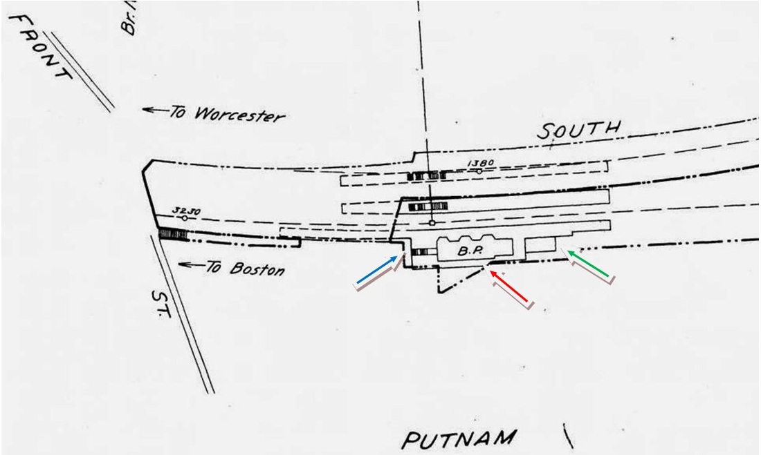
|
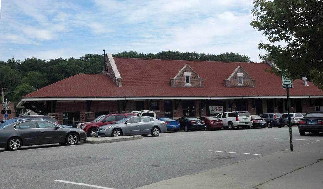
|
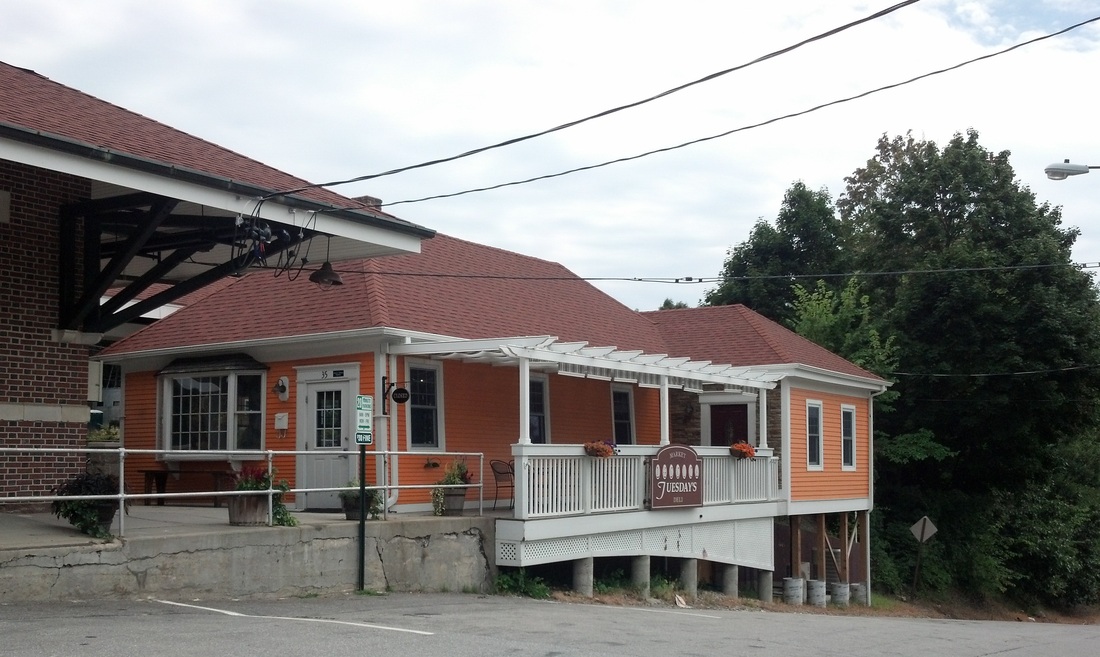
|

|
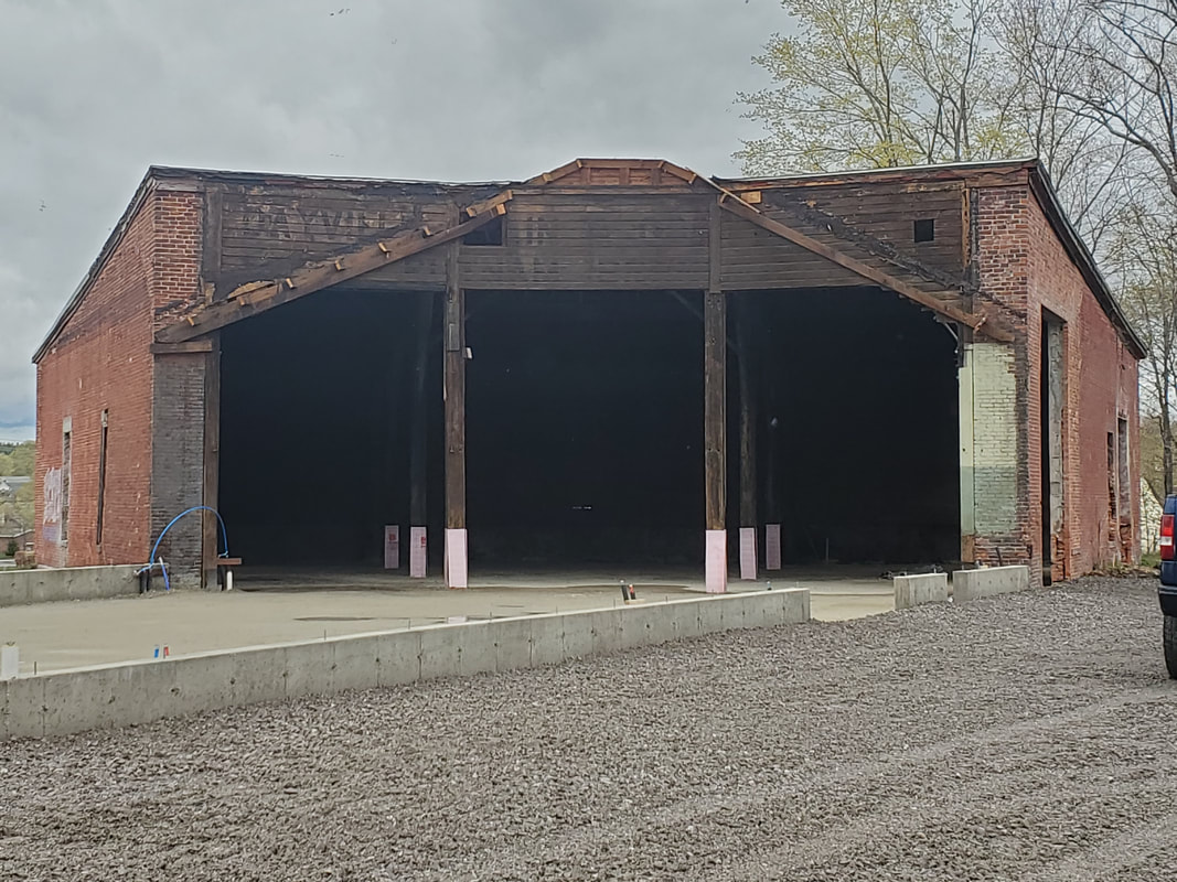 Bill Zamagni Collection
PUTNAM4 [NYNH&H, 1907]
The newspaper said in April, 1906 that the masonry work and foundation for this station were nearly complete and the project now would be pushed in earnest. This station would not open until 6/16/1907, but even today the words of the Courant ring true that the "fine location of the new station has given the city a great boost in the right direction, for it now has a more modern and business-like appearance." The closing of the Main St. crossing, the extension of South Main St. up to Front St., and the construction of a subway under the tracks at the new station, for the use of pedestrians as well as railroad patrons, were other parts of the plan, for which the city was assessed one quarter of the $80,000 station cost. The newspaper said the main building was 83x27 feet, with patterned red "Harvard" brickwork and black headers trimmed in terra cotta and brownstone and, like its predecessor, contained a restaurant. Plans called for a Spanish tile roof, leaded glass, and ornately embossed ceilings all of which embellishments were executed by contractor William Patterson of Hartford, who was working simultaneously on POMFRET3 which he completed early in 1906. The 2/24/1911 real estate card at [6] gives some additional details. A 100-ft-long pedestrian subway lined with enameled, cream-colored bricks allowed patrons to access the easterly three tracks where two additional coversheds were provided along the 132-ft platform. The view at [1] appears to be in the 1920s and shows a train either headed east for Willimantic or south to New London. The ICC valuation photo at [2] appears to be dated 6/2/1917. The 6/30/1915 ICC valuation map at [3] shows 'BP' for the brick passenger station at the red arrow and the stairs from the depot to the subway at the blue arrow. Our photo at [4] shows the station in recent days. The old Adams Express Office, relocated to the south end of the station, is seen on the val map at the green arrow and, still extant today, in our photo at [5]. Also extant today is the three-stall engine house built by the NY&NE ca. 1875 north of here at Buck St. in the freight yard. By the 1940s, rail passenger service on the N&W had dwindled to the daily, bi-directional State of Maine which was rerouted via the Shore Line on 4/28/1946. At that time officials said that riders on the N&W line were "'out of luck' due to a lack of public necessity," while bus service at least ran from New London to Norwich.
The newspaper said in April, 1906 that the masonry work and foundation for this station were nearly complete and the project now would be pushed in earnest. This station would not open until 6/16/1907, but even today the words of the Courant ring true that the "fine location of the new station has given the city a great boost in the right direction, for it now has a more modern and business-like appearance." The closing of the Main St. crossing, the extension of South Main St. up to Front St., and the construction of a subway under the tracks at the new station, for the use of pedestrians as well as railroad patrons, were other parts of the plan, for which the city was assessed one quarter of the $80,000 station cost. The newspaper said the main building was 83x27 feet, with patterned red "Harvard" brickwork and black headers trimmed in terra cotta and brownstone and, like its predecessor, contained a restaurant. Plans called for a Spanish tile roof, leaded glass, and ornately embossed ceilings all of which embellishments were executed by contractor William Patterson of Hartford, who was working simultaneously on POMFRET3 which he completed early in 1906. The 2/24/1911 real estate card at [6] gives some additional details. A 100-ft-long pedestrian subway lined with enameled, cream-colored bricks allowed patrons to access the easterly three tracks where two additional coversheds were provided along the 132-ft platform. The view at [1] appears to be in the 1920s and shows a train either headed east for Willimantic or south to New London. The ICC valuation photo at [2] appears to be dated 6/2/1917. The 6/30/1915 ICC valuation map at [3] shows 'BP' for the brick passenger station at the red arrow and the stairs from the depot to the subway at the blue arrow. Our photo at [4] shows the station in recent days. The old Adams Express Office, relocated to the south end of the station, is seen on the val map at the green arrow and, still extant today, in our photo at [5]. Also extant today is the three-stall engine house built by the NY&NE ca. 1875 north of here at Buck St. in the freight yard. By the 1940s, rail passenger service on the N&W had dwindled to the daily, bi-directional State of Maine which was rerouted via the Shore Line on 4/28/1946. At that time officials said that riders on the N&W line were "'out of luck' due to a lack of public necessity," while bus service at least ran from New London to Norwich.
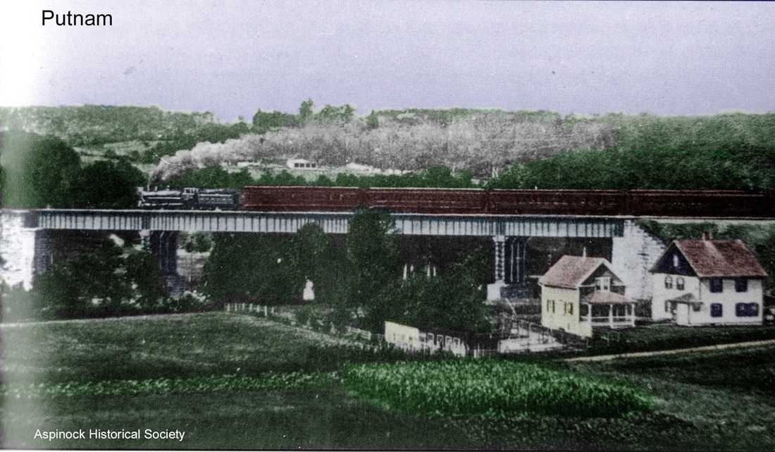
|
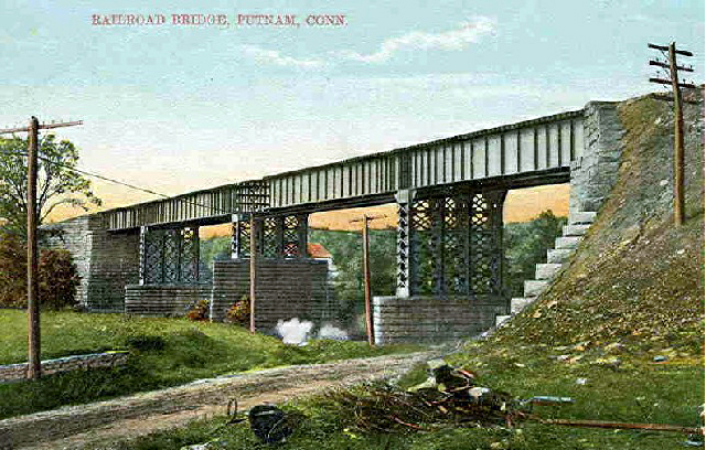
|
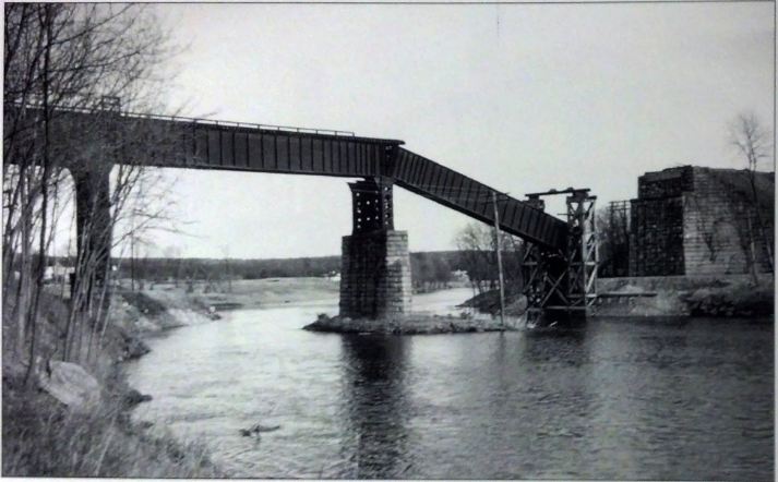
|
East-west service continued at PUTNAM4 until the floods of 1955 took out the Quinebaug River bridge just west of downtown and, citing what some called inflated cost estimates, the NYNH&H declined to rebuild the structure, the PUC acquiescing shortly thereafter, thus ending service on the Midland Division. On the N&W the Shoreliner, a newly minted $168,000 Budd RDC, debuted on 6/5/1952 making two daily round trips from Worcester to New London. That lasted until Amtrak declined on 5/1/1971 to include the N&W in its route system, with Penn Central claiming an annual loss of $123,000 on the run which averaged 12 riders. As far back as 1963, the NYNH&H had tried to close this station and others to save maintenance costs and free them up for sale. After objections were voiced by public officials who said that passengers were still using the building here and that the city was paying the janitorial expenses, PUTNAM4 was retained. Ultimately, it was was sold to Putnam Redevelopment Agency and in August, 1969 to the Grube Camera Co. An adjoining plexiglass shelter was built at the time as part of the agreement and torn down when passenger service ceased in 1971. The station today, listed on the National Register of Historic Places in 2007, is still a hub of downtown activity and today houses The Crossings Restaurant and Brew Pub. The old subway has been walled off but now serves as the wine cellar. [REFS: CRC53.1905.28; CRC.54.1906.34: prematurely says completed; HC/01/17/1907/15; HC/06/17/1907/01; CRC55.1907.45; HC/04/19/1946/24; HC/06/08/1952/A5; HC/01/19/1956/8B; HC/02/28/1963/06; HC/04/29/1971/52; K106; R83; SL28.1.25][rev071817, 032320, 092322]