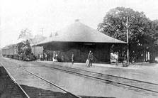
Track 12: CT Passenger Stations, WH-Y
See TCS Home Page links for information, abbreviations, and sources.
Use Track 11 to map link locate stations, rail and trolley lines, and POIs.
Use Track 11 to map link locate stations, rail and trolley lines, and POIs.
WHEATONS [HP&F, 1855]
Station in the town of Plymouth established by the HP&F in 1855. No photo yet found. Probably discontinued in 1910 when the NYNH&H relocated this portion of the Highland Division.
Station in the town of Plymouth established by the HP&F in 1855. No photo yet found. Probably discontinued in 1910 when the NYNH&H relocated this portion of the Highland Division.
WHITING RIVER [CW, 1871]
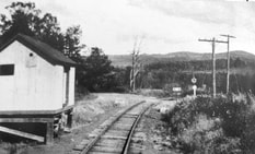
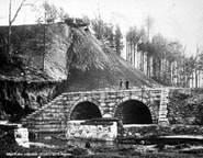
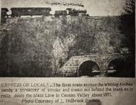
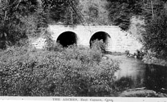
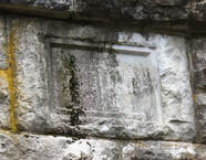
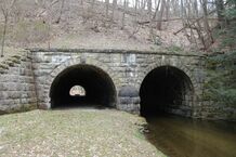
This name of this stop in the present town of North Canaan appeared as such on an 1871 pre-opening list of stations in the newspaper but the name CANAAN VALLEY was used officially by the CW until about 1882 when the line was reorganized as the H&CW and the name was changed back. The shot at [1] looks east past the small milk depot, also apparently used by passengers. Nimke says the milk station was built in 1915 and it was gone by 1938, the same year passenger service was abandoned. Prior to that perhaps this stop only had a platform. The structure is just ahead of the famed Whiting Arches, which are down at the base of the embankment. The shot at [2] shows the arches under construction. The project was already underway in September, 1870 and completed on 1/3/1871 with due ceremony. The last CW rail was laid on 12/7/1871 at Canton. The newspaper clipping at [3] shows the first CW train crossing, likely the inspection train carrying Pres. Barnum, company officials and the railroad commissioners on 12/13/1871. The western arch bridged the Hartford Tpke, today's Rte 44, and the eastern one channeled the Whiting River. The project was undertaken by Alderman Ives & Co. of East Canaan, consisting of Ives, David Starick and Willie A. Barnes. The names are visible to this day on the cornerstone on the south side of the massive masonry structure. Apparently, this was at or near the last hurrah for this partnership which was dissolved on 10/27/1871, Starick, spelled Starrick on the stone, retiring at the time. A 1000-ft cut about 40 feet in depth was necessary to approach the river from the west and the 250,000 square yards of removed debris was used for the 80-ft high, 1000-ft long "great fill" across the river valley. The 206-ft long 'tunnels' are 20 feet high and 20 feet wide. This was always a must-see stop on the CNE tours and endures today as a landmark feat of railroad engineering in the state. Many thanks to railfan Alan Lagocki for the photos at [5] and [6] taken in April, 2020. [REFS: HDC/09/20/1870/04; CC/01/17/1871/04; CWN/12/15/1871/02; HDC/12/15/1871/01; WDA/08/22/1871/03; CWN/10/20/1871/03; HDC/12/14/1871/02; WH/10/25/1872/02; K115; N3.62][rev042113, 052120]
This name of this stop in the present town of North Canaan appeared as such on an 1871 pre-opening list of stations in the newspaper but the name CANAAN VALLEY was used officially by the CW until about 1882 when the line was reorganized as the H&CW and the name was changed back. The shot at [1] looks east past the small milk depot, also apparently used by passengers. Nimke says the milk station was built in 1915 and it was gone by 1938, the same year passenger service was abandoned. Prior to that perhaps this stop only had a platform. The structure is just ahead of the famed Whiting Arches, which are down at the base of the embankment. The shot at [2] shows the arches under construction. The project was already underway in September, 1870 and completed on 1/3/1871 with due ceremony. The last CW rail was laid on 12/7/1871 at Canton. The newspaper clipping at [3] shows the first CW train crossing, likely the inspection train carrying Pres. Barnum, company officials and the railroad commissioners on 12/13/1871. The western arch bridged the Hartford Tpke, today's Rte 44, and the eastern one channeled the Whiting River. The project was undertaken by Alderman Ives & Co. of East Canaan, consisting of Ives, David Starick and Willie A. Barnes. The names are visible to this day on the cornerstone on the south side of the massive masonry structure. Apparently, this was at or near the last hurrah for this partnership which was dissolved on 10/27/1871, Starick, spelled Starrick on the stone, retiring at the time. A 1000-ft cut about 40 feet in depth was necessary to approach the river from the west and the 250,000 square yards of removed debris was used for the 80-ft high, 1000-ft long "great fill" across the river valley. The 206-ft long 'tunnels' are 20 feet high and 20 feet wide. This was always a must-see stop on the CNE tours and endures today as a landmark feat of railroad engineering in the state. Many thanks to railfan Alan Lagocki for the photos at [5] and [6] taken in April, 2020. [REFS: HDC/09/20/1870/04; CC/01/17/1871/04; CWN/12/15/1871/02; HDC/12/15/1871/01; WDA/08/22/1871/03; CWN/10/20/1871/03; HDC/12/14/1871/02; WH/10/25/1872/02; K115; N3.62][rev042113, 052120]
WILLIAMS [HP&F, c1870]
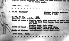
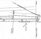
This stop in the town of MANCHESTER appears on an HP&F 1872TT at a point 1.625 miles west of BUCKLAND and 1.875 miles east of BURNSIDE. We have seen this stop called WOODLAND on a later timetable. The val map shows a siding here with track to Woodland Mills in 1915 and the ca. 1930 PUC notes show no stop or station, just a grade crossing, here at that time.
This stop in the town of MANCHESTER appears on an HP&F 1872TT at a point 1.625 miles west of BUCKLAND and 1.875 miles east of BURNSIDE. We have seen this stop called WOODLAND on a later timetable. The val map shows a siding here with track to Woodland Mills in 1915 and the ca. 1930 PUC notes show no stop or station, just a grade crossing, here at that time.
WILLIAMS SWITCH [NLW&P, c1850]
[REFS: 1855tt: btw YANTIC and SOUTH WINDHAM, 24 mi fm NEW LONDON; LEBANON? (mp 23); WS is not on 1871TT]
[REFS: 1855tt: btw YANTIC and SOUTH WINDHAM, 24 mi fm NEW LONDON; LEBANON? (mp 23); WS is not on 1871TT]
WILLIMANTIC1 [NLW&P/HP&F, 1850]
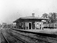
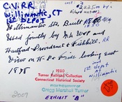
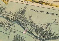
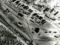
The reverse side of the singularly unique and rare CHS photo at [1] identifies the station as the first in the Thread City. No other images of this depot have been found thus far. The photograph was once in the collection of the late Walter Fogg who generously shared material with us back in the 1970s. The reverse side at [2] shows black-ink writing that looks to be the oldest and later ballpoint and marker revisions. Regular NLW&P service began for this city on 11/19/1849 and HP&F timetable trains debuted on 11/26/1849, a scant week later. The corrected build date of 1850 and the cost of $2,225 have been independently corroborated in our research. Further verification shows that the Willimantic depot was already up by January, 1850. A gala NL&WP excursion from New London on 1/10/1850 departed at 7:00 p.m. and "... reached the depot at Willimantic at precisely eight...." According to the notations, the 1878 view at [1] looks east along the HP&F track that ran on the north side of the station; the NLW&P came in on the south side. By the time of the photo, the HP&F had evolved into the NY&NE, the NLW&P had become the NLN, and the B&NYAL was also bringing trains into this station on the Air Line that opened in 1873. This depot stood between tracks, as seen on the 1856WC map at [3] and on the 1876 Bailey bird's-eye map at [4]. By 1882, there were increased calls for a newer, safer arrangement. Conditions here had been decried all the way back to 1855 in the second annual report of the railroad commissioners. They were still counseling patience to the legislature 10 years later, and themselves finally complained that "after waiting in vain seventeen years for the 'maturity' of these plans," nothing yet had been done. In "The Willimantic Depot" opinion piece, the Courant said: "The rapid growth of Willimantic, the recent development of the New England road into a trunk line, and the general increase of railroad business through the state have combined to make the present Willimantic railway depot utterly unfit for its purposes. It is surrounded by tracks, cars are almost constantly moving past it. To approach it is to walk into danger. Every day sees narrow escapes there, and only recently a well known gentleman was run over and cut to pieces there." [REFS: HDC/11/16/1849/02; SR/11/28/1849/02; NLDC/01/12/1850/02; HC/01/05/1852/02; CRC12. 1865.8; CRC24.1877 .20: remodeled; HDC/04/25/1882/02; CRC30 .1883.25; W31][rev041922]
The reverse side of the singularly unique and rare CHS photo at [1] identifies the station as the first in the Thread City. No other images of this depot have been found thus far. The photograph was once in the collection of the late Walter Fogg who generously shared material with us back in the 1970s. The reverse side at [2] shows black-ink writing that looks to be the oldest and later ballpoint and marker revisions. Regular NLW&P service began for this city on 11/19/1849 and HP&F timetable trains debuted on 11/26/1849, a scant week later. The corrected build date of 1850 and the cost of $2,225 have been independently corroborated in our research. Further verification shows that the Willimantic depot was already up by January, 1850. A gala NL&WP excursion from New London on 1/10/1850 departed at 7:00 p.m. and "... reached the depot at Willimantic at precisely eight...." According to the notations, the 1878 view at [1] looks east along the HP&F track that ran on the north side of the station; the NLW&P came in on the south side. By the time of the photo, the HP&F had evolved into the NY&NE, the NLW&P had become the NLN, and the B&NYAL was also bringing trains into this station on the Air Line that opened in 1873. This depot stood between tracks, as seen on the 1856WC map at [3] and on the 1876 Bailey bird's-eye map at [4]. By 1882, there were increased calls for a newer, safer arrangement. Conditions here had been decried all the way back to 1855 in the second annual report of the railroad commissioners. They were still counseling patience to the legislature 10 years later, and themselves finally complained that "after waiting in vain seventeen years for the 'maturity' of these plans," nothing yet had been done. In "The Willimantic Depot" opinion piece, the Courant said: "The rapid growth of Willimantic, the recent development of the New England road into a trunk line, and the general increase of railroad business through the state have combined to make the present Willimantic railway depot utterly unfit for its purposes. It is surrounded by tracks, cars are almost constantly moving past it. To approach it is to walk into danger. Every day sees narrow escapes there, and only recently a well known gentleman was run over and cut to pieces there." [REFS: HDC/11/16/1849/02; SR/11/28/1849/02; NLDC/01/12/1850/02; HC/01/05/1852/02; CRC12. 1865.8; CRC24.1877 .20: remodeled; HDC/04/25/1882/02; CRC30 .1883.25; W31][rev041922]
WILLIMANTIC2 [NY&NE, 1883]
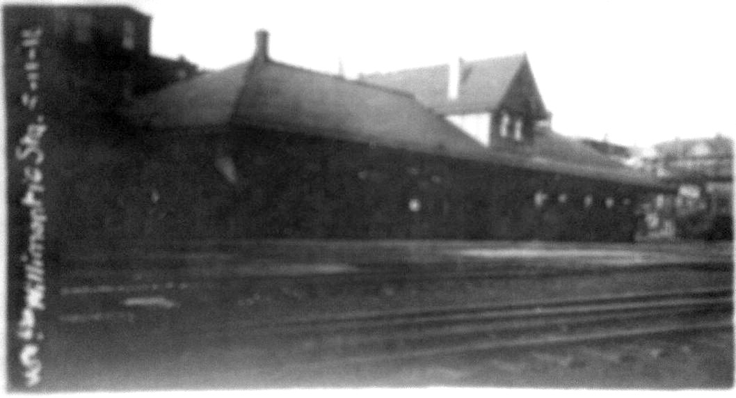
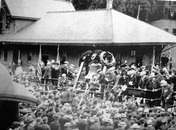
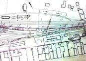
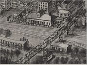
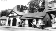
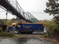
Complaints about the dangers here set Willimantic up as a poster child for depot safety issues, a direct result of which was a legislative bill to give the railroad commissioners the power to compel the railroads to relocate stations and to cooperate in union station projects where needed. The measure passed the house but "was amended into nothing" in the state senate, where it was reportedly stymied by the NLN president who was a senator on the committee considering the bill! His road "objects to changing," according to the Courant. Apparently the NY&NE then took the initiative and the railroad commissioners spoke of the new depot in January of 1884. Blueprints from the Peters Railroad Museum are now at UConn. Dated 6/2/1883, they bear this parentage and timing out and the NY&NE annual report in December stated that the company had erected "a commodious Union Passenger Station, at a cost to date of $8506.38. It was opened for the use of the Public on the 19th of November." As far away as Canaan, the Connecticut Western News reported that it was a 130x32-ft wooden structure with a slate roof. The val photo at [1] shows the station in 1916 still sporting the stick-bracketed dormer that was later removed, reportedly after the hurricane of 1938. The shot at [2] captures the station hosting the Liberty Bell on 6/16/1903, when the Revolutionary War relic was on its way to Boston to mark the 128th anniversary of the Battle of Bunker Hill. The NY&NE real estate map at [3] shows the grounds in 1891 and it also indicates a baggage building just west of the 1883 station. Heavy passenger traffic here created a need for more space as early as 1889 when the newspaper said a "commodious structure 25x40 feet, to be used as the baggage room" was going up, with the vacated space in the station going for expanded Western Union quarters. This baggage building is seen in the aero view [click here] at [4], flanked by wings for further expansion by that time. This rather grand, composite structure is seen at [5]. As early as 1909 there were calls for the NYNH&H to build a newer passenger station "considering the fact that more than $100,000.00 worth of tickets are sold at the depot here every year," but WILLIMANTIC2 would endure until 1955. At that time, downtown businesses were booming and the city was looking for more automobile parking. The PUC approved the transfer of the station parcel early in 1955 as part of a plan for the railroad to build a smaller passenger depot west of Bridge St. Enter the hurricanes later that year and the resulting severance of the Midland Division at Putnam. The photo at [6] was taken on 10/3/1955 by local resident Clifford A. Heath and shows up on a Christmas card to Frank Ballard Ramsdell whose collection is now at the Thompson Historical Society. Info on the back of the card says the station was torn down on 10/5/1955 but that must have only been the start of the demolition, which the Courant says was still in progress on 10/14/1955. City planners now admit this was an unfortunate choice; no new passenger stop would exist until almost 40 years later, coincidentally at the intended Bridge St. location. The 11/12/2012 photo at [7] caught a New England Central locomotive jockeying cars beneath the 1906 pedestrian walkway, the ultimate solution to the safety problems here. It reportedly was the first such structure in the country to traverse roadway, sidewalk, railway and river. The walkway was given an NRHP designation in 1979. [REFS: HDC/04/25/1882/02; HDC/01/15/1883/02; CWN/06/06/1883/03; TVH/12/13/1883/??; NYNEAR8 .1883.17; CRC31.1884.19; HDC/02/15/1889/06; HC/01/26/1896/09; HC/08/25/1896/06; HC/02/16/1905/02; HC/10/09/1909/13; HC/08/16/1952/8A; HC/02 /02/1955/19B; HC/10/14/1955/30B; HC/12/13/1955/A13B: lost ref; HC/12/17/1955/6B; K113][rev123016, rrd032622]
Complaints about the dangers here set Willimantic up as a poster child for depot safety issues, a direct result of which was a legislative bill to give the railroad commissioners the power to compel the railroads to relocate stations and to cooperate in union station projects where needed. The measure passed the house but "was amended into nothing" in the state senate, where it was reportedly stymied by the NLN president who was a senator on the committee considering the bill! His road "objects to changing," according to the Courant. Apparently the NY&NE then took the initiative and the railroad commissioners spoke of the new depot in January of 1884. Blueprints from the Peters Railroad Museum are now at UConn. Dated 6/2/1883, they bear this parentage and timing out and the NY&NE annual report in December stated that the company had erected "a commodious Union Passenger Station, at a cost to date of $8506.38. It was opened for the use of the Public on the 19th of November." As far away as Canaan, the Connecticut Western News reported that it was a 130x32-ft wooden structure with a slate roof. The val photo at [1] shows the station in 1916 still sporting the stick-bracketed dormer that was later removed, reportedly after the hurricane of 1938. The shot at [2] captures the station hosting the Liberty Bell on 6/16/1903, when the Revolutionary War relic was on its way to Boston to mark the 128th anniversary of the Battle of Bunker Hill. The NY&NE real estate map at [3] shows the grounds in 1891 and it also indicates a baggage building just west of the 1883 station. Heavy passenger traffic here created a need for more space as early as 1889 when the newspaper said a "commodious structure 25x40 feet, to be used as the baggage room" was going up, with the vacated space in the station going for expanded Western Union quarters. This baggage building is seen in the aero view [click here] at [4], flanked by wings for further expansion by that time. This rather grand, composite structure is seen at [5]. As early as 1909 there were calls for the NYNH&H to build a newer passenger station "considering the fact that more than $100,000.00 worth of tickets are sold at the depot here every year," but WILLIMANTIC2 would endure until 1955. At that time, downtown businesses were booming and the city was looking for more automobile parking. The PUC approved the transfer of the station parcel early in 1955 as part of a plan for the railroad to build a smaller passenger depot west of Bridge St. Enter the hurricanes later that year and the resulting severance of the Midland Division at Putnam. The photo at [6] was taken on 10/3/1955 by local resident Clifford A. Heath and shows up on a Christmas card to Frank Ballard Ramsdell whose collection is now at the Thompson Historical Society. Info on the back of the card says the station was torn down on 10/5/1955 but that must have only been the start of the demolition, which the Courant says was still in progress on 10/14/1955. City planners now admit this was an unfortunate choice; no new passenger stop would exist until almost 40 years later, coincidentally at the intended Bridge St. location. The 11/12/2012 photo at [7] caught a New England Central locomotive jockeying cars beneath the 1906 pedestrian walkway, the ultimate solution to the safety problems here. It reportedly was the first such structure in the country to traverse roadway, sidewalk, railway and river. The walkway was given an NRHP designation in 1979. [REFS: HDC/04/25/1882/02; HDC/01/15/1883/02; CWN/06/06/1883/03; TVH/12/13/1883/??; NYNEAR8 .1883.17; CRC31.1884.19; HDC/02/15/1889/06; HC/01/26/1896/09; HC/08/25/1896/06; HC/02/16/1905/02; HC/10/09/1909/13; HC/08/16/1952/8A; HC/02 /02/1955/19B; HC/10/14/1955/30B; HC/12/13/1955/A13B: lost ref; HC/12/17/1955/6B; K113][rev123016, rrd032622]
 Dick Arnold Collection
WILLIMANTIC3 [ATK, 1991]
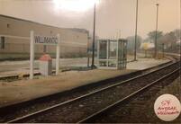
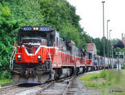
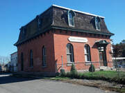
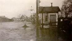
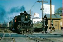
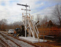
After an absence of 36 years, rail passenger service returned to the Thread City on 11/2/1991 when the Montrealer began to make one stop daily in each direction. About 1,000 people gathered for the midnight homecoming at the Bridge St. platform, which was decorated with balloons and signs for the occasion. The Montrealer itself had only started running again in July, 1989 after being suspended because of dilapidated track conditions on its former Conn. River routing between Springfield and Vermont. The switch to CVT tracks was to Willimantic's advantage. With nearby Eastern Connecticut State University and the University of Connecticut to add intermediate destination traffic, success seemed assured, but Amtrak announced in December, 1994 that it was dropping the train as part of a plan to eliminate a $2M annual deficit. The last Montrealer passed quietly through Willimantic on 4/1/1995. The image at [1] shows the plexiglass shelter that Amtrak put up. The old 'gallows' signal that controlled the CVT/NYNH&H crossover at Bridge St., is seen in the historic photo at [2] taken by Charles Palmer with his parents on the concrete platform. This site was an ironic precursor to Amtrak since it is about as far as the NYNH&H got with their plans to build a station here in 1955 before the hurricanes and floods of that year eliminated passenger service altogether. The site, with concrete platform and lights still remaining, is seen to the right of the third P&W locomotive in the same view at [3] that the late Lee Carlson took in 2010. West of Bridge St. were the freight yard, depot and office. The latter structure dates to 1870 and was originally the office building of the Windham Cotton Manufacturing Co., some of whose property the NYNH&H bought in 1892 to move the freight yard here from the congested area at the passenger station. The mansard-roofed structure, seen at [4], still stands today and was given an NRHP designation in 1982. Our photo was taken on 10/13/2012. The view at [5] is presumably in the aftermath of the 9/21/1938 hurricane, still the mostly deadly in Connecticut and New England history. The shot looks west at the signal and the crossing shanty from which the gate tender operated the signal and the Bridge St. gates. A similar shot at [6] shows CV 467 crossing Bridge St., the operator standing in the street with his STOP sign. Interesting side note to the history of this location is that protecting the crossover was the responsibility of the NLW&P because of its 'junior' status at the junction. The signal is variously said to have been erected in 1852 or 1854 with no firm documentation that we have ever seen. Perhaps it came as early as January, 1850 when the NLW&P began to extend its line north from the depot and had to cross the HP&F in the process. We also think that the first placement was somewhere further east toward the downtown passenger station where the original crossover was located. See image [3] at WILLIMANTIC1. The entire operation at Bridge St. was made obsolete with "new flashing light signals" in use on 12/29/1961. Reportedly still standing in 1962, the signal was likely removed in that year. We have been unable to find either an exact date or the party responsible, or the fate of the venerable structure, which was likely just destroyed with no appreciation of its historical significance. Today the access road to the Connecticut Eastern Railroad Museum starts here. Be sure to look to the right to see Dick Arnold's meticulous recreation of the 'gallows' signal, dedicated on 5/21/2011 to the memory of member Frank Johnson. To understand the workings of the signal, there is a nice modeling article referenced below. Fran Donovan's notes at UConn mention the fact that there was only one arm prior to 1873 when the Air Line opened and created a triple intersection of rail traffic here. [REFS: HTI/01/05/1850/02; HC/12/16/1961/12C; HC/12/19/1961/28C; HC1/12/29/1961/20C; HC/11/02/1991/??; HC/03/09/1992/C1; HC/03/21/1992/C8; HC/12/15/1994/A11; HC/01/25/1995/A11; HC/04/02/1995/D7; T.J. Sommer, Model Railroader, October 1963, p55ff][rev010714; 052319, 041922]
After an absence of 36 years, rail passenger service returned to the Thread City on 11/2/1991 when the Montrealer began to make one stop daily in each direction. About 1,000 people gathered for the midnight homecoming at the Bridge St. platform, which was decorated with balloons and signs for the occasion. The Montrealer itself had only started running again in July, 1989 after being suspended because of dilapidated track conditions on its former Conn. River routing between Springfield and Vermont. The switch to CVT tracks was to Willimantic's advantage. With nearby Eastern Connecticut State University and the University of Connecticut to add intermediate destination traffic, success seemed assured, but Amtrak announced in December, 1994 that it was dropping the train as part of a plan to eliminate a $2M annual deficit. The last Montrealer passed quietly through Willimantic on 4/1/1995. The image at [1] shows the plexiglass shelter that Amtrak put up. The old 'gallows' signal that controlled the CVT/NYNH&H crossover at Bridge St., is seen in the historic photo at [2] taken by Charles Palmer with his parents on the concrete platform. This site was an ironic precursor to Amtrak since it is about as far as the NYNH&H got with their plans to build a station here in 1955 before the hurricanes and floods of that year eliminated passenger service altogether. The site, with concrete platform and lights still remaining, is seen to the right of the third P&W locomotive in the same view at [3] that the late Lee Carlson took in 2010. West of Bridge St. were the freight yard, depot and office. The latter structure dates to 1870 and was originally the office building of the Windham Cotton Manufacturing Co., some of whose property the NYNH&H bought in 1892 to move the freight yard here from the congested area at the passenger station. The mansard-roofed structure, seen at [4], still stands today and was given an NRHP designation in 1982. Our photo was taken on 10/13/2012. The view at [5] is presumably in the aftermath of the 9/21/1938 hurricane, still the mostly deadly in Connecticut and New England history. The shot looks west at the signal and the crossing shanty from which the gate tender operated the signal and the Bridge St. gates. A similar shot at [6] shows CV 467 crossing Bridge St., the operator standing in the street with his STOP sign. Interesting side note to the history of this location is that protecting the crossover was the responsibility of the NLW&P because of its 'junior' status at the junction. The signal is variously said to have been erected in 1852 or 1854 with no firm documentation that we have ever seen. Perhaps it came as early as January, 1850 when the NLW&P began to extend its line north from the depot and had to cross the HP&F in the process. We also think that the first placement was somewhere further east toward the downtown passenger station where the original crossover was located. See image [3] at WILLIMANTIC1. The entire operation at Bridge St. was made obsolete with "new flashing light signals" in use on 12/29/1961. Reportedly still standing in 1962, the signal was likely removed in that year. We have been unable to find either an exact date or the party responsible, or the fate of the venerable structure, which was likely just destroyed with no appreciation of its historical significance. Today the access road to the Connecticut Eastern Railroad Museum starts here. Be sure to look to the right to see Dick Arnold's meticulous recreation of the 'gallows' signal, dedicated on 5/21/2011 to the memory of member Frank Johnson. To understand the workings of the signal, there is a nice modeling article referenced below. Fran Donovan's notes at UConn mention the fact that there was only one arm prior to 1873 when the Air Line opened and created a triple intersection of rail traffic here. [REFS: HTI/01/05/1850/02; HC/12/16/1961/12C; HC/12/19/1961/28C; HC1/12/29/1961/20C; HC/11/02/1991/??; HC/03/09/1992/C1; HC/03/21/1992/C8; HC/12/15/1994/A11; HC/01/25/1995/A11; HC/04/02/1995/D7; T.J. Sommer, Model Railroader, October 1963, p55ff][rev010714; 052319, 041922]
WILLIMANTIC CAMP STATION [> CAMP STATION/WILLIMANTIC]
WILLINGTON [> WEST WILLINGTON]
WILLINGTON [> WEST WILLINGTON]
WILSON POINT1 [D&N, 1882]
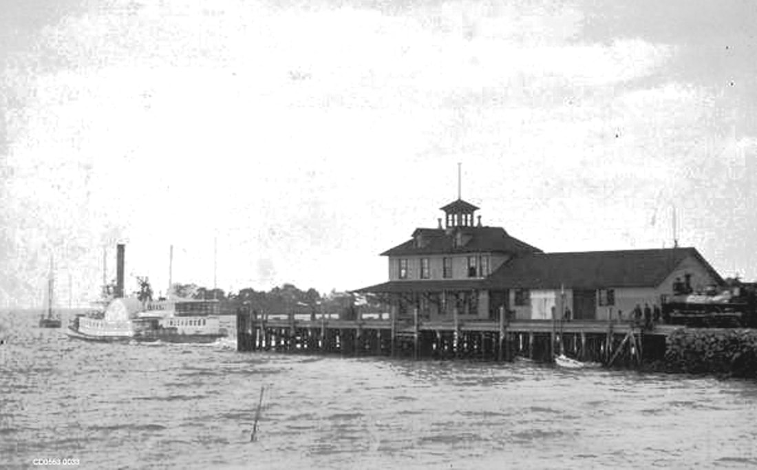
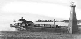
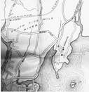
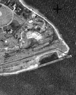
The new warm-water Norwalk terminus of the D&N opened on 7/4/1882 with better access to Long Island Sound and less likelihood of freezing than the D&N's 'downtown' dock on the Norwalk River: see NORWALK/D3. Gregg Turner says the view at [2] is 1882 and we are inclined to agree with the pastoral setting and quiet activity. Cornwall says the first passenger train ran to the point on 7/4/1882. People and freight were transported to and from this point by the Pegasus and the Cape Charles to New York City beginning on 9/18/1882; coal was also received here for shipment inland. Day excursions to New York were popular here. The boat seen in the shot at [1] is presumably approaching and will soon fill the empty dock with passengers to board the waterside train. The windmill in the shot at [2] likely pumped fresh water for the terminal complex. The HRR lease of the D&N in 1886 would bring an expansion of the facilities in 1888, including a pier that jutted out 500 feet into the Sound for the accommodation of larger boats and more being simultaneously serviced. By 4/19/1889 a newspaper article mentions a "... new water supply for locomotives..." as well as a new turntable and "heavy iron transfer bridge resting on its mammoth pontoon..." as part of the improvements. The map at [3] is from the 1892 Norwalk city directory. This complex was in the midst of this almost-completed expansion when a fire of 5/23/1889, caused by an overturned lamp in the freight house, ignited and quickly leveled the buildings before firefighters from Norwalk could arrive via a train dispatched from here. [REFS: NHER/09/14/1882/04: Pegasus; SAD/09/29/1882/04; CRC30.1883.17; RRC map 434 (11/28/1888) for extension of terminal grounds; CDE/12/28/1888/01: HRR buys Cape Charles; C102: 1882; P46,62][rev030318]
The new warm-water Norwalk terminus of the D&N opened on 7/4/1882 with better access to Long Island Sound and less likelihood of freezing than the D&N's 'downtown' dock on the Norwalk River: see NORWALK/D3. Gregg Turner says the view at [2] is 1882 and we are inclined to agree with the pastoral setting and quiet activity. Cornwall says the first passenger train ran to the point on 7/4/1882. People and freight were transported to and from this point by the Pegasus and the Cape Charles to New York City beginning on 9/18/1882; coal was also received here for shipment inland. Day excursions to New York were popular here. The boat seen in the shot at [1] is presumably approaching and will soon fill the empty dock with passengers to board the waterside train. The windmill in the shot at [2] likely pumped fresh water for the terminal complex. The HRR lease of the D&N in 1886 would bring an expansion of the facilities in 1888, including a pier that jutted out 500 feet into the Sound for the accommodation of larger boats and more being simultaneously serviced. By 4/19/1889 a newspaper article mentions a "... new water supply for locomotives..." as well as a new turntable and "heavy iron transfer bridge resting on its mammoth pontoon..." as part of the improvements. The map at [3] is from the 1892 Norwalk city directory. This complex was in the midst of this almost-completed expansion when a fire of 5/23/1889, caused by an overturned lamp in the freight house, ignited and quickly leveled the buildings before firefighters from Norwalk could arrive via a train dispatched from here. [REFS: NHER/09/14/1882/04: Pegasus; SAD/09/29/1882/04; CRC30.1883.17; RRC map 434 (11/28/1888) for extension of terminal grounds; CDE/12/28/1888/01: HRR buys Cape Charles; C102: 1882; P46,62][rev030318]
WILSON POINT2 [HRR, 1889]
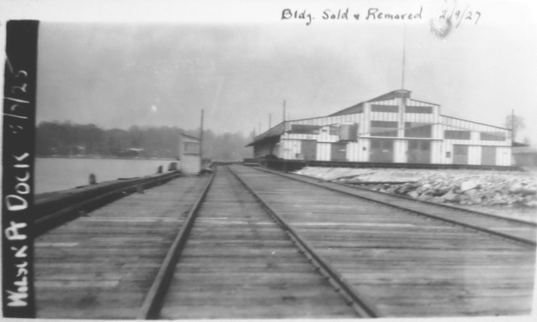
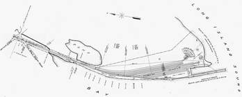
In the wake of the fire, the HRR temporarily transferred the boat operation to Bridgeport and announced its intention to immediately rebuild and expand further at WILSON POINT. A terminal complex with 500-car capacity was the result by the following year, with 24 "heavily-laden cars" sent to New York every night and goods reaching their destination by 7:00 a.m. "... beating all rival carriers." We do not know if the shot at [1] was it or it shows a later structure. The NY&NE/HRR alliance created the New England Terminal Co. to operate boats to Manhattan and to Jersey City for direct connections with the Pennsylvania RR there. New service began on 5/15/1890 and William H. Stevenson, NH&D president and HRR vice president and general manager, lost no time in inviting Connecticut legislators as well as businessmen from Pittsfield, Springfield and Hartford to show them that this was the best way for their goods to travel, running special inspection trains that connected with boats down to Piers 45 and 46 on the East River. The alliance pinned more hopes here on 9/16/1891 with the start of the short-lived Long Island & Eastern States Express line taking trains overnight to Boston from Brooklyn via Oyster Bay, NY and cross-Sound transfer barges. The party was over, however, on 6/10/1892 after J.P. Morgan obtained stock control of the HRR/D&N/NH&D on behalf of the NYNH&H. One of the first announcements was the cancellation of special tariffs via Wilson Point. Passenger service ended thereafter, likely in 1893, according to timetables; the last oblique reference is an August, 1892 newspaper article which noted a party from Bell Island being rowed across the water to "catch the early train" to South Norwalk. With its own facilities at Harlem River, the Consolidated also scaled this back as a freight terminus though newspaper articles show 'Wilson Point freights' and switching activity here until at least 1912. In 1893 this became a Standard Oil terminal with tanks built just to the north and a coal unloading facility was announced in 1905. During WWI the location was used for military and shipbuilding purposes but was still railroad property at the time the 5/2/1925 PUC photo at [1] was taken. The handwritten note at top says the building was sold and removed on 2/9/1927. The footprint on the 1915 val map at [2] appears to match the structure in the photo. The 1934 aerial map at [3] shows the building gone; the outline of the old engine house still may be seen. [REFS: NBE/04/19/1889/02; NHER/07/26/1889/04; NYTR/11/25/1889/02: Express; SAD/02/14/1890/02; NYTR/02/26/1890/12: oyster damage feared from oil; SWP/02/28/1890/01; WSDN/05/16/1890/02; SR/05/25/1890/07; SR/06/04/1890/06; NYT/06/24/1892/03; 11/6/1892PTT: Wilson Point yes; rev7/15/1894PTT: no; WH/08/18/1893/03; NBE/07/20/1894/03: old dock torn down; NHER/12/27/1894/01; NHER/03/06/1896/02: depot burned; DN/06/28/1905/03: new coal facility; BEF/09/04/1912/01; NBU/02/16/1922/01][rev030618]
In the wake of the fire, the HRR temporarily transferred the boat operation to Bridgeport and announced its intention to immediately rebuild and expand further at WILSON POINT. A terminal complex with 500-car capacity was the result by the following year, with 24 "heavily-laden cars" sent to New York every night and goods reaching their destination by 7:00 a.m. "... beating all rival carriers." We do not know if the shot at [1] was it or it shows a later structure. The NY&NE/HRR alliance created the New England Terminal Co. to operate boats to Manhattan and to Jersey City for direct connections with the Pennsylvania RR there. New service began on 5/15/1890 and William H. Stevenson, NH&D president and HRR vice president and general manager, lost no time in inviting Connecticut legislators as well as businessmen from Pittsfield, Springfield and Hartford to show them that this was the best way for their goods to travel, running special inspection trains that connected with boats down to Piers 45 and 46 on the East River. The alliance pinned more hopes here on 9/16/1891 with the start of the short-lived Long Island & Eastern States Express line taking trains overnight to Boston from Brooklyn via Oyster Bay, NY and cross-Sound transfer barges. The party was over, however, on 6/10/1892 after J.P. Morgan obtained stock control of the HRR/D&N/NH&D on behalf of the NYNH&H. One of the first announcements was the cancellation of special tariffs via Wilson Point. Passenger service ended thereafter, likely in 1893, according to timetables; the last oblique reference is an August, 1892 newspaper article which noted a party from Bell Island being rowed across the water to "catch the early train" to South Norwalk. With its own facilities at Harlem River, the Consolidated also scaled this back as a freight terminus though newspaper articles show 'Wilson Point freights' and switching activity here until at least 1912. In 1893 this became a Standard Oil terminal with tanks built just to the north and a coal unloading facility was announced in 1905. During WWI the location was used for military and shipbuilding purposes but was still railroad property at the time the 5/2/1925 PUC photo at [1] was taken. The handwritten note at top says the building was sold and removed on 2/9/1927. The footprint on the 1915 val map at [2] appears to match the structure in the photo. The 1934 aerial map at [3] shows the building gone; the outline of the old engine house still may be seen. [REFS: NBE/04/19/1889/02; NHER/07/26/1889/04; NYTR/11/25/1889/02: Express; SAD/02/14/1890/02; NYTR/02/26/1890/12: oyster damage feared from oil; SWP/02/28/1890/01; WSDN/05/16/1890/02; SR/05/25/1890/07; SR/06/04/1890/06; NYT/06/24/1892/03; 11/6/1892PTT: Wilson Point yes; rev7/15/1894PTT: no; WH/08/18/1893/03; NBE/07/20/1894/03: old dock torn down; NHER/12/27/1894/01; NHER/03/06/1896/02: depot burned; DN/06/28/1905/03: new coal facility; BEF/09/04/1912/01; NBU/02/16/1922/01][rev030618]
WILSONS1 [H&NH, 1871]
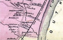
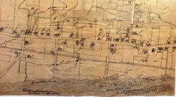
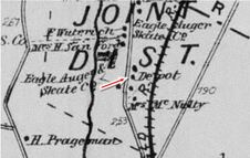
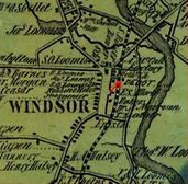
We do not know what the first station at this stop in Windsor just over the Hartford line looked like but a newspaper article, likely the Hartford Times, of August, 1928, said it was built by Allyn, Samuel and Fred Wilson at their own expense as part of a deal to have trains stop here. However valid the builders might be, a Courant article notes the debut in February, 1871. It reads: "Suburban Residences. The new stopping-place on the Hartford and New Haven road, between this city and Windsor... is called 'Wilson's Station,' and is three and one-half miles from the State House... The establishment of such stations in the immediate vicinity of Hartford... and the running of frequent trains at cheap fares is the true way to build up a large local business on the roads, and to promote the public welfare. The fare to the new station is only fifteen cents." This was the era when the railroad actually created places and put them on the map. Hundreds of newspaper articles thereafter reference Wilson Station and the economic and social activity here, undoubtedly stimulated by local rail access. The image at [1] is from the Baker & Tilden atlas of 1869 and shows residences with the Wilson surname for which the locale came to be known, similar to HAYDENS also in WINDSOR. The 1887 map at [2] was hand-drawn by Allyn's cartographically precocious 15-year-old son, Leland P. Wilson, and shows the depot in the southwest quadrant of the Wilson Lane grade crossing, where Wilson Ave. dead-ends today. Nefarious doings here most notably came in an 1891 dynamiting incident. The perpetrator then was a debonair French con man by the name of Amie (=Friend!) Louis Barrand who admitted that he "wanted to have fun with an explosion." His decade-long career of swindle, impersonation and sabotage began in 1879 and on 7/2/1891 he said he planted charges on a culvert south of WILSONS hoping to see the train thrown into the creek. Minor damage and no serious injures resulted and Barrand said then that he "remained about the wreck and enjoyed the excitement" of the frightened passengers with whom he mingled. Shortly thereafter, he got a ten-year prison sentence for blowing a Lehigh Valley engine off the track in Belvidere, NJ. We do not know if he ever faced the wrath of the NYNH&H. [REFS: HDC/02/01/1871/02; HDC/09/01/1871/02; HDC/12/31/ 1881/04; HDC/05/31/1872/02; HDC/07/02/1891/01; SR/07/02/1891/05; HC/09/19/1891/01; HC/10/01/1891/01; HC/08/21/1896/08][rev072816]
We do not know what the first station at this stop in Windsor just over the Hartford line looked like but a newspaper article, likely the Hartford Times, of August, 1928, said it was built by Allyn, Samuel and Fred Wilson at their own expense as part of a deal to have trains stop here. However valid the builders might be, a Courant article notes the debut in February, 1871. It reads: "Suburban Residences. The new stopping-place on the Hartford and New Haven road, between this city and Windsor... is called 'Wilson's Station,' and is three and one-half miles from the State House... The establishment of such stations in the immediate vicinity of Hartford... and the running of frequent trains at cheap fares is the true way to build up a large local business on the roads, and to promote the public welfare. The fare to the new station is only fifteen cents." This was the era when the railroad actually created places and put them on the map. Hundreds of newspaper articles thereafter reference Wilson Station and the economic and social activity here, undoubtedly stimulated by local rail access. The image at [1] is from the Baker & Tilden atlas of 1869 and shows residences with the Wilson surname for which the locale came to be known, similar to HAYDENS also in WINDSOR. The 1887 map at [2] was hand-drawn by Allyn's cartographically precocious 15-year-old son, Leland P. Wilson, and shows the depot in the southwest quadrant of the Wilson Lane grade crossing, where Wilson Ave. dead-ends today. Nefarious doings here most notably came in an 1891 dynamiting incident. The perpetrator then was a debonair French con man by the name of Amie (=Friend!) Louis Barrand who admitted that he "wanted to have fun with an explosion." His decade-long career of swindle, impersonation and sabotage began in 1879 and on 7/2/1891 he said he planted charges on a culvert south of WILSONS hoping to see the train thrown into the creek. Minor damage and no serious injures resulted and Barrand said then that he "remained about the wreck and enjoyed the excitement" of the frightened passengers with whom he mingled. Shortly thereafter, he got a ten-year prison sentence for blowing a Lehigh Valley engine off the track in Belvidere, NJ. We do not know if he ever faced the wrath of the NYNH&H. [REFS: HDC/02/01/1871/02; HDC/09/01/1871/02; HDC/12/31/ 1881/04; HDC/05/31/1872/02; HDC/07/02/1891/01; SR/07/02/1891/05; HC/09/19/1891/01; HC/10/01/1891/01; HC/08/21/1896/08][rev072816]
ICC Collection / NARA
WILSONS2 [H&NH, c1900?]
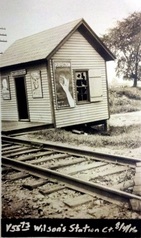
We do not know the build date for the structure seen in the 8/14/1916 ICC shot at left but this is the only photo we have ever seen for a depot here. The field crew noted the depot as well as a platform and a mail crane at this location. The 1915 val map shows a siding that may have been used for the gravel pit, brick works, and freight. Whatever the situation, it did not stop a local poultry breeder from using this stop for her own purposes when she "raised the signal at the local depot" in 1913 to halt the train but did not board it. Instead, as instructed by a Windsor Locks customer, she handed him a live rooster in a bag as he appeared on one of the car platforms! In spite of the fact that this Windsor village was the largest in terms of school population This stop was eliminated in 1928, the headline reading "Railroad Erases Wilson Station." Corroborating the photo, the structure was described as "a one-room shelter from the weather, remote from the thickly populated section of the village and was never more than a flag station." Contradicting the latter point, we have schedules showing regular stops here in former times but to the larger point of loss of service, it appears to have been as a boarding point only, our schedules showing at least one train leaving passengers until ca. 1952. An attempt by special act of the General Assembly to reestablish the flag station for boarding trains at WILSONS failed in 1935. [REFS: HC/04/15/1907/06; SR/07/07/1912/12; HC/09/13/1913/02; HC/01/29/1917/04; HC/08/10/1929/21; HC/03/08/1935/16: SB 470][rev072816]
We do not know the build date for the structure seen in the 8/14/1916 ICC shot at left but this is the only photo we have ever seen for a depot here. The field crew noted the depot as well as a platform and a mail crane at this location. The 1915 val map shows a siding that may have been used for the gravel pit, brick works, and freight. Whatever the situation, it did not stop a local poultry breeder from using this stop for her own purposes when she "raised the signal at the local depot" in 1913 to halt the train but did not board it. Instead, as instructed by a Windsor Locks customer, she handed him a live rooster in a bag as he appeared on one of the car platforms! In spite of the fact that this Windsor village was the largest in terms of school population This stop was eliminated in 1928, the headline reading "Railroad Erases Wilson Station." Corroborating the photo, the structure was described as "a one-room shelter from the weather, remote from the thickly populated section of the village and was never more than a flag station." Contradicting the latter point, we have schedules showing regular stops here in former times but to the larger point of loss of service, it appears to have been as a boarding point only, our schedules showing at least one train leaving passengers until ca. 1952. An attempt by special act of the General Assembly to reestablish the flag station for boarding trains at WILSONS failed in 1935. [REFS: HC/04/15/1907/06; SR/07/07/1912/12; HC/09/13/1913/02; HC/01/29/1917/04; HC/08/10/1929/21; HC/03/08/1935/16: SB 470][rev072816]
WILSONVILLE [N&W, 1840]
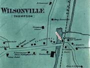
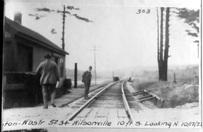
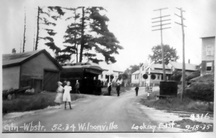
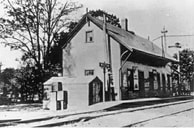
This station in the town of Thompson was also called WILSONS and sometimes confused with WILSON POINT. The 1851TT at upper middle shows this to be as early a stop as the neighboring stations, but whether it goes back to 1840 will not be known until we find an earlier timetable, and there are later timetables which do not show it either. We can also not be sure that this is the first depot built here. The PUC photo at lower middle dates to the 10/12/1922 and the one at lower right is from 9/18/1935. WILSONVILLE disappears from the Lines East timetable between our 5/4/1925 and 9/6/1926 issues. [REFS: Q84j][rev123113]
This station in the town of Thompson was also called WILSONS and sometimes confused with WILSON POINT. The 1851TT at upper middle shows this to be as early a stop as the neighboring stations, but whether it goes back to 1840 will not be known until we find an earlier timetable, and there are later timetables which do not show it either. We can also not be sure that this is the first depot built here. The PUC photo at lower middle dates to the 10/12/1922 and the one at lower right is from 9/18/1935. WILSONVILLE disappears from the Lines East timetable between our 5/4/1925 and 9/6/1926 issues. [REFS: Q84j][rev123113]
WILTON1 [D&N, 1852]
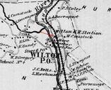
The location, as seen on the 1868 map, was on the west side of the main. This wooden, two-story, Gothic structure was similar to the other D&N stations of the period. See BETHEL1, DANBURY1, and GEORGETOWN1. This one had its cross gable only on the street side. In later days, this station would be moved up Rte. 7 to become an insurance agency office and it still maintains a handsome appearance today. [REFS: NL6.1.2; NL6.3.9; R109]
The location, as seen on the 1868 map, was on the west side of the main. This wooden, two-story, Gothic structure was similar to the other D&N stations of the period. See BETHEL1, DANBURY1, and GEORGETOWN1. This one had its cross gable only on the street side. In later days, this station would be moved up Rte. 7 to become an insurance agency office and it still maintains a handsome appearance today. [REFS: NL6.1.2; NL6.3.9; R109]
WILTON2 [NYNH&H, 1939]
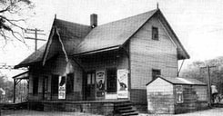
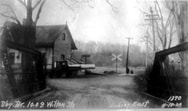
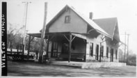
The photo at top left shows the original 1939 structure built to replace WILTON1, complete with vintage car parked along the north end where a portico can be seen. Not only was that later enclosed, as John Roy says, but an addition seems to have been put on the south end. The other two photos show the enlarged building, and date to after early 1961 when, according to Cornwall, electrification ended and the wires, no longer seen, were taken down. WILTON2 still stands in 2011 on the east side of the main. [REFS: C89,104; R109]
The photo at top left shows the original 1939 structure built to replace WILTON1, complete with vintage car parked along the north end where a portico can be seen. Not only was that later enclosed, as John Roy says, but an addition seems to have been put on the south end. The other two photos show the enlarged building, and date to after early 1961 when, according to Cornwall, electrification ended and the wires, no longer seen, were taken down. WILTON2 still stands in 2011 on the east side of the main. [REFS: C89,104; R109]
National Archives
WINDERMERE [CC, 1876]
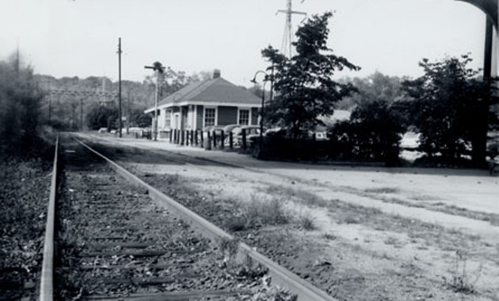
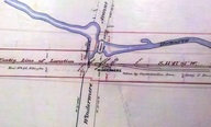
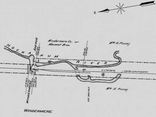
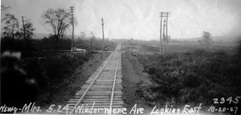
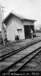
This stop was established for a euphoniously named mill town in ELLINGTON. Image [1] is an NY&NE 1888rev real estate map and [2] is the 1915 val map, both showing the depot in the southwest quadrant of the grade crossing. Area tobacco farmers and the namesake woolen mill probably utilized the freight siding that is also seen on the maps. The mill operation dated back to 1854 and the property, consisting of a five-story stone and brick building with wing additions, engine room, boiler house and coal shed, 22 tenement units, frame store and office buildings, was transformed by the Avery-Bates Co. for the production of coated papers in 1905. A canal carrying water from the Hockanum River supplemented the 150-horse power Green-Corliss engine in the plant at that time. Image [4] is the 8/9/1916 val photo. With inroads from the automobile, the truck and the competing trolley line that opened in 1906, all service seems to have been eliminated here by the time the 10/20/1927 PUC photo [3] was taken. Neither the station nor the freight siding are seen. [REFS: HC/03/10/1891/06; HC/04/06/1896/06; HC/03/15/1897/06; HC/02/01/1905/13; HC/07/29/1905/12; HC/11/20/1905/05; HC/09/09/1907/12; HC/03/17/1906 /15; K121][rev021014]
This stop was established for a euphoniously named mill town in ELLINGTON. Image [1] is an NY&NE 1888rev real estate map and [2] is the 1915 val map, both showing the depot in the southwest quadrant of the grade crossing. Area tobacco farmers and the namesake woolen mill probably utilized the freight siding that is also seen on the maps. The mill operation dated back to 1854 and the property, consisting of a five-story stone and brick building with wing additions, engine room, boiler house and coal shed, 22 tenement units, frame store and office buildings, was transformed by the Avery-Bates Co. for the production of coated papers in 1905. A canal carrying water from the Hockanum River supplemented the 150-horse power Green-Corliss engine in the plant at that time. Image [4] is the 8/9/1916 val photo. With inroads from the automobile, the truck and the competing trolley line that opened in 1906, all service seems to have been eliminated here by the time the 10/20/1927 PUC photo [3] was taken. Neither the station nor the freight siding are seen. [REFS: HC/03/10/1891/06; HC/04/06/1896/06; HC/03/15/1897/06; HC/02/01/1905/13; HC/07/29/1905/12; HC/11/20/1905/05; HC/09/09/1907/12; HC/03/17/1906 /15; K121][rev021014]
WINDSOR1 [H&NH, 1844]
In 1866, the newspaper reported that the construction of a new depot here had been put off, the railroad instead opting "to economize by slightly painting and papering the old shell." It was on the east side of the track, as seen on the 1855HC map. When the next station was built in 1870, WINDSOR1 became the freight house, as reported in the Courant which said that the new station was on the west side of the tracks "so that passengers do not have to cross the rails to reach it as formerly, in going to the ancient building, now to be made into a freight depot...." The H&NH annual report for 1871 corroborates in telling us that "a new and expensive Passenger Building has been constructed at Windsor station on the opposite side of the track from the freight-house, in which all the passenger accommodations were previously furnished." Additional research turned up a December, 1872 article that says a new freight house was "completed but a few months ago," probably meaning that WINDSOR1 was torn down at that time. The 1872 clarification for the date of the freight house is a discovery that the 1988 NRHP [click here to search database] designation did not have at the time of the nomination. We have no photo of WINDSOR1 or any of the original H&NH stations north of Hartford. The closest in time frame is WINDSOR LOCKS2, which was built in 1859. [REFS: HDC/06/28/1866/02; HNHAR35.1871.7; HDC/03/10/1870/02; HDC/12/09/1872/02][rev042113]
In 1866, the newspaper reported that the construction of a new depot here had been put off, the railroad instead opting "to economize by slightly painting and papering the old shell." It was on the east side of the track, as seen on the 1855HC map. When the next station was built in 1870, WINDSOR1 became the freight house, as reported in the Courant which said that the new station was on the west side of the tracks "so that passengers do not have to cross the rails to reach it as formerly, in going to the ancient building, now to be made into a freight depot...." The H&NH annual report for 1871 corroborates in telling us that "a new and expensive Passenger Building has been constructed at Windsor station on the opposite side of the track from the freight-house, in which all the passenger accommodations were previously furnished." Additional research turned up a December, 1872 article that says a new freight house was "completed but a few months ago," probably meaning that WINDSOR1 was torn down at that time. The 1872 clarification for the date of the freight house is a discovery that the 1988 NRHP [click here to search database] designation did not have at the time of the nomination. We have no photo of WINDSOR1 or any of the original H&NH stations north of Hartford. The closest in time frame is WINDSOR LOCKS2, which was built in 1859. [REFS: HDC/06/28/1866/02; HNHAR35.1871.7; HDC/03/10/1870/02; HDC/12/09/1872/02][rev042113]
WINDSOR2 [H&NH, 1870]
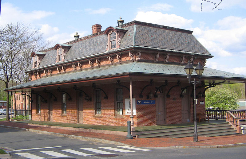
The Courant reported in March, 1870 that "The Hartford and New Haven Railroad Company are erecting a new depot in Windsor to meet the wants of their increasing business at that station. It is to be of brick, 26 by 62 feet, surrounded by a platform ten feet wide, and having a French roof, and will be an improvement that the Windsor people will appreciate. Internally the arrangements are for a ladies' sitting room and also one for gentlemen, a baggage room and a telegraph office." The French, or Mansard, roof was popular at the time and would also be seen in WALLINGFORD3 and NEW HAVEN4. When the structure was finished, the newspaper said it was "the finest of its size between New York and Boston" and praised the officers of the H&NH "that in the improvements they make, they consult permanence rather than resort to expedients to defer doing what is needed for public accommodation." Money was apparently no object with wainscotting, settees, fine carpeting, two furnaces, a ten-foot-square addtion for a women's drawing room, and a telegraph office "where a young lady operator is constantly in attendance." Abandoned for two decades after the NYNH&H exited the scene in 1968, WINDSOR2 was beautifully restored and received an NRHP designation in 1988 along with the gabled-roof freight house across the tracks. It still graces the Amtrak stop here today in 2013. [REFS: HNHAR31.1871.7; CRC18.1871.10; HDC/03/10/1870/02; NA/03/16/1870/04; HDC/09/07/1870/02; R110] [rev070113]
The Courant reported in March, 1870 that "The Hartford and New Haven Railroad Company are erecting a new depot in Windsor to meet the wants of their increasing business at that station. It is to be of brick, 26 by 62 feet, surrounded by a platform ten feet wide, and having a French roof, and will be an improvement that the Windsor people will appreciate. Internally the arrangements are for a ladies' sitting room and also one for gentlemen, a baggage room and a telegraph office." The French, or Mansard, roof was popular at the time and would also be seen in WALLINGFORD3 and NEW HAVEN4. When the structure was finished, the newspaper said it was "the finest of its size between New York and Boston" and praised the officers of the H&NH "that in the improvements they make, they consult permanence rather than resort to expedients to defer doing what is needed for public accommodation." Money was apparently no object with wainscotting, settees, fine carpeting, two furnaces, a ten-foot-square addtion for a women's drawing room, and a telegraph office "where a young lady operator is constantly in attendance." Abandoned for two decades after the NYNH&H exited the scene in 1968, WINDSOR2 was beautifully restored and received an NRHP designation in 1988 along with the gabled-roof freight house across the tracks. It still graces the Amtrak stop here today in 2013. [REFS: HNHAR31.1871.7; CRC18.1871.10; HDC/03/10/1870/02; NA/03/16/1870/04; HDC/09/07/1870/02; R110] [rev070113]
WINDSOR3 [ATK, c1970]
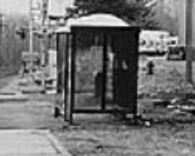
This shelter was built by the state of Connecticut in the early 1970s when passenger service was being operated by Amtrak. Similar ones at the time would be in use at ENFIELD, NORTH HAVEN and WINDSOR LOCKS4 is still in service today. When WINDSOR2 reopened in 1988, this plexiglass structure was abandoned. [rev070113]
This shelter was built by the state of Connecticut in the early 1970s when passenger service was being operated by Amtrak. Similar ones at the time would be in use at ENFIELD, NORTH HAVEN and WINDSOR LOCKS4 is still in service today. When WINDSOR2 reopened in 1988, this plexiglass structure was abandoned. [rev070113]
WINDSOR LOCKS1 [H&NH, 1844]
This was likely a combination station serving both freight and passengers. The location is seen on the 1855HC map. We have no photograph of this station.
This was likely a combination station serving both freight and passengers. The location is seen on the 1855HC map. We have no photograph of this station.
WINDSOR LOCKS2 [H&NH, 1859]
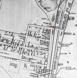
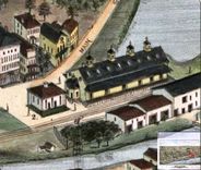
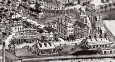
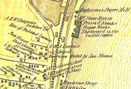
In April, 1859, the Courant said that "the Hartford and New Haven Railroad are to build a new and enlarged depot at Windsor Locks; to be located 100 feet north of the present depot." We think that the small structure on the 1877 Bailey map [click here] at right is this second station and the 1868 map at left corroborates the new location, now at the foot of Grove St. instead of at Oak St., as formerly. The H&NH annual report, dated September, 1859, says that "a new passenger depot has been built at Windsor Locks during the year." Thirteen years later, the Courant said in 1872 that "the Hartford and New Haven railroad company will begin the erection of new passenger and freight depots at Windsor Locks, May 1st" and permission for the taking of land for expanded facilities was granted by the railroad commissioners at that time. While nothing more is said about this newer passenger station, which we do not think was built, the Massachusetts Spy says work on the 140x85-foot brick freight depot was in progress by July, 1872. Bailey clearly shows the new freight house but still has the old passenger station, leaving the open question as to how this map is dated 1877 when the 1875 WINDSOR LOCKS3 should be in place. A possible explanation is that the sketch for this map was done prior to 1875 and dated 1877 when released. Such a discrepancy was proven for NAUGATUCK2 and theorized for DANBURY2. Once again, we owe Mr. B. a debt of thanks for preserving an image of WINDSOR LOCKS2, the only representation we have of an H&NH station of this vintage on the line above Hartford. [REFS: HDC/04/25/1859/02; HNHAR24.1859.6; HDC/04/10/1871/02; RRC8.82 (5/13/1872); HDC/04/11/1872/04; MS/07/12/1872/02; HDC/02/19/1874/02; HDC/08/26/1876/02; SR/12/10/1938/03][rev120916]
In April, 1859, the Courant said that "the Hartford and New Haven Railroad are to build a new and enlarged depot at Windsor Locks; to be located 100 feet north of the present depot." We think that the small structure on the 1877 Bailey map [click here] at right is this second station and the 1868 map at left corroborates the new location, now at the foot of Grove St. instead of at Oak St., as formerly. The H&NH annual report, dated September, 1859, says that "a new passenger depot has been built at Windsor Locks during the year." Thirteen years later, the Courant said in 1872 that "the Hartford and New Haven railroad company will begin the erection of new passenger and freight depots at Windsor Locks, May 1st" and permission for the taking of land for expanded facilities was granted by the railroad commissioners at that time. While nothing more is said about this newer passenger station, which we do not think was built, the Massachusetts Spy says work on the 140x85-foot brick freight depot was in progress by July, 1872. Bailey clearly shows the new freight house but still has the old passenger station, leaving the open question as to how this map is dated 1877 when the 1875 WINDSOR LOCKS3 should be in place. A possible explanation is that the sketch for this map was done prior to 1875 and dated 1877 when released. Such a discrepancy was proven for NAUGATUCK2 and theorized for DANBURY2. Once again, we owe Mr. B. a debt of thanks for preserving an image of WINDSOR LOCKS2, the only representation we have of an H&NH station of this vintage on the line above Hartford. [REFS: HDC/04/25/1859/02; HNHAR24.1859.6; HDC/04/10/1871/02; RRC8.82 (5/13/1872); HDC/04/11/1872/04; MS/07/12/1872/02; HDC/02/19/1874/02; HDC/08/26/1876/02; SR/12/10/1938/03][rev120916]
National Park Service
WINDSOR LOCKS3 [NYNH&H, 1875]
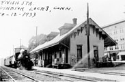
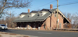
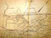
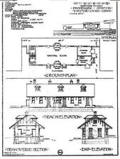
In February, 1874, the Courant reported that, because of "heavy expenses" elsewhere, it was doubtful that a new station would be built here. This statement seems to verify the fact that the depot that was expected back in 1872 never came to fruition and, in fact, this third station did not come until the 1875 date seen at [4] on the architectural plan submitted with its NRHP designation. This station was moved a bit to the south after being built where WINDSOR LOCKS1 had stood. An 1885 article says that an addition was to be put on the south end for a telegraph and express office and another report in 1886 said that "the old brick depot has been moved south in front of the hotel, and an addition is to be put on to it for the accommodation of the public." The NYNH&H annual report for 1886 says, somewhat cryptically, that the station "is being reconstructed and enlarged at an expense thus far of about eighteen hundred dollars." The southward shift is apparent when the 1913 aerial map at [1] is compared to the 1877 map in the previous entry. The handwriting on the 10/12/1933 photo at [2] may have be Irving Drake's; a Springfield-bound freight passes the water tank south of the station. The 1/2/2020 photo shows this station undergoing renovation as a community center with the support of the town. Even the boarded-up windows have been painted to look like real paned glass! [REFS: HDC/02/19/1874/02; SR/08/13/1885/07; HDC/00/00/1886/00qq; NHAR14.1886.11; SR/11/21/1902/10; R111] [rev042113, 031820]
In February, 1874, the Courant reported that, because of "heavy expenses" elsewhere, it was doubtful that a new station would be built here. This statement seems to verify the fact that the depot that was expected back in 1872 never came to fruition and, in fact, this third station did not come until the 1875 date seen at [4] on the architectural plan submitted with its NRHP designation. This station was moved a bit to the south after being built where WINDSOR LOCKS1 had stood. An 1885 article says that an addition was to be put on the south end for a telegraph and express office and another report in 1886 said that "the old brick depot has been moved south in front of the hotel, and an addition is to be put on to it for the accommodation of the public." The NYNH&H annual report for 1886 says, somewhat cryptically, that the station "is being reconstructed and enlarged at an expense thus far of about eighteen hundred dollars." The southward shift is apparent when the 1913 aerial map at [1] is compared to the 1877 map in the previous entry. The handwriting on the 10/12/1933 photo at [2] may have be Irving Drake's; a Springfield-bound freight passes the water tank south of the station. The 1/2/2020 photo shows this station undergoing renovation as a community center with the support of the town. Even the boarded-up windows have been painted to look like real paned glass! [REFS: HDC/02/19/1874/02; SR/08/13/1885/07; HDC/00/00/1886/00qq; NHAR14.1886.11; SR/11/21/1902/10; R111] [rev042113, 031820]
WINDSOR LOCKS4 [ATK, 1981]
WINDSOR LOCKS5 [ATK, 2020(?)]
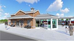
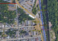
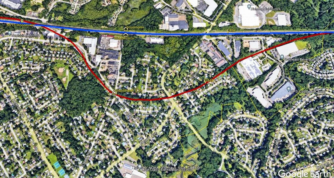
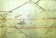
Currently about to begin construction at 231 Main St., just north of WINDSOR LOCKS3, the plan being to replace the minimal AM-shack down at I-91. The Track 11 Google Earth map snippet shows the locations of four of the five stations. Windsor Locks almost got another railroad and station in 1902 when the CNE, thwarted in East Granby from going to Springfield, considered building the Windsor Locks RR, either as an alternative route to Massachusetts or as a stub-end branch to drain some of the industrial traffic that the NYNH&H was monopolizing. Several newspaper articles tell of land acquisitions to bring the new line into town. The terminus was to be at Chestnut St., seen on 1913 map snippet [1] in the previous entry, and the area to the west corresponding to today's Pesci Park was to be the site for the CNE facilities. The red line coming in from the left on is the terminus of the never-built Windsor Locks RR.
[031820]
WINNIPAUK [D&N, 1852]
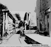
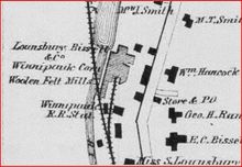
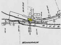
The impressive wooden-railed bridge in the photo at upper left probably dates the scene to the late 1800s, possibly even before the NYNH&H leased the D&N and the HRR in 1892. The location of this station is seen at middle on the map from the 1867 Beers atlas of New York and vicinity. This was a D&N stop from its opening, within the town of Norwalk but just north of the borough itself. The woolen mill and other industries powered by the waters of the Norwalk River that the railroad crossed here were major employers in this area. Cornwall says this ceased to be a passenger stop by 1929. The val map at right shows the station on the east side of the track, corresponding to the historical photograph and the map. The location is seen today [lower left] behind the commercial buildings at 330 Main Avenue, just south of the Merritt Pkwy. [REFS: SL17.4.24]
The impressive wooden-railed bridge in the photo at upper left probably dates the scene to the late 1800s, possibly even before the NYNH&H leased the D&N and the HRR in 1892. The location of this station is seen at middle on the map from the 1867 Beers atlas of New York and vicinity. This was a D&N stop from its opening, within the town of Norwalk but just north of the borough itself. The woolen mill and other industries powered by the waters of the Norwalk River that the railroad crossed here were major employers in this area. Cornwall says this ceased to be a passenger stop by 1929. The val map at right shows the station on the east side of the track, corresponding to the historical photograph and the map. The location is seen today [lower left] behind the commercial buildings at 330 Main Avenue, just south of the Merritt Pkwy. [REFS: SL17.4.24]
WINSTED/N1 [NRR, 1849]
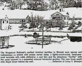
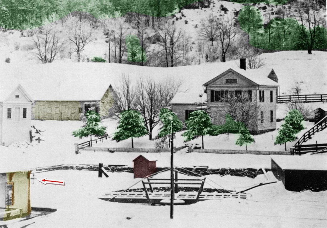
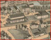
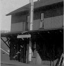
The photo at upper left is misidentified as WEST WINSTED in the book Connecticut Railroads and elsewhere but, in fact, is the NRR's 1849 downtown station. It looks pretty typical of others like DERBY1 and NAUGATUCK1. The middle photo is from Bob Adams's "Winsted's Quintuplets" article and carries the original captioning that refers to "a station with ornate corner lamp." Al Weaver's colorized version at right has helped greatly in showing the building in the left foreground that Adams meant and our red arrow points to the lamp. This photo, often seen without the captioning that is admittedly vague, has understandably added to the confusion. While the downtown depot appears adequate enough, the Winsted Herald railed retrospectively in 1879 that it had been "cussed and discussed" for nigh the 30 years it stood, that it wasn't "fit to put pigs in -- much less passengers" and that, since the depot floor was a step lower than the outside platform, "many an old lady or other unwary passenger pitched headlong into the darkness after alighting from the evening train." The paper went on to blame the avarice of the NRR management for not replacing it sooner. The 1854LC map at lower left shows the location at the corner of Bridge and Depot Sts., in the center of the borough. [REFS: WH/07/25/1879/05; NMRA Bulletin 43.8 (4/1978); C134][rev 031113]
The photo at upper left is misidentified as WEST WINSTED in the book Connecticut Railroads and elsewhere but, in fact, is the NRR's 1849 downtown station. It looks pretty typical of others like DERBY1 and NAUGATUCK1. The middle photo is from Bob Adams's "Winsted's Quintuplets" article and carries the original captioning that refers to "a station with ornate corner lamp." Al Weaver's colorized version at right has helped greatly in showing the building in the left foreground that Adams meant and our red arrow points to the lamp. This photo, often seen without the captioning that is admittedly vague, has understandably added to the confusion. While the downtown depot appears adequate enough, the Winsted Herald railed retrospectively in 1879 that it had been "cussed and discussed" for nigh the 30 years it stood, that it wasn't "fit to put pigs in -- much less passengers" and that, since the depot floor was a step lower than the outside platform, "many an old lady or other unwary passenger pitched headlong into the darkness after alighting from the evening train." The paper went on to blame the avarice of the NRR management for not replacing it sooner. The 1854LC map at lower left shows the location at the corner of Bridge and Depot Sts., in the center of the borough. [REFS: WH/07/25/1879/05; NMRA Bulletin 43.8 (4/1978); C134][rev 031113]
WINSTED/N2 [NRR, 1876]
The image at left is from the Bailey bird's-eye map of 1877 [click here]. This NRR depot opened on 12/4/1876. The railroad commissioners described this building in their 1877 annual report as "substantially built of brick, with stone trimmings," having a nine-foot wide covered platform on the south and east sides and a 30x20-ft covered platform on the west end for baggage and express. Inside was a 65-ft-long single waiting room for men and women, "heated by steam and lighted by gas," with ticket office in the center, freight and baggage room on one end (east) and telegraph and express offices on the other (west), the cost of the depot being about $10,000. The Winsted Herald, continuing its 1879 rant, said this station had come, not out of generosity, but because the NRR was compelled by the competition. The NRR, it continued, had the entire Valley by the throat and that in 1879 Wolcottville, aka Torrington, was paying $2.00 more per ton for coal than Winsted which had been rescued from "the rigor of a railroad monopoly" by the coming of the Connecticut Western. In 1905, when all the other Winsted depots were abandoned, this one, which had been enlarged and refurbished, became the sole station here until it was torn down in 1966. [REFS: CWN/01/28/1876/02; HDC/12/07/1876/04; CRC24.1877.21; HC/06/28/1905/18; HC/09/06/1905/13; HC/09/13/1905/11; HC/07/16/1965/24E; HC/07/23/1966/9D]
The image at left is from the Bailey bird's-eye map of 1877 [click here]. This NRR depot opened on 12/4/1876. The railroad commissioners described this building in their 1877 annual report as "substantially built of brick, with stone trimmings," having a nine-foot wide covered platform on the south and east sides and a 30x20-ft covered platform on the west end for baggage and express. Inside was a 65-ft-long single waiting room for men and women, "heated by steam and lighted by gas," with ticket office in the center, freight and baggage room on one end (east) and telegraph and express offices on the other (west), the cost of the depot being about $10,000. The Winsted Herald, continuing its 1879 rant, said this station had come, not out of generosity, but because the NRR was compelled by the competition. The NRR, it continued, had the entire Valley by the throat and that in 1879 Wolcottville, aka Torrington, was paying $2.00 more per ton for coal than Winsted which had been rescued from "the rigor of a railroad monopoly" by the coming of the Connecticut Western. In 1905, when all the other Winsted depots were abandoned, this one, which had been enlarged and refurbished, became the sole station here until it was torn down in 1966. [REFS: CWN/01/28/1876/02; HDC/12/07/1876/04; CRC24.1877.21; HC/06/28/1905/18; HC/09/06/1905/13; HC/09/13/1905/11; HC/07/16/1965/24E; HC/07/23/1966/9D]
WINSTED/C1 [CW, 1879; becomes EAST WINSTED, 1890]
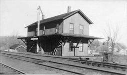
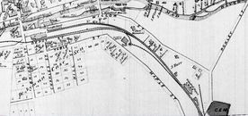
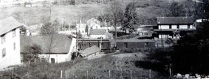
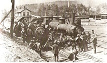
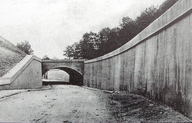
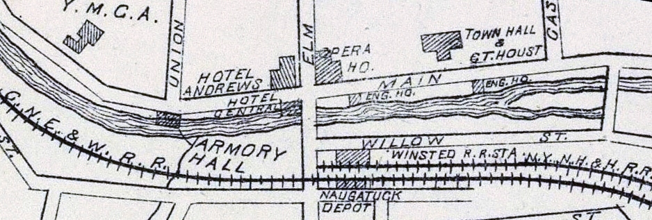
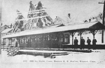
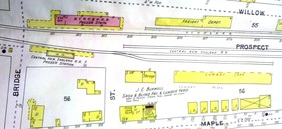
When the CW opened in 1871, it met the NRR on the east side of the borough at a point called NAUGATUCK JUNCTION on some early travelers guides and also on the RRM maps. The CW put up a freight station here at Willow St. just off of Rowley Rd. in 1872 and it can be seen on the 1877 Bailey bird's-eye map [click here] and on the 1874 Beers map at upper right. It would not be until December, 1878 that the Connecticut Western News said that the company was "building a new passenger depot near the East Winsted freight house." The Register said subsequently that a passenger station was "recently built" and that the CW had also put in 1,800 feet of track to eliminate the gap in its own rails between here and the NRR station. Motivated to save $1,000 to $2,500 per year in rental fees paid to the NRR, as well as to avoid numerous instances of "serious inconvenience at being compelled to await the moving of Naugatuck trains when on the track belonging to that company," the CW began using its own rails and this new passenger depot for its Winsted stop. Permission to do so was requested in an application to the railroad commissioners in May, 1879. The NRR, however, feeling no obligation to change its schedules and inconvenience its passengers, reacted by declining to stop here, the result being that neither company was serving the other's station. Public complaint about what the Winsted Herald called a "dis-arrangement" soon forced the railroad commissioners to rule that, when passengers wished to make connections with the other road, northbound NRR trains had to stop at East Winsted and eastbound CW trains had to stop at the Naugatuck depot. Some locals were still dissatisfied and got a Superior Court ruling that all CW trains had to stop at the NRR depot because it had been the CW's original Winsted station. The Register aptly remarked that there will now "therefore be three stopping places for Connecticut Western trains in Winsted." The 1880 NY&NE appraisal of CW properties said this two-story structure, though new, was only valued at $800. In contrast, and for reasons not apparent to us, the one-story stations at BLOOMFIELD and CANTON were said to be worth $1500. Sometime between our timetables for 9/8/1889 and 6/16/1890, this station was renamed EAST WINSTED. The lower left image is a northward view of the station. The lower middle photo from Bob Adam's collection shows the depot standing west of a 1902 collision of locomotives 128 and 183. At lower right is a shot of the concrete arch, completed by 1908, that eliminated the dangerous Rowley St. grade crossing. The bridge reportedly took longer to take down than to put up because of its steel reinforcing rods. Adams seems to say that EAST WINSTED was torn down with the NYNH&H takeover and abandonment of all the CNE stations in 1905. A 1961 photo in Nimke [3.39] shows it was not there as of that date. [REFS: WH/02/27/1872/02; HDC/08/20/1873/02; CWN/09/11/1874/02; 1875TT; 1877TT; CWN/12/11/1878/02; RRC16.31 (5/17/1879); WH/05/23/1879/05; HDC/05/26/1879/04; NHER/05/29/1879/01; NHER/06/02/1879/04; NHER/06/07/1879/04; WH/06/27/1879/05; HDC/07/07/1879/02; NHER/07/24/1879/04; NHER/08/28/1879/04; CW/NYNE 1880; RRC20.396 (9/12/1905); CRC53.1905.14; CRC54.1906.35 CRC55.1907 .47; CRC56.1908.52; Nimke 1.86,129, 3.39][rev031613]
When the CW opened in 1871, it met the NRR on the east side of the borough at a point called NAUGATUCK JUNCTION on some early travelers guides and also on the RRM maps. The CW put up a freight station here at Willow St. just off of Rowley Rd. in 1872 and it can be seen on the 1877 Bailey bird's-eye map [click here] and on the 1874 Beers map at upper right. It would not be until December, 1878 that the Connecticut Western News said that the company was "building a new passenger depot near the East Winsted freight house." The Register said subsequently that a passenger station was "recently built" and that the CW had also put in 1,800 feet of track to eliminate the gap in its own rails between here and the NRR station. Motivated to save $1,000 to $2,500 per year in rental fees paid to the NRR, as well as to avoid numerous instances of "serious inconvenience at being compelled to await the moving of Naugatuck trains when on the track belonging to that company," the CW began using its own rails and this new passenger depot for its Winsted stop. Permission to do so was requested in an application to the railroad commissioners in May, 1879. The NRR, however, feeling no obligation to change its schedules and inconvenience its passengers, reacted by declining to stop here, the result being that neither company was serving the other's station. Public complaint about what the Winsted Herald called a "dis-arrangement" soon forced the railroad commissioners to rule that, when passengers wished to make connections with the other road, northbound NRR trains had to stop at East Winsted and eastbound CW trains had to stop at the Naugatuck depot. Some locals were still dissatisfied and got a Superior Court ruling that all CW trains had to stop at the NRR depot because it had been the CW's original Winsted station. The Register aptly remarked that there will now "therefore be three stopping places for Connecticut Western trains in Winsted." The 1880 NY&NE appraisal of CW properties said this two-story structure, though new, was only valued at $800. In contrast, and for reasons not apparent to us, the one-story stations at BLOOMFIELD and CANTON were said to be worth $1500. Sometime between our timetables for 9/8/1889 and 6/16/1890, this station was renamed EAST WINSTED. The lower left image is a northward view of the station. The lower middle photo from Bob Adam's collection shows the depot standing west of a 1902 collision of locomotives 128 and 183. At lower right is a shot of the concrete arch, completed by 1908, that eliminated the dangerous Rowley St. grade crossing. The bridge reportedly took longer to take down than to put up because of its steel reinforcing rods. Adams seems to say that EAST WINSTED was torn down with the NYNH&H takeover and abandonment of all the CNE stations in 1905. A 1961 photo in Nimke [3.39] shows it was not there as of that date. [REFS: WH/02/27/1872/02; HDC/08/20/1873/02; CWN/09/11/1874/02; 1875TT; 1877TT; CWN/12/11/1878/02; RRC16.31 (5/17/1879); WH/05/23/1879/05; HDC/05/26/1879/04; NHER/05/29/1879/01; NHER/06/02/1879/04; NHER/06/07/1879/04; WH/06/27/1879/05; HDC/07/07/1879/02; NHER/07/24/1879/04; NHER/08/28/1879/04; CW/NYNE 1880; RRC20.396 (9/12/1905); CRC53.1905.14; CRC54.1906.35 CRC55.1907 .47; CRC56.1908.52; Nimke 1.86,129, 3.39][rev031613]
WINSTED/C2 [CW, 1880]
According to Adams, the CW put a box car body here in 1880 in the narrow space between its track and Depot St. to comply with the order that its trains stop opposite the NRR station at Bridge St. The 1880 NY&NE appraisal of CW properties said this structure was worth a mere $200, thus validating Adams claim. The earliest map we could find to reflect this is the one at upper left from 1893. It shows the NRR depot as 'Winsted station' and the 'Naugatuck Depot' of the then PR&NE to the south. The 1896 map at upper right reiterates this arrangement and the 1897 map at lower left shows the small footprint of the box car. When TARIFFVILLE1 burned down in 1892, the Winsted Citizen wrote the following requiem: "The Tariffville railroad station burned the other night. It was the meanest, shabbiest, dirtiest and most disgraceful hog pen on the road between Hartford and Poughkeepsie through courtesy known as an alleged railroad station, excepting, of course, the ancient old ark on the flat." That hometown "ark" was this depot which sat in the central low-lying part of the borough known as the flat. In April, 1896 a Herald article mentions repairs being made to the platform at the PR&NE station. The Courant reported late in 1897 that "the 'cheese box' depot on the Flat" that was "squatty, unsightly and uncomfortable" was being torn down and a new one was going to be erected immediately to the east. PR&NE tickets were, meanwhile, to be sold at the NRR station. We have no photo of the structure that was so reviled. [REFS: WC/10/01/1890/00; WC/05/06/1892/00; WC/09/00/1895/00; WH/04/15/1896/08; WEC/12/10/1898/00; HDC/12/14/1897/11; HDC/12/22/1897/12][rev020518]
According to Adams, the CW put a box car body here in 1880 in the narrow space between its track and Depot St. to comply with the order that its trains stop opposite the NRR station at Bridge St. The 1880 NY&NE appraisal of CW properties said this structure was worth a mere $200, thus validating Adams claim. The earliest map we could find to reflect this is the one at upper left from 1893. It shows the NRR depot as 'Winsted station' and the 'Naugatuck Depot' of the then PR&NE to the south. The 1896 map at upper right reiterates this arrangement and the 1897 map at lower left shows the small footprint of the box car. When TARIFFVILLE1 burned down in 1892, the Winsted Citizen wrote the following requiem: "The Tariffville railroad station burned the other night. It was the meanest, shabbiest, dirtiest and most disgraceful hog pen on the road between Hartford and Poughkeepsie through courtesy known as an alleged railroad station, excepting, of course, the ancient old ark on the flat." That hometown "ark" was this depot which sat in the central low-lying part of the borough known as the flat. In April, 1896 a Herald article mentions repairs being made to the platform at the PR&NE station. The Courant reported late in 1897 that "the 'cheese box' depot on the Flat" that was "squatty, unsightly and uncomfortable" was being torn down and a new one was going to be erected immediately to the east. PR&NE tickets were, meanwhile, to be sold at the NRR station. We have no photo of the structure that was so reviled. [REFS: WC/10/01/1890/00; WC/05/06/1892/00; WC/09/00/1895/00; WH/04/15/1896/08; WEC/12/10/1898/00; HDC/12/14/1897/11; HDC/12/22/1897/12][rev020518]
WINSTED/C3 [PR&NE, 1898]
Articles in the Winsted Herald reported that plans for a new station were in the works as far back as 1895. The Lakeville Journal reported in November, 1897 that "one of the greatest improvements that could possibly be made by the P.R. & N.E. road is now begun. A new station is being built at Winsted, a little east of where the insignificant old thing now stands." With the town granting the railroad five feet of additional land on Depot St., the foundation was laid late in December, 1897. Arrangements were made with the NYNH&H for all services to be provided for passengers at the NRR station across the track until WINSTED/C3 opened early the next year. The railroad commissioners described it as small but adequate and the best that could be done in the small space available. The important captioning on the photo at left refers to the "severest ice storm ever known here," that began on 2/20/1898 and raged for more than three days. These words, cropped out of most copies of this photo, not only explain the frozen utility lines but clarify that the station was up in time for this historic weather event. We were fortunate to find the 1904 map seen here that shows the footprint of this station. Compare to the 1897 map at WINSTED/C2 to see how much larger than its predecessor it was. WINSTED/C3 was torn down in 1905 after the NYNH&H got control of the CNE and eliminated all three of its Winsted stations in favor of the refurbished WINSTED/N2. A brief article in the Courant said that "the Central New England station at Winsted was abandoned Sunday [the 25th] and the trains now arrive and depart from the 'Consolidated' station." [REFS: WH/04/19/1895/02; WH/09/11/1895/01; LJ/11/27/1897/08; LJ/12/18/1897/06; HDC/12/22/1897/12; HC/02/21/1898/01; HC/02/23/1898/11; HC/05/28/1898/03; CRC46.1898.23; RRC16.334 (8/3/1905); HC/06/14/1905/17; HC/06/27/1905/07]
Articles in the Winsted Herald reported that plans for a new station were in the works as far back as 1895. The Lakeville Journal reported in November, 1897 that "one of the greatest improvements that could possibly be made by the P.R. & N.E. road is now begun. A new station is being built at Winsted, a little east of where the insignificant old thing now stands." With the town granting the railroad five feet of additional land on Depot St., the foundation was laid late in December, 1897. Arrangements were made with the NYNH&H for all services to be provided for passengers at the NRR station across the track until WINSTED/C3 opened early the next year. The railroad commissioners described it as small but adequate and the best that could be done in the small space available. The important captioning on the photo at left refers to the "severest ice storm ever known here," that began on 2/20/1898 and raged for more than three days. These words, cropped out of most copies of this photo, not only explain the frozen utility lines but clarify that the station was up in time for this historic weather event. We were fortunate to find the 1904 map seen here that shows the footprint of this station. Compare to the 1897 map at WINSTED/C2 to see how much larger than its predecessor it was. WINSTED/C3 was torn down in 1905 after the NYNH&H got control of the CNE and eliminated all three of its Winsted stations in favor of the refurbished WINSTED/N2. A brief article in the Courant said that "the Central New England station at Winsted was abandoned Sunday [the 25th] and the trains now arrive and depart from the 'Consolidated' station." [REFS: WH/04/19/1895/02; WH/09/11/1895/01; LJ/11/27/1897/08; LJ/12/18/1897/06; HDC/12/22/1897/12; HC/02/21/1898/01; HC/02/23/1898/11; HC/05/28/1898/03; CRC46.1898.23; RRC16.334 (8/3/1905); HC/06/14/1905/17; HC/06/27/1905/07]
WINTHROP [NYP&B, 1891?]
This was an obscure stop about a half mile east of NEW LONDON at the head of Winthrop Cove, probably for the convenience of locals and seasonal visitors to the shore area. The 5/18/1891 NYP&B timetable at [1] shows it as a flag stop only on one train eastbound from STONINGTON LANDING at 6:48 AM. In 1892, the NYP&B leased its lines to the NYNH&H. The new operator's September, 1893 public timetable lists this as an 6:47 eastbound stop, with no trains stopping in the opposite direction. We have no additional information at this time. [add011523]
This was an obscure stop about a half mile east of NEW LONDON at the head of Winthrop Cove, probably for the convenience of locals and seasonal visitors to the shore area. The 5/18/1891 NYP&B timetable at [1] shows it as a flag stop only on one train eastbound from STONINGTON LANDING at 6:48 AM. In 1892, the NYP&B leased its lines to the NYNH&H. The new operator's September, 1893 public timetable lists this as an 6:47 eastbound stop, with no trains stopping in the opposite direction. We have no additional information at this time. [add011523]
WOLCOTTVILLE [> TORRINGTON]
WOODLAND [> WILLIAMS]
WOODLAND [> WILLIAMS]
WOODMONT1 [NYNH&H, 1874]
This stop in the town of Milford was established in 1874. The Register tells us that the 20x50-ft structure "... was erected by citizens residing at Merwin's Point, Oyster River and Bunnell's Farms, and on Saturday evening last [1/24/1874] the subscribers met at the depot, and decided to call the station 'Woodmont'...," after a wooded slope near the stop. It cost "... a trifle over $2,000...." At the same time a petition was sent to the postmaster general and the Woodmont post office located in the depot began operation on 3/3/1874 with James R. Ayres as postmaster. The Register first reported on 2/11/1874 that trains were now stopping here. The depot was substantial for a fledgling stop. It is seen ca. 1885 in the image at [1]. The arrow on the 1852NH map at [2] shows the location. Courtesy of Richard Fleischer, the August/September, 1946 Along the Line issue at [3] identifies the man in the doorway as Station Agent John McCormick and left of him, hands on hips, is Section Foreman John Noonan. WOODMONT began as a flag stop but with the shore just 10 minutes away, this area would grow quickly as a summer resort. By 1883 at least, this appears to have become a timetable stop. A short-lived demotion back to flag stop and a refusal by the company to continue to handle less-than-carload freight in 1887, with 19 trains per day reportedly stopping here, had local farmers "up in arms,"... ready to go to TYLER CITY and patronize the NH&D. The Consolidated quickly came to its senses. This ill-timed move was even more surprising since the Derby road was about to be leased by the HRR and the battle for customers would commence, with the NYNH&H threatening to build the link that its newly acquired NRR had planned earlier from WHEELERS FARM -- think Sikorsky Bridge and Wilbur Cross Parkway -- to here. WOODMONT1 would burn on 10/17/1890 shortly after 10:00 in the morning, with the Register saying that nothing remained "but a heap of smoldering ruins." Though the loss was said to be relatively minor, "as the station was a small one-story affair of wood and the damage will not exceed $2,000" and it was fully insured. According to other sources, the building had contained a waiting room, a baggage room, the post office, and the Western Union telegraph office. The fire was thought to have been caused by a defective chimney flue and it resisted the efforts of twenty men to save it. By November, the Courant reported that a passenger car was being used as a waiting room and a freight car was in service for baggage, and presumably freight purposes as well. [REFS: NHDP/07/23/1873/04; WHJ/12/01/1873/02; CRC21.1874.18; NHDP/01/27/1874/04; NHER/01/31/ 1874/03; WH/02/13/1874/03; Post office: Warmsley p245 (3/3/1874): NHDP/06/11/1878/04; NHER/06/27/1887/01; NHER/06/28/1887/04; NHER/07/27/1887/01; NHER/08/18/1890/01; NHER/10/17/ 1890/01; HC/10/18/1890/08; HC/11/26/1890/06; RRC32.23 (12/24/1892); RRC32.30 (12/31/1892); NHER /08/28/1895/01 [rev030415, 052422]
This stop in the town of Milford was established in 1874. The Register tells us that the 20x50-ft structure "... was erected by citizens residing at Merwin's Point, Oyster River and Bunnell's Farms, and on Saturday evening last [1/24/1874] the subscribers met at the depot, and decided to call the station 'Woodmont'...," after a wooded slope near the stop. It cost "... a trifle over $2,000...." At the same time a petition was sent to the postmaster general and the Woodmont post office located in the depot began operation on 3/3/1874 with James R. Ayres as postmaster. The Register first reported on 2/11/1874 that trains were now stopping here. The depot was substantial for a fledgling stop. It is seen ca. 1885 in the image at [1]. The arrow on the 1852NH map at [2] shows the location. Courtesy of Richard Fleischer, the August/September, 1946 Along the Line issue at [3] identifies the man in the doorway as Station Agent John McCormick and left of him, hands on hips, is Section Foreman John Noonan. WOODMONT began as a flag stop but with the shore just 10 minutes away, this area would grow quickly as a summer resort. By 1883 at least, this appears to have become a timetable stop. A short-lived demotion back to flag stop and a refusal by the company to continue to handle less-than-carload freight in 1887, with 19 trains per day reportedly stopping here, had local farmers "up in arms,"... ready to go to TYLER CITY and patronize the NH&D. The Consolidated quickly came to its senses. This ill-timed move was even more surprising since the Derby road was about to be leased by the HRR and the battle for customers would commence, with the NYNH&H threatening to build the link that its newly acquired NRR had planned earlier from WHEELERS FARM -- think Sikorsky Bridge and Wilbur Cross Parkway -- to here. WOODMONT1 would burn on 10/17/1890 shortly after 10:00 in the morning, with the Register saying that nothing remained "but a heap of smoldering ruins." Though the loss was said to be relatively minor, "as the station was a small one-story affair of wood and the damage will not exceed $2,000" and it was fully insured. According to other sources, the building had contained a waiting room, a baggage room, the post office, and the Western Union telegraph office. The fire was thought to have been caused by a defective chimney flue and it resisted the efforts of twenty men to save it. By November, the Courant reported that a passenger car was being used as a waiting room and a freight car was in service for baggage, and presumably freight purposes as well. [REFS: NHDP/07/23/1873/04; WHJ/12/01/1873/02; CRC21.1874.18; NHDP/01/27/1874/04; NHER/01/31/ 1874/03; WH/02/13/1874/03; Post office: Warmsley p245 (3/3/1874): NHDP/06/11/1878/04; NHER/06/27/1887/01; NHER/06/28/1887/04; NHER/07/27/1887/01; NHER/08/18/1890/01; NHER/10/17/ 1890/01; HC/10/18/1890/08; HC/11/26/1890/06; RRC32.23 (12/24/1892); RRC32.30 (12/31/1892); NHER /08/28/1895/01 [rev030415, 052422]
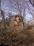
WOODMONT2 [NYNH&H, 1891]
The Register reported on 5/6/1891 that ground was being broken that very day for a temporary station, presumably to replace the rail cars in use since the fire. The size of the wooden structure was said to be 25x30 feet and the article also said that a new permanent station would not be built for two years until this portion of the four-tracking and grade-crossing elimination project on the New York Division was completed. Plans here also included a realignment that would take out the southerly dip that diverged as much as a quarter of a mile from the new right of way. The time period for finishing this extensive work actually turned out to be three years and we wonder, not only what this small depot looked like, but also what happened to it after such a short time in service. The image at [1] looks west on the work in progress; the old wooden SS-73 is seen in the distance ahead on the left. The red arrow on the 6/30/1915 val map image at [2] shows the location of the tower at the point where the old right of way crossed the new. The Track 11 Google Earth map snippet at [3] shows the old and new station locations, blue being the current line and red the 1848 routing. We took the photo at [4] of the 'new' SS-73 tower on 12/29/2011. Note that Rock Lane once went under the railroad. At some point the bridge was removed and Quirk Road has taken its place as an alternate route over to Anderson Ave. along the south side of the tracks. The entire GE map is available through a link on Track 11. [REFS: NHER/05/06/1891/01][rev030415, 052422]
The Register reported on 5/6/1891 that ground was being broken that very day for a temporary station, presumably to replace the rail cars in use since the fire. The size of the wooden structure was said to be 25x30 feet and the article also said that a new permanent station would not be built for two years until this portion of the four-tracking and grade-crossing elimination project on the New York Division was completed. Plans here also included a realignment that would take out the southerly dip that diverged as much as a quarter of a mile from the new right of way. The time period for finishing this extensive work actually turned out to be three years and we wonder, not only what this small depot looked like, but also what happened to it after such a short time in service. The image at [1] looks west on the work in progress; the old wooden SS-73 is seen in the distance ahead on the left. The red arrow on the 6/30/1915 val map image at [2] shows the location of the tower at the point where the old right of way crossed the new. The Track 11 Google Earth map snippet at [3] shows the old and new station locations, blue being the current line and red the 1848 routing. We took the photo at [4] of the 'new' SS-73 tower on 12/29/2011. Note that Rock Lane once went under the railroad. At some point the bridge was removed and Quirk Road has taken its place as an alternate route over to Anderson Ave. along the south side of the tracks. The entire GE map is available through a link on Track 11. [REFS: NHER/05/06/1891/01][rev030415, 052422]
WOODMONT3 [NYNH&H, 1894]
Apparently this depot was already built at the old location, and perhaps briefly in service there, but moved to the the new alignment slightly to the north. The Register reported on 5/20/1894 that, while one gang of men was taking up rail from the abandoned right of way, another gang "loaded the Woodmont depot, chimney and all, upon flat cars. Two locomotives then drew the depot down to the junction with the new main line and then pushed it back midway in the new cut where it was unloaded and the passengers received just as usual. Still another gang loaded the signal tower on a flat car, and by noon that was in operation in the new cut. The 4:22 express thundered over the new rails at high speed and the gliding of the cars was as smooth as over any bit of track on the line of the road." The paper went on to say that everything had been done to perfection and that the work here had cost a seemingly high $2,000,000. How easily the station was initially accessed in the new location is unclear because Depot Rd. was not finished until June, 1895. The val photo at [1] is dated 10/25/1916. The 6/30/1915 val map at [2] shows the layout of the station grounds, with the larger WOODMONT3 on the south, eastbound side, in contrast to most other locations. The view at [3] looks west with the row of beautiful steel catenary looking like goes on forever. Shades of the mirror scene in Citizen Kane! This depot was razed in the spring of 1929, as the Courant reported in November, with service discontinued almost two years earlier on 6/11/1927. At the hearing on 11/13/1929, a legal formality that had to precede the abandonment of any stop in existence over a year, the railroad justified its actions with the claim that traffic had dwindled toward the end to two riders per day. Though local residents protested and the decision was reserved, C.C. Elwell of the PUC said "prospects of continuing the station did not look very promising." Our 11/18/1928TT shows no stop here any more. [REFS: RRC32.23 (12/31/92); HC/12/28/1892/06; NHER/05/21/1894/01; NHJC/08/22/1894/02; CRC42.1894.17; NHER/06/24/1895/08; HC/10/26/1929/09; HC/11/14/1929/12][rev022815, 052422]
Apparently this depot was already built at the old location, and perhaps briefly in service there, but moved to the the new alignment slightly to the north. The Register reported on 5/20/1894 that, while one gang of men was taking up rail from the abandoned right of way, another gang "loaded the Woodmont depot, chimney and all, upon flat cars. Two locomotives then drew the depot down to the junction with the new main line and then pushed it back midway in the new cut where it was unloaded and the passengers received just as usual. Still another gang loaded the signal tower on a flat car, and by noon that was in operation in the new cut. The 4:22 express thundered over the new rails at high speed and the gliding of the cars was as smooth as over any bit of track on the line of the road." The paper went on to say that everything had been done to perfection and that the work here had cost a seemingly high $2,000,000. How easily the station was initially accessed in the new location is unclear because Depot Rd. was not finished until June, 1895. The val photo at [1] is dated 10/25/1916. The 6/30/1915 val map at [2] shows the layout of the station grounds, with the larger WOODMONT3 on the south, eastbound side, in contrast to most other locations. The view at [3] looks west with the row of beautiful steel catenary looking like goes on forever. Shades of the mirror scene in Citizen Kane! This depot was razed in the spring of 1929, as the Courant reported in November, with service discontinued almost two years earlier on 6/11/1927. At the hearing on 11/13/1929, a legal formality that had to precede the abandonment of any stop in existence over a year, the railroad justified its actions with the claim that traffic had dwindled toward the end to two riders per day. Though local residents protested and the decision was reserved, C.C. Elwell of the PUC said "prospects of continuing the station did not look very promising." Our 11/18/1928TT shows no stop here any more. [REFS: RRC32.23 (12/31/92); HC/12/28/1892/06; NHER/05/21/1894/01; NHJC/08/22/1894/02; CRC42.1894.17; NHER/06/24/1895/08; HC/10/26/1929/09; HC/11/14/1929/12][rev022815, 052422]
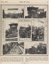 UConn Arch. & Spec. Colls.
WOODMONT4 [NYNH&H, 1894]
This depot was built as part of the four-tracking project, which the railroad commissioners said in their 1894 annual report had been completed, including the fact that the "freight and passenger stations in Stratford, Milford, Woodmont, and West Haven have been re-arranged to facilitate the transaction of business in each of those places." The val photo at [1] looks west and is dated 10/25/1916. The ca. 1900 real estate map at [2] shows the smaller station on the westbound (north) side of the tracks. The map at [3] shows the property owners in the area, likely in connection with the NYNH&H's plans for a large freight yard here in 1917, either to supplement or supplant Cedar Hill. Much of the property that was retained along the 1848 alignment was to be used, along with newly acquired parcels. The Courant reported late in 1916 that the railroad was seeking permission to make this "a main distribution point" to include a freight house, a transfer building, numerous classification tracks, and even possibly housing for employees. As far away as the Pawtucket Times, coverage said that railroad officials had appeared before the PUC on 1/19/1917 to testify that the yard was to be four miles long, 700 feet wide, and over 600 acres in area, capable of handling 15,000 freight cars per month, in an effort to relieve congested conditions at New Haven. The paper went on to say that opposition was expected from Milford citizens and "summer colonists" at Woodmont. The Elm City Nursery, whose property would have been given up for the project, was especially fearful of losing land said to be some of the best in the state for the cultivation of fruit trees and shrubs. The 1/19/1917 PUC Map 512 at [4] shows the extensive plans in great detail; massive would be an understatement and Orange would have never been the same. When studies showed that each train originating or terminating here would pass by New Haven Union Station and clog up the main line, the plan was abandoned. Much to the relief of residents, the Courant reported in March, 1917 that the railroad had reconsidered, among the reasons it said, was the challenge of clearing the rocky terrain in Woodmont. The stated intent at that point was to build "closer to New Haven," meaning ultimately a Cedar Hill expansion, which, though spurred on by the rail congestion during World War I, would not be completed until the end of 1921. The image at [5] shows a brand new Mack Rail bus here. The 9000 was one of the first three delivered to the railroad and were assigned to the NH&D line in January, 1922. See Track 4C, MP4.64.2. Dale Martin, former NH SS-73 tower operator here tells us that employees used to walk along the old alignment in the 1970s and find "all sorts of old stuff, spikes, ancient tie plates of some kind" and that he was told that Woodmont tower was so well made, inside and out, because it was supposed to have been the gateway to the NYNH&H's new yard facility. Perhaps that explains the lush gardens still seen decorating the newer pagoda-style concrete tower at [6] in the July, 1931 Along the Line, with the Elm City Nursery listed as one of the contributors, perhaps in gratitude for its life being spared! Dale credits Ed 'The Scoop' Russell, a former tower operator, for much of what Dale is relating, because "he seemed to know everything about everything." We recall it was a Russell descendant who donated abandonment maps to the Orange Historical Society's impressive collection of NH&D materials. The name Russell in Orange, of course, goes back to Tyler City days [see Track 1] and far earlier in local history. WOODMONT4 was presumably razed in 1929 along with its eastbound cousin. Many thanks to Assistant State Archivist Allen Ramsey for providing the map at [4][REFS: CRC42.1894.17; HC/12/25/1916/03; PTI/01/19/1917/11; HC/03/03/1917/15; HC/09/17/1919/09; HC/11/26/1920/02; HC/12/15/1921/22; HC/01/08/1922/A5; HC/10/26/1929/09; CSLIB RG041, Series 10: PUC Map 512] [rev030415, 052422]
This depot was built as part of the four-tracking project, which the railroad commissioners said in their 1894 annual report had been completed, including the fact that the "freight and passenger stations in Stratford, Milford, Woodmont, and West Haven have been re-arranged to facilitate the transaction of business in each of those places." The val photo at [1] looks west and is dated 10/25/1916. The ca. 1900 real estate map at [2] shows the smaller station on the westbound (north) side of the tracks. The map at [3] shows the property owners in the area, likely in connection with the NYNH&H's plans for a large freight yard here in 1917, either to supplement or supplant Cedar Hill. Much of the property that was retained along the 1848 alignment was to be used, along with newly acquired parcels. The Courant reported late in 1916 that the railroad was seeking permission to make this "a main distribution point" to include a freight house, a transfer building, numerous classification tracks, and even possibly housing for employees. As far away as the Pawtucket Times, coverage said that railroad officials had appeared before the PUC on 1/19/1917 to testify that the yard was to be four miles long, 700 feet wide, and over 600 acres in area, capable of handling 15,000 freight cars per month, in an effort to relieve congested conditions at New Haven. The paper went on to say that opposition was expected from Milford citizens and "summer colonists" at Woodmont. The Elm City Nursery, whose property would have been given up for the project, was especially fearful of losing land said to be some of the best in the state for the cultivation of fruit trees and shrubs. The 1/19/1917 PUC Map 512 at [4] shows the extensive plans in great detail; massive would be an understatement and Orange would have never been the same. When studies showed that each train originating or terminating here would pass by New Haven Union Station and clog up the main line, the plan was abandoned. Much to the relief of residents, the Courant reported in March, 1917 that the railroad had reconsidered, among the reasons it said, was the challenge of clearing the rocky terrain in Woodmont. The stated intent at that point was to build "closer to New Haven," meaning ultimately a Cedar Hill expansion, which, though spurred on by the rail congestion during World War I, would not be completed until the end of 1921. The image at [5] shows a brand new Mack Rail bus here. The 9000 was one of the first three delivered to the railroad and were assigned to the NH&D line in January, 1922. See Track 4C, MP4.64.2. Dale Martin, former NH SS-73 tower operator here tells us that employees used to walk along the old alignment in the 1970s and find "all sorts of old stuff, spikes, ancient tie plates of some kind" and that he was told that Woodmont tower was so well made, inside and out, because it was supposed to have been the gateway to the NYNH&H's new yard facility. Perhaps that explains the lush gardens still seen decorating the newer pagoda-style concrete tower at [6] in the July, 1931 Along the Line, with the Elm City Nursery listed as one of the contributors, perhaps in gratitude for its life being spared! Dale credits Ed 'The Scoop' Russell, a former tower operator, for much of what Dale is relating, because "he seemed to know everything about everything." We recall it was a Russell descendant who donated abandonment maps to the Orange Historical Society's impressive collection of NH&D materials. The name Russell in Orange, of course, goes back to Tyler City days [see Track 1] and far earlier in local history. WOODMONT4 was presumably razed in 1929 along with its eastbound cousin. Many thanks to Assistant State Archivist Allen Ramsey for providing the map at [4][REFS: CRC42.1894.17; HC/12/25/1916/03; PTI/01/19/1917/11; HC/03/03/1917/15; HC/09/17/1919/09; HC/11/26/1920/02; HC/12/15/1921/22; HC/01/08/1922/A5; HC/10/26/1929/09; CSLIB RG041, Series 10: PUC Map 512] [rev030415, 052422]
WOODROW [>SOUTH KENT]
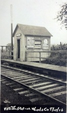 National Archives
WOODS [WL&S, 1870]
Station in the town of Suffield on the Windsor Locks & Suffield RR that was promoted by the H&NH and leased upon opening. According to an article in the Springfield Republican, this as well as BOSTON NECK and SOUTH STREET were original stops on the branch that opened to SUFFIELD on 12/12/1870. The 7/15/1894rev timetable at [1] shows all the stops on the branch, with six trains in both directions, six days per week. The val photo at [4] shows the depot on 8/10/1916 with what looks like a paddle-on-post mechanism to indicate passengers waiting at this flag stop. The 1915 val map is at [2]. The Dolph and Stewart atlas at [3] shows the station in 1931. Though freight service continued, passenger trains ceased on 1/23/1926 and were replaced by buses going from Suffield to Hartford via East Granby. [REFS: SR/12/12/1870/08; SR/10/15/1889/07; SR/10/13/1893/04; SR/02/17/1918/09; SR/08/10/1919/06; SR/09/04/1920/13; SR/01/17/1926/02][rev111914]
Station in the town of Suffield on the Windsor Locks & Suffield RR that was promoted by the H&NH and leased upon opening. According to an article in the Springfield Republican, this as well as BOSTON NECK and SOUTH STREET were original stops on the branch that opened to SUFFIELD on 12/12/1870. The 7/15/1894rev timetable at [1] shows all the stops on the branch, with six trains in both directions, six days per week. The val photo at [4] shows the depot on 8/10/1916 with what looks like a paddle-on-post mechanism to indicate passengers waiting at this flag stop. The 1915 val map is at [2]. The Dolph and Stewart atlas at [3] shows the station in 1931. Though freight service continued, passenger trains ceased on 1/23/1926 and were replaced by buses going from Suffield to Hartford via East Granby. [REFS: SR/12/12/1870/08; SR/10/15/1889/07; SR/10/13/1893/04; SR/02/17/1918/09; SR/08/10/1919/06; SR/09/04/1920/13; SR/01/17/1926/02][rev111914]
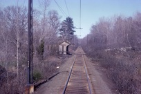 Robert Gambling photo
WOODWAY [NYNH&H, 1918]
Nothing shows on the 1915 val map for this DARIEN station, which was located about a mile north of SPRINGDALE CEMETERY and a mile south of TALMADGE HILL on the New Canaan line. Our red arrow on the 1929 map at right shows the location. The nearby golf course, for which this stop was likely named and established, opened in 1916. WOODWAY is not on the 9/23/1917LWTT we have but it is on the 1919 station list and on our 1923 and subsequent timetables into the Penn Central era. Service would continue until a new train schedule of 7/17/1972 'merged' this station with TALMADGE HILL. SPRINGDALE CEMETERY was also eliminated at this time, riders using SPRINGDALE thereafter. The 1967 shot at lower left was taken by Bob Gambling on a trip up the branch in a 4400 Washboard. An 11/6/2013 conversation on the NHRHTA Forum has some interesting commentary: "The station was located right behind the house at 405 Hoyt St. I know because my family lived in that house in 1948. The path from Hoyt St was located to the north of the house. The station had a small, unpaved parking area on the east side of the tracks with access from Hollow Tree Ridge Road via an unpaved road, but I never saw a car parked there. The station structure had a single kerosene lantern that was mounted on the front left wall, and was lit and extinguished by a member of the train crew. The station also had a cinder platform in front of and to the south of the structure with the latter part having a fence on the back and side edges and a flag-stop signal." [REFS:NYT/06/27/1919/22; ICC3 (1919); 6/8/1919LWTT; 1923-1969TTs; Town of Darien. Darien, Connecticut: The Darien Community Association, 1935; NYT/08/07/1971/08; HC/08/08/1971/26A; HC/07/02/1972/74D; HC/07/18/1972/21D][rev121413]
Nothing shows on the 1915 val map for this DARIEN station, which was located about a mile north of SPRINGDALE CEMETERY and a mile south of TALMADGE HILL on the New Canaan line. Our red arrow on the 1929 map at right shows the location. The nearby golf course, for which this stop was likely named and established, opened in 1916. WOODWAY is not on the 9/23/1917LWTT we have but it is on the 1919 station list and on our 1923 and subsequent timetables into the Penn Central era. Service would continue until a new train schedule of 7/17/1972 'merged' this station with TALMADGE HILL. SPRINGDALE CEMETERY was also eliminated at this time, riders using SPRINGDALE thereafter. The 1967 shot at lower left was taken by Bob Gambling on a trip up the branch in a 4400 Washboard. An 11/6/2013 conversation on the NHRHTA Forum has some interesting commentary: "The station was located right behind the house at 405 Hoyt St. I know because my family lived in that house in 1948. The path from Hoyt St was located to the north of the house. The station had a small, unpaved parking area on the east side of the tracks with access from Hollow Tree Ridge Road via an unpaved road, but I never saw a car parked there. The station structure had a single kerosene lantern that was mounted on the front left wall, and was lit and extinguished by a member of the train crew. The station also had a cinder platform in front of and to the south of the structure with the latter part having a fence on the back and side edges and a flag-stop signal." [REFS:NYT/06/27/1919/22; ICC3 (1919); 6/8/1919LWTT; 1923-1969TTs; Town of Darien. Darien, Connecticut: The Darien Community Association, 1935; NYT/08/07/1971/08; HC/08/08/1971/26A; HC/07/02/1972/74D; HC/07/18/1972/21D][rev121413]
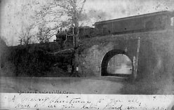
YALESVILLE1 [H&NH, 1867?]
This stop on the H&NH in the northern part of Wallingford was not original on the opening of the road in 1838. As late as the Geer's Express Directory in 1858, Yalesville is shown as being served by the Meriden station. The first timetable we have seen to show it is 1871; it is not on the 1866. The stop must have been established on or somewhat before 1/9/1868 when a newspaper article mentions a the vaillage of Hanover in Meriden as "... one mile northwest of the Yalesville depot." The location is seen on the 1868 map at [1]. The title data valuation map at [2] gives 5/14/1868 as the recording date for the deeded transfer of the land from H. Clark and James C. Wilson "For depot grounds only." These purpose resstrictions are rare but always worth checking for. [REFS: HDC/01/09/1868/02; HDC/01/13/1868/02; CR/04/30/1870/02; CC/05/04/1870/04; HDC/06/28/1871/02]
This stop on the H&NH in the northern part of Wallingford was not original on the opening of the road in 1838. As late as the Geer's Express Directory in 1858, Yalesville is shown as being served by the Meriden station. The first timetable we have seen to show it is 1871; it is not on the 1866. The stop must have been established on or somewhat before 1/9/1868 when a newspaper article mentions a the vaillage of Hanover in Meriden as "... one mile northwest of the Yalesville depot." The location is seen on the 1868 map at [1]. The title data valuation map at [2] gives 5/14/1868 as the recording date for the deeded transfer of the land from H. Clark and James C. Wilson "For depot grounds only." These purpose resstrictions are rare but always worth checking for. [REFS: HDC/01/09/1868/02; HDC/01/13/1868/02; CR/04/30/1870/02; CC/05/04/1870/04; HDC/06/28/1871/02]
YALESVILLE2 [H&NH, 1889?]
It is found neither on the 1851, 1858, or 1866TTs, but does appear on an 1871TT. The val map property section at [7] bottom left gives 5/14/1868 as the recording date for the deeded transfer of the land from H. Clark and James C. Wilson for the station grounds. This is the first time we have seen such a notation and we will check for others that may pinpoint the depot debuts as nicely as this one does. The stop, however, must already have been established because a 1/9/1868 newspaper article mentions a depot already standing with no note of newness. The station is shown on the map of the same year at upper left. Rockey says this depot was remodeled in the summer of 1889 and that may account for its enlarged size and more modern appearance. The 1893 map at [4] shows the location in the northern section of Wallingford. The val photo at lower middle is dated 8/23/1916. The 1938 SSRR list has this station sold on 11//31/1939 to J.W. Neal. The view at lower right is the famed skew arch bridge at the intersections of Routes 150 and 71, just below the site of the YALESVILLE station. Reportedly built in 1838 by Scottish stonemason William MacKenzie, it is said to be the first of its type in America and one of the oldest still in use today. Its 30-degree angle was to obviate any change either to the railroad or to the New Haven-Meriden turnpike as the H&NH was being built. The swampy nature of the surrounding land forced the railroad to build a high embankment to stabilize the right of way. It is said that there is as much foundation in the ground as the height of the arch, which was designed to be high enough to allow passage of the tall hay wagons of the farmer that sold the property. Today a traffic light coordinates alternating-direction motor vehicle traffic. [REFS: HDC/01/09/1868/02; CR/04/30/1870/02; CC/05/04/1870/04; HDC/06/28/1871/02; R1.349][rev010518]
It is found neither on the 1851, 1858, or 1866TTs, but does appear on an 1871TT. The val map property section at [7] bottom left gives 5/14/1868 as the recording date for the deeded transfer of the land from H. Clark and James C. Wilson for the station grounds. This is the first time we have seen such a notation and we will check for others that may pinpoint the depot debuts as nicely as this one does. The stop, however, must already have been established because a 1/9/1868 newspaper article mentions a depot already standing with no note of newness. The station is shown on the map of the same year at upper left. Rockey says this depot was remodeled in the summer of 1889 and that may account for its enlarged size and more modern appearance. The 1893 map at [4] shows the location in the northern section of Wallingford. The val photo at lower middle is dated 8/23/1916. The 1938 SSRR list has this station sold on 11//31/1939 to J.W. Neal. The view at lower right is the famed skew arch bridge at the intersections of Routes 150 and 71, just below the site of the YALESVILLE station. Reportedly built in 1838 by Scottish stonemason William MacKenzie, it is said to be the first of its type in America and one of the oldest still in use today. Its 30-degree angle was to obviate any change either to the railroad or to the New Haven-Meriden turnpike as the H&NH was being built. The swampy nature of the surrounding land forced the railroad to build a high embankment to stabilize the right of way. It is said that there is as much foundation in the ground as the height of the arch, which was designed to be high enough to allow passage of the tall hay wagons of the farmer that sold the property. Today a traffic light coordinates alternating-direction motor vehicle traffic. [REFS: HDC/01/09/1868/02; CR/04/30/1870/02; CC/05/04/1870/04; HDC/06/28/1871/02; R1.349][rev010518]
YANTIC1 [NLW&P, 1849?]
This was probably an original stop in the town of NORWICH on the NLW&P, which opened in 1849, and appears at least by our 1859TT. The first station here was replaced in 1876 and the depot grounds expanded in the process, as noted by the railroad commissioners in 1877 who said "new and convenient passenger depots have been built at Norwich Town, Yantic, Lebanon and Orcutts." [REFS: NLDE/04/07/1849/03; NLDE/12/29/1849/02; DC/01/14/1873/03]
YANTIC2 [NLN, 1876]
Built 1876. Burned 1891. [REFS: CRC24.1877.18; CRC39.1891.16]
YANTIC3 [CVT, 1891]
YANTIC2 was destroyed by fire in 1891 and this new brick structure was built by the end of the year and is so mentioned in the annual report of the railroad commissioners in December, 1891. [REFS: NLDE/04/07/1849/03; NLDE/12/29/1849/02; DC/01/14/1873/03; CRC24.1877.18; CRC.39.1891.16; HC/09/04/1964/03; HC/11/03/1965/22: CVT wants to end LCL freight at six stations][rev012314]
YANTIC2 was destroyed by fire in 1891 and this new brick structure was built by the end of the year and is so mentioned in the annual report of the railroad commissioners in December, 1891. [REFS: NLDE/04/07/1849/03; NLDE/12/29/1849/02; DC/01/14/1873/03; CRC24.1877.18; CRC.39.1891.16; HC/09/04/1964/03; HC/11/03/1965/22: CVT wants to end LCL freight at six stations][rev012314]
